The best walks and hikes around Péret-Bel-Air
4.7
(129)
672
hikers
47
hikes
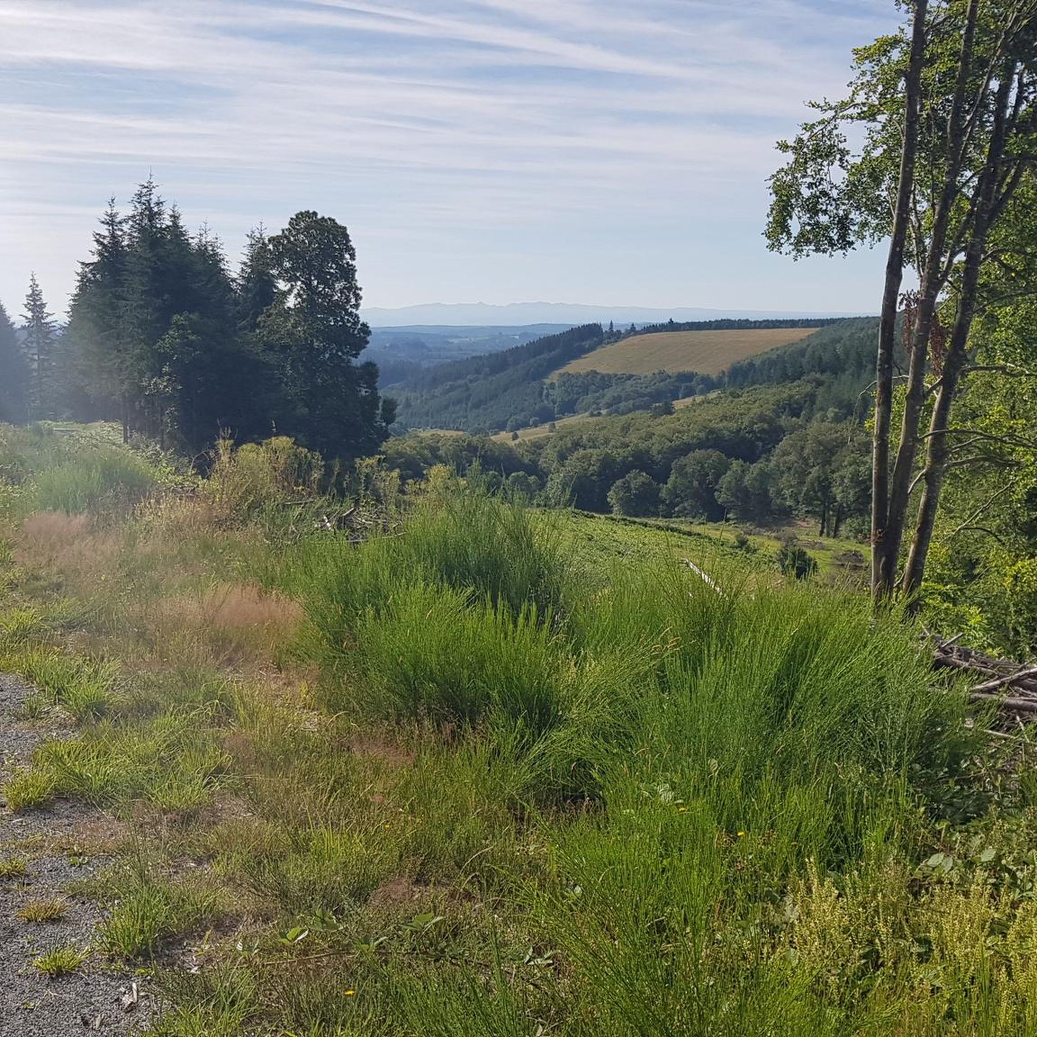
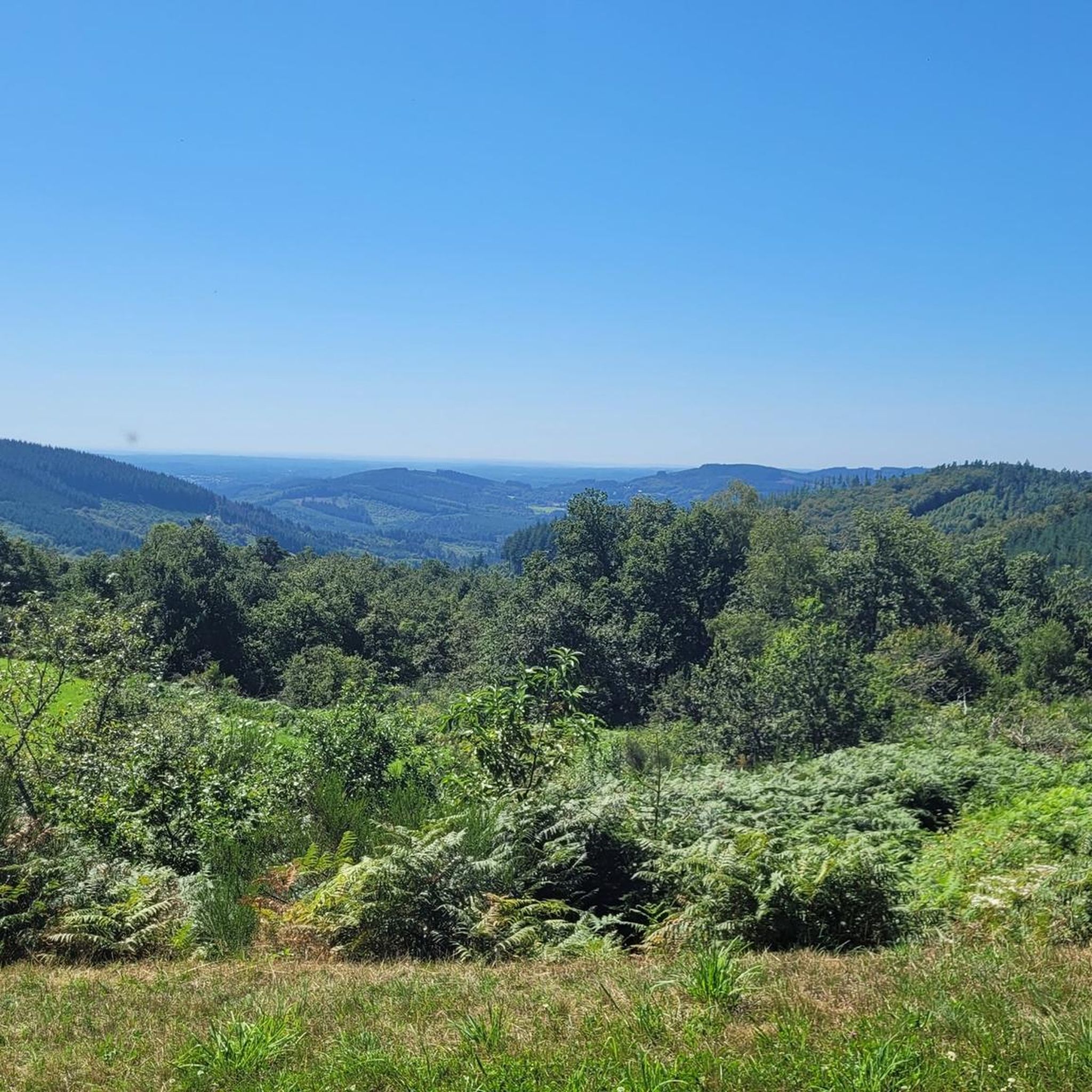
Hiking around Péret-Bel-Air offers exploration of a diverse landscape within the Corrèze department of central France. The commune is situated on the southern edge of the Millevaches Plateau, characterized by elevations ranging from 617 to 938 meters. This area is an integral part of the Regional Natural Park of Millevaches in Limousin, featuring dense beech forests and varied terrain. The elevated position provides opportunities for panoramic views across the region.
Best hiking trails in Péret-Bel-Air
- The most popular hiking route…
Last updated: July 2, 2026
10
hikers
10.4km
02:57
230m
230m
Moderate hike. Good fitness required. Easily-accessible paths. Suitable for all skill levels.
4.4
(5)
10
hikers
11.7km
03:23
290m
290m
Moderate hike. Good fitness required. Easily-accessible paths. Suitable for all skill levels.

Sign up for free
5.0
(1)
18
hikers
14.0km
04:02
340m
340m
Moderate hike. Good fitness required. Easily-accessible paths. Suitable for all skill levels.
5.0
(2)
21
hikers
Easy hike. Great for any fitness level. Easily-accessible paths. Suitable for all skill levels.
4.0
(2)
19
hikers
1.81km
00:30
40m
30m
Easy hike. Great for any fitness level. Easily-accessible paths. Suitable for all skill levels.
Get access to more routes and recommendations from other explorers.
Sign up for free
Already have an account?
Our route recommendations are based on thousands of hikes, rides, and runs completed by other people on komoot.
Start today with a free account
Your next adventure awaits.
Login or Signup

Tips from the Community

Heritage Contensousas Mill The mill was built around 1860 by the Contensousas family. Once thatched, the mill operated year-round, meeting the family's flour needs. The precious grains stored in the granaries were brought down to the mill by oxback. The water released from the sluice powered the mechanism. The rye flour was used to make bread pies and the buckwheat flour for tourtous (cakes). The mill stopped operating in 1950.
1
0
In this land of water, mills appeared in the Middle Ages. By the 19th century, Corrèze had hundreds of them. Modest in size, the mills were located on small waterways. The river was diverted by a canal (the millrace) to a reservoir (the étanchade) located above the mill. Its operation was simple and ingenious: a horizontal wooden spoon wheel, placed under the mill, drove the millstone running on the fixed millstone to grind rye and buckwheat.
0
0

Magnificent Sully lime tree. Departure of the hike to Clédat.
0
0

The village of Bonnefond has this particularity, like others including Tarnac, of having a four-hundred-year-old tree, here in this case a so-called Sully lime tree. This imposing lime tree has withstood the ravages of time and weather, even if it has been "pampered" in recent years. Adjoining this venerable lime tree, discover the 15th century granite church, of modest construction, and yet whose interior does not leave you indifferent with its floor paved with thick stones, and its oculus on the north wall. Finally, we will be truly impressed, as we can be in every village, by the terrible tribute paid here by the locals during the First World War: 55 lost their lives there, devastating families, ruining the rural fabric, its agriculture and economy. Let's not forget them.
0
0

There are 3-4 tables over the bridge, very cozy
0
0


Frequently Asked Questions
How many hiking trails are available around Péret-Bel-Air?
There are over 50 hiking routes around Péret-Bel-Air, offering a wide range of options for different skill levels and preferences. These trails explore the diverse landscapes of the Millevaches Plateau and the Regional Natural Park.
What kind of landscapes can I expect to see while hiking in Péret-Bel-Air?
Hiking in Péret-Bel-Air offers a blend of landscapes, from the distinctive topography of the Millevaches Plateau to dense beech forests, often described as 'forest cathedrals'. The elevated terrain provides opportunities for panoramic views across the Limousin region, all within the protected Regional Natural Park of Millevaches.
Are there any easy hiking routes suitable for beginners or families?
Yes, Péret-Bel-Air offers 22 easy hiking routes. A great option for a relaxed outing is the Beach at Lac de Vassivière loop from Égletons, which is just 2.1 km long and takes about 30 minutes to complete, offering pleasant views of Lac de Vassivière.
Are there any challenging hikes for experienced hikers?
While the majority of routes are easy to moderate, there are 4 difficult trails available for those seeking a more strenuous experience. These routes typically feature greater elevation gains and longer distances, providing a good challenge within the varied terrain of the Millevaches Plateau.
What are some interesting natural features or landmarks to see on the trails?
Hikers can discover several interesting natural features and landmarks. The area is known for its remarkable beech forests, such as the 'Hêtraies de Péret-Bel-Air'. You can also visit the Tine Waterfall, which is part of the Tine Waterfall – Hameau de Sénéjoux loop from Clédat trail, or explore the Sainte-Magdeleine Fountain near Clédat.
Are there any circular hiking routes around Péret-Bel-Air?
Yes, many of the trails around Péret-Bel-Air are circular, allowing you to start and end at the same point. Examples include the La Fageolle loop from Clédat, which explores local forests, and the Chadebec Mill – Bonnefond Village loop from Clédat.
What do other hikers say about the trails in Péret-Bel-Air?
The hiking routes in Péret-Bel-Air are highly rated by the komoot community, with an average score of 4.7 stars from over 100 reviews. Hikers often praise the diverse terrain, the beauty of the beech forests, and the well-preserved natural environment within the Regional Natural Park.
Can I find hikes that feature waterfalls?
Yes, the area features the beautiful Tine Waterfall. You can experience it directly on the Tine Waterfall – Hameau de Sénéjoux loop from Clédat, a moderate 11.7 km trail.
What is the best season for hiking in Péret-Bel-Air?
Péret-Bel-Air offers enjoyable hiking experiences across multiple seasons. Spring brings lush greenery and blooming flora, while autumn transforms the beech forests into vibrant displays of color. Summer is ideal for longer days on the trails, and even winter can offer serene, crisp walks, especially in the sheltered forests.
Are there any historical sites or abandoned villages to explore?
Yes, the region has historical interest. You can visit the Abandoned Village of Clédat, which offers a glimpse into the past. This site is often included in local hiking itineraries, providing a unique point of interest along your walk.
Are there any trails that offer good viewpoints?
Given Péret-Bel-Air's elevated position, with altitudes reaching 938 meters, many trails offer rewarding vistas. The varied terrain of the Millevaches Plateau provides numerous spots for panoramic views across the surrounding Limousin landscape, particularly from higher points within the beech forests and open areas.
Most popular attractions around Péret-Bel-Air

Get inspired with the komoot mobile app


Explore more
Browse the best Hikes in other regions.
