The best road cycling routes around Gripport
4.6
(29)
863
riders
111
rides
Road cycling routes around Gripport are situated within the Meurthe-et-Moselle department, offering diverse terrain for cyclists. The area is defined by its proximity to the Meurthe River and the Canal des Vosges, providing relatively flat greenways. Cyclists can experience varied landscapes, including agricultural plateaus, forested hillsides, and valley bottoms with meadows. This composition allows for a range of road cycling experiences, from gentle riverside rides to routes with moderate elevation changes.
Best road cycling routes around Gripport
- The most popular…
Last updated: July 2, 2026
5.0
(1)
8
riders
86.8km
03:58
860m
860m
Moderate road ride. Good fitness required. Mostly well-paved surfaces and easy to ride.
5.0
(4)
121
riders
43.8km
01:51
110m
110m
Easy road ride. Great for any fitness level. Mostly well-paved surfaces and easy to ride.

Sign up for free
32
riders
Moderate road ride. Good fitness required. Mostly well-paved surfaces and easy to ride.
5.0
(1)
26
riders
Easy road ride. Great for any fitness level. Mostly well-paved surfaces and easy to ride.
5.0
(1)
24
riders
54.0km
02:21
250m
250m
Moderate road ride. Good fitness required. Mostly well-paved surfaces and easy to ride.
Get access to more routes and recommendations from other explorers.
Sign up for free
Already have an account?
Our route recommendations are based on thousands of hikes, rides, and runs completed by other people on komoot.
Start today with a free account
Your next adventure awaits.
Login or Signup


Tips from the Community

For several centuries, it was the old castle chapel that served as the parish church in Bayon. In 1865, Mgr Charles-Martial ALLEMAND-LAVIGNE, bishop of Nancy and Toul, moved by the advanced state of degradation of the chapel, which was threatening to collapse, urged the parishioners to raise a subscription for the reconstruction of a church worthy of a cantonal capital. It was not until 1879 that this subscription was set up by Abbé MICHEL, parish priest, and raised 101,022 F, distributed as follows: 76,022 F from subscriptions, 15,000 F donated by the church fabric, and 10,000 F by the Commune. The new church being estimated at 153,000 F, the difference was the subject of a subsidy request to the State and the Department. Work began in 1881. The new church was consecrated on September 24, 1884, by Mgr TURINAZ, bishop of Nancy and Toul. It is in the shape of a Latin cross and oriented to the West, opposite the previous church. In the Neo-Renaissance style, the building was designed by Mr. GIGOUT, architect, and built by Mr. JEUDY, contractor. In 1905, 21 years after its consecration, numerous defects were noted which compromised the structural stability of the building. The diagnosis established by the expert appointed by the Commune and the Prefect noted, among other things, the fall of a complete section of cornices onto the square, where children were playing. It also noted that vegetation was taking root and dislodging the stones. The installation of scaffolding to carry out the essential repairs allowed for a deeper diagnosis and revealed the "unheard-of" defects of the building. In October 1918, the sacristy was set on fire, as was part of the choir, where the tiling lifted in places. Cracks appeared in the transept and some plaster panels detached from the vault. In the inter-war period, the church underwent numerous repairs. On June 20, 1940, the church was hit by shell fire. The vault over the choir and the high altar were destroyed. The central vault was damaged. The lighting and the bells were put out of order. The bell tower, particularly targeted, was heavily damaged, as were the clock and the organ. From 1948 onwards, major renovations were financed thanks to "war damages". In 1952, the church was equipped with a sound system and the stained glass windows were restored. The following year, a new altar, designed by Abbé GUÉNAIRE and built by the THOMAS company of Bayon, was installed. In January 2012, following a negative opinion from the district safety commission, the church had to be closed to the public "as long as the stability of the bell tower was not assured". After very significant work was carried out, the building has welcomed the faithful again since May 2015. The Saint Martin church is 44.25 meters long, 18.25 meters wide, and originally housed 520 chairs (390 today). Its height is 15 meters under the vault and 18 meters under the dome. The spire soars to a height of 54 meters. By prefectural decree of March 28, 2012, the Saint-Martin church was entirely listed as a Historical Monument "as a representative example of Neo-Renaissance architecture in Lorraine and of the work of architect Léopold GIGOUT". It houses religious heritage which is also listed in the inventory of Historical Monuments but as "objects": a pietà and three 15th-century statues from the old church, as well as a deposition scene dating from the early 16th century and from the chapel of the Hospital.
0
0

Magnificent site with a view over the entire Saintois.
1
0

Good to drive. Sometimes the side changes are a bit confusingly signposted.
0
0
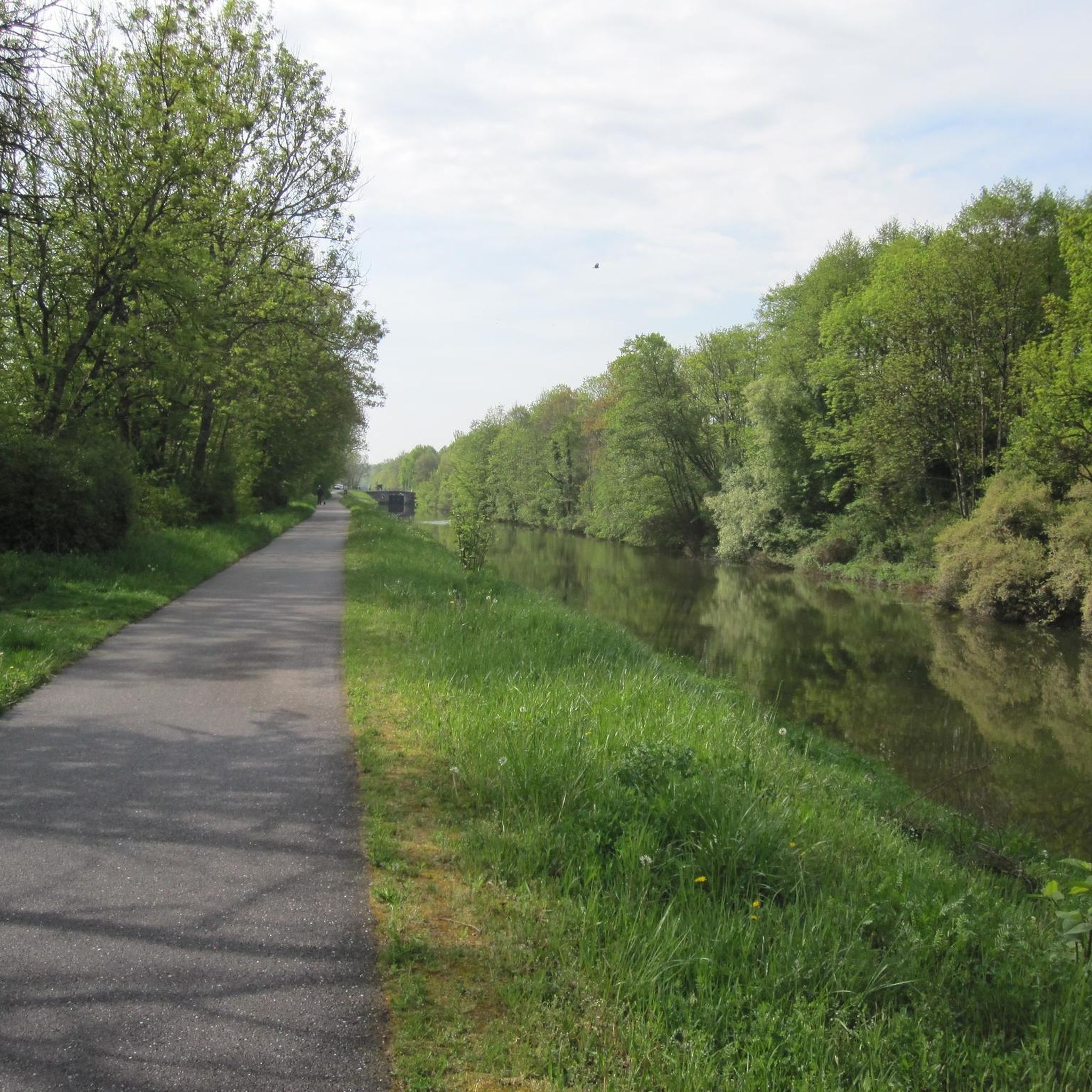
Beautiful cycle path along the canal. Every now and then the path changes sides and the route is sometimes a bit misleading.
0
0

The Monument de Lorraine or monument to the victory of Lorraine is a monument located overlooking the town of Charmes in the Vosges department, which was erected in the aftermath of the First World War to celebrate the victory of France on its Lorraine lands during the battle of the Charmes gap. https://fr.m.wikipedia.org/wiki/Monument_de_Lorraine
2
0
The bridge crosses the Moselle and the Canal des Vosges
2
0
Schleuse am Canal des Vosges bei Bainville-aux-Miroirs https://www.reperesdecrues.developpement-durable.gouv.fr/site/barrage-de-bainville
2
0
Lock on the Canal des Vosges near Crévéchamps https://canalplan.uk/place/w4v9
2
0
Frequently Asked Questions
What kind of terrain can I expect on road cycling routes around Gripport?
The region around Gripport offers a diverse landscape for road cyclists. You'll find relatively flat greenways along the Meurthe River and the Canal des Vosges, ideal for relaxed rides. For those seeking more challenge, there are routes with moderate elevation changes through agricultural plateaus and undulating forested hillsides, particularly in areas bordering the Lorraine Regional Natural Park.
Are there road cycling routes suitable for beginners or those seeking an easier ride?
Yes, Gripport offers several easy road cycling routes. For instance, La Voie Bleue – The Rotonde Parks loop from Charmes is an easy 43.8 km path that follows a section of La Voie Bleue, offering pleasant views alongside the Meurthe River with minimal elevation gain. Another easy option is the Lock on the Canal des Vosges loop from Bainville-aux-Miroirs, which is 29.1 km long.
What natural features or landmarks can I see while cycling near Gripport?
The routes often pass by significant natural and historical features. You can cycle alongside the tranquil Canal des Vosges and the Meurthe River, experiencing the rich flora and fauna of the Moselle Valley. Notable landmarks include the Gripport Lock on the canal, and the picturesque Ponds of the Saussaie de Bayon. Further afield, the routes can lead you past the impressive Haroué Castle.
When is the best time of year for road cycling around Gripport?
The Meurthe-et-Moselle region, including Gripport, is generally pleasant for cycling from spring through early autumn. During these seasons, the weather is typically mild, and the natural landscapes are at their most vibrant. The riverside paths and forested areas offer beautiful scenery, making it an ideal time to explore the diverse routes.
Are there family-friendly road cycling routes in the Gripport area?
Yes, the region is well-suited for family cycling, especially along the greenways. The sections of La Voie Bleue and paths alongside the Canal des Vosges offer flat, safe, and scenic routes away from heavy traffic, making them perfect for families with children or those looking for a relaxed ride. These routes often pass through charming villages and natural areas.
Is there convenient parking for cyclists in Gripport?
While specific dedicated cyclist parking isn't detailed, Gripport is a small village, and parking is generally available within the village or at trailheads for the main cycling routes. It's advisable to check local signage upon arrival for the most convenient spots.
Can I reach Gripport and its cycling routes using public transport with my bike?
The Meurthe-et-Moselle region has public transport options, but carrying bikes can vary. For long-distance routes like La Voie Bleue, some regional trains or buses may accommodate bikes, often with specific conditions or during off-peak hours. It's recommended to check the specific public transport provider's policy regarding bike carriage before planning your trip.
What do other road cyclists enjoy the most about road cycling in Gripport?
The area is highly rated by the komoot community, with an average score of 4.5 stars from over 25 reviews. Cyclists often praise the tranquil riverside paths, the scenic sections along the Canal des Vosges, and the variety of routes that cater to different ability levels, from easy flat rides to more challenging routes through undulating terrain.
Are there any long-distance road cycling routes that pass through or near Gripport?
Yes, Gripport is strategically located along significant long-distance routes. It sits directly on a section of La Voie Bleue – Moselle Saône à vélo, which offers a journey alongside the Meurthe River and Canal des Vosges. The broader Meurthe-et-Moselle region also features the Moselle Loop (Boucle de la Moselle), a variant of The Blue Way, and the long-distance V52 Route (Paris/Prague), providing extensive cycling opportunities.
What are some challenging road cycling routes for experienced riders?
For experienced riders seeking more elevation and distance, routes like Le Château de Haroué — loop from Charmes offer a substantial challenge. This 86.8 km trail includes over 850 meters of elevation gain, exploring the countryside around the historic Château de Haroué and providing a more demanding ride through varied terrain.
Are there any specific cycling events or tours related to the region?
While specific events are not detailed here, the presence of major routes like La Voie Bleue and the Moselle Loop often means that organized tours or local cycling events take place throughout the year. Checking local tourism websites, such as tourisme-meurtheetmoselle.fr, can provide up-to-date information on regional cycling events.
Can I combine road cycling with exploring local culture and gastronomy?
Absolutely. The region is rich in cultural heritage and local delicacies. Cycling routes often pass through charming villages and offer opportunities to visit historic towns like Nancy (famous for Place Stanislas) or Toul (with its cathedral). You can also discover local gastronomy, including the Côtes de Toul vineyards, making for a well-rounded experience combining sport and discovery.
Most popular attractions around Gripport

Get inspired with the komoot mobile app


Explore more
Browse the best Road cycling routes in other regions.
