The best running trails around Klingenberg
4.3
(56)
264
runners
24
runs
Jogging routes around Klingenberg offer diverse terrain for runners of all levels. The region is characterized by its location near the Tharandt Forest and the foothills of the Ore Mountains, providing lush woodlands and varied topography. The Red Weißeritz river carves through picturesque valleys like the Rabenauer Grund, creating idyllic paths. Additionally, the Klingenberg Dam and its reservoir offer pleasant waterside running routes.
Best jogging routes around Klingenberg
- The most popular jogging route is Klingenberg Dam – Klingenberg Reservoir loop…
Last updated: August 5, 2026
4.7
(20)
90
runners
13.4km
01:28
180m
180m
Moderate run. Good fitness required. Mostly paved surfaces. Suitable for all skill levels.
4.3
(3)
42
runners
12.5km
01:23
230m
230m
Moderate run. Good fitness required. Mostly paved surfaces. Suitable for all skill levels.

Sign up for free
23
runners
8.78km
00:59
150m
150m
Moderate run. Good fitness required. Mostly paved surfaces. Suitable for all skill levels.
5.0
(2)
13
runners
6.91km
00:45
100m
100m
Moderate run. Good fitness required. Mostly paved surfaces. Suitable for all skill levels.
5.0
(2)
11
runners
9.03km
00:57
80m
80m
Moderate run. Good fitness required. Mostly paved surfaces. Suitable for all skill levels.
Get access to more routes and recommendations from other explorers.
Sign up for free
Already have an account?
Our route recommendations are based on thousands of hikes, rides, and runs completed by other people on komoot.
Start today with a free account
Your next adventure awaits.
Login or Signup





Tips from the Community

In the years 1910/11 it was built as a wooden bridge, hence the name, and allowed the works railway on its 3.7 km journey between the station and the dam construction to cross the "Langen Grund". The demolition of the wooden bridge and new construction in reinforced concrete took place in 1924 as the works railway line was used for the road layout. The bridge was technically checked and completely overhauled in 1992.
0
0
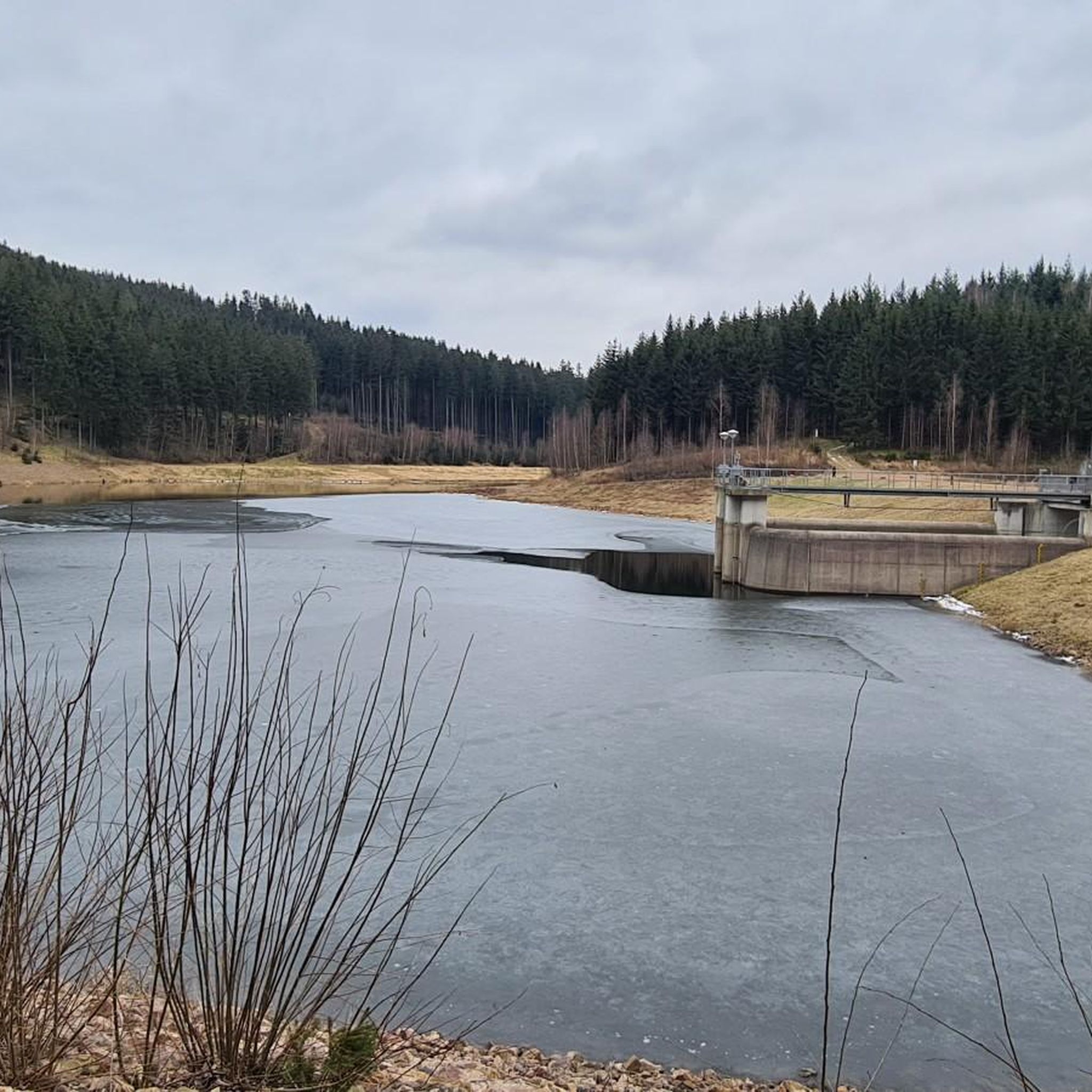
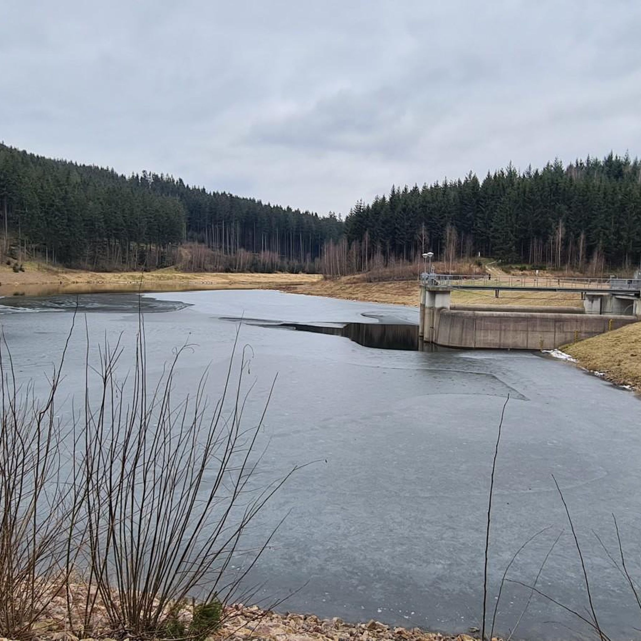
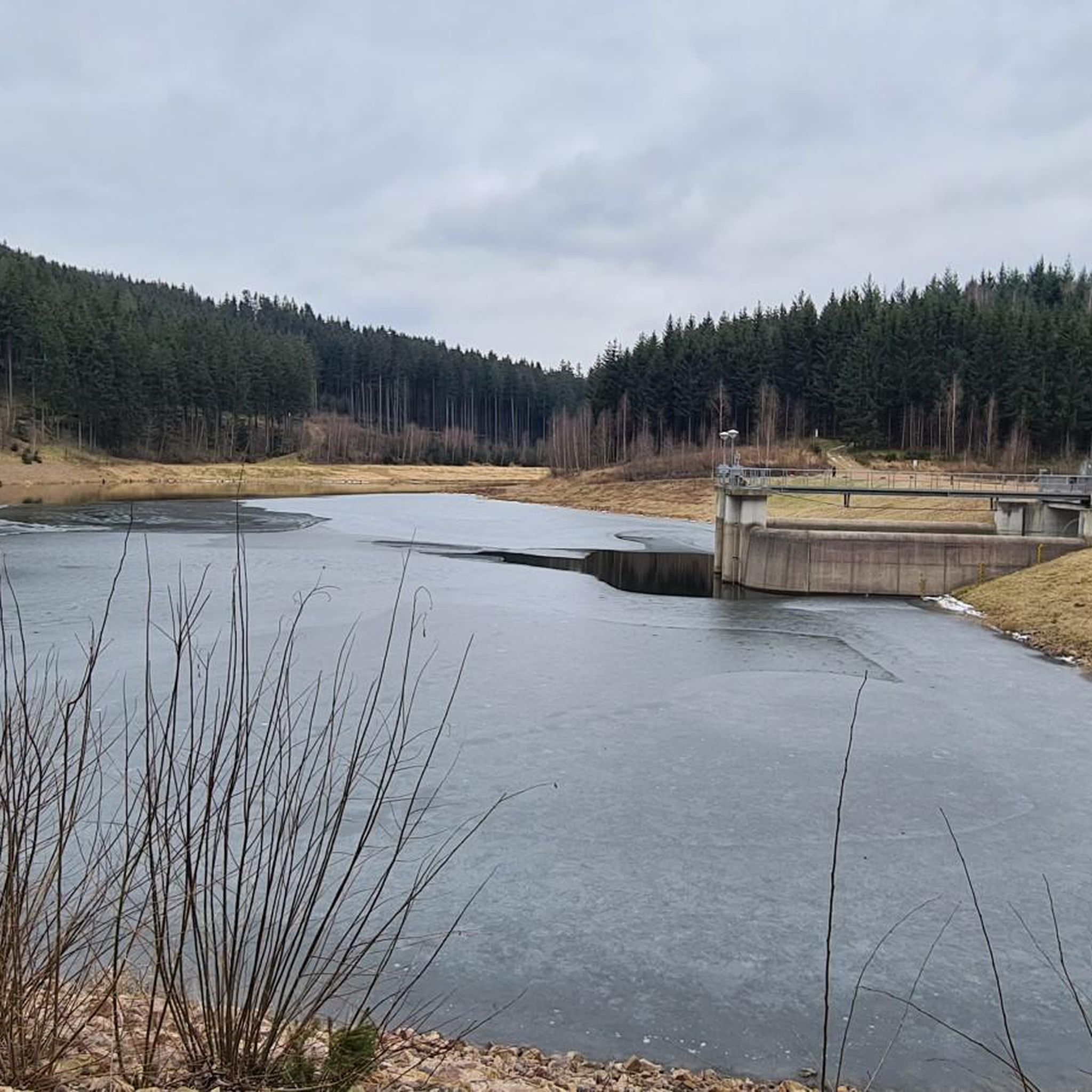
The dam of the Klingenberg reservoir is an arched gravity dam made of rubble masonry according to the Intze principle. Remarkable about this listed dam is the striking crown structure in the middle. A public path leads across the dam. The reservoir has a pre-dam, whose closing structure is an earth dam, and two forebays. The Lehnmühle reservoir is also part of the system, which had the function of a pre-dam until its construction and is today primarily a controlled part of the drinking water supply and flood defense. The raw water is diverted to the Dresden-Coschütz waterworks via the Dorfhain and Tharandt hydroelectric power plants. At the foot of the dam are the waterworks and the Klingenberg hydroelectric power plant. The flood of the Wilde Weißeritz in 2002 caused damage (scouring), especially at the dam's spillway and the 150 m long cascade flood relief with its seven drop stages. It was only designed for a maximum flood of 86 cubic meters per second, but there were peak discharges of 160 m³/s.
0
0
The Klingenberg dam in the eastern Ore Mountains is a picturesque reservoir and an important drinking water reserve. It was built between 1908 and 1914. The charming circular hiking trail is perfect for nature lovers, walkers, and families. The dam was built from 1908 near Klingenberg in the foothills of the Osterzgebirge according to an architectural design by Hans Poelzig. In 1914, the dam went into operation and was named after the last Saxon king: Friedrich-August-Talsperre. The impounded body of water is the Wilde Weißeritz. Its construction was part of a flood protection concept that was developed after the devastating flood of 1897 in the Dresden-Altstadt district under the leadership of district administrator and dam commissioner Arnold Streit. During construction, a standard-gauge works railway was laid from Klingenberg-Colmnitz station to the construction site, which operated from 1911 to 1914. The Höhenweg trail now runs along its route over the Streichholzbrücke (matchstick bridge).
0
0

This is not the view of the Lichtenberg dam, but of the Klingenberg dam.
0
0

Possibility of a circular hike or (bicycle) tour near the water, more visibility than at other dams, numerous benches, a mini-beach on the eastern shore, bird watching, a restaurant on the dam wall - in short: suitable for a day trip.
0
0

Lips-Tullian Rock with a view and seating. Information: It owes its name to a notorious robber baron who terrorized the area in the 17th century. The rock is a weathered cliff made of rhyolite with low quartz content. It is also a popular viewpoint offering a glimpse into the Colmnitzbach valley, a narrow, up to 75-meter-deep ravine in the Tännichtgrund valley.
3
0
Geographical Center of Saxony. Information: This marker, a granite stele in front of the Diebskammerfelsen (Thieves' Chamber Rock), was erected because the official geographical center (not far from here) was only developed for tourism in 1995.
2
0
Frequently Asked Questions
How many running routes are available in Klingenberg?
Klingenberg offers a diverse selection of over 25 running routes, catering to various preferences and fitness levels. These include 5 easy routes, 18 moderate trails, and 2 more challenging options, ensuring there's something for everyone.
What makes the running trails in Klingenberg unique?
Running in Klingenberg is defined by its picturesque natural setting. The region features lush woodlands from the nearby Tharandt Forest and the foothills of the Ore Mountains, idyllic river valleys like the Rabenauer Grund along the Red Weißeritz, and pleasant waterside paths around the Klingenberg Dam and its reservoir. This diverse landscape provides varied terrain and beautiful scenery for your runs.
Are there easy running routes suitable for beginners or families in Klingenberg?
Yes, Klingenberg offers 5 easy running routes perfect for beginners or families looking for a more relaxed pace. These trails often feature gentler inclines and well-maintained paths, allowing everyone to enjoy the natural beauty of the area. While specific family-friendly routes aren't detailed, the easy trails are generally suitable.
Can I find challenging running trails in Klingenberg?
Absolutely. For those seeking a more intense workout, Klingenberg has 2 difficult running routes that feature significant elevation gain and more rugged terrain. Additionally, many of the 18 moderate trails offer varied topography that can provide a good challenge. For example, the Hysselsberg – Plateau loop from Klingenberg covers 7.8 miles with over 200 meters of elevation gain.
Are there circular running routes available in Klingenberg?
Yes, many of the running routes in Klingenberg are designed as circular loops, allowing you to start and finish at the same point. A popular example is the Klingenberg Dam – Klingenberg Reservoir loop from Klingenberg, an 8.3-mile trail offering scenic views around the reservoir. Another great option is the Running loop from Klingenberg, which is 5.4 miles through local woodlands.
What natural attractions or landmarks can I see while running in Klingenberg?
Klingenberg's running routes often pass by significant natural and historical points of interest. You can explore the picturesque Rabenauer Grund, a nature reserve along the Red Weißeritz river, or enjoy views around the Klingenberg Dam and reservoir. For specific landmarks, consider routes near highlights like the Wilisch Summit Triangulation Pillar or the Kaitzer Heights viewpoint, which offer expansive vistas.
What do other runners say about the trails in Klingenberg?
The running trails in Klingenberg are highly regarded by the komoot community, boasting an average rating of 4.3 stars from over 50 reviews. More than 250 runners have explored these routes using komoot, frequently praising the diverse terrain, scenic views, and the well-maintained paths through woodlands and along the reservoir.
Are the running routes in Klingenberg dog-friendly?
While specific regulations for dogs on every trail can vary, the natural environment of Klingenberg, with its extensive woodlands and river valleys like the Rabenauer Grund, generally offers many opportunities for running with dogs. It's always advisable to keep dogs on a leash, especially in nature reserves or areas with wildlife, and to respect local signage.
When is the best time of year to go running in Klingenberg?
Klingenberg offers enjoyable running conditions throughout much of the year. Spring and autumn provide pleasant temperatures and beautiful scenery with blooming flora or vibrant fall foliage. Summer is also great, especially for shaded woodland trails. Winter running is possible, but some paths might be icy or snowy, particularly in higher elevations or less frequented areas.
Are there running routes with viewpoints in Klingenberg?
Yes, Klingenberg's varied topography, including its proximity to the Ore Mountains foothills, means there are several routes that offer rewarding viewpoints. Trails that ascend to areas like the Kaitzer Heights or near the Wilisch Summit provide excellent panoramic views of the surrounding landscapes.
Is parking available near the running trails in Klingenberg?
Many of the popular running routes in Klingenberg, especially those starting from the town or near key attractions like the Klingenberg Dam, typically have designated parking areas nearby. While specific parking details for every trail are not listed, the accessibility of the region suggests convenient options for runners arriving by car.
How can I access the running routes in Klingenberg using public transport?
Klingenberg is generally accessible by public transport, which can help you reach various starting points for running routes. Depending on your specific starting location, local bus services or regional trains might connect you to different parts of the area, including the town center or villages closer to the trails. It's recommended to check local transport schedules for the most up-to-date information.
Most popular routes around Klingenberg
Most popular attractions around Klingenberg

Get inspired with the komoot mobile app


Explore more
Browse the best Running Trails & Routes in other regions.
