The best road cycling routes around Smermesnil
5.0
(2)
157
riders
49
rides
Road cycling around Smermesnil, located in France's Seine-Maritime department, offers varied terrain within the Pays de Bray region. This area is characterized by rolling hills, hedged farmlands, and verdant dales, providing a mix of ascents and descents. Situated on a plateau between the Yères and Eaulne river valleys, Smermesnil provides expansive views and opportunities for flatter routes along waterways. The surrounding Normandy countryside features picturesque villages and traditional farms, creating a scenic backdrop for road cycling.
Best road cycling routes…
Last updated: July 13, 2026
15
riders
124km
05:08
690m
690m
Hard road ride. Very good fitness required. Mostly well-paved surfaces and easy to ride.
9
riders
55.6km
02:47
600m
600m
Moderate road ride. Good fitness required. Mostly well-paved surfaces and easy to ride.

Sign up for free
7
riders
83.0km
03:47
700m
700m
Moderate road ride. Good fitness required. Some segments of this route may be unpaved and difficult to ride.
5.0
(1)
12
riders
65.7km
02:57
710m
710m
Moderate road ride. Good fitness required. Mostly well-paved surfaces and easy to ride.
11
riders
62.2km
02:43
500m
500m
Moderate road ride. Good fitness required. Mostly well-paved surfaces and easy to ride.
Get access to more routes and recommendations from other explorers.
Sign up for free
Already have an account?
Our route recommendations are based on thousands of hikes, rides, and runs completed by other people on komoot.
Start today with a free account
Your next adventure awaits.
Login or Signup

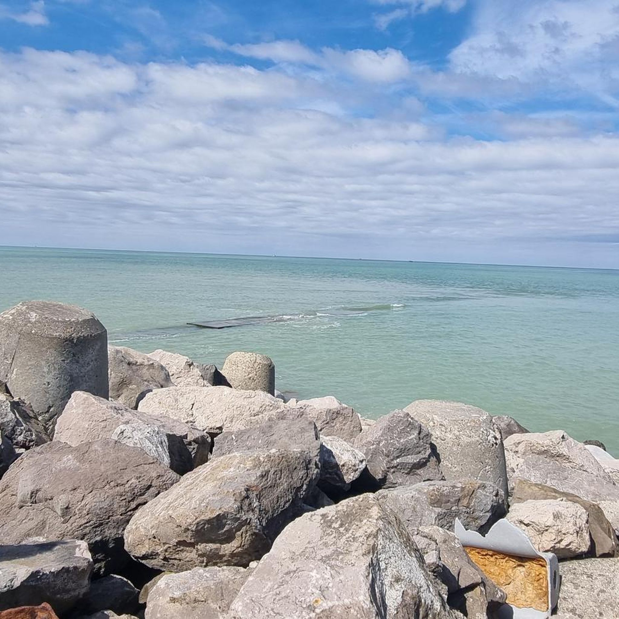


Tips from the Community

a beautiful old carousel on the beach
3
0


The cliffs are made of chalk and are impressive to look at.
3
0
Here in Ault begin the chalk cliffs, which stretch all the way to Normandy and repeatedly appear as enormous cliffs.
4
0

Lovely passage under the viaduct with a beautiful pond and animals Possibility of crossing it on gravel by following the green path
0
0

The cliffs around the beach of Ault are composed of chalk from the Upper Cretaceous, more precisely from the Turonian and Coniacian (around 83 million years ago to 90 million years ago). They are strewn with flint nodules which highlight the subhorizontal stratification planes (the formation of flint has already been discussed in Discovery of the geology of the cliffs of Étretat, presentation of an excursion from the beach of Tilleul (Antifer) to the Porte d'Amont (Étretat Nord)). The relative proportion of chalk and flint is around 90-95% chalk to 5-10% flint. Flint horizons are stratigraphic markers. On the cliffs of Ault, the regular flint band called Seven Sisters is recognizable and characterizes the boundary between the Middle Coniacian and the Upper Coniacian (around 87 million years ago). The boundary between the lower and middle Coniacian is marked by the Shoreham 2 marl level, which is more difficult to identify. These lithostratigraphic markings allow in particular the correlation of distant deposits, such as between the Normandy and Picardy coasts, or between the French and English coasts.
3
0
The cliffs around the beach of Ault are composed of chalk from the Upper Cretaceous, more precisely from the Turonian and Coniacian (around 83 million years ago to 90 million years ago). They are strewn with flint nodules which highlight the subhorizontal stratification planes (the formation of flint has already been discussed in Discovery of the geology of the cliffs of Étretat, presentation of an excursion from the beach of Tilleul (Antifer) to the Porte d'Amont (Étretat Nord)). The relative proportion of chalk and flint is around 90-95% chalk to 5-10% flint. Flint horizons are stratigraphic markers. On the cliffs of Ault, the regular flint band called Seven Sisters is recognizable and characterizes the boundary between the Middle Coniacian and the Upper Coniacian (around 87 million years ago). The boundary between the lower and middle Coniacian is marked by the Shoreham 2 marl level, which is more difficult to identify. These lithostratigraphic markings allow in particular the correlation of distant deposits, such as between the Normandy and Picardy coasts, or between the French and English coasts.
2
0
Frequently Asked Questions
What kind of terrain can I expect when road cycling around Smermesnil?
Road cycling around Smermesnil, situated in the Pays de Bray, offers a varied topography. You'll encounter rolling hills, hedged farmlands (bocages), and verdant dales, providing a mix of ascents and descents. Being on a plateau between the Yères and Eaulne river valleys, the area also offers expansive views and opportunities for flatter routes along waterways.
Are there road cycling routes for all skill levels in the Smermesnil area?
Yes, the Smermesnil area provides road cycling options for various abilities. Out of 41 available routes, you'll find 8 easy routes, 30 moderate routes, and 3 more challenging options, ensuring there's something for every cyclist.
What historical sites or viewpoints can I discover while cycling near Smermesnil?
While cycling near Smermesnil, you can explore several interesting sites. Consider routes that pass by the V1 Launch Site of Guerville or the Site of Queen Mother Elizabeth. For scenic views, look for routes that include the Sainte Catherine viewpoint.
What natural landscapes will I encounter on road cycling routes in Smermesnil?
The road cycling routes around Smermesnil showcase the picturesque Normandy countryside. You'll ride through charming villages, past traditional farms, and alongside lush greenery. The region's distinctive 'buttonhole' landscape, with its rolling hills and river valleys, provides a beautiful and varied natural backdrop.
Where can I park my car when planning a road cycling trip in Smermesnil?
Specific parking facilities for cyclists in Smermesnil are not detailed, but generally, in rural French communes, you can find parking in village centers or near local amenities. For routes starting from specific towns like Grandcourt or Foucarmont, look for public parking areas within those villages.
Is it possible to reach road cycling routes in Smermesnil using public transport?
While Smermesnil is a rural commune, the broader Seine-Maritime department has efforts to integrate cycling with transport. However, direct public transport options to Smermesnil that accommodate bicycles might be limited. It's advisable to check local bus or train services to nearby larger towns like Dieppe or Rouen and plan your cycling route from there, or consider driving to a starting point.
What is the best time of year for road cycling in Smermesnil?
The best time for road cycling in Smermesnil, like much of Normandy, is typically from spring through early autumn (April to October). During these months, the weather is generally milder and more pleasant, with less rain, making for ideal cycling conditions to enjoy the countryside.
Are there any family-friendly road cycling routes near Smermesnil?
Yes, there are family-friendly options. For instance, the Water mill loop from Grandcourt is an easy 24.5 km route that takes about 1 hour 3 minutes to complete, making it suitable for families or those looking for a more relaxed ride.
Can I find cafes or accommodation near road cycling routes in Smermesnil?
Smermesnil itself is a small commune, but the surrounding Normandy countryside features picturesque villages where you can often find local cafes for refreshments. For accommodation, you might need to look in slightly larger nearby towns or consider gîtes (holiday rentals) in the rural areas. The region is known for its hospitality.
What do other road cyclists enjoy most about road cycling in Smermesnil?
The komoot community highly rates the road cycling experience in Smermesnil, with an average score of 5.0 stars. Cyclists often praise the varied terrain, which offers both challenging climbs and scenic, flatter sections, as well as the charming backdrop of the Normandy countryside and its quiet back roads.
Are there any long-distance cycling routes that pass through or near Smermesnil?
Yes, the iconic Avenue Verte London-Paris®, a well-known long-distance cycling route, passes through the broader Seine-Maritime region, including parts of the Pays de Bray. This offers an emblematic cycling experience for those looking for longer journeys.
Are there any coastal road cycling routes accessible from Smermesnil?
While Smermesnil is inland, some routes extend towards the coast, offering diverse scenery. For example, the Departure for Criel Plage – Le Tréport Harbor loop from Foucarmont is a moderate 98.3 km route that includes coastal views near Criel Plage and Le Tréport Harbor.
How many road cycling routes are available in the Smermesnil area?
There are over 40 road cycling routes available around Smermesnil, offering a wide variety of distances and difficulty levels to explore the Pays de Bray region and its surroundings.
Most popular attractions around Smermesnil

Get inspired with the komoot mobile app


Explore more
Browse the best Road cycling routes in other regions.
