The best walks and hikes around Les Ifs
4.5
(16)
65
hikers
5
hikes
Hiking around Les Ifs offers routes through a landscape characterized by rolling hills, rural paths, and occasional coastal views. The region features a mix of open countryside and areas with historical significance, providing varied terrain for exploration. Elevation changes are generally moderate, making many trails accessible for different fitness levels.
Best hiking trails around Les Ifs
- The most popular hiking route is View of CRIEL-SUR-MER – View of Criel-sur-mer loop from Saint-Martin-le-Gaillard, a 12.9 miles (20.7 km) trail that…
Last updated: June 25, 2026
4.3
(3)
9
hikers
11.4km
03:07
180m
180m
Moderate hike. Good fitness required. Easily-accessible paths. Suitable for all skill levels.
4.5
(6)
13
hikers
16.4km
04:30
270m
270m
Moderate hike. Good fitness required. Easily-accessible paths. Suitable for all skill levels.

Sign up for free
3.0
(2)
10
hikers
Hard hike. Very good fitness required. Easily-accessible paths. Suitable for all skill levels.
5.0
(1)
2
hikers
8.31km
02:18
140m
140m
Moderate hike. Good fitness required. Easily-accessible paths. Suitable for all skill levels.
4.0
(1)
10
hikers
13.3km
03:33
150m
150m
Moderate hike. Good fitness required. Easily-accessible paths. Suitable for all skill levels.
Our route recommendations are based on thousands of hikes, rides, and runs completed by other people on komoot.
Start today with a free account
Your next adventure awaits.
Login or Signup
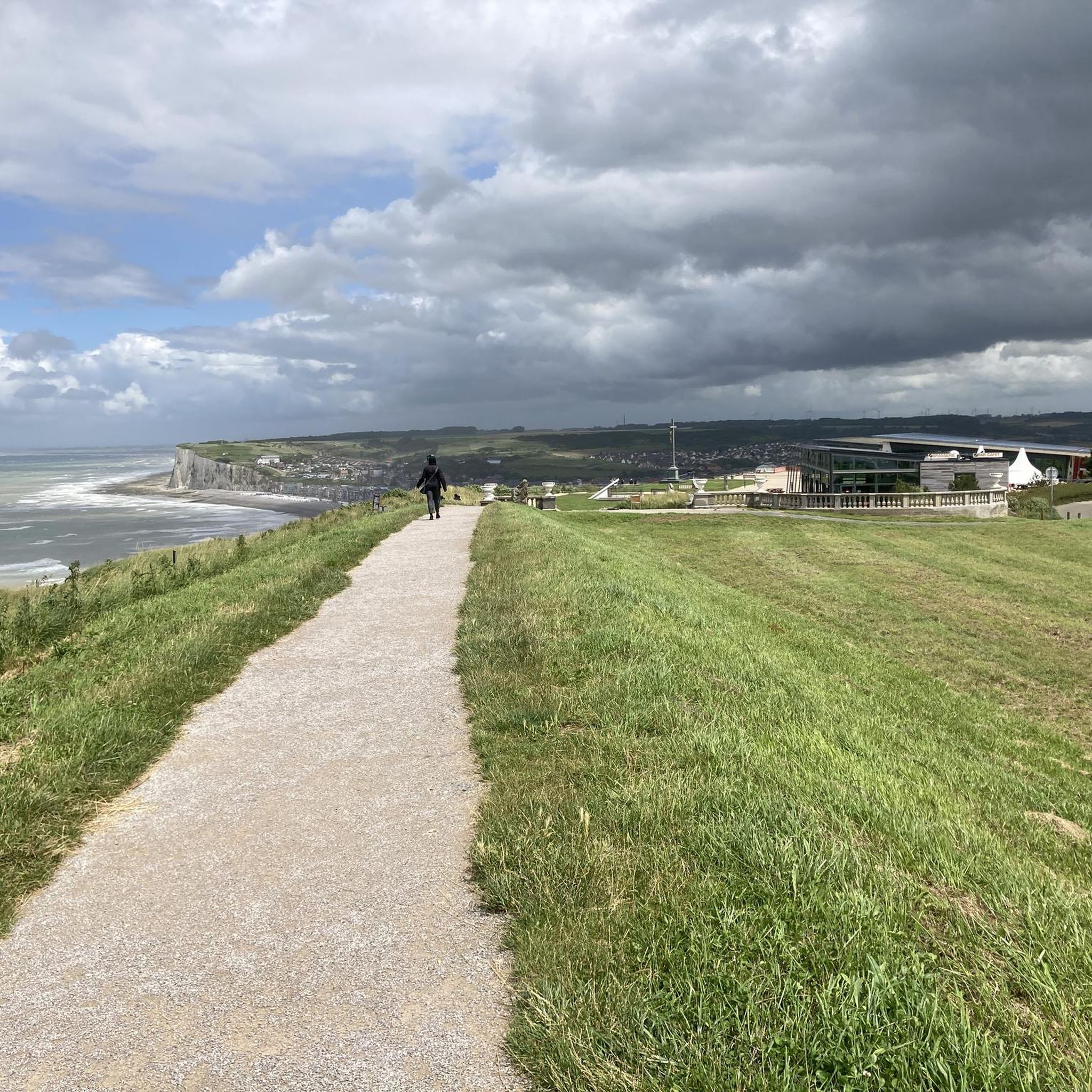


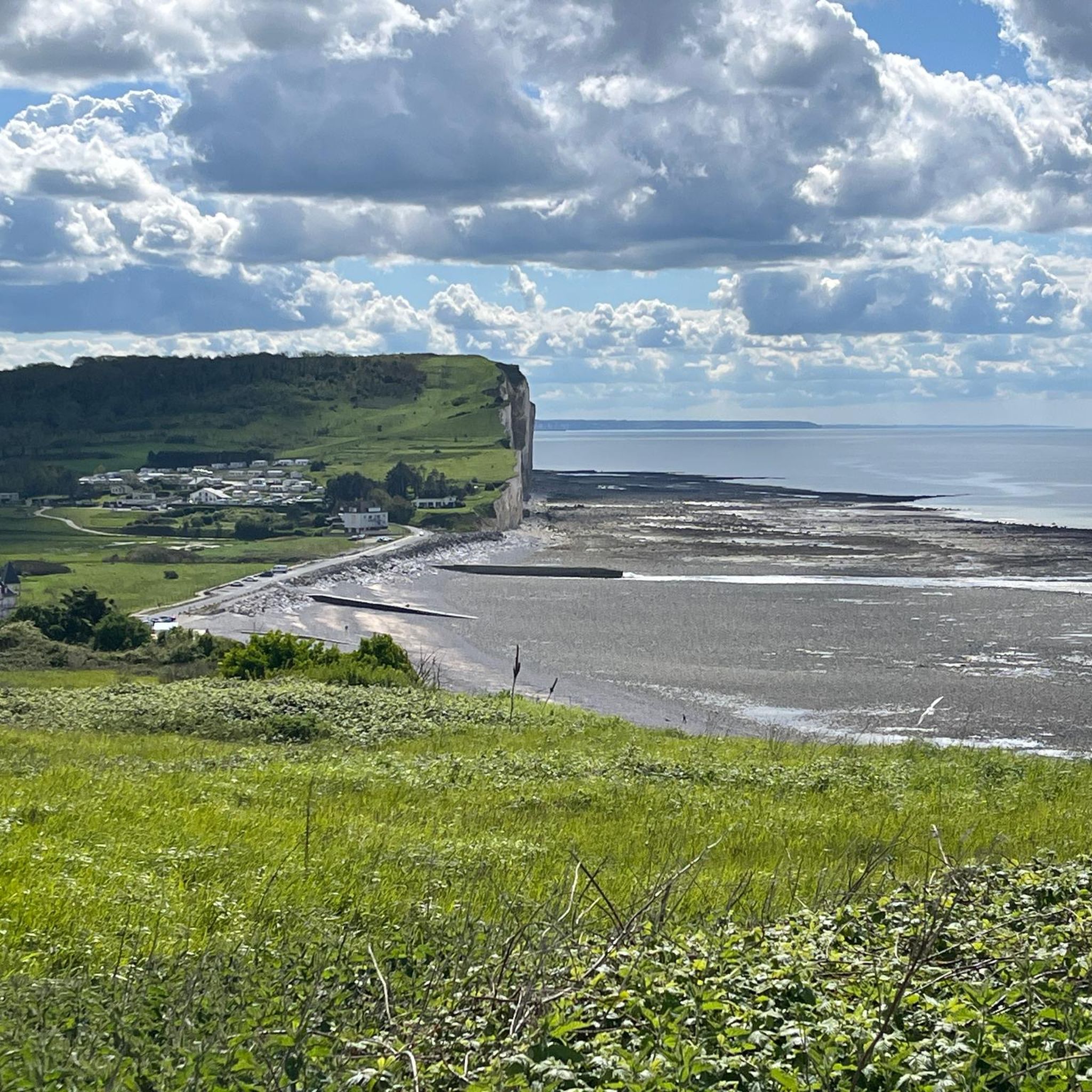

Tips from the Community

A beautiful walk with stunning views. A fairly steep climb to the highest point and a unique descent through the forest.
0
0

Be careful, this route takes you a few meters from the cliff, which is very dangerous!
0
0

An ideal place for a picnic
0
0
Breathtaking view of the Yères valley
0
0

Seine-Maritime has a rich 19th century industrial heritage in various forms. This is the case of the Touffreville-sur-Eu railway viaduct, which has just been awarded the "Rural Heritage of Seine-Maritime" label. The viaduct is part of the "Chemin Vert du Petit Caux" hiking trail. It all began in 1872 with the opening of the 40 km Dieppe-Eu railway line, on which the Touffreville-sur-Eu viaduct was built to cross the Yères valley. Inaugurated in 1885, the brick viaduct has nine arches and is operated by the Compagnie de l'Ouest, in particular for the transport of pebbles exported for industrial purposes. A coastal railway line then operates from Tréport to Le Havre to serve the beaches where seaside life is booming with casinos, villas and sumptuous hotels with architecture typical of the Normandy coast. From 1938, the line is closed to passenger traffic and reserved exclusively for freight transport. The Second World War led to the disappearance of most of the buildings on the coast and seaside activities were interrupted. Freight traffic then resumed until 1972, when it was stopped with the oil crisis. The SNCF then bought the 17 km line between Saint-Quentin-au-Bosc and Eu in 1986 to transform it into a hiking trail and that was the birth of the Chemin Vert du Petit Caux! Source: www.normandie-tourisme.fr
0
0


Small bucolic spot for a short break, with a pretty water mill on the Yrès.
0
0
Frequently Asked Questions
How many hiking trails are there in Les Ifs?
There are over 4 hiking routes around Les Ifs, offering a variety of experiences through rural landscapes and rolling hills. These trails are generally moderate in difficulty, with one challenging option for those seeking a longer adventure.
What do other hikers enjoy most about hiking in Les Ifs?
The komoot community highly rates the hiking experience in Les Ifs, with an average score of 4.7 stars from over 7 reviews. Hikers often praise the varied terrain, from open countryside to areas with historical significance, and the scenic viewpoints, especially those offering glimpses towards the coast.
Are there easy hikes around Les Ifs?
While most routes in Les Ifs are classified as moderate, the region's terrain with rolling hills and gentle ascents makes many trails accessible for various fitness levels. There are no routes specifically categorized as 'easy' in the current selection, but moderate trails like the Poteau Saint-Remi loop from Cimetière de Guerre de Grandcourt offer manageable distances and elevation changes.
Are there challenging hikes in Les Ifs?
Yes, for those seeking a more demanding experience, the View of CRIEL-SUR-MER – View of Criel-sur-mer loop from Saint-Martin-le-Gaillard is a challenging 12.9-mile (20.7 km) route. It offers expansive views towards the coast and requires a good level of fitness to complete.
Are there circular walks in Les Ifs?
Many of the popular hikes in Les Ifs are circular routes, perfect for returning to your starting point. Examples include the Hiking loop from Grandcourt and the Water mill loop from Sept-Meules, both offering scenic journeys through the countryside.
What attractions can I see near the hiking trails in Les Ifs?
Around Les Ifs, you can explore several interesting sites. Notable attractions include the historical V1 Launch Site of Guerville and the Site of Queen Mother Elizabeth. For scenic views, consider visiting the Sainte Catherine viewpoint.
Is Les Ifs suitable for family-friendly hikes?
The moderate elevation changes and rural paths make many trails in Les Ifs suitable for families, especially those with older children or who are used to walking. Routes like the Water mill loop from Sept-Meules offer a good balance of distance and manageable terrain.
Are dogs allowed on the hiking trails in Les Ifs?
Generally, dogs are welcome on hiking trails in rural areas like Les Ifs, especially if kept on a leash. However, it's always advisable to check local signage, particularly when passing through private land or nature reserves, to ensure compliance with any specific regulations.
When is the best time of year to hike in Les Ifs?
The best time to hike in Les Ifs is typically from spring through autumn (April to October). During these months, the weather is generally mild and pleasant, making for comfortable walking conditions. Spring brings blooming wildflowers, while autumn offers beautiful foliage.
Are there any hikes with viewpoints in Les Ifs?
Yes, several routes in Les Ifs offer scenic viewpoints. The challenging View of CRIEL-SUR-MER – View of Criel-sur-mer loop from Saint-Martin-le-Gaillard is known for its expansive coastal views. Additionally, the Sainte Catherine viewpoint is a specific highlight worth visiting for panoramic vistas.
What are the parking options for hikers in Les Ifs?
Parking for hikers in Les Ifs is typically available in or near the villages where trails begin. Many routes, being loops, start and end in locations with public parking, such as near churches or village squares. It's recommended to check the specific starting point of your chosen route for detailed parking information.
How can I reach the hiking trails in Les Ifs by public transport?
Public transport options to reach the starting points of hikes in Les Ifs may be limited, as it is a rural area. Regional bus services might connect larger towns to some villages. For the most flexibility, driving to the trailheads is often the most convenient option. Always check local bus schedules in advance if planning to use public transport.
Most popular attractions around Les Ifs

Get inspired with the komoot mobile app


Explore more
Browse the best Hikes in other regions.
