The best cycling routes around La Monselie
4.8
(59)
584
riders
100
rides
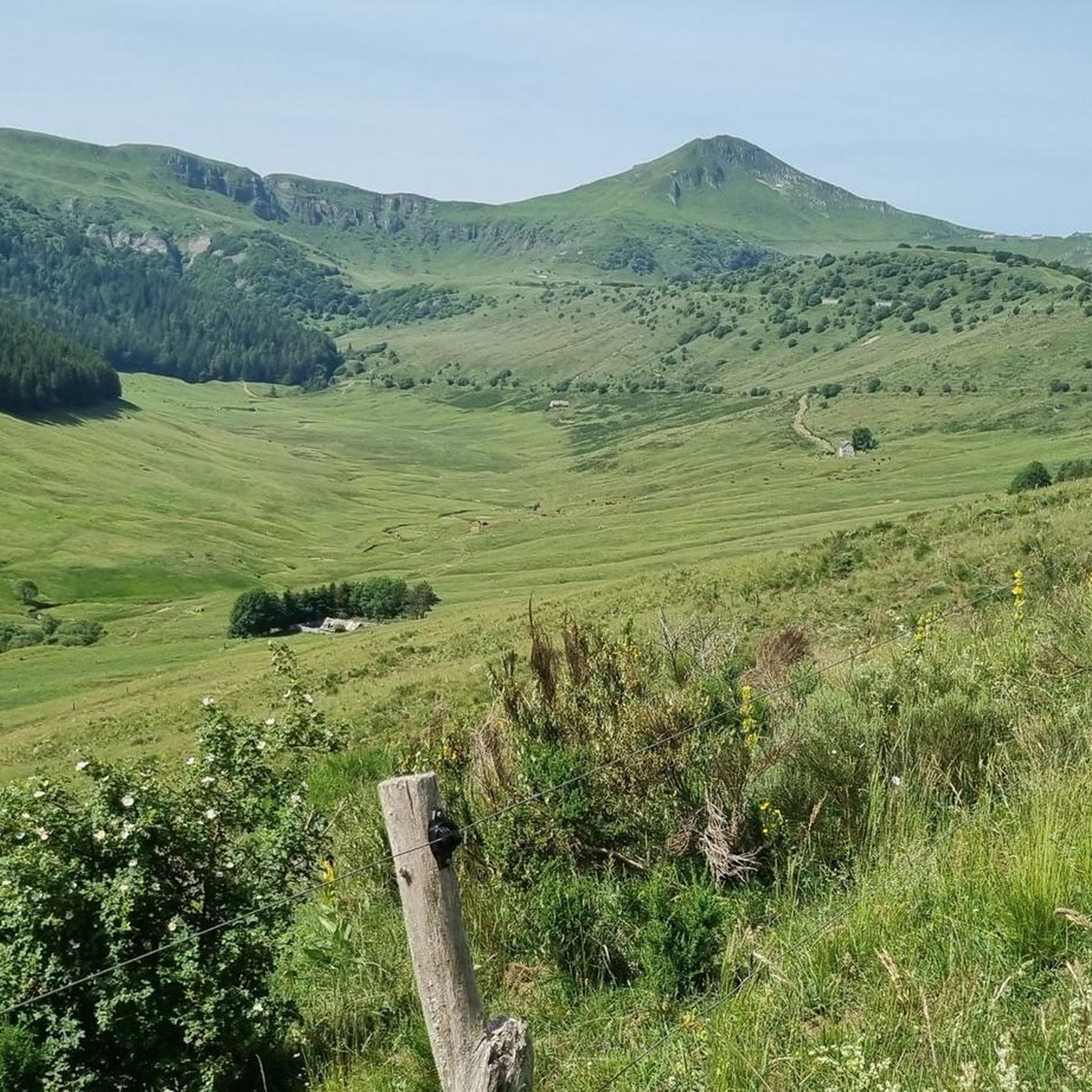
Touring cycling around La Monselie offers diverse terrain within the Cantal department of the Auvergne-Rhône-Alpes region. The area is characterized by its volcanic origins, featuring forested peaks, high plateaus, and extinct volcanoes of the Massif Central. Cyclists can navigate routes through gorges, along rolling hills, and through lush forests, with elevations reaching 730 meters in La Monselie itself. This varied landscape provides a range of challenges and scenic opportunities for touring cyclists.
Best touring cycling routes around La Monselie
- The…
Last updated: June 30, 2026
3.5
(2)
9
riders
20.9km
01:15
140m
140m
Cycle the easy 13.0-mile Saignes and Sumène-Artense green way loop, enjoying the Sumène Valley and views of the Cantal Puys.
5.0
(2)
14
riders
39.8km
02:45
700m
700m
Hard bike ride. Very good fitness required. Mostly paved surfaces. Suitable for all skill levels.

Sign up for free
4
riders
31.6km
02:02
410m
410m
Moderate bike ride. Good fitness required. Mostly paved surfaces. Suitable for all skill levels.
7
riders
34.2km
02:19
570m
570m
Hard bike ride. Very good fitness required. Mostly paved surfaces. Suitable for all skill levels.
8
riders
82.3km
06:24
1,950m
1,950m
Hard bike ride. Very good fitness required. Mostly paved surfaces. Suitable for all skill levels.
Get access to more routes and recommendations from other explorers.
Sign up for free
Already have an account?
Our route recommendations are based on thousands of hikes, rides, and runs completed by other people on komoot.
Start today with a free account
Your next adventure awaits.
Login or Signup



Tips from the Community

Very pleasant, quite shady, a shame the shortcuts are very difficult to take.
0
0
Gentiane Express is a touristic train between Riom-ès-Montagnes and Lugarde. The trains are former SNCF diesel trains. During summer there are 2 daily return services (in the morning and the afternoon)
0
0

Road to Puy Mary, not so hearty here.
0
0
Descent or ascent to Puy Mary.
0
0

At an altitude of 1,588 meters, the Pas de Peyrol is located between the Puy Mary and the Puy de la Tourte. It is known to be the highest road pass in the Massif Central and is worth it, because the last few kilometers have high percentages. There you can admire Puy Mary which peaks at an altitude of 1,783 metres. It is one of the peaks of the Cantal mountains. It is easily recognizable with its pyramidal silhouette.
1
0

All asphalted greenway, which passes through the small village of Ydes. In the heart of the Massif Central, it extends over 14 kilometers and connects Cheyssac to Parensol.
3
0
Small village of medieval origin in Cantal, at the foot of the Puy of the same name. Beautiful old houses and remains of an old fortress.
2
0
Small quiet road along the Sumène river, between Ydes and Ydes Bourg.
1
0
Frequently Asked Questions
How many touring cycling routes are available around La Monselie?
There are over 100 touring cycling routes available around La Monselie, offering a wide variety of experiences. These routes are highly rated by the komoot community, with an average score of 4.7 stars.
What is the general terrain like for touring cyclists in La Monselie?
The terrain around La Monselie is characterized by its volcanic origins, featuring forested peaks, high plateaus, and extinct volcanoes of the Massif Central. You can expect routes that traverse gorges, rolling hills, and lush forests, with La Monselie itself situated at an altitude of 730 meters. This varied landscape provides both challenging climbs and scenic, gentler rides.
Are there routes suitable for beginners or those seeking an easier ride?
Yes, La Monselie offers several easier routes. For instance, the Sumène-Artense Greenway Loop is an easy 13.0-mile (20.9 km) trail that follows a dedicated greenway, providing a smooth and scenic ride suitable for less experienced cyclists or those looking for a relaxed tour. Overall, there are 6 easy routes available.
What kind of challenges can advanced touring cyclists expect around La Monselie?
Advanced touring cyclists will find plenty of challenging routes in La Monselie, with 75 difficult routes available. These often feature significant elevation gains and traverse mountain passes. An example is the Route du col de Besseyrre – Besseyre Pass loop from Le Monteil, a difficult 24.7-mile (39.8 km) path that offers expansive views and demanding climbs. Another challenging option is the Pas de Peyrol Pass (1,589 m) – Aulac Pass. loop from Vebret, which covers over 82 km with nearly 2000 meters of elevation gain.
Are there any notable natural features or landmarks to see while cycling near La Monselie?
Absolutely! The region is rich in natural beauty and historical sites. You can cycle past the impressive Bort-les-Orgues Dam, enjoy the View over Bort-les-Orgues, or visit the picturesque medieval Chateau de Val. The area is also part of the vast Parc des Volcans, offering dramatic volcanic landscapes and high plateaus.
Can I find waterfalls or lakes along the cycling routes?
Yes, the region around La Monselie features beautiful natural water bodies. You can discover the Saut de la Saule Waterfall and cycle near mountain lakes like Lac de Lastioulles. Lac Pavin is another notable lake in the vicinity, often nestled in extinct volcanoes.
What do other touring cyclists enjoy most about cycling in La Monselie?
The area is highly rated by the komoot community, with an average score of 4.7 stars from over 50 reviews. More than 600 touring cyclists have explored La Monselie's varied terrain using komoot. Reviewers often praise the diverse landscapes, from volcanic mountains and high plateaus to rolling hills and lush forests, as well as the range of routes suitable for different ability levels.
Are there any circular touring cycling routes in the area?
Yes, many routes around La Monselie are designed as loops, allowing you to start and end at the same point. Examples include the easy Sumène-Artense Greenway Loop, the difficult Route du col de Besseyrre – Besseyre Pass loop from Le Monteil, and the moderate Village de Saignes loop from Parking de la voie verte.
Are there family-friendly cycling options around La Monselie?
Yes, the region offers family-friendly cycling options, particularly on dedicated greenways. The "Green slope," a 14 km tarred old railway line between Bassignac and Vebret, is ideal for families seeking a less strenuous and safe cycling experience. The Sumène-Artense Greenway Loop is another excellent easy option for families.
When is the best time of year to go touring cycling in La Monselie?
The Auvergne-Rhône-Alpes region, where La Monselie is located, is generally pleasant for outdoor activities. Spring and autumn offer milder temperatures and beautiful scenery, making them ideal for touring cycling. Summer can also be great, especially in the higher altitudes, though some routes might be more exposed to sun. Always check local weather forecasts before heading out.
What are the parking options for cyclists in La Monselie?
While specific parking areas for cyclists are not detailed, many routes, such as the Village de Saignes loop from Parking de la voie verte, indicate starting points with parking availability. It's advisable to check the starting points of individual routes on komoot for specific parking information.
Is public transport available to access cycling routes around La Monselie?
Information on specific public transport links directly to trailheads in La Monselie is limited. However, the broader Auvergne-Rhône-Alpes region has transport networks. For detailed information on public transport options to access specific cycling routes, it's best to consult local transport authorities or tourist information centers in the Cantal department.
Are there any dedicated greenways for cycling in La Monselie?
Yes, there is a notable greenway in the area. The "Green slope" is a 14 km tarred old railway line between Bassignac and Vebret, perfectly suited for cycling. Additionally, the Greenway in Sumène-Artense is a dedicated cycle path that offers a smooth and enjoyable ride.
Most popular attractions around La Monselie

Get inspired with the komoot mobile app


Explore more
Browse the best Cycling routes in other regions.
