The best mountain hikes around Zilshausen
4.3
(4)
12
hikers
3
hikes
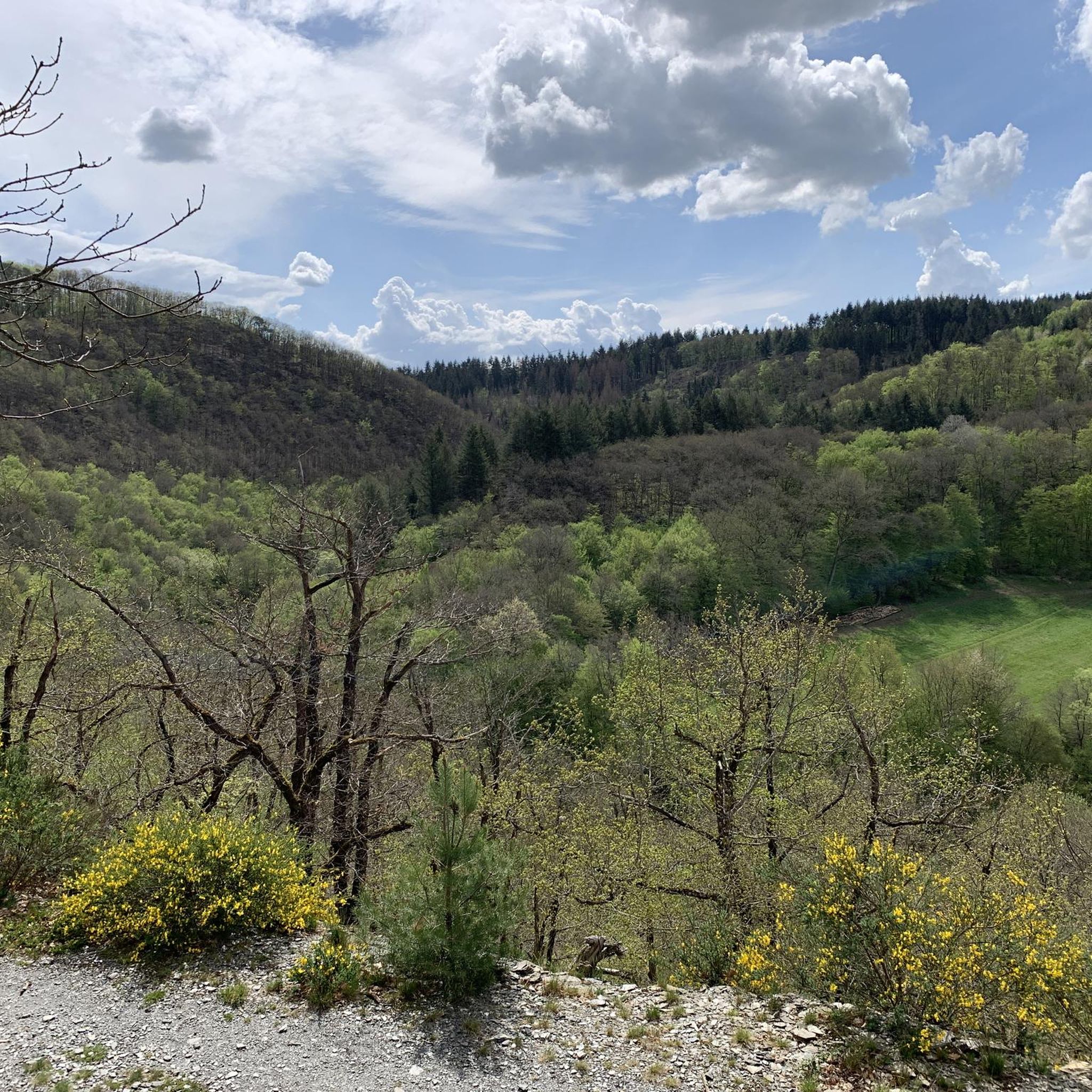
Mountaineering routes around Zilshausen traverse a landscape characterized by rolling hills, extensive forests, and notable rock formations within the northern Hunsrück region. Situated between the Lützbach and Dünnbach valleys, the area offers varied topography for exploration. While not a hub for technical climbing, the terrain provides challenging and scenic routes for those seeking strenuous hikes.
Best mountaineering routes around Zilshausen
- The most popular mountaineering route is Eltz Castle – Forest Path to Eltz Castle loop from Moselkern, a 7.7…
Last updated: July 2, 2026
5.0
(2)
9
hikers
Moderate mountaineering route. Good fitness required. Mostly accessible paths. Sure-footedness required.
3.0
(1)
2
hikers
14.0km
04:37
540m
540m
Moderate mountaineering route. Good fitness required. Mostly accessible paths. Sure-footedness required.

Sign up for free
5.0
(1)
1
hikers
12.6km
03:42
330m
330m
Moderate mountaineering route. Good fitness required. Easily-accessible paths. Suitable for all skill levels.
Our route recommendations are based on thousands of hikes, rides, and runs completed by other people on komoot.
Start today with a free account
Your next adventure awaits.
Login or Signup
Tips from the Community


Fine, natural paths and yet you are rarely alone here
10
0

The climb here is tough.
2
0


The Moselsteig Trail, or rather, the dream path, continues from the restaurant/café to the left, over a small bridge... Caution ⚠️ the path goes uphill to the left!!! DO NOT go straight ahead!!! Otherwise, the trail ends on a very, very steep slope with lots of loose scree.
5
0

"...We are now embarking on our final stage. We pass the tanning mill from the 17th century, which was used to tan skin into leather. Now we only have to go through the town of Müden, where our accommodation and a glass of wine are waiting for us..." Find out more about our idyllic hike to Eltz Castle at: https://www.netreisetagebuch.de/burg-eltz-wandern/
0
1

You can also have a beautiful view of the castle from the stream below.
3
0

Relatively steep climb Good footwear and safety gear are recommended
4
0
Frequently Asked Questions
What kind of terrain can I expect on mountaineering routes around Zilshausen?
The routes around Zilshausen traverse a landscape characterized by rolling hills, extensive forests, and notable rock formations within the northern Hunsrück region. You'll find varied topography, including sections that can be quite demanding, especially between the Lützbach and Dünnbach valleys.
What is the general difficulty level of the mountaineering routes in Zilshausen?
The mountaineering routes around Zilshausen are generally considered moderate. For example, routes like Eltz Castle – Forest Path to Eltz Castle loop from Moselkern and Stone Bridge over the Elzbach – View of Eltz Castle loop from Treis-Karden are rated as moderate, offering a good balance of challenge and scenic beauty.
Are there any circular mountaineering routes in the area?
Yes, several routes around Zilshausen are designed as loops, allowing you to start and end at the same point. Examples include the Eltz Castle – Forest Path to Eltz Castle loop from Moselkern and the Moselsteig Trail at the Elzbach – Eltz Castle loop from Moselkern, which offer varied terrain and historical sights.
What interesting sights or landmarks can I see along the routes?
Many routes offer views of historic landmarks. For instance, you can explore paths leading towards the impressive Eltz Castle. The wider region also features significant natural rock formations and is close to other historic sites like Pyrmont Castle. You might also encounter natural highlights such as the Water Lily Pond or various caves like the Baybachtal Bat Cave (Slate Tunnel).
When is the best time of year to go mountaineering in Zilshausen?
The Hunsrück region, where Zilshausen is located, is beautiful throughout the warmer months, typically from spring to autumn. These seasons offer pleasant temperatures and vibrant natural scenery, making them ideal for exploring the extensive forests and rolling hills. Winter can also be an option, but some paths might become more challenging due to snow or ice.
Are the mountaineering routes around Zilshausen suitable for families?
While the routes are described as moderate and can be challenging in sections, many families with older children who are accustomed to longer hikes might enjoy them. The trails often lead through forests and past interesting geological features, providing an adventurous experience. Always check the specific route details for distance and elevation to ensure it matches your family's fitness level.
Can I bring my dog on the mountaineering routes?
Generally, dogs are welcome on hiking trails in the Hunsrück region. The extensive forest sections and natural paths around Zilshausen provide a great environment for dogs. However, it's always advisable to keep your dog on a leash, especially in wildlife areas or near livestock, and to be mindful of other hikers.
What do other mountaineers enjoy most about the routes in Zilshausen?
The komoot community highly rates the mountaineering routes around Zilshausen, with an average score of 4.3 stars. Users often praise the varied terrain, the peaceful forest paths, and the scenic views, particularly those leading to Eltz Castle. The blend of natural beauty and historical sights is a common highlight.
Are there any places to stop for refreshments along the trails?
While the guide doesn't specify cafes directly on the trails, the routes often pass through or near villages. It's always a good idea to carry sufficient water and snacks, especially on longer routes. You might find refreshment options in nearby towns like Moselkern or Treis-Karden, which serve as starting points for some tours.
What kind of wildlife might I encounter while mountaineering in Zilshausen?
The extensive forests and valleys around Zilshausen are home to various wildlife typical of the Hunsrück region. You might spot deer, wild boar, various bird species, and smaller forest animals. Early mornings or late afternoons are often the best times for wildlife spotting.
What is the longest mountaineering route available in Zilshausen?
Among the listed routes, the Stone Bridge over the Elzbach – View of Eltz Castle loop from Treis-Karden is the longest, covering approximately 8.7 miles (14.0 km). This route offers extensive exploration and takes around 4 hours 36 minutes to complete.
Is parking available near the trailheads for these routes?
For routes starting in towns like Moselkern or Treis-Karden, you can typically find public parking facilities. It's recommended to check local parking options in these villages before your trip, especially during peak seasons, to ensure a smooth start to your mountaineering adventure.
Most popular attractions around Zilshausen

Get inspired with the komoot mobile app


Explore more
Browse the best Mountain Hikes & Routes in other regions.
