The best running trails around Aulhat-Flat
4.1
(52)
3,611
runners
265
runs
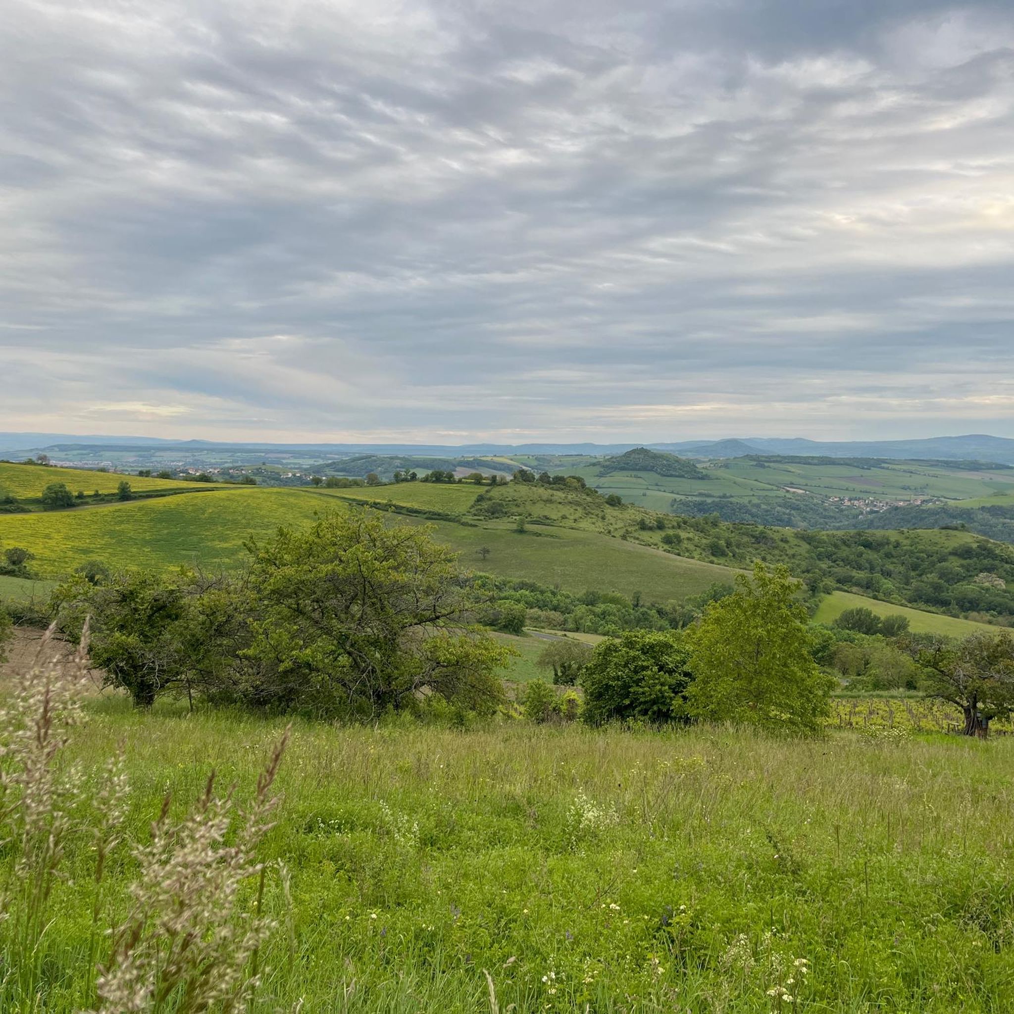
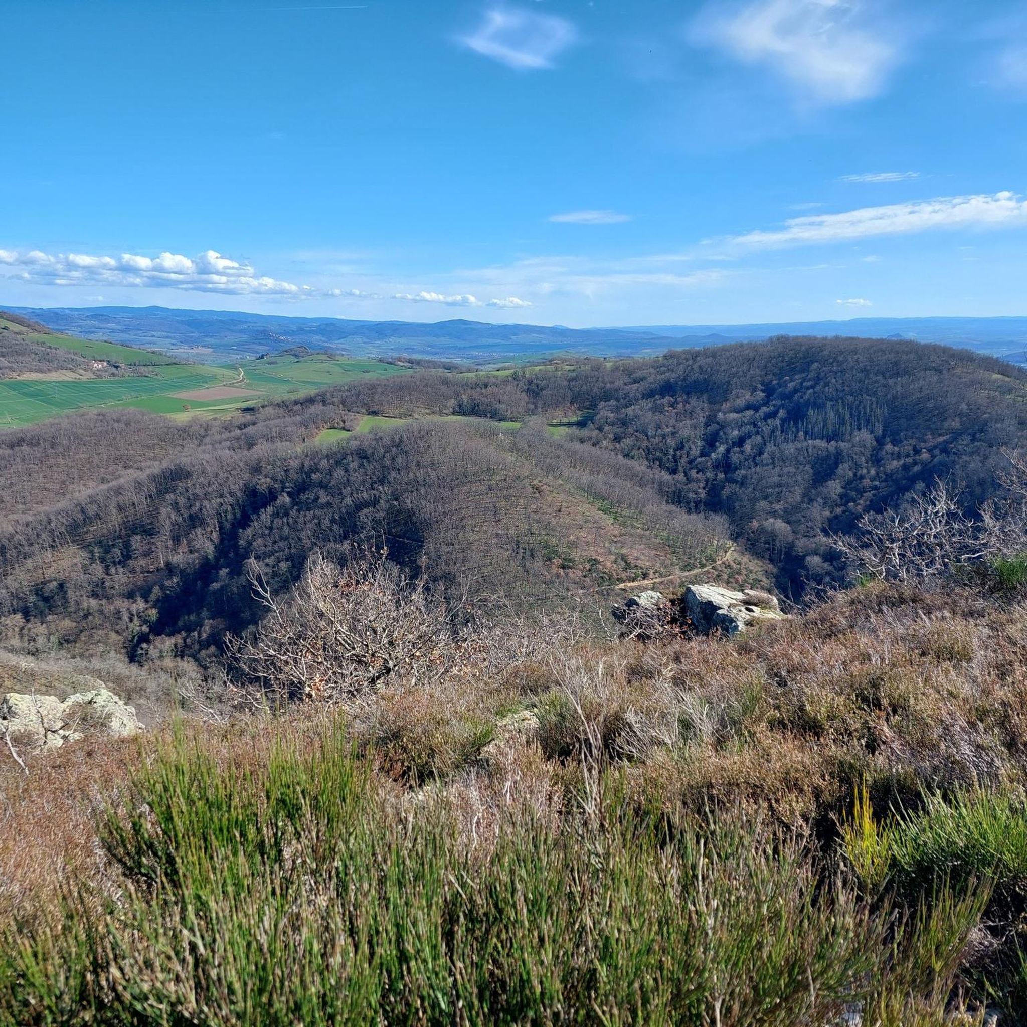
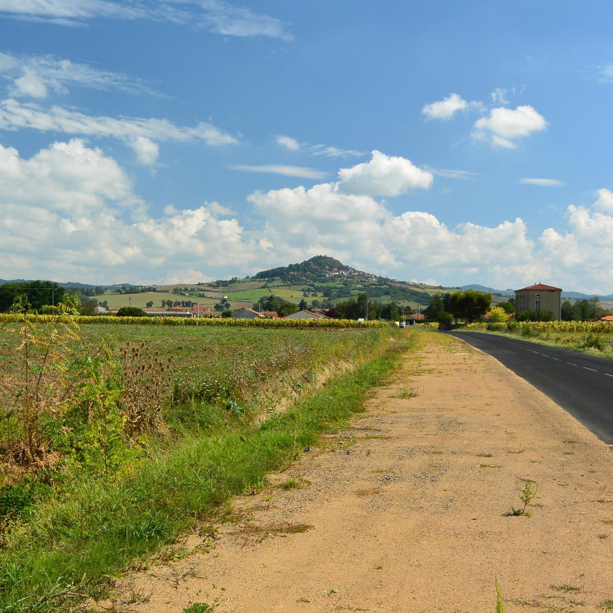
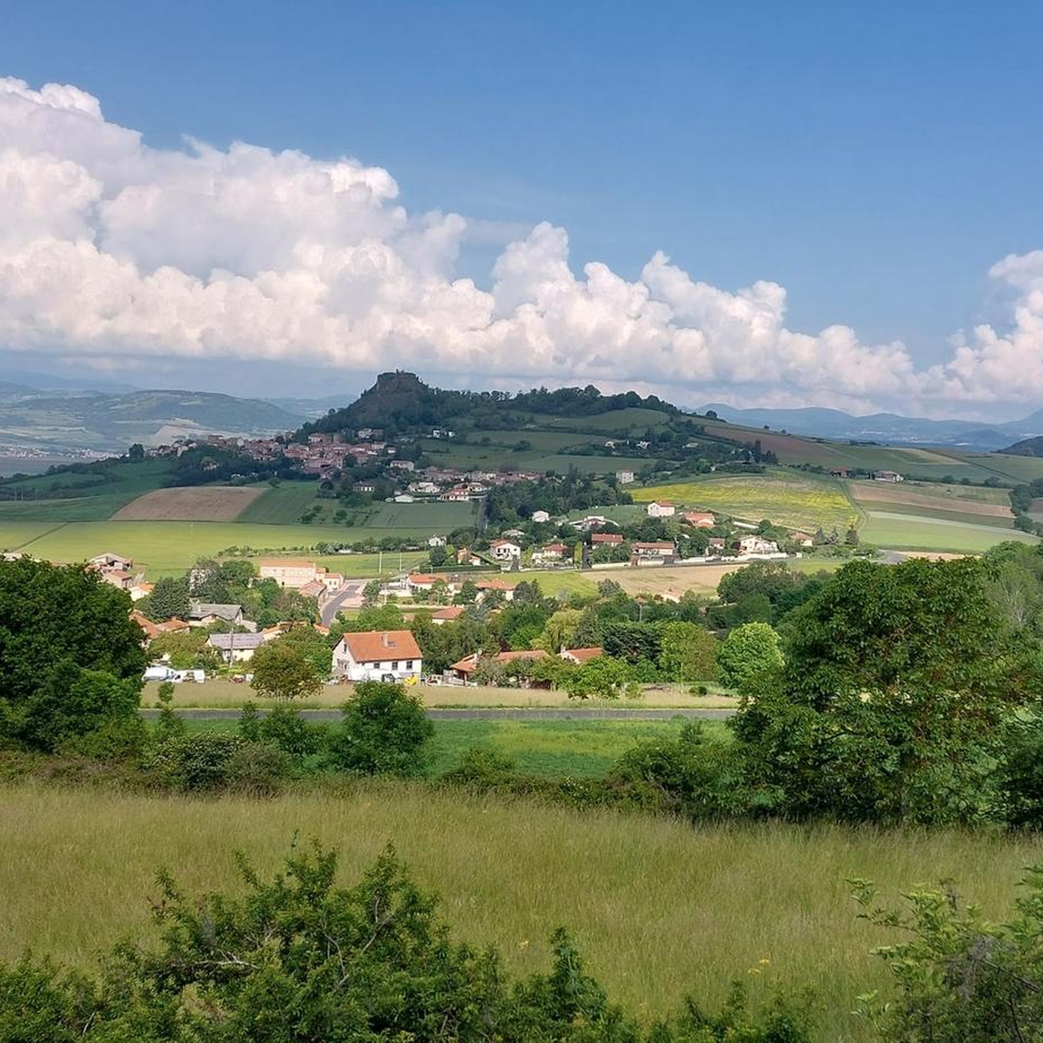
Jogging around Aulhat-Flat reveals a diverse landscape characterized by volcanic and granitic soils alongside sedimentary lands, creating varied terrain. The region offers expansive panoramas over the Val d'Allier and the Monts Dore, with views extending from the Monts du Forez to the Sancy mountain range. Gentle slopes and the presence of the Ailloux stream contribute to the natural charm, providing a picturesque backdrop for running. Elevations range from 364 meters to 671 meters, offering varied elevation changes for different types…
Last updated: October 16, 2026
31
runners
7.30km
00:49
50m
50m
Moderate run. Good fitness required. Mostly paved surfaces. Suitable for all skill levels.
13
runners
11.6km
01:25
300m
300m
Hard run. Very good fitness required. Mostly paved surfaces. Suitable for all skill levels.

6
runners
7.08km
00:53
240m
240m
Moderate run. Good fitness required. Mostly paved surfaces. Suitable for all skill levels.
6
runners
5.82km
00:42
160m
160m
Moderate run. Good fitness required. Mostly paved surfaces. Suitable for all skill levels.
2
runners
24.5km
03:00
670m
670m
Hard run. Very good fitness required. Mostly paved surfaces. Suitable for all skill levels.
Get access to more routes and recommendations from other explorers.
Already have an account?
Our route recommendations are based on thousands of hikes, rides, and runs completed by other people on komoot.
Start today with a free account
Your next adventure awaits.

Tips from the Community

A lovely walk along the Allier river, and a pretty crossing of the county woods.
0
0

Small "pass" but very pleasant to drive and offers beautiful views
0
0

This pass culminates at an altitude of 654 meters. Of medium difficulty, it offers you a breathtaking 360-degree view at its summit.
2
1

Very beautiful panorama on each side of the pass
0
1

The Col de la Croix des Gardes does not present any great difficulties. the progression is surrounded by the green of the fields.
0
0

The Col de la Croix des Gardes from the D49 road is 7.7 km long with a total drop of 273 m. The average gradient is 3.55% with maximum gradients of 8%.
1
0

Not high, no question. But, after immersing yourself in the solitude of the Auvergne, here is a first wonderful view of what we could expect on the tour scenic yet.
0
0
Frequently Asked Questions
How many running routes are available in Aulhat-Flat?
Aulhat-Flat offers a wide selection of running routes, with over 250 trails available. These routes cater to various preferences, from easy jogs to more challenging runs.
What kind of scenery can I expect on the jogging trails in Aulhat-Flat?
Jogging in Aulhat-Flat provides diverse and picturesque scenery. You'll encounter varied terrain, including volcanic and granitic soils, and enjoy unexpected panoramas over the Val d'Allier and the Monts Dore. Views often stretch from the Monts du Forez to the Sancy mountain range. The area also features the charming Ailloux stream and gentle slopes reminiscent of the Italian Tuscany.
Are there easy running routes suitable for beginners in Aulhat-Flat?
Yes, Aulhat-Flat has several easy running routes perfect for beginners or those looking for a relaxed jog. There are 15 easy routes available, ensuring accessible paths for all skill levels. Many trails are well-suited for casual joggers.
Are there any long-distance running trails in Aulhat-Flat for more experienced runners?
Absolutely. For experienced runners seeking a challenge, Aulhat-Flat offers several longer and more difficult trails. For example, the Croix des Gardes Pass – Col de la Croix des Gardes loop from Flat is a difficult 24.3 km (15.1 miles) route with significant elevation gain, taking over 3 hours to complete. Another challenging option is the Running loop from Flat, which covers 10.2 km (6.3 miles) with over 320 meters of elevation.
What do other runners enjoy most about the trails in Aulhat-Flat?
The running trails in Aulhat-Flat are highly rated by the komoot community, with an average score of 4.1 stars from over 40 reviews. Runners often praise the varied terrain, the stunning panoramic views, and the accessibility of the paths, which cater to different ability levels.
Are there any circular running routes in Aulhat-Flat?
Yes, many of the running routes in Aulhat-Flat are circular, allowing you to start and finish at the same point. A popular moderate option is the L'Allier – Plan d'Eau du Mas loop from Orbeil, which is 7.3 km (4.5 miles) long. For a longer, more challenging circular run, consider the L'Allier loop from Orbeil, an 11.6 km (7.2 miles) route with over 300 meters of elevation gain.
What interesting landmarks or attractions can I see while jogging in Aulhat-Flat?
While jogging in Aulhat-Flat, you can explore various local heritage sites and natural features. Notable attractions include the historic Château de Lachaux, the medieval village of Montpeyroux with its tower, and the View of the old suspension bridge of Parentignat. The trails also lead through charming small villages and offer views of the Ailloux stream and the Allier river.
Are there any running routes that pass by water features?
Yes, several running routes in Aulhat-Flat incorporate water features. The L'Allier – Plan d'Eau du Mas loop from Orbeil and the Plan d'Eau du Mas – L'Allier loop from Flat both feature the Plan d'Eau du Mas and the Allier river, offering pleasant waterside sections for your run.
What is the elevation range for running trails in Aulhat-Flat?
The elevation in Aulhat-Flat ranges from approximately 364 meters to 671 meters. This diverse topography means you can find routes with gentle slopes for easier runs, as well as more challenging trails with significant elevation changes, such as the L'Allier loop from Orbeil which features over 300 meters of ascent.
Can I find running routes that are mostly on paved surfaces?
Yes, some running routes in Aulhat-Flat feature mostly paved surfaces. For instance, the L'Allier – Plan d'Eau du Mas loop from Orbeil is primarily on paved surfaces, making it suitable for those who prefer a smoother running experience.
Are there any specific trails that offer expansive views?
Many trails in Aulhat-Flat are known for their expansive views. From elevated points like the hamlet of La Suchère and the Ybois hill, you can enjoy extensive panoramas stretching from the Monts du Forez in the east to the Sancy mountain range in the west, providing inspiring scenery for your runs.
Most popular routes around Aulhat-Flat
Most popular attractions around Aulhat-Flat

Get inspired with the komoot mobile app


Explore more
Browse the best Running Trails & Routes in other regions.
