The best running trails around Terras De Bouro
4.4
(7)
485
runners
22
runs
Jogging around Terras De Bouro offers diverse terrain within the Peneda-Gerês National Park, characterized by rugged mountains, ancient forests, and river valleys. The region features a variety of running surfaces, from gentle forest paths to challenging mountain trails, often composed of dirt roads. Runners can explore areas with granite boulders, lush vegetation, and picturesque reservoirs formed by the Caniçada and Vilarinho das Furnas dams. These best running trails Terras De Bouro provide options for various fitness levels, including routes along…
Last updated: August 21, 2026
15
runners
6.70km
01:03
390m
390m
Hard run. Very good fitness required. Mostly paved surfaces. Suitable for all skill levels.
3
runners
21.2km
03:52
950m
950m
Hard run. Very good fitness required. Sure-footedness, sturdy shoes and alpine experience required.

Sign up for free
112
runners
39.5km
04:56
1,340m
1,340m
Hard run. Very good fitness required. Sure-footedness, sturdy shoes and alpine experience required.
4.0
(1)
24
runners
10.2km
01:26
600m
600m
Hard run. Very good fitness required. Mostly paved surfaces. Suitable for all skill levels.
27
runners
11.6km
01:47
650m
650m
Hard run. Very good fitness required. Sure-footedness, sturdy shoes and alpine experience required.
Get access to more routes and recommendations from other explorers.
Sign up for free
Already have an account?
Our route recommendations are based on thousands of hikes, rides, and runs completed by other people on komoot.
Start today with a free account
Your next adventure awaits.
Login or Signup
Tips from the Community

Leonte waterfall is now dry (August). Still a beautiful path to walk.
0
0

The Chalcedony Trail (PR1 TBR – Trilho da Cidade da Calcedonia) is one of the most iconic routes in Peneda-Gerês National Park, located in Covide (Braga), within the municipality of Terras de Bouro. It leads to the ruins of the City of Chalcedony, an ancient pre-Roman hill fort high in the mountains. It offers panoramic views over the Homem River valley and the Gerês mountains. The trail passes through native forests, rocky areas, and natural viewpoints.
2
0
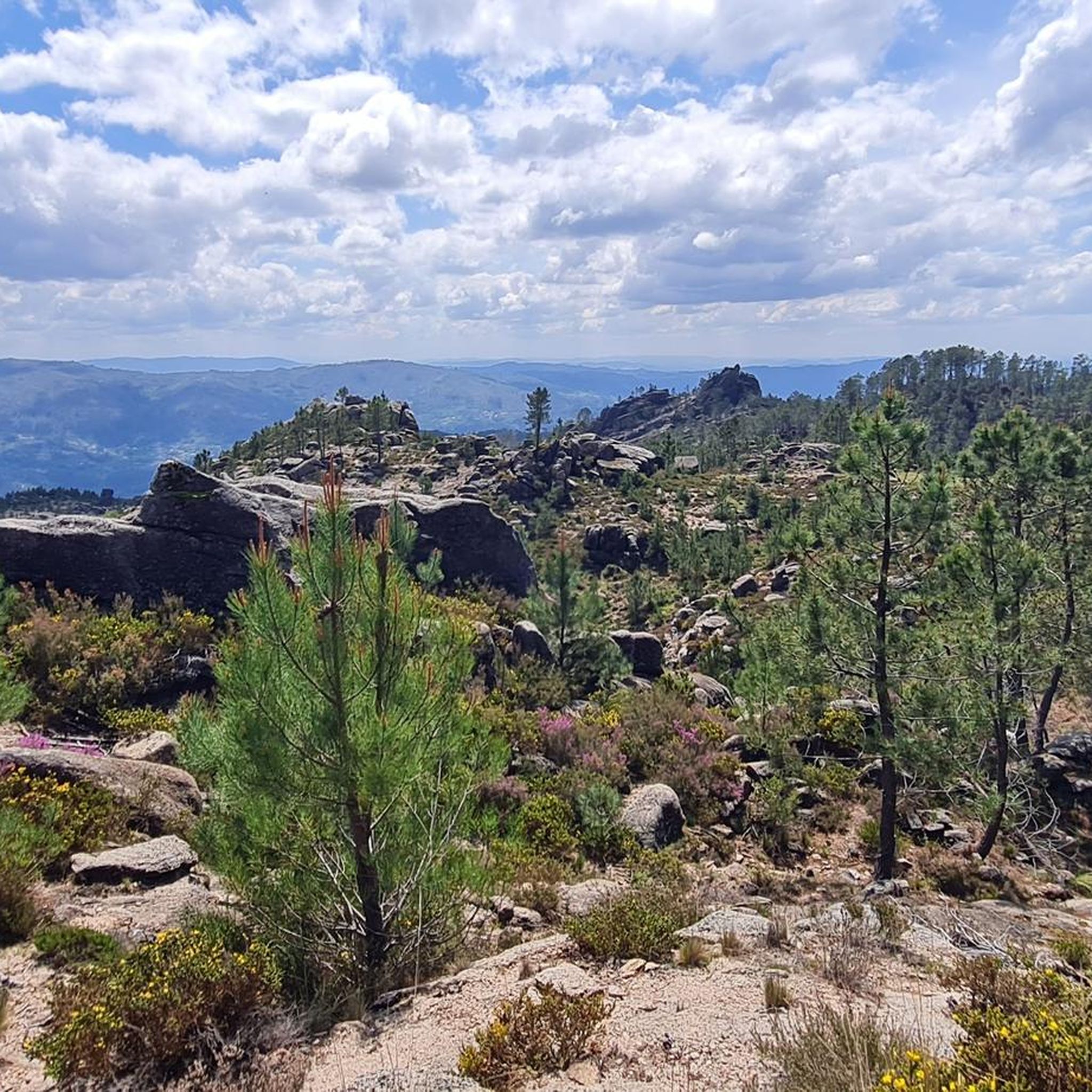
A spectacular rocky section where granite boulders rise like "sleeping giants" all around you. The trail ascends towards the peak of Curvaceira, at 919m, and offers panoramic views of the deep Covide Valley.
2
0

The Calcedonia Crack is one of those passages that seems to have come straight out of an old fairy tale: a monumental crack between two granite giants. For those who like a challenge, the route involves climbing and jumping between huge blocks fitted together at the base. Going up is easier than going down: there is more support, more traction, and less hesitation. There is no need to cross it (the trail elegantly skirts the crack) but, for the more adventurous, facing this crack is almost a ritual: a mix of adrenaline, vertigo and raw landscape that leaves its mark on those who pass by.
1
1
As you climb, the granite blocks grow around you like sleeping giants. To the south, the Curvaceira rises up at 919 metres. To the north, the Covide valley stretches out below, green and deep. Here, the barrosãs roam freely among the rocks, but those who run know: this is the hard part. Tapered trails, serious ramps and rock that sometimes begs for a handhold on the ground. This is the mountain in its purest form, above 800 metres. Raw, beautiful and unforgettable.
1
1

The Leonte Waterfall appears when the waters of the Taleira stream fall from a granite cliff, plunging 19 metres into the bed of the Gerês River. However, in drier summers, nature imposes its own rhythm and the flow can disappear, transforming the waterfall into a temporary silence.
4
1
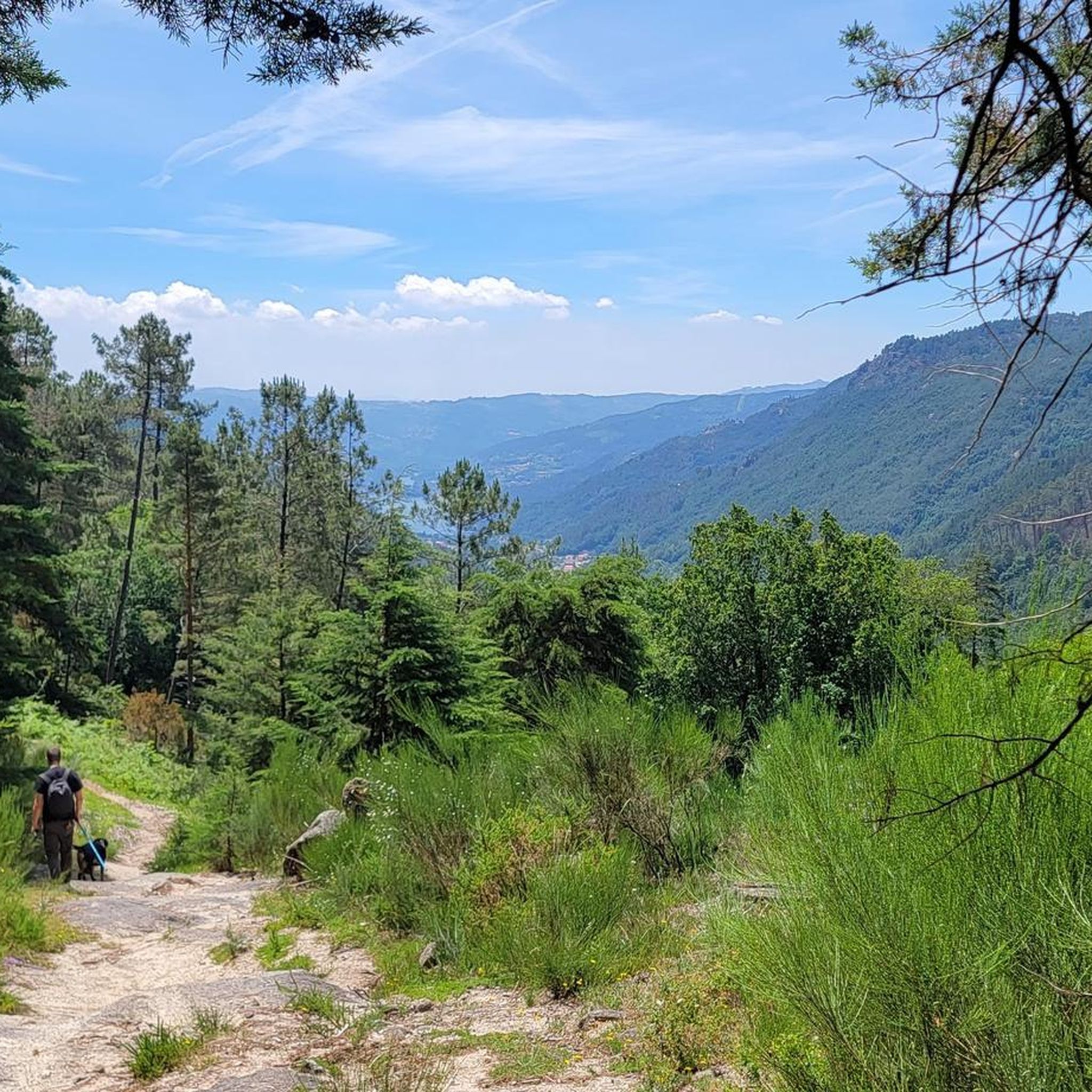
From the top of this viewpoint, the view takes in breathtaking landscapes. To the south, the Gerês valley stretches out, with the Caniçada reservoir framing the horizon. A little to the north, lies the source of the Gerês River, which, over the centuries, followed the course of the Gerês/Lovios fault, carving out the straight and imposing valley that now lies before you.
2
0
Frequently Asked Questions
How many running routes are available in Terras De Bouro?
Terras De Bouro offers a wide selection of running routes, with over 25 trails documented on komoot. These include 5 moderate routes and 20 more challenging options, catering to various fitness levels within the stunning Peneda-Gerês National Park.
Are there circular running routes in Terras De Bouro?
Yes, many of the running routes in Terras De Bouro are circular, allowing you to start and finish at the same point. For example, the challenging Circular Ruta to Minas dos Carris — Peneda-Gerês National Park is a popular loop covering 21.2 km through mountainous landscapes. Another option is the Campo do Gerês Roman Road – Campo do Gerês village loop from Gerês, a longer 36.4 km trail that takes you through traditional villages.
Can I bring my dog on the running trails in Terras De Bouro?
Terras De Bouro is located within the Peneda-Gerês National Park, which has specific regulations regarding pets to protect wildlife and natural habitats. While some trails may permit dogs on a leash, it's always best to check local park rules or specific route guidelines before heading out with your canine companion.
Are there running routes that pass by waterfalls in Terras De Bouro?
Absolutely! The region is famous for its beautiful waterfalls. While specific running routes may not be dedicated solely to waterfalls, many trails offer opportunities to discover refreshing spots like the Fecha de Barjas Waterfall (Tahiti), Pincães Waterfall, or the Cela Cavalos Waterfall. These natural features provide excellent points of interest during your run.
What historical sites can I explore while jogging in Terras De Bouro?
Terras De Bouro offers a unique blend of exercise and history. You can run along parts of the ancient Roman Geira Trail, an old Roman road that traverses beautiful areas of Gerês. The Trilho da Calcedónia (PR 1) — Peneda-Gerês National Park, for instance, explores this historic path and leads to the ruins of the City of Chalcedony. You might also pass through traditional mountain villages like Campo do Gerês, offering glimpses into local life and architecture.
What do other runners enjoy most about jogging in Terras De Bouro?
The komoot community highly rates the running experience in Terras De Bouro, with an average score of 4.2 stars from over 5 reviews. Runners frequently praise the diverse terrain, from gentle forest paths to challenging mountain trails, and the stunning natural landscapes within the Peneda-Gerês National Park. The combination of ancient forests, rugged mountains, and picturesque reservoirs makes for an invigorating and scenic run.
Are there any easy running routes suitable for beginners in Terras De Bouro?
While Terras De Bouro is known for its challenging mountainous terrain, there are some moderate options available. The region's trails often feature dirt roads and forest paths that can be more forgiving. It's recommended to check the difficulty grade for each route on komoot to find one that matches your fitness level. Currently, there are 5 moderate routes listed, with the majority being more difficult.
What kind of terrain can I expect on the running trails?
You can expect a highly diverse terrain in Terras De Bouro. Trails range from gentle forest paths and dirt roads, offering ample shade, to rugged mountain trails with significant inclines. The landscape is characterized by lush vegetation, granite boulders, and spectacular rocky sections, especially within the Serra da Peneda and Serra do Gerês ranges. Many routes also follow rivers and reservoirs, providing varied surfaces and scenic views.
Are there viewpoints along the running routes for scenic breaks?
Yes, Terras De Bouro is dotted with numerous viewpoints (Miradouros) that offer breathtaking panoramic views, perfect for a short break during your run. While specific routes aren't listed with viewpoints in the guide, the region is known for spots like Junceda, Boneca, and Fraga Negra viewpoints overlooking the Caniçada Reservoir, as well as Mirante Velho. Many trails naturally lead to elevated spots with expansive vistas.
Can I find running routes near reservoirs or rivers?
Absolutely. The Homem River flows through the area, and the beautiful reservoirs formed by the Caniçada and Vilarinho das Furnas dams provide picturesque routes with stunning lakeside vistas. Jogging alongside these bodies of water offers a refreshing experience and often flatter sections compared to the mountainous trails.
What is the typical duration for running routes in Terras De Bouro?
The duration of running routes in Terras De Bouro varies significantly based on distance and difficulty. For example, the Trilho da Calcedónia (PR 1) — Peneda-Gerês National Park, a 6.7 km trail, typically takes about 1 hour 3 minutes. Longer, more challenging routes like the View of Gerês village loop from Gerês (20.5 km) can take around 2 hours 28 minutes, while the Campo do Gerês Roman Road – Campo do Gerês village loop from Gerês (36.4 km) might take over 4 hours.
Are there any unique natural monuments to see while running?
Yes, the region boasts several unique natural monuments. Beyond the numerous waterfalls, you might encounter the Blue Pool, a stunning natural feature. The landscape itself, with its spectacular rocky sections and granite boulders, forms unique geological formations that are a sight to behold during your run.
Most popular routes around Terras De Bouro
Most popular attractions around Terras De Bouro

Get inspired with the komoot mobile app


Explore more
Browse the best Running Trails & Routes in other regions.
