The best running trails around Largantea
4.0
(2)
176
runners
37
runs
Jogging around Largantea offers access to diverse landscapes in County Londonderry, Northern Ireland. The region features a mix of challenging hilly terrain, serene river valleys, and extensive woodlands. Runners can explore routes along the River Roe, through ancient forests, and up to panoramic viewpoints. The area provides varied elevations and natural settings suitable for different running preferences.
Best jogging routes around Largantea
- The most popular jogging route is Binevenagh Hill loop from River Roe — Binevenagh, a 9.6 miles…
Last updated: June 25, 2026
16
runners
15.5km
02:00
390m
390m
Hard run. Very good fitness required. Sure-footedness, sturdy shoes and alpine experience required.
4
runners
5.46km
00:48
170m
170m
Hard run. Good fitness required. Sure-footedness, sturdy shoes and alpine experience required.

Sign up for free
4.76km
00:36
120m
120m
Moderate run. Good fitness required. Mostly paved surfaces. Suitable for all skill levels.
7.86km
00:56
200m
200m
Hard run. Good fitness required. Sure-footedness, sturdy shoes and alpine experience required.
7
runners
11.2km
01:10
60m
60m
Moderate run. Good fitness required. Mostly paved surfaces. Suitable for all skill levels.
Get access to more routes and recommendations from other explorers.
Sign up for free
Already have an account?
Our route recommendations are based on thousands of hikes, rides, and runs completed by other people on komoot.
Start today with a free account
Your next adventure awaits.
Login or Signup

Tips from the Community

The way this church has been known has varied over time, starting with the name Tamhlacht Oirthear Arda, then Teampall Chadáin or St. Cadan's Church, and ending with the current name. The oldest remains date back to the 13th century, although there is also an ancient holy well, indicating that this place was a spiritual site before Christianity.
2
0
In this stretch of the road, if you look to the north, you can easily spot a beautiful building. It's the church of Tamlaghtard. Did you know that it is said to have been founded by St. Patrick?
1
0
From this point on the plateau, above the cliffs, you'll have incredible views of the surrounding countryside and the North Atlantic Sea. If you've brought your camera, you're sure to end up with a memorable photo.
0
0
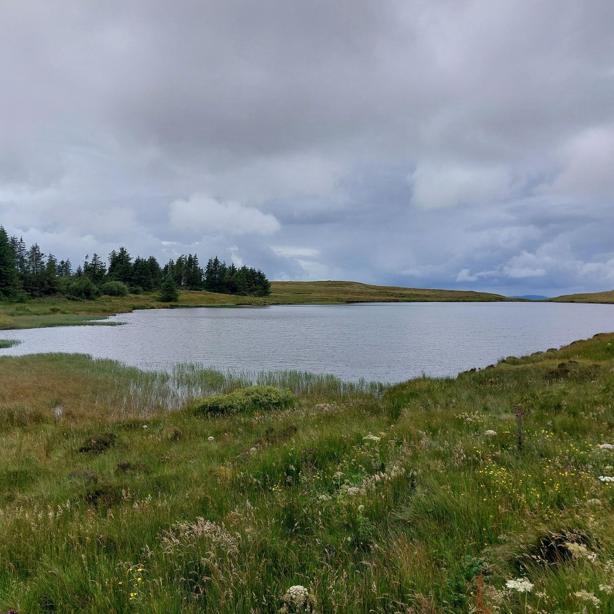
This beautiful artificial lake is located atop the Binevenagh hills. Fishing here, especially for trout, is very popular.
0
0
If you're lucky enough to reach this viewpoint on a clear day, you'll have stunning views of the Inishowen Peninsula, Lough Foyle stretching down to Londonderry, or even Scotland!
1
0
This statue is located right next to the parking area and is easily accessible. The statue represents this sea god from Irish mythology overlooking the channel toward Greencastle, and from here, you can observe the beautiful countryside that surrounds you.
0
0
Gortmore is a fascinating place with an atmosphere all of its own. On clear days you can get stunning views. To the west is Lough Foyle stretching down to Londonderry and beyond; to the north is the Inishowen Peninsula and to the east you can see as far as Scotland.
0
0

This is a breathtaking section of running along the Ulster Way between Castlerock and Manannan Mac Lir. You'll run along a narrow paved road that runs through Binevenagh Area of Natural Beauty with an expansive view of the north coast of Ireland to your right.
0
0
Frequently Asked Questions
How many running routes are available in Largantea?
Largantea and the surrounding County Londonderry area offer over 35 diverse running routes. These range from gentle riverside paths to more challenging hilly trails, catering to various fitness levels.
What kind of terrain can I expect when running around Largantea?
The region around Largantea features a varied landscape. You'll find everything from challenging, hilly terrain with exposed boggy scrubland, such as the historic Windyhill Road, to serene riverside paths along the River Roe in Roe Valley Country Park. There are also extensive woodlands like Banagher Glen and forest roads around Binevenagh Mountain, offering a mix of paved and undulating tracks.
Are there any easy jogging routes for beginners in Largantea?
Yes, Largantea offers several easier jogging options. While many routes involve varied terrain, there are 4 routes specifically rated as easy. Look for paths within Roe Valley Country Park, which provides gentler, linear trails along the River Roe through woodlands, ideal for a relaxed run.
Are there challenging running routes for experienced runners in the area?
Absolutely. For experienced runners seeking a challenge, Largantea provides 11 difficult routes. The area around Binevenagh Mountain, for instance, offers significant elevation gain, such as the Binevenagh Hill loop from River Roe, a 9.6-mile trail with substantial climbs. The historic Windyhill Road is also known for its strenuous 6-mile climb through exposed, hilly conditions.
What can I see along the running routes in Largantea?
Many routes offer scenic views and points of interest. Around Binevenagh, you can enjoy panoramic vistas from Binevenagh Summit or the Binevenagh Viewpoint, overlooking Lough Foyle and the Roe Valley. The Manannán Mac Lir and Gortmore Viewpoint loop specifically highlights these natural monuments. You might also encounter historical sites like Mussenden Temple and Downhill House Ruins near some coastal paths.
Are there any circular running routes in Largantea?
Yes, many of the running routes in Largantea are circular, allowing you to start and finish at the same point. Examples include the popular Binevenagh Hill loop from River Roe and the Running loop from Meencraig. These loops provide a varied experience without needing to retrace your steps.
Are the running trails in Largantea dog-friendly?
Many of the outdoor trails in County Londonderry, including those around Largantea, are generally dog-friendly, especially in forest parks and open countryside. However, it's always advisable to keep dogs on a lead, particularly in areas with livestock or wildlife, and to check specific park regulations for places like Roe Valley Country Park or Binevenagh Mountain before you go.
Are there family-friendly jogging routes in the Largantea area?
For families, the linear paths within Roe Valley Country Park offer a gentler and more accessible option for jogging. These trails are generally flatter and wind through scenic woodlands along the River Roe, providing a pleasant environment for all ages. Look for routes rated as easy or moderate for the best family experience.
What do other runners enjoy most about jogging in Largantea?
The running routes in Largantea are highly rated by the komoot community, with an average score of 4.0 stars from 2 reviews. Runners often praise the diverse terrain, from challenging hills with panoramic views to tranquil riverside and woodland paths. The variety ensures there's something for every preference, and over 170 runners have explored the area using komoot.
Where can I find parking for running trails near Largantea?
Parking is generally available at key access points for popular trails. For example, Roe Valley Country Park has designated parking areas. For routes around Binevenagh Mountain, there are often car parks near trailheads or viewpoints. It's recommended to check specific route details on komoot for parking information related to your chosen trail.
What is the best time of year for jogging in Largantea?
The region offers good running opportunities year-round, but spring and autumn often provide the most pleasant conditions with milder temperatures and beautiful scenery. Summer can be warm, while winter runs might be windy and wet, especially on exposed routes like Windyhill Road or Binevenagh. Always check the local weather forecast before heading out.
Are there cafes or pubs near the jogging trails in Largantea?
While Largantea itself is a small townland, the nearby town of Limavady, which is close to many of the region's trails, offers a selection of cafes and pubs where you can refuel after your run. Roe Valley Country Park also has visitor facilities that may include refreshments.
Most popular routes around Largantea
Most popular attractions around Largantea

Get inspired with the komoot mobile app


Explore more
Browse the best Running Trails & Routes in other regions.
