The best running trails around Ilmmünster
4.3
(3)
253
runners
25
runs
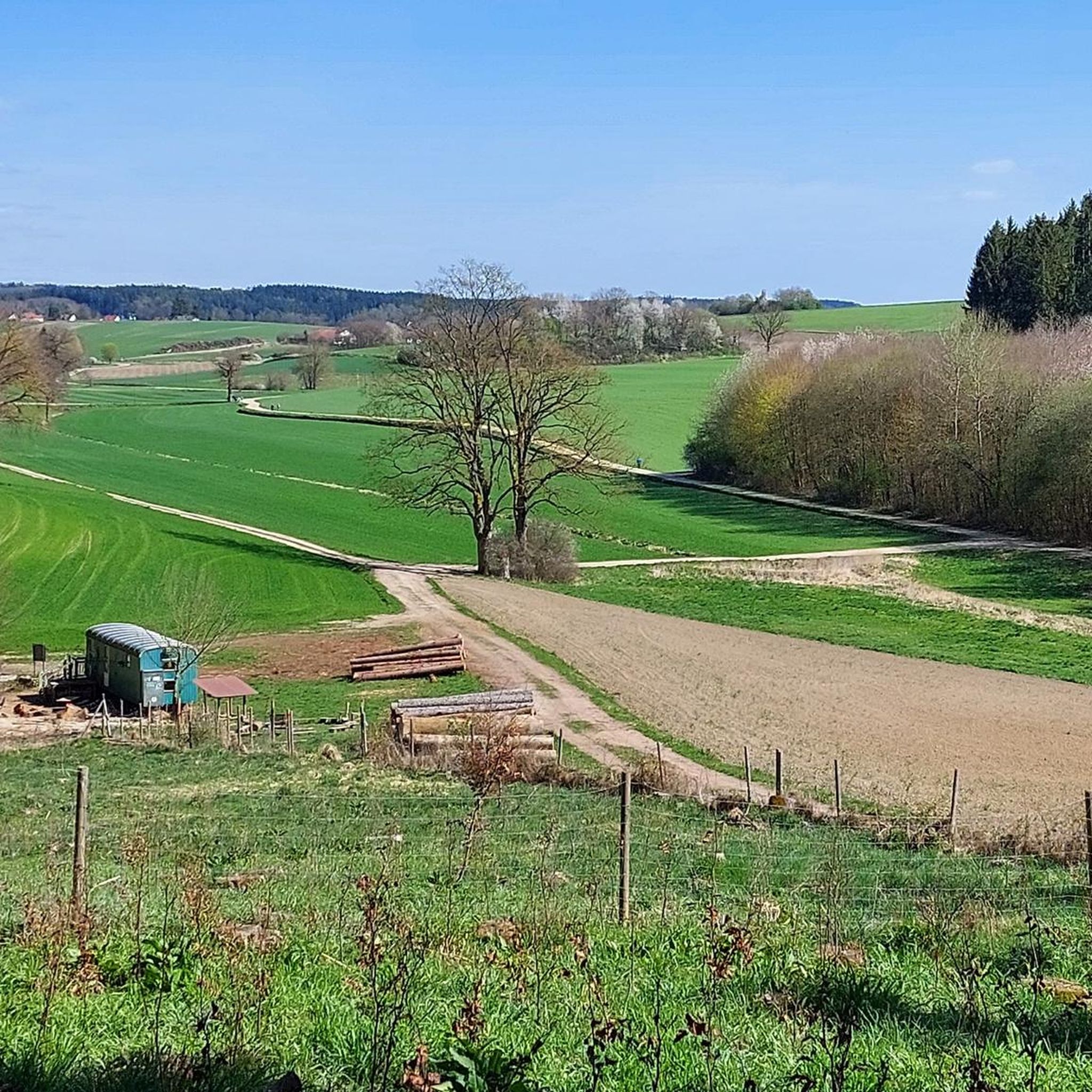
Jogging routes around Ilmmünster traverse a landscape characterized by a mix of woodlands, undulating hills, and the tranquil Ilm river valley. This geographical setting provides diverse natural features for running. The area offers engaging routes, from flat paths along the river to more challenging hilly sections. An extensive trail network, including parts of the "Waldwandergebiet Reichertshausen, Paunzhausen, Ilmmünster," is suitable for various running experiences.
Best jogging routes around Ilmmünster
- The most popular jogging route is Running loop from Ilmmünster,…
Last updated: July 5, 2026
3.0
(1)
27
runners
7.61km
00:47
40m
40m
Moderate run. Good fitness required. Mostly paved surfaces. Suitable for all skill levels.
8
runners
16.5km
01:48
210m
210m
Hard run. Very good fitness required. Mostly paved surfaces. Suitable for all skill levels.

Sign up for free
4
runners
5.98km
00:39
80m
80m
Moderate run. Good fitness required. Mostly paved surfaces. Suitable for all skill levels.
3
runners
4.64km
00:34
60m
60m
Easy run. Great for any fitness level. Mostly paved surfaces. Suitable for all skill levels.
3
runners
6.04km
00:40
80m
80m
Moderate run. Good fitness required. Mostly paved surfaces. Suitable for all skill levels.
Get access to more routes and recommendations from other explorers.
Sign up for free
Already have an account?
Our route recommendations are based on thousands of hikes, rides, and runs completed by other people on komoot.
Start today with a free account
Your next adventure awaits.
Login or Signup

Other adventures around Ilmmünster

Tips from the Community

In the directory of Freising's own churches, an oratory (prayer hall) in Reichertshausen is first mentioned in a document in the year 779. When the first church in Reichertshausen, dedicated to St. Stephen, was built is unknown. In the older registers of the Diocese of Freising from 1315, Reichertshausen is not directly named, but it is one of the four branches of Lampertshausen counted there. Under parish vicar Nikolaus Carl in 1767, the church was half demolished and "raised higher from the apostle crosses" and furnished. One hundred years later, the church was too small again. Instead of a new building, in 1897, under pastor Friedl, an expansion of the church from the entrance door westward was considered. The extension and restoration of the church were completed in 1901, and it was furnished with altars in the Neo-Romanesque style. The church underwent further renovation in 1949, during which some pictures and figures that had existed until then were apparently removed. In 1957, the church received a new high altar with side windows and ceiling painting. The present appearance of our parish church was created after a thorough exterior and interior renovation in the years 1980/81. https://www2.erzbistum-muenchen.de/pfarrei/pv-ilmmuenster/Reichertshausen/st-stephanus
1
0

Beautiful local church built around 1200 with a crypt and a great history. Founding date of Ilmmünster 746, making it one of the oldest, if not the oldest, settlement in the Ilmtal. Initially a Benedictine monastery, later an Augustinian canonry until its dissolution in 1492.
0
0

There is no reliable information about the life of Saint Arsacius or Arsatius. According to legend, he was Bishop of Milan and possibly a martyr or confessor. His lifetime is dated around 400 or to the 6th century. His relics were transferred from Rome to the Ilmmünster Monastery in 766, where his veneration grew and the Church of St. Arsatius is dedicated to him to this day. In 1495, they were transferred to Munich, but in 1846, they were returned to Ilmmünster. His feast day is November 12th.
0
0


Beautiful excursion destination, with hiking trails and game reserves.
3
1
Also nice the deer enclosure
2
0
Beautiful view of the Sanctuary
2
0
Beautiful basilica characterizes the village
1
0
Frequently Asked Questions
How many running routes are available in Ilmmünster?
Ilmmünster offers a good selection of running routes, with over 25 different trails to explore. These routes cater to various fitness levels, including easy, moderate, and difficult options.
Are there easy running routes for beginners in Ilmmünster?
Yes, Ilmmünster has several easy running routes perfect for beginners or those looking for a relaxed run. An example is the Rieder Buch loop from Ilmmünster, which is 4.6 km long and classified as easy.
Can I find circular running routes in the Ilmmünster area?
Absolutely. Many of the running routes in Ilmmünster are circular, allowing you to start and finish at the same point. Popular options include the Running loop from Ilmmünster and the Christelberg loop from Ilmmünster, both offering diverse scenery.
What kind of terrain can I expect on running trails around Ilmmünster?
The running trails around Ilmmünster feature a varied landscape. You'll find a charming mix of woodlands, undulating hills, and tranquil paths along the Ilm river valley. This provides options from flat, riverside runs to more challenging hilly sections with significant elevation changes.
Are the running routes in Ilmmünster suitable for families?
Yes, the region around Ilmmünster offers trails that are suitable for families. The diverse network includes easier, flatter paths, particularly along the Ilm river, which can be enjoyable for a family outing. Some routes, like those in the "Waldwandergebiet Reichertshausen, Paunzhausen, Ilmmünster," are part of a broader network of trails that cater to various recreational activities, including family-friendly hikes that can be adapted for running.
Are dogs allowed on the jogging trails in Ilmmünster?
Generally, dogs are welcome on trails in natural areas around Ilmmünster. However, it's always recommended to keep your dog on a leash, especially in nature reserves or agricultural areas, and to be mindful of other trail users and local wildlife. Specific rules may vary, so always look for local signage.
What natural features or landmarks can I see while running in Ilmmünster?
While running in Ilmmünster, you can enjoy scenic landscapes including woodlands, hills, and the tranquil Ilm river valley. Notable natural attractions include Kranzberg Pond, which is ideal for outdoor enthusiasts, and the peaceful Ilm valley itself. You might also pass by the Planet Path Scheyern or even catch a glimpse of Hohenkammer Castle on longer routes.
Where can I park when accessing running trails in Ilmmünster?
While specific parking locations for each trailhead are not detailed, Ilmmünster is part of a well-developed region for outdoor activities. It is generally possible to find parking in or near the village centers or at designated trailheads for the extensive network of trails. We recommend checking the starting points of individual routes on Komoot for more precise parking information.
What is the best time of year for jogging in Ilmmünster?
The spring, summer, and autumn months are particularly pleasant for jogging in Ilmmünster. During these seasons, the natural landscapes, including the woodlands and river valleys, are at their most vibrant and offer comfortable temperatures for outdoor activity. The Kranzberg Pond area is especially enjoyable during these times.
What do other runners say about the trails in Ilmmünster?
The running routes in Ilmmünster are highly rated by the Komoot community, with an average score of 4.5 stars. Runners often praise the varied terrain, from quiet woodlands to paths along the Ilm river, and appreciate the options for different difficulty levels. Over 250 runners have already explored the area using Komoot.
Are there any longer, more challenging running routes available in Ilmmünster?
Yes, for those seeking a greater challenge, Ilmmünster offers longer and more difficult routes. A prime example is the Three Beech Trees – Pilgrimage Church Herrnrast loop from Ilmmünster, which is a difficult 16.5 km path featuring significant elevation gain through varied landscapes.
What is the typical length of running routes in Ilmmünster?
The running routes in Ilmmünster vary in length to suit different preferences. You can find shorter routes, such as the Christelberg loop from Ilmmünster at 6.0 km, up to longer, more challenging trails like the Three Beech Trees – Pilgrimage Church Herrnrast loop from Ilmmünster, which spans 16.5 km.
Most popular routes around Ilmmünster
Most popular attractions around Ilmmünster

Get inspired with the komoot mobile app


Explore more
Browse the best Running Trails & Routes in other regions.
