The best walks and hikes around Whitchurch-On-Thames
4.5
(1602)
10,436
hikers
30
hikes
Hikes around Whitchurch-On-Thames explore the landscape where the River Thames meets the Chiltern Hills National Landscape. The area is characterized by riverside paths, rolling hills, and sections of woodland. Many routes follow parts of the Thames Path National Trail, offering a mix of flat riverside walking and ascents into the surrounding hills for wider views of the Thames Valley.
Best hiking trails around Whitchurch-On-Thames
- The most popular hiking route is Whitchurch Bridge – Goring-on-Thames village loop from Pangbourne, a 9.7 mile (15.6 km) trail that takes around 4 hours 10 minutes to complete. This route combines riverside sections with paths through the Chiltern Hills.
- Another top favourite among local hiking enthusiasts is Whitchurch Bridge loop from Pangbourne, a moderate 6.0 mile (9.6 km) path. The trail features a mix of woodland and open countryside scenery.
- Local hiking enthusiasts also love the Whitchurch Bridge – Hartslock Nature Reserve loop from Pangbourne, a 9.0 mile (14.4 km) trail leading through the chalk grassland of the nature reserve, often completed in about 3 hours 55 minutes.
- Hiking around Whitchurch-On-Thames is defined by paths along the River Thames, rolling chalk hills, and beech woodlands. The network of trails provides options for different ability levels, from easy riverside strolls to more challenging circular walks.
- The routes in Whitchurch-On-Thames are highly rated by the komoot community with an average score of 4.5 stars from over 350 reviews. More than 3,000 hikers have used komoot to explore Whitchurch-On-Thames's varied terrain.
Last updated: October 12, 2026
4.9
(23)
99
hikers
15.4km
04:07
180m
180m
Moderate hike. Good fitness required. Easily-accessible paths. Suitable for all skill levels.
4.9
(25)
84
hikers
9.69km
02:39
150m
150m
Moderate hike. Good fitness required. Easily-accessible paths. Suitable for all skill levels.

4.0
(4)
31
hikers
14.4km
03:56
220m
220m
Moderate hike. Good fitness required. Easily-accessible paths. Suitable for all skill levels.
4.5
(4)
29
hikers
19.6km
05:16
230m
240m
Hard hike. Very good fitness required. Easily-accessible paths. Suitable for all skill levels.
5.0
(1)
23
hikers
4.60km
01:10
10m
10m
Easy hike. Great for any fitness level. Easily-accessible paths. Suitable for all skill levels.
Get access to more routes and recommendations from other explorers.
Already have an account?
Our route recommendations are based on thousands of hikes, rides, and runs completed by other people on komoot.
Start today with a free account
Your next adventure awaits.
Popular around Whitchurch-On-Thames

Other adventures around Whitchurch-On-Thames

Tips from the Community

Rivers and canals crisscross the country, as they were – especially in the early days of industrialisation – a very essential part of the transport infrastructure. After all, the factories needed the delivery of raw materials in previously unknown quantities, and the finished goods then had to find their way to the traders. Many of the canals originate from this era. Later, the railways and, later still, trucks took over the task of transporting goods. However, when building the artificial waterways and making the rivers navigable, it had to be taken into account that differences in altitude always had to be overcome, and so locks are often lined up along the canals and rivers – at more or less large intervals, depending on the local situation. Shipping could only be made possible with their help.
0
0

All cyclists are able to pass the toll bridge for free
0
0

This is a scenic riverside area located in the village of Pangbourne that features open green space popular for picnics. The meadow is a great place to stop and rest whilst travelling the Thames Path National Trail.
1
0

Stop at the top of the Track & just take in that view.
0
0

now called the artichoke. nice patio, although beside the road. salmon sandwich ordered
0
0

Lovely place to pause and take a look at the view before you finish your walk and head back into town.
0
0

Particularly on a clear, sunny day, this is a fantastically beautiful walk. River Thames winds its way slowly towards Goring-on-Thames, but you also pass beautiful green fields with livestock grazing in them as you walk. A lovely, peaceful and tranquil walk.
1
1

All along the south side of the Thames between Purley and Pangbourne there are gorgeous views across the water. There are often swans, geese and ducks swimming by too.
0
0
Frequently Asked Questions
Are there many circular walks starting from Whitchurch-on-Thames?
Yes, the area is well-known for its circular walks that combine riverside scenery with climbs into the Chiltern Hills. Many routes begin and end in or near the village, offering a variety of lengths and difficulties without the need to retrace your steps. A good example is the Whitchurch Bridge loop from Pangbourne, which provides a classic mix of woodland and open country.
Are the hiking trails around Whitchurch-on-Thames suitable for dogs?
Many trails in the area are great for walking with dogs, especially the paths through local woodlands and along the River Thames. However, be mindful of livestock in fields and wildlife in nature reserves like Hartslock. It's always best to keep your dog on a lead where indicated. Some local pubs are also dog-friendly, making for a perfect end to your walk.
What is the general difficulty of the hikes in this area?
The trails offer a good mix for most abilities. You'll find over 30 routes, with the majority being of moderate difficulty, typically involving some gentle ascents into the Chilterns. There are also a number of easier, flatter walks, particularly along the river, and a couple of more challenging options for those seeking a longer day out with more elevation.
Are there any easy, family-friendly walks available?
Absolutely. There are several shorter and flatter routes perfect for a family outing. Walks along the Thames Path are particularly suitable, offering lovely river views without strenuous climbs. The Mapledurham Lock – View of the River Thames loop from Pangbourne is a great option, providing a gentle walk with plenty to see along the water.
Where can I find the best viewpoints on a hike?
For expansive views across the Thames Valley, you'll need to take a trail that climbs into the Chiltern Hills. Hartslock Nature Reserve is a local favorite, offering magnificent views over a winding section of the river. For a dedicated viewpoint hike, the challenging Whitchurch Bridge – Viewpoint on Lough Down loop from Pangbourne rewards the effort with fantastic panoramic scenery.
What do other hikers enjoy about the trails around Whitchurch-on-Thames?
The area is highly regarded by the komoot community, with hikers often praising the beautiful blend of riverside walking and rolling hill scenery. Reviewers frequently mention the stunning views from the Chilterns, the tranquility of the beech woodlands, and the well-maintained paths along the Thames Path National Trail.
Is it possible to reach the hiking trails using public transport?
Yes, the area is quite accessible by public transport. Pangbourne, which is just across the bridge from Whitchurch-on-Thames, has a mainline train station. Many of the most popular hikes, including several circular routes, start and finish in Pangbourne, making it an excellent base for exploring the region without a car.
Where is the best place to park for a walk?
Many walkers start from the village of Pangbourne, on the opposite side of the river, where you can find public parking options. From there, you can easily access the Whitchurch Bridge and the network of trails on both sides of the Thames. Arriving early is recommended, especially on sunny weekends, as spaces can fill up quickly.
What kind of hiking can I expect in the Chiltern Hills from here?
Hiking from Whitchurch-on-Thames into the Chiltern Hills Area of Outstanding Natural Beauty involves ascents through ancient beech woodlands and across open chalk grassland. The trails reward you with classic English countryside scenery and impressive views over the Goring Gap and the Thames Valley. The Whitchurch Bridge – Goring-on-Thames village loop is a popular route that showcases this varied landscape.
Do many routes include a section of the Thames Path?
Yes, the Thames Path National Trail is a central feature of hiking in this area. Many routes incorporate sections of this well-marked trail, allowing for scenic, flat walking along the river's edge. These riverside stretches are often combined with loops that head into the hills, creating diverse and interesting hikes.
Are there any historical sites to see while hiking?
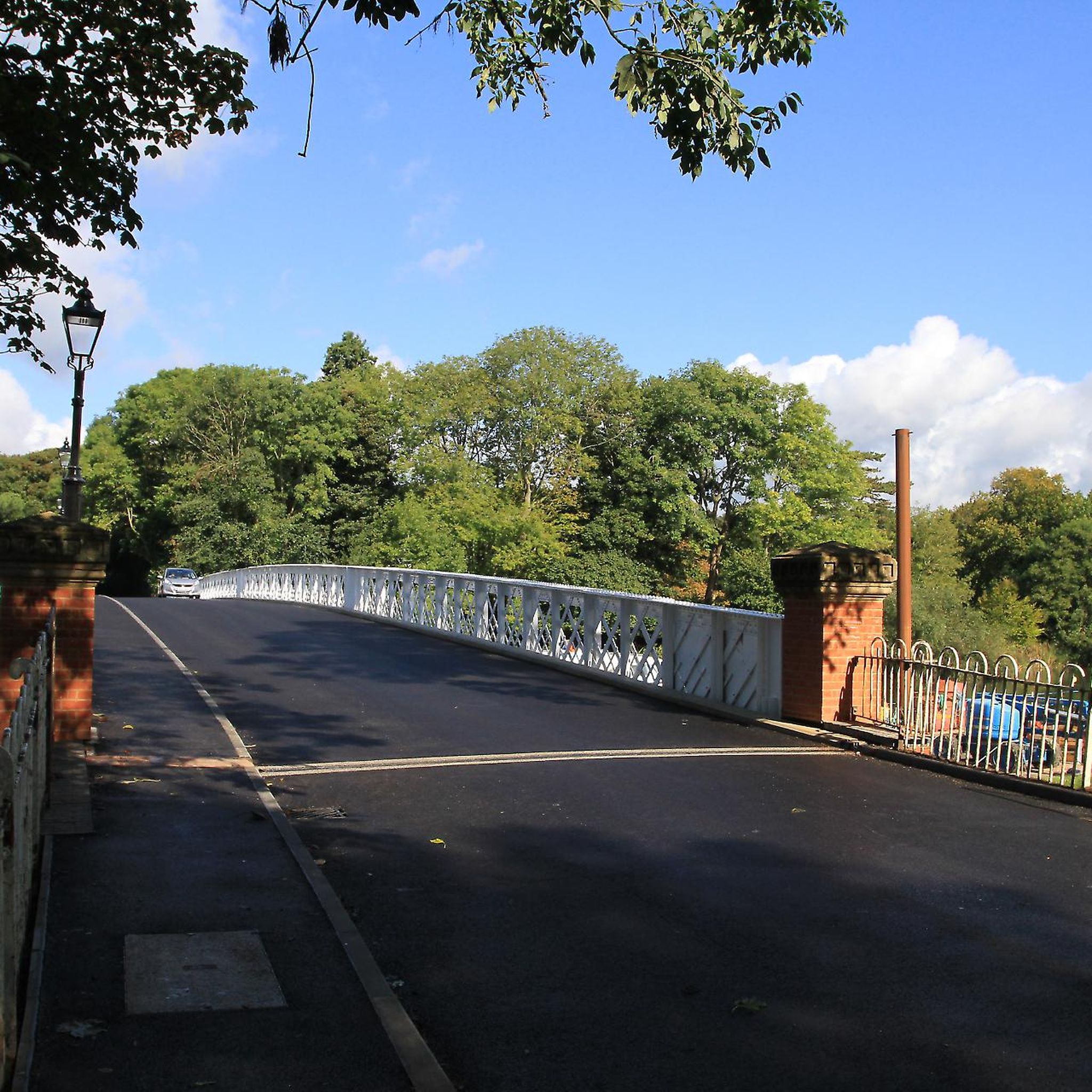
The region is rich in history. The Whitchurch Bridge itself is a Grade II listed toll bridge. A short walk along the Thames Path can also take you towards the historic Mapledurham House and its working watermill. Many routes pass through or near charming villages with traditional pubs and architecture.
What wildlife might I see in the area?
The diverse habitats support a variety of wildlife. Along the River Thames, you can spot birds like kingfishers, herons, and red kites, which are a common sight in the Chilterns. The chalk grasslands of Hartslock Nature Reserve are known for rare orchids and butterflies, while the woodlands are home to deer and badgers. The Whitchurch Bridge – Hartslock Nature Reserve loop is an excellent choice for nature lovers.
Most popular routes around Whitchurch-On-Thames
Most popular attractions around Whitchurch-On-Thames

Get inspired with the komoot mobile app


Explore more
Browse the best Hikes in other regions.
