Attractions and Places To See around Goltho CP - Top 20
Best attractions and places to see around Goltho CP include a blend of historical sites, natural beauty, and ancient woodlands. This hamlet in Lincolnshire, England, offers insights into its past, including the remains of a deserted medieval village. The area is also known for its diverse gardens and is situated within the Lincolnshire Limewoods, a National Nature Reserve. Visitors can explore a variety of landscapes, from historical ruins to ancient woodlands.
Best attractions and places to see around Goltho CP
…Last updated: July 2, 2026
Water Rail Way: River Witham Sculptures and Countryside
Highlight (Segment) • Cycleway
Tip by

Bardney Lock
Highlight • Bridge
Tip by

Sign up now to discover places like this
Get recommendations on the best single tracks, peaks, & plenty of other exciting outdoor places.
Sign up for free
Water Rail Way (NCN Route 1)
Highlight (Segment) • Viewpoint
The railway lines runs between the River Witham and South Delph. Dotted …
Tip by

The Lady of Shalott Sculpture
Highlight • Monument
A sculpture designed and produced by Anwick Forge, comprising an elegant 4.5 metre high split arch representing sheaves of barley. The base bears the opening lines …
Tip by

Water Rail Way at Stixwould
Highlight (Segment) • Cycleway
Tip by

Sign up for free to discover even more attractions around Goltho CP.
Sign up for free
Already have an account?
Start today with a free account
Your next adventure awaits.
Login or Signup



Tips from the Community

Brilliant ride with good tarmac apart from 1 mile at Bardney.Suitable for mountain and road bikes Just have to push through central Lincoln or preferably don't cycle this section. Together with the 11.7 miles of old track heading west out of Lincoln over the Trent, this can make a 60 miles circuit of good off road cycling from Tuxford to Boston
0
0

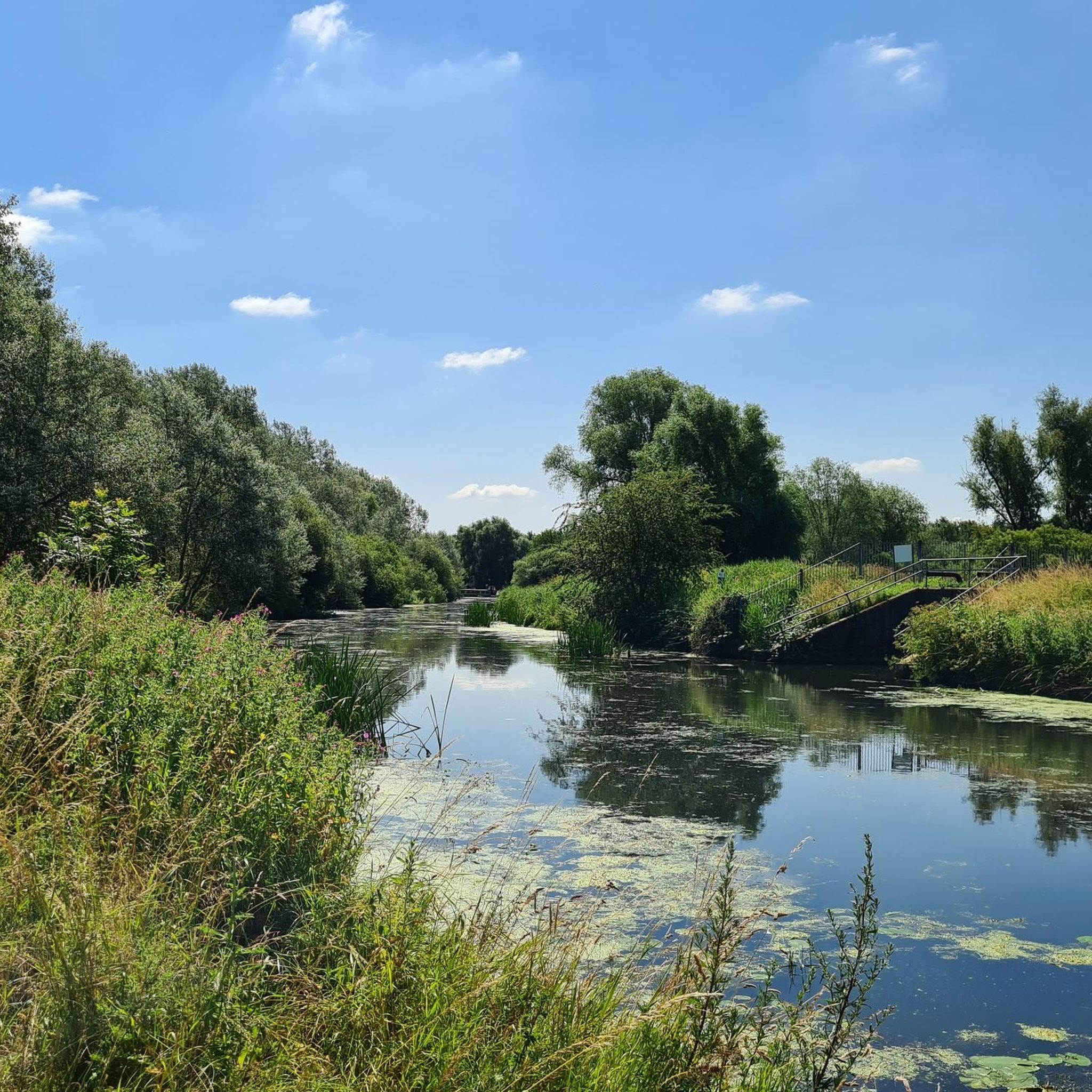
Bardney lock is located on the River Witham about 11 miles to the East of Lincoln. The River Witham flows through the peaceful Lincolnshire countryside and is has beautiful views with a remote feeling for much of its length. The flat marshy fenlands stretch out on either side of the river allowing spectacular sunsets to be seen.
1
0

almost at bardney travelling from lincoln - treat yourself to a chippy dinner from sunnys plaice, lovely
0
0
Lovely cycle route, can get you lincoln to boston, windy in winter
0
0

The Lady of Shalott A sculpture designed and produced by Anwick Forge, comprising an elegant 4.5 metre high split arch representing sheaves of barley. The base bears the opening lines of the poem by Alfred Lord Tennyson: "On either side the river lie long fields of barley and of rye".
0
0
Good route to stretch out the cycling legs, pleasant for all cyclists with many benches along route for a quick stop
1
0

From 1142 onwards, sluices were constructed to prevent flooding by the sea, and this culminated in the Great Sluice, which was constructed in 1766. It maintained river levels above Boston, and helped to scour the channel below it. The land through which the lower river runs has been the subject of much land drainage, and many drains are connected to the Witham by flood doors, which block them off if river levels rise rapidly. The river is navigable from Brayford Pool in Lincoln to Boston. Its locks are at Lincoln, Bardney and the Grand/Great Sluice. Passage through the latter is restricted typically to 4-hour intervals during daylight when the tidal levels are suitable. The river provides access for boaters to the Witham Navigable Drains, to the north of Boston, and to the South Forty-Foot Drain to the south, which was reopened as part of the Fens Waterways Link, a project to link the river to the Nene flowing through the city of Peterborough. From Brayford Pool the Fossdyke Navigation links to the Trent. The Witham's course, which flows to the north and then to the south-east may be the result of glaciation (and possibly isostatic rebound) redirecting older rivers.[citation needed] The source of the river is on high ground near South Witham, Lincolnshire,[6] at around 340 feet (100 m) above ordnance datum (AOD). After briefly flowing to the east to reach South Witham, it flows generally north, passing through Colsterworth where it is crossed by the A1 road, which largely follows the line of the river to Newark on Trent. At Great Ponton, it is joined by the Cringle Brook on its left bank, and continues through Grantham, where it has already descended to 170 feet (52 m) AOD. After Barkston it turns to the west to pass through Marston. Foston Beck joins on the left bank, and at Long Bennington it resumes its northerly course. Beyond Claypole and near Barnby in the Willows it forms the border between Lincolnshire and Nottinghamshire for about 3 miles (4.8 km), before passing through an Army training area near Beckingham. The River Brant joins on the right bank, before it passes through North Hykeham to reach Lincoln, where it is only 16 feet (4.9 m) AOD.[7][6] The upper waters are important for agricultural water extraction, and for coarse fish such as roach, common bream and pike; small mammals like water voles, and native crayfish.[5] A gap in the limestone scarp (see Lincolnshire Wolds) near Ancaster may represent an earlier course of the River Trent towards Boston, but is now occupied by the River Slea.[8] In Lincoln, the river flows into Brayford Pool and exits along a narrow channel that passes under the medieval High Bridge.[9] The bridge not only restricts navigation due to its small size, but the volume of water that can pass through the gap is limited in times of flood. This is alleviated by the Sincil Dyke, which leaves the main channel at Bargate Weir and runs for 1.5 miles (2.4 km) through the industrial areas to the south of the main city centre. It used to rejoin the main channel at Stamp End, but was re-routed into the South Delph, a drainage ditch constructed by John Rennie in the early 19th century that joins the main channel below Bardney lock. The origins of the Sincil Dyke are unknown, but it is known to have been used as a drainage channel in the mid-13th century and is thought to be pre-medieval or even Roman. Parts of it were culverted in 1847 to allow the construction of Lincoln Central railway station.[10] From Lincoln, the river again turns first east, then south, making a cut through a belt of upland known as the Lincoln Gap. This section has also been suggested as a lower course of the Trent during and before periods of glaciation.[8] From Dogdyke near Coningsby to Boston, the north bank of the river was used by a section of the Great Northern Railway from Lincoln to Boston. A long-distance footpath, the Water Rail Way, follows the course of the river from Lincoln to Boston. The path uses sections of the river towpath and abandoned railway tracks, and has been opened in stages, with the final 2 miles (3.2 km) being completed in September 2008. The path is now part of Route 1 of the National Cycle Network and features a number of sculptures along its length, each commissioned from local artists.[11] They include Lincoln longwool sheep at Stixwould, Lincoln Red cows at Washingborough, and Lincoln curly pigs, which became extinct in 1972, at Southrey.
1
0
Frequently Asked Questions
What historical sites can I explore in Goltho CP?
Goltho CP is rich in history. You can visit the remains of the Deserted Medieval Village of Goltho, where earthworks and cropmarks reveal a once-thriving settlement. The brick shell of St. George's Church (Goltho Chapel) is the sole surviving structure, with archaeological evidence of Roman and Anglo-Saxon occupation. Additionally, Goltho Hall and its associated buildings are Grade II listed, adding to the area's architectural heritage.
Are there any notable gardens or natural attractions in Goltho CP?
Yes, Goltho Gardens offers 4.5 acres of diverse landscapes, including a Nut walk, a Prairie garden, a Wild Flower Meadow, and a beautiful rose garden. The wider area is part of the Lincolnshire Limewoods, a National Nature Reserve known for its ancient woodlands, such as Cocklode and Great West Woods, and the Woodland Trust's Goltho Wood.
What cycling opportunities are available around Goltho CP?
The area is excellent for cycling. You can enjoy the Water Rail Way at Stixwould, a traffic-free path perfect for a pleasant ride. Another popular section is the Water Rail Way: River Witham Sculptures and Countryside, featuring various sculptures. The Lady of Shalott Sculpture is also located along a lovely cycle route. For more options, explore the cycling routes around Goltho CP.
Are there family-friendly activities or attractions in the area?
Many attractions around Goltho CP are family-friendly. The Water Rail Way at Stixwould and Water Rail Way: River Witham Sculptures and Countryside are cycle paths suitable for families. The Lady of Shalott Sculpture is also along a family-friendly cycle route. Additionally, exploring the diverse landscapes of Goltho Gardens and the ancient woodlands of the Lincolnshire Limewoods can be enjoyable for all ages.
What walking trails are available near Goltho CP?
For walkers, the Wragby & Goltho Limewood Walk is a circular path that takes you through the ancient Lincolnshire Limewoods, passing by Goltho Hall and St. George's Church. These woodlands offer diverse habitats and opportunities for mindful walks. You can find more details on this walk via West Lindsey District Council or Visit Lincolnshire.
Can I find mountain biking trails near Goltho CP?
Yes, there are mountain biking opportunities in the wider area. You can explore various MTB trails around Goltho CP, offering different distances and difficulty levels for mountain biking enthusiasts.
What do visitors enjoy most about the cycling routes?
Visitors particularly enjoy the pleasant, traffic-free nature of routes like the Water Rail Way at Stixwould. The Water Rail Way: River Witham Sculptures and Countryside is praised for its various sculptures and places to rest by the river. Many appreciate the tarmacked sections and the scenic views over the fens and waterways.
Is the Water Rail Way accessible for wheelchairs?
Yes, parts of the Water Rail Way, specifically the Water Rail Way: River Witham Sculptures and Countryside section, are noted as being wheelchair accessible, offering a pleasant experience for all visitors.
What kind of wildlife can I expect to see in the Lincolnshire Limewoods?
The Lincolnshire Limewoods, including areas like Cocklode and Great West Woods, are ancient woodlands that provide diverse habitats. While specific wildlife sightings can vary, these natural areas are home to a variety of woodland birds, insects, and small mammals, making them ideal for wildlife spotting and nature observation.
Are there any unique sculptures or art installations in the area?
Yes, along the Water Rail Way, you can find several art installations. A notable example is The Lady of Shalott Sculpture, designed by Anwick Forge. This elegant 4.5-meter high split arch represents sheaves of barley and features the opening lines of Alfred Lord Tennyson's poem.
Where can I find information about longer road cycling routes?
For those interested in longer road cycling adventures, there are several road cycling routes around Goltho CP. These routes vary in distance and difficulty, offering options for different fitness levels and preferences.
What is the significance of Bardney Lock?
Bardney Lock is a rural mooring location on the River Witham, about 11 miles east of Lincoln. It's part of the navigable section of the river and is known for its peaceful, remote setting amidst the marshy fenlands, offering beautiful views and spectacular sunsets.

Get inspired with the komoot mobile app


Explore more
Still not found the Highlight you’re looking for? See guides of the top attractions in other regions:
