The best walks and hikes around Harthill
4.5
(530)
3,421
hikers
155
hikes
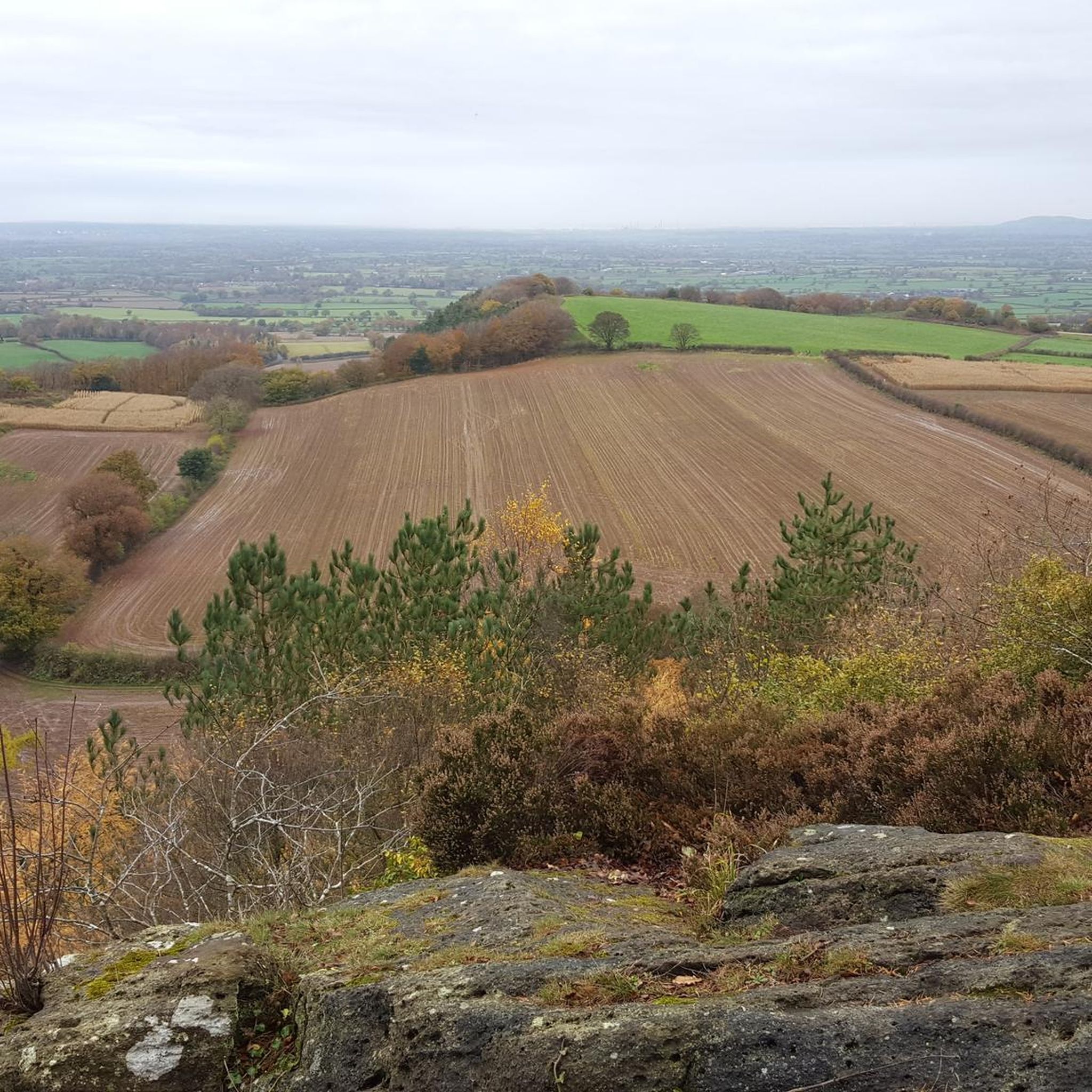
Hiking around Harthill offers diverse landscapes, from serene waterscapes to rolling agricultural lands and accessible woodland paths. The area features the Harthill Reservoir, providing pleasant walks along its surfaced footpath and through a small woodland section. Trails also wind through picturesque woodlands and open farmland, with some routes offering panoramic views across the Cheshire Plain. The region presents a mix of terrains, including easily accessible paths and routes with elevation gain.
Best hiking trails around Harthill
- The most popular hiking route is Sandstone Trail: Raw Head and Bulkeley Hill Loop, a 10.6 miles (17.0 km) trail that takes 4 hours 40 minutes to complete. This moderate route is known for its expansive panoramic views.
- Another top favourite among local hikers is View from Bickerton Hill – View from Rawhead loop from Bickerton, a moderate 9.4 miles (15.1 km) path. This trail features elevated viewpoints and varied terrain, including woodlands and open fields.
- Local hikers also love the The Pheasant Inn loop from Burwardsley, a 3.3 miles (5.2 km) trail leading through woodlands and open farmland, often completed in about 1 hour 30 minutes.
- Hiking around Harthill is defined by serene waterscapes, rolling agricultural lands, and accessible woodland paths. The network offers options for different ability levels, from easy strolls to more challenging hikes.
- The routes in Harthill are highly rated by the komoot community with an average score of 4.5 stars from over 400 reviews. More than 3,000 hikers have used komoot to explore Harthill's varied terrain.
Last updated: October 13, 2026
4.6
(28)
87
hikers
17.0km
04:42
300m
300m
Hike the moderate 10.6-mile Sandstone Trail: Raw Head and Bulkeley Hill Loop for panoramic views across the Cheshire Plain.
4.8
(56)
235
hikers
15.1km
04:13
300m
300m
Moderate hike. Good fitness required. Easily-accessible paths. Suitable for all skill levels.

4.8
(11)
73
hikers
5.24km
01:28
110m
110m
Easy hike. Great for any fitness level. Easily-accessible paths. Suitable for all skill levels.
4.9
(9)
50
hikers
8.55km
02:27
200m
200m
Moderate hike. Good fitness required. Easily-accessible paths. Suitable for all skill levels.
5.0
(5)
50
hikers
6.36km
01:49
150m
150m
Easy hike. Great for any fitness level. Easily-accessible paths. Suitable for all skill levels.
Get access to more routes and recommendations from other explorers.
Already have an account?
Our route recommendations are based on thousands of hikes, rides, and runs completed by other people on komoot.
Start today with a free account
Your next adventure awaits.
Tips from the Community

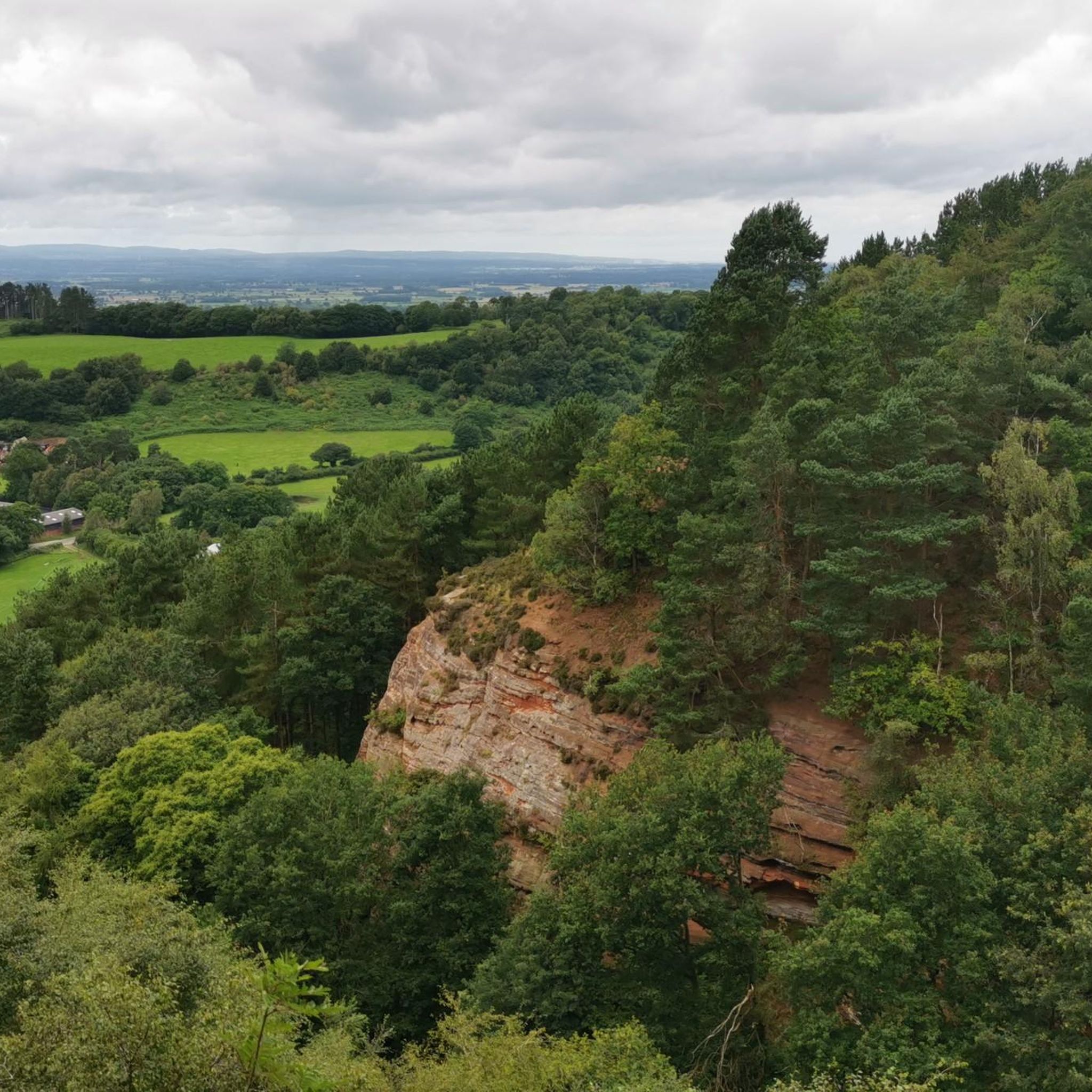
Beeston Castle is a former royal castle that sits on a rocky sandstone crag about 107 metres above the Cheshire Plain. It was built in the 1220s by Ranulf de Blondeville, the 6th Earl of Chester, after he returned from the Crusades. Because of its dramatic position it was known as the Castle of the Rock. The site itself is much older, with Bronze Age and Iron Age earthworks that were later reused by the medieval builders. In 1237 Henry III took it over and it stayed in crown hands. It was garrisoned by Simon de Montfort during the Barons War in 1264 to 1265, then retaken by the future Edward I. It was kept in good repair until the 16th century, when it was considered to have no further military use, but it was pressed into service again in the English Civil War and was partially demolished in 1646 after a siege. It is now a ruin owned by English Heritage. The gatehouse is still impressive, and on a clear day you can see from the Pennines to the Welsh mountains. There is also a famous legend that the treasure of Richard II was buried in the grounds, but despite many searches it has never been found.
0
0
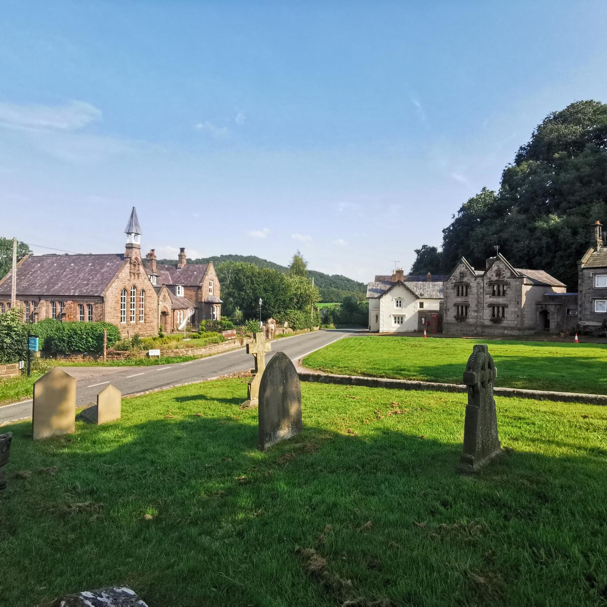
It was built in 1839 as a chapel of ease to St Oswald's in Malpas, because the local population was growing quickly. The architect was Edmund Sharpe from Lancaster, who was well known for his Gothic Revival churches. The land was donated by Sir Philip Grey Egerton of Oulton, and the money was raised by public subscription. Around £2,000 was collected in total, but only £700 of that was spent on building the church itself. Another £300 went towards a house for the minister, and the rest was invested to provide an income for him. The church also received a grant of £120 from the Incorporated Church Building Society. It was consecrated on the 7th of January 1840 by John Sumner, the Bishop of Chester, and it became a separate parish church in its own right in 1869. It is Grade II listed and is still an active parish church. In the churchyard, overlooking the crossroads, there is a war memorial.
0
0

A good Christian welcome of the Sermon on the Mount sort - tea, coffee and milk offered for anyone who drops in 😊. Make it yourself and place a donation in the offering box. And a toilet round the back 😊! Church blesses the community 😊👏👏. Well done and thank you!
0
0


Great place to visit, amazing views on a clear day.
0
0


Decent little climb no to bad and only around 2-3km surroundings are beautiful god road surface. Take you time and enjoy.
1
0
Frequently Asked Questions
What kind of terrain can I expect on hikes around Harthill?
Harthill offers a diverse range of terrain. You'll find pleasant walks along surfaced footpaths, especially around the Harthill Reservoir, as well as paths winding through picturesque woodlands and open farmland. Some routes also feature waterside walking along canal towpaths. For those seeking more challenge, there are routes with elevation gain that require good fitness.
Are there easy walks suitable for beginners or families in Harthill?
Yes, Harthill is very accommodating for all skill levels. There are over 80 easy routes available, many of which are suitable for families or those looking for a gentle stroll. Walks around the Harthill Reservoir are particularly popular for their accessibility and scenic beauty.
Are there challenging hikes in the Harthill area?
While Harthill is known for its accessible trails, there are a few more challenging options. Some routes feature significant elevation gain and varied terrain, offering a good workout for experienced hikers. For example, the Sandstone Trail: Raw Head and Bulkeley Hill Loop is a moderate 10.6-mile hike with notable elevation changes and panoramic views.
Are there any viewpoints with panoramic scenery in Harthill?
Absolutely. Several routes in Harthill offer expansive panoramic views, particularly across the Cheshire Plain. The Sandstone Trail: Raw Head and Bulkeley Hill Loop is renowned for its vistas. You can also find elevated viewpoints like View from Bickerton Hill, which is featured on routes such as View from Bickerton Hill – View from Rawhead loop from Bickerton.
What natural features can I explore while hiking in Harthill?
Harthill boasts several appealing natural features. The Harthill Reservoir is a central attraction, offering serene waterscapes. You'll also encounter picturesque woodlands, open farmland, and sections of canal towpaths, such as the Cuckoo Way, providing a varied natural experience.
Are there historical landmarks or attractions near the hiking trails?
Yes, the area around Harthill is rich in history. You can explore significant sites like Beeston Castle, a dramatic hilltop fortress, and the ancient Maiden Castle Iron Age Hillfort. These landmarks offer fascinating diversions and often provide excellent views.
Are there circular hiking routes available in Harthill?
Yes, many of the hiking routes in Harthill are circular, allowing you to start and end at the same point without retracing your steps. There are several popular loops, including those around the Harthill Reservoir and longer trails that combine farmland, open fields, and canal towpaths.
Are the trails around Harthill dog-friendly?
Many trails in Harthill are suitable for dogs, especially those through woodlands and along canal towpaths. However, when hiking through farmland, please be mindful of livestock and keep dogs on a lead. Always check local signage for specific restrictions, especially around nature reserves or protected areas.
Where can I find parking for hikes in Harthill?
Parking is generally available at key starting points for popular trails, such as near the Harthill Reservoir or in villages like Bickerton and Burwardsley, which serve as access points for routes like The Pheasant Inn loop from Burwardsley. Specific parking details can often be found on individual route descriptions.
How long do hikes around Harthill typically take?
Hikes in Harthill vary greatly in length and duration. You can find short walks around the reservoir that take 1-2 hours, such as the 3.3-mile The Pheasant Inn loop from Burwardsley which takes about 1 hour 30 minutes. Longer, moderate routes like the Sandstone Trail: Raw Head and Bulkeley Hill Loop can take around 4 hours 40 minutes to complete.
Are there places to eat or drink near the hiking routes?
Yes, several villages and towns in the Harthill area offer pubs and cafes where you can refuel. For instance, the The Pheasant Inn loop from Burwardsley is named after a local establishment, indicating that such amenities are often conveniently located near popular trails.
What do other hikers enjoy the most about hiking in Harthill?
The area is highly rated by the komoot community, with an average score of 4.5 stars from over 460 reviews. Reviewers often praise the diverse landscapes, from serene waterscapes to rolling agricultural lands and accessible woodland paths, as well as the panoramic views from elevated points.
Most popular attractions around Harthill

Get inspired with the komoot mobile app


Explore more
Browse the best Hikes in other regions.
