The best road cycling routes around Alta
4.7
(6)
206
riders
8
rides
Road cycling routes around Alta are defined by the challenging climbs and scenic vistas of the Wasatch Mountains. The region features dramatic canyons like Little Cottonwood and Big Cottonwood, offering significant elevation gains. Paved roads wind through these mountainous landscapes, providing diverse terrain for road cyclists.
Best road cycling routes around Alta
- The most popular road cycling route is Alta to Lake Trangdalsvatn loop (Euro Velo 7), a 73.3 miles (117.9 km) trail that takes 10 hours 23 minutes…
Last updated: July 7, 2026
4.0
(3)
118
riders
87.1km
03:55
830m
800m
Moderate road ride. Good fitness required. Mostly well-paved surfaces and easy to ride.
5.0
(2)
13
riders
20.1km
00:57
180m
180m
Cycle the easy 12.5-mile (20.1 km) Northern Lights Cathedral loop of Alta, featuring the iconic modern cathedral and scenic city views.

Sign up for free
3
riders
118km
10:24
1,080m
1,080m
Hard road ride. Very good fitness required. Some segments of this route may be unpaved and difficult to ride.
31
riders
Hard road ride. Very good fitness required. Some segments of this route may be unpaved and difficult to ride.
5.0
(1)
13
riders
113km
04:49
830m
830m
Moderate road ride. Good fitness required. Some segments of this route may be unpaved and difficult to ride.
Get access to more routes and recommendations from other explorers.
Sign up for free
Already have an account?
Our route recommendations are based on thousands of hikes, rides, and runs completed by other people on komoot.
Start today with a free account
Your next adventure awaits.
Login or Signup



Tips from the Community

Here you'll find a board with a map that shows the hiking trails around Komsatoppen.
0
0

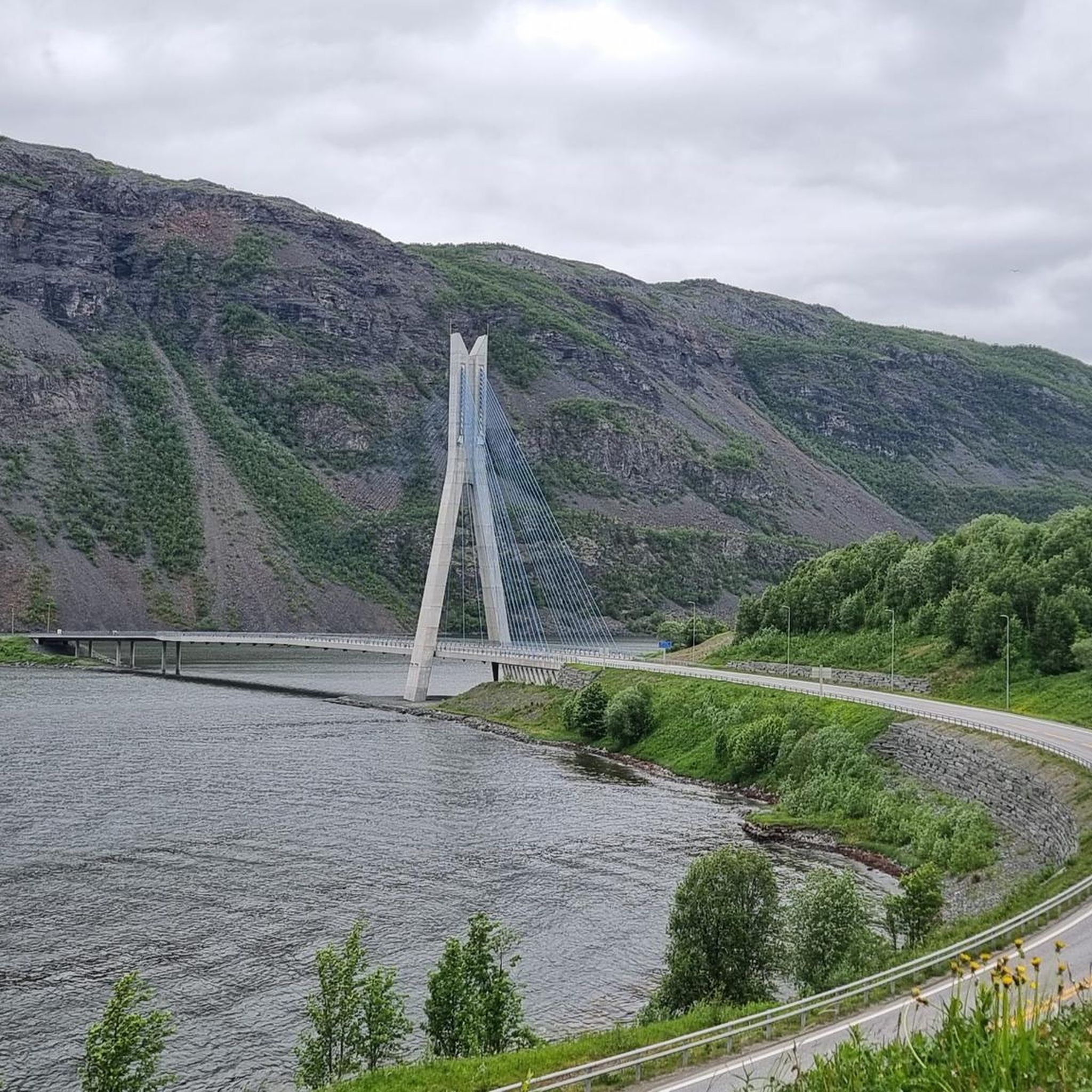
A great suspension bridge with a dedicated cycle lane. The views in both directions are magnificent too.
0
0

There is a good view of the river from the bridge. Right next to it is the campsite. A few small boats are parked on the beach. I'm not sure if you can rent one.
0
0

I recommend the Strand Camping site a few meters away, right next to River Camping. It's a bit more spacious and the owners are very friendly. You can walk through the bush down to the river.
0
0

Great walk from the Arctic Cathedral to Alta Museum.
0
2

Kristian Birkeland was a Norwegian physicist who studied the northern lights and built a northern lights observatory on Mount Haldde near Alta.
0
1
I stayed here in a lovely room and enjoyed a delicious dinner that was cooked with lots of love! The breakfast was also fantastic! Highly recommended!
0
0

Small cafe located right on the street. Prices are relatively Norwegian, but still worth a stop.
0
0
Frequently Asked Questions
What kind of terrain can I expect on road cycling routes around Alta?
Road cycling in Alta is characterized by mountainous canyons and high-elevation passes within the Wasatch Mountains. You'll encounter dramatic climbs, such as those in Little Cottonwood Canyon, which features steep grades. While most routes are paved, some, like the upper sections towards Alta and Snowbird in Little Cottonwood Canyon, may transition to hard-packed dirt roads that are still manageable for road bikes. Expect diverse terrain from challenging ascents to scenic, gentler climbs like the Albion Basin Road.
Are there routes suitable for beginners or families in Alta?
Yes, Alta offers options for various ability levels. For strong beginners or families, the Alta Cycle City Environmental Route is an easy 12.5-mile trail. Additionally, the Albion Basin Road, while not a komoot route in this guide, is described as a broad, smooth dirt road suitable for strong beginners and family rides, offering a gentler experience within the Alta ski area.
What are the difficulty levels of road cycling routes in Alta?
The routes around Alta cater to a range of cyclists. Our guide features 9 routes, including 2 easy, 5 moderate, and 2 difficult options. Challenging climbs like those found in Little Cottonwood Canyon and Guardsman Pass offer significant workouts, while routes such as the Alta to Skaidi (National Cycle Route 1) provide a rewarding moderate experience with steady climbs.
What natural features or landmarks can I see along the road cycling routes?
Alta's road cycling routes offer stunning natural beauty. You'll ride through dramatic areas like Little Cottonwood Canyon and Big Cottonwood Canyon, which are gateways to the High Wasatch. The Albion Basin is particularly famous for its spectacular wildflower displays in late July to early August. You might also spot prominent peaks like Devil's Castle and Mount Superior. For specific landmarks, consider visiting the Alta Rock Art – UNESCO World Heritage Site or the Orvvosfossen Waterfall.
When is the best time of year to go road cycling in Alta?
The best time for road cycling in Alta is typically during the warmer months, from late spring through early autumn, when the mountain roads are clear of snow. Late July to early August is particularly scenic, as the Albion Basin is known for its abundant wildflowers during this period. Always check local weather and road conditions before heading out, especially for higher elevation passes.
How many road cycling routes are available in Alta?
There are 9 road cycling routes detailed in this guide for the Alta area, offering a variety of distances and difficulty levels to explore the region's stunning landscapes.
What do other road cyclists enjoy the most about road cycling in Alta?
The road cycling experience in Alta is highly rated by the komoot community, with an average score of 4.7 stars from more than 5 reviews. Cyclists often praise the challenging climbs, the rewarding scenic views of the Wasatch Mountains, and the diverse terrain that includes both paved roads and manageable dirt sections leading to alpine areas.
Are there any viewpoints along the cycling routes in Alta?
Yes, many routes in Alta offer spectacular viewpoints. The climbs through Little Cottonwood Canyon and Big Cottonwood Canyon provide excellent views throughout. Guardsman Pass, accessible from Big Cottonwood Canyon, is particularly known for its panoramic views from the summit. Additionally, Wasatch Boulevard offers elevated views of the Salt Lake Valley. For a specific viewpoint, consider visiting Komsatoppen.
Can I reach the road cycling routes in Alta using public transport?
While the region is known for its mountain access, specific public transport options directly to all road cycling trailheads in Alta can be limited. Wasatch Boulevard serves as a popular starting point for many cyclists in the region, offering convenient access to the canyon climbs. It's advisable to check local transit schedules for services that might connect to the base of the canyons or nearby areas.
Are there any waterfalls I can see while cycling in Alta?
Yes, you can encounter waterfalls in the Alta area. The Orvvosfossen Waterfall is a notable natural monument in the region that you might consider visiting as part of your cycling adventure or as a nearby attraction.
What are some of the longer road cycling routes in Alta?
For longer rides, the Alta to Lake Trangdalsvatn loop (Euro Velo 7) is a difficult 73.3-mile (117.9 km) trail. Another substantial option is the Kvalsund Bridge – Northern Lights Cathedral loop from Alta Airport, which is a moderate 70.3-mile (113.1 km) route.
Are there any cultural or historical sites near the road cycling routes?
Yes, the Alta area is rich in cultural and historical significance. You can visit the Northern Lights Cathedral (Alta Church), a distinctive architectural landmark. Additionally, the Alta Rock Art – UNESCO World Heritage Site and the Alta Rock Carvings offer a glimpse into ancient history.
Most popular routes around Alta
Most popular attractions around Alta

Get inspired with the komoot mobile app


Explore more
Browse the best Road cycling routes in other regions.
