The best walks and hikes in Viterbo
4.4
(4779)
22,727
hikers
727
hikes
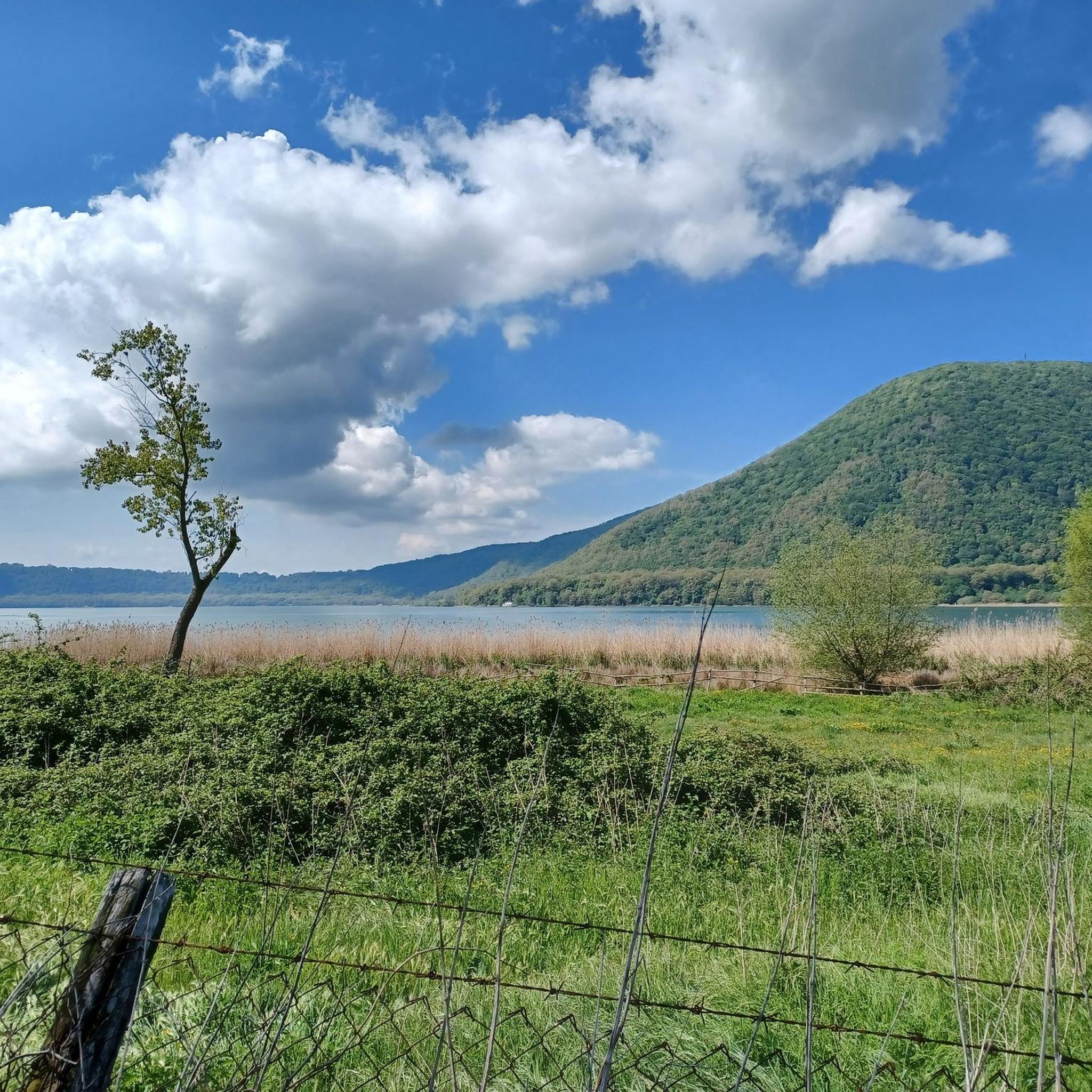
Hiking trails in Viterbo traverse a landscape shaped by volcanic activity, featuring diverse natural and historical elements. The region is characterized by volcanic lakes, the Monti Cimini with extensive woodlands, and distinctive "forre" (gorges) and tuff rock formations. These geological features create varied terrain for outdoor exploration.
Best hiking trails in Viterbo
- The most popular hiking route is From Calcata to the Monte Gelato Waterfalls – ring tour – Treja Valley Park, a 10.2 miles (16.5 km) trail that takes about 4 hours 35 minutes to complete. This moderate route explores the scenic Monte Gelato Waterfalls within Treja Valley Park.
- Another top favourite among local hikers is Monte Venere Loop, a moderate 8.0 miles (12.8 km) path. This trail offers a good workout through varied terrain around Monte Venere.
- Local hikers also love the UNESCO Beech Forest of Monte Raschio Trail, a 5.2 miles (8.4 km) trail leading through ancient beech groves, often completed in about 2 hours 25 minutes.
- Hiking in Viterbo is defined by volcanic lakes, the forested Monti Cimini, and ancient Etruscan sites. The network offers options for different ability levels, from easy walks to more challenging treks.
- The routes in Viterbo are highly rated by the komoot community with an average score of 4.4 stars from over 3,100 reviews. More than 14,000 hikers have used komoot to explore Viterbo's varied terrain.
Last updated: October 10, 2026
4.3
(146)
837
hikers
17.7km
04:48
120m
430m
Moderate hike. Good fitness required. Easily-accessible paths. Suitable for all skill levels.
4.5
(146)
785
hikers
16.8km
04:57
590m
290m
Moderate hike. Good fitness required. Easily-accessible paths. Suitable for all skill levels.

4.6
(133)
731
hikers
23.0km
06:17
300m
370m
Hard hike. Very good fitness required. Easily-accessible paths. Suitable for all skill levels.
4.8
(119)
645
hikers
24.1km
06:36
340m
380m
Hard hike. Very good fitness required. Easily-accessible paths. Suitable for all skill levels.
4.3
(116)
631
hikers
23.9km
06:30
320m
300m
Hard hike. Very good fitness required. Easily-accessible paths. Suitable for all skill levels.
4.5
(153)
393
hikers
Embark on a moderate 10.2-mile (16.5 km) ring tour through the Treja Valley Park, starting from the dramatic cliff-top village of Calcata. This hike, which takes around 4 hours and 33 minutes, leads you through varied terrain, including unpaved paths and sections carved into tuff rock. You will gain about 894 feet (272 metres) in elevation as you explore dense woodlands and follow the Treja River, culminating at the picturesque Monte Gelato Waterfalls where the river cascades over volcanic formations.
Good footwear is essential for this route, as some sections can be slippery, especially near streams. The path features ascents and descents, with parts running along the river, so be prepared for a mix of natural surfaces. While the research does not specify parking or public transport details, the trail is easily accessible for a day trip, located about an hour from Rome.
This trail offers a unique blend of natural beauty and rich history. The Monte Gelato Waterfalls are famous as a backdrop for numerous films and TV series, adding a cinematic touch to your journey. Beyond the natural wonders, you will encounter ancient Roman villa remains, a Faliscan necropolis, and a medieval water mill, all set against the charming backdrop of Calcata and Mazzano Romano villages.
4.5
(46)
274
hikers
21.9km
06:20
540m
560m
Hard hike. Very good fitness required. Easily-accessible paths. Suitable for all skill levels.
4.4
(47)
154
hikers
12.8km
04:05
530m
510m
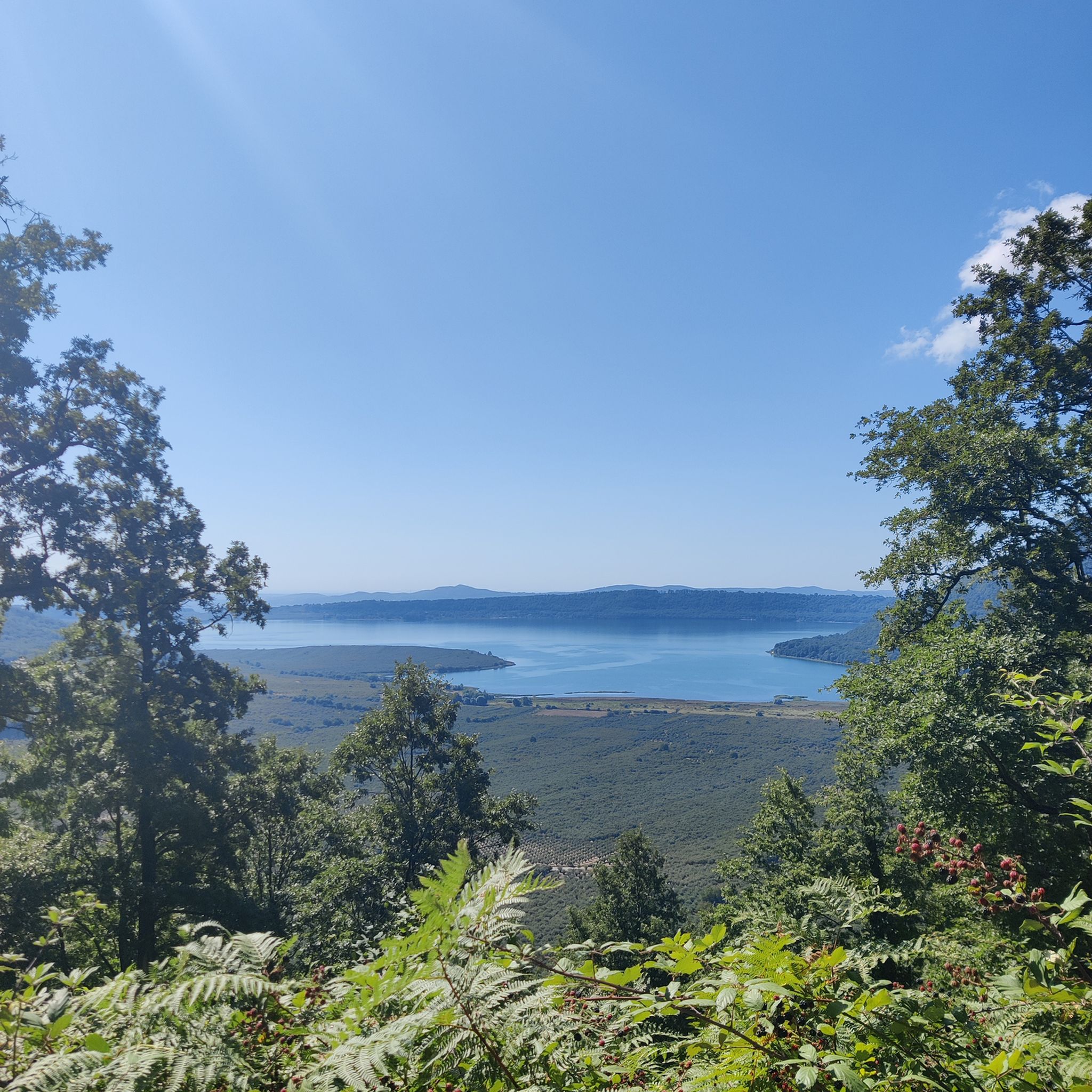
Embark on the Monte Venere Loop, a moderate hike that takes you through the Riserva Naturale Lago di Vico. This 8.0 miles (12.8 km) route offers diverse terrain and rewarding views of Lake Vico, with an elevation gain of 1724 feet (525 metres). You can expect a pleasant journey through the volcanic landscape, passing by the scenic Strada di Mezzo Trail. The estimated duration for completing the loop is around 4 hours and 5 minutes, making it a good half-day adventure. You'll experience varied natural beauty as you traverse this well-marked path.
Before you set out, it's wise to check local conditions, as accessibility can sometimes vary. Parking is usually convenient and available close to the trailhead, which is helpful if you are driving. Remember to wear appropriate hiking shoes for the varied terrain you will encounter on the path. This ensures a comfortable and safe experience as you explore the natural reserve.
The Monte Venere Loop is notable for its position within the Lake Vico Nature Reserve, offering a unique perspective on the region's volcanic origins. The trail provides an excellent opportunity to immerse yourself in the local ecosystem and appreciate the natural beauty surrounding Lake Vico. It stands out as a well-rounded option for those seeking a balanced challenge and scenic rewards in this area.
4.6
(32)
102
hikers
15.4km
04:14
260m
260m
Embark on a moderate 9.6-mile (15.4 km) hike from Bolsena, exploring a landscape shaped by volcanic activity. This route, taking about 4 hours and 14 minutes, leads you through hilly terrain, lush forests, and along streams, with an elevation gain of 854 feet (260 metres). You will traverse a mix of unpaved paths, gravel, and some paved sections. The highlight is the Fosso d'Arlena Waterfall, a spectacular cascade where you can even swim in the natural pool at its base.
This moderate hike requires good fitness and sure-footedness, as you will encounter varied terrain. The starting point in Bolsena is easily accessible by public transport, making it convenient to begin your adventure. While the trail offers rewarding views, be aware that some sections might have overgrown vegetation. Plan for a comfortable pace to fully enjoy the natural surroundings and historical sites along the way.
The Bolsena region is known for its unique volcanic origins, centered around Lake Bolsena, Europe's largest volcanic lake. This trail offers a chance to experience this distinct environment, combining natural beauty with historical sites. The opportunity to swim at the Fosso d'Arlena Waterfall adds a special touch to this popular route, which is highly rated by the hiking community.
4.2
(26)
70
hikers
5.61km
01:46
220m
220m
The Etruscan Pyramid and Santa Cecilia Necropolis Trail offers an easy 3.5-mile (5.6 km) hike through ancient history and lush woodlands. You will gain 714 feet (218 metres) in elevation over an estimated 1 hour and 45 minutes. Expect to walk through dense forests with beech trees and climbing ivies, experiencing rich, earthy smells. The route features impressive tufa stone walls and ancient 'via cava', narrow paths carved by the Etruscans. A key visual landmark is the monumental Etruscan Pyramid of Bomarzo, a 10-meter-high altar carved from volcanic rock.
While the trail is generally accessible, some sections, like the steps leading to the Etruscan Pyramid, can be steep. Sturdy hiking shoes are advisable for the varied terrain, which includes natural paths, ancient excavated roads, and some paved sections. Parking is typically available near the starting point in Bomarzo, making it convenient for drivers. There are no specific permits or fees mentioned for this route. Consider visiting during milder weather to fully enjoy the outdoor experience.
This circular walk offers a fascinating journey through ancient history, blending dense woodlands with significant historical sites. You will discover the unique geological features of the region, including the tufa stone walls and the volcanic rock from which the Etruscan Pyramid was carved. The presence of ancient 'via cava' highlights the Etruscan civilization's ingenuity in shaping the landscape. This trail stands out for its direct connection to a rich past, offering a glimpse into a bygone era.
Get access to more routes and recommendations from other explorers.
Already have an account?
Our route recommendations are based on thousands of hikes, rides, and runs completed by other people on komoot.
Start today with a free account
Your next adventure awaits.
Popular around Viterbo
Other adventures in Viterbo


Tips from the Community

About halfway (when you're on the plain near the houses after the woods), be careful not to turn into the tall grass where the app tells you to go, but continue along the road alongside the houses. I encountered a Maremma Sheepdog that came toward me barking. Fortunately, when I calmly turned back, it stopped. Also be careful on the long stretch of dirt road immediately afterward; there are cattle and sheep, along with many dogs. Luckily, the shepherd was there to keep them in check.
0
0
Following this path, just before reaching the devil's well, it is not clear where to go, the path disappears and also the white and red signs. We had to go a bit by intuition and take a very steep climb in the woods to get there. Once we reach the well, the path continues easily until the end.
0
1

Be careful not to lean out!
0
0

incredibly beautiful, we liked it very much
3
0

Beautiful town on the lake of the same name and along the Via Francigena
1
0

the green of the male with the contrast of the foliage... fantastic
0
0

It is a large boulder of shaped and carved peperino stone, located in a forest between Bomarzo and Chia; It was rediscovered in 2001 by the Archeotuscia association and the archaeological company Pro-Ferento. The structure has 26 steps carved into the volcanic rock, with a height of 8 meters in the upstream part and 16 meters in the downstream part. It is believed to have been an Etruscan rock altar, probably dating back to the 6th-7th century BC, although some hypotheses suggest even older origins.
0
0

My husband and I did this trail and a few others for a 13.5 km walk up and down Monte Venere. It was great. Watch out for pozzo del diavolo. My husband fell in, and now I'm looking for a new husband.
0
0
Frequently Asked Questions
How many hiking trails are available in Viterbo?
Viterbo offers a wide variety of hiking experiences, with over 630 routes available. These trails cater to all levels, including easy walks, moderate treks, and more challenging paths for experienced hikers.
What types of landscapes can I expect to see while hiking in Viterbo?
Hiking in Viterbo takes you through diverse landscapes shaped by volcanic activity. You'll encounter scenic volcanic lakes like Lake Bolsena, lush woodlands in the Monti Cimini, distinctive 'forre' (gorges), and dramatic tuff rock formations. The region also features ancient Etruscan sites and sections of the historic Via Francigena.
Are there easy hiking trails suitable for beginners or families in Viterbo?
Yes, Viterbo has many easy trails perfect for beginners or families. Over 250 routes are classified as easy. A great option is the Calcata Loop Trail, which is just over 3 miles (5.6 km) and offers a pleasant walk through the area.
Are there any hikes that feature waterfalls in Viterbo?
Absolutely! The region is home to beautiful waterfalls. You can explore the scenic Monte Gelato Waterfalls within Treja Valley Park on the From Calcata to the Monte Gelato Waterfalls – ring tour – Treja Valley Park. Another option is the From Bolsena to the Fosso d'Arlena Waterfall - panoramic hike, which leads to the Fosso d'Arlena Waterfall near Lake Bolsena.
Can I find circular hiking routes in Viterbo?
Yes, many trails in Viterbo are designed as circular routes, allowing you to start and end in the same location. For example, the Monte Venere Loop offers a good workout around Monte Venere, and the UNESCO Beech Forest of Monte Raschio Trail is a moderate circular route through ancient beech groves.
What historical or cultural sites can I explore on a hike in Viterbo?
Viterbo is rich in history, with many trails passing through ancient sites. You can hike the Etruscan Pyramid and Santa Cecilia Necropolis Trail to discover ancient Etruscan heritage. The historic Via Francigena also passes through the region, offering a journey through ancient Roman roads and historic villages. The Corchiano Historic Village and Gorges is another notable site.
Are there any thermal springs near hiking trails where I can relax?
Viterbo is famous for its thermal springs, a perfect way to relax after a hike. While not directly on every trail, many are easily accessible. Natural pools like Bullicame and Carletti, or thermal parks such as Bagnaccio and Terme dei Papi, are popular choices, known since Roman times for their therapeutic properties.
What are some notable landmarks or natural monuments to see near the trails?
The region boasts several impressive landmarks and natural monuments. You can visit Lake Bolsena, Europe's largest volcanic lake, or explore the unique Etruscan Pyramid of Bomarzo. The dramatic 'forre' (gorges) and ancient 'tagliate' (cut roads) like Tagliata di Santo Antonio are also prominent features.
What do other hikers say about the trails in Viterbo?
The hiking trails in Viterbo are highly regarded by the komoot community, with an impressive average rating of 4.4 stars from over 3,100 reviews. Hikers often praise the diverse scenery, from ancient woodlands to volcanic landscapes, and the well-maintained paths that make exploration enjoyable.
Is public transport available to reach hiking trailheads in Viterbo?
While some trailheads might be accessible by local buses, public transport options can be limited for reaching all hiking starting points in Viterbo's more rural areas. It's advisable to check local bus schedules in advance or consider driving to trailheads, especially for routes further from the city center.
Are there parking facilities near the hiking trails?
Many popular hiking trailheads and natural parks in the Viterbo region offer designated parking areas. However, for smaller or more remote trails, parking might be less formal. It's recommended to check specific route details or local information for parking availability before you go.
What is the best time of year to go hiking in Viterbo?
The best time for hiking in Viterbo is typically during spring (April-May) and autumn (September-October). During these seasons, the weather is mild and pleasant, and the landscapes are particularly beautiful with blooming flowers or vibrant fall foliage. Summer can be hot, especially in July and August, while winter offers cooler temperatures but can be ideal for quieter walks.
Most popular routes in Viterbo
Most popular attractions in Viterbo

Get inspired with the komoot mobile app


Didn’t find what you were looking for?
Check out more Hikes throughout Viterbo below and find the perfect route in your destination.
