The best walks and hikes around Leivi
4.5
(4244)
23,857
hikers
11
hikes
Hiking around Leivi offers diverse terrain characterized by hilly landscapes and elevated viewpoints. The region features a network of trails that traverse forested areas and lead to panoramic vistas. Hikers can explore paths ranging from gentle loops to more challenging ascents, often encountering historical sites along the way. The varied topography provides options for different ability levels.
Best hiking trails around Leivi
- The most popular hiking route is Le Cinque Torri Trail, a difficult 11.2 miles (18.0 km) trail…
Last updated: October 10, 2026
4.0
(1)
1
hikers
5.82km
01:53
260m
260m
Easy hike. Great for any fitness level. Easily-accessible paths. Suitable for all skill levels.
4.5
(2)
11
hikers
2.37km
00:42
70m
70m
Easy hike. Great for any fitness level. Easily-accessible paths. Suitable for all skill levels.

4.2
(6)
20
hikers
15.2km
05:35
570m
570m
Hard hike. Very good fitness required. Mostly accessible paths. Sure-footedness required.
3.5
(4)
20
hikers
11.0km
04:03
650m
650m
Moderate hike. Good fitness required. Mostly accessible paths. Sure-footedness required.
5.0
(3)
11
hikers
10.8km
03:40
430m
420m
Moderate hike. Good fitness required. Mostly accessible paths. Sure-footedness required.
Get access to more routes and recommendations from other explorers.
Already have an account?
Our route recommendations are based on thousands of hikes, rides, and runs completed by other people on komoot.
Start today with a free account
Your next adventure awaits.

Tips from the Community

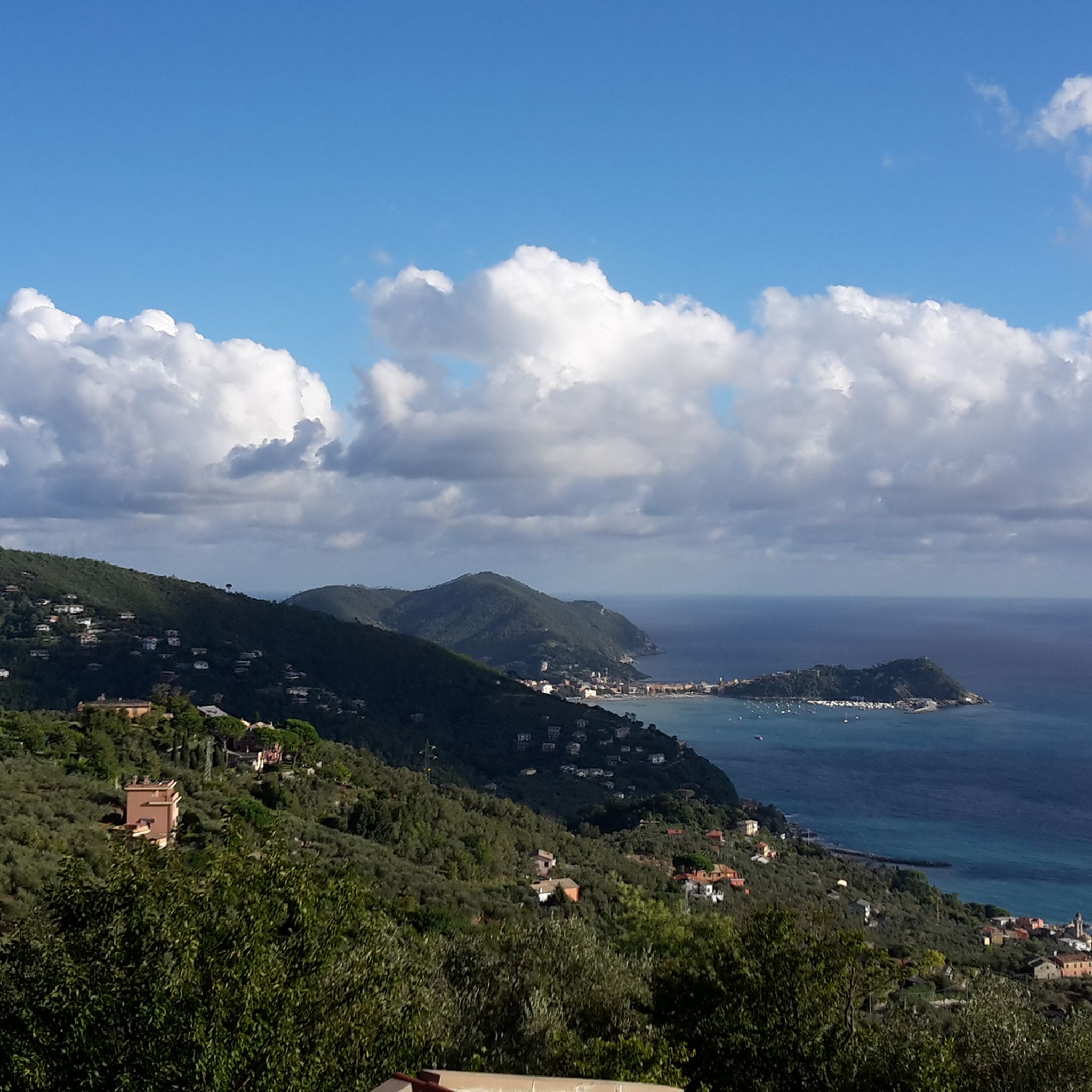
The hut on Monte Pegge near Rapallo is the Rifugio Margherita, an unmanaged self-catering hut of the local Alpine club. It is located at an altitude of 775 meters and offers a wide view of the Gulf of Tigullio.
8
0

A very beautiful church, inside and out.
0
0

A charming place steeped in history, it offers a beautiful view of Chiavari and the sea. The cobbled pavement, decorated with "rissêu" mosaics, typical of Tigullio and Liguria, adorns the churchyard in front of the church. Comfortable creuze (except for a few poorly maintained sections) allow for an easy visit, with two alternative routes back to Chiavari. From Ri Alto, the trail to Curlo di San Tommaso begins. The signposts are marked "Square Rosso Solida" (full red square) from the Ceive ascent next to the Chiavari cemetery, and the trail markers are two parallel red lines on the way down.
0
0

Wow! The entire forecourt is paved with rounded, plastered stones.
0
0
Great place! Cozy, authentic, and almost mystical with those giant arches! ❤️
0
0


Wonderful holm oak forest that you come across after the sanctuary of Montallegro
0
0

The sanctuary of the Madonnetta is located at an altitude of 435 meters above sea level and was built in the 19th century. It can be reached by following several mule tracks, some of which start not far from the center of Zoagli. The facade of the sanctuary is a distinctive white color.
0
0
Frequently Asked Questions
How many hiking trails are there around Leivi?
Leivi offers a wide selection of hiking routes, with over 480 trails available. These include a good mix of easy, moderate, and difficult options to suit various skill levels.
What kind of terrain can I expect when hiking in Leivi?
Hiking around Leivi is characterized by hilly landscapes, forested slopes, and elevated viewpoints. The trails traverse varied topography, offering everything from gentle paths to more challenging ascents, often leading to panoramic vistas.
Are there easy hiking options suitable for beginners in Leivi?
Yes, Leivi has plenty of options for beginners. There are over 140 easy routes available, such as the Cinque Torri Loop Variant, which is a 5.8 km trail with moderate elevation gain, perfect for a relaxed outing.
What are some notable landmarks or natural features to see along the trails in Leivi?
The region around Leivi is rich in both natural beauty and historical sites. You can explore natural monuments like Pietre Strette or enjoy stunning views from Punta Manara, offering vistas of Sestri Levante and Baia del Silenzio. Historical sites include the Ruins of the Church of Sant'Anna.
Are there any family-friendly hiking trails in Leivi?
While specific family-friendly routes are not highlighted in the data, the presence of over 140 easy trails suggests many options suitable for families. Look for routes with lower elevation gain and shorter distances, which are generally more manageable for children.
Can I find circular hiking routes in Leivi?
Yes, Leivi offers several circular hiking routes. A popular option is the Monte Telegrafo Loop Trail, a 10.6 km route that takes about 3 hours 34 minutes to complete, leading through hilly terrain and returning to your starting point.
What do other hikers enjoy most about hiking in Leivi?
The area is highly rated by the komoot community, with an average score of 4.5 stars from almost 4000 reviews. Hikers often praise the diverse terrain, the beautiful forested areas, and the rewarding elevated viewpoints. The variety of routes caters to all levels, making it a popular destination.
Are there any challenging hikes for experienced trekkers in Leivi?
Absolutely. For experienced trekkers, Leivi offers over 75 difficult routes. The Le Cinque Torri Trail is a challenging 18 km route with significant elevation gain, taking nearly 6 hours to complete. Another demanding option is the Historic pilgrimage trail to Santuario di Montallegro, which is 16.7 km long and features substantial ascents.
What is the best time of year to go hiking in Leivi?
Given the hilly and forested nature of Leivi, spring and autumn are generally ideal for hiking, offering pleasant temperatures and vibrant scenery. Summer can also be enjoyable, though it might be warmer. Winter hikes are possible, but some trails might be affected by weather conditions, so checking local forecasts is advisable.
Are there any castles or historical sites I can visit near the hiking trails?
Yes, the region around Leivi features several historical castles. You can visit Rapallo Castle or Chiavari Castle. Additionally, you can find viewpoints offering scenic perspectives of places like Castello Brown and the charming town of Portofino.
Are there any trails that offer views of the sea or coastline?
While Leivi itself is inland, the nearby attractions suggest coastal views are accessible. For instance, the Punta Manara Trail is a highlight that offers stunning views of the coastline, including Sestri Levante and Baia del Silenzio, and the Portofino Lighthouse is another coastal landmark.
Is there public transport available to reach hiking trailheads in Leivi?
Information on specific public transport routes to trailheads in Leivi is not detailed. However, for regions like this, it's common for local bus services to connect towns and villages. It's recommended to check local transport schedules for connections to specific starting points.
Most popular attractions around Leivi

Get inspired with the komoot mobile app


Explore more
Browse the best Hikes in other regions.
