The best walks and hikes around Calderara Di Reno
4.3
(2493)
19,445
hikers
623
hikes
Hiking around Calderara Di Reno offers routes through a predominantly agricultural and flat landscape, shaped by its proximity to the Reno River. The region features the Golena San Vitale Ecological Rebalancing Area, a floodplain recognized for its diverse plant and animal species. While the immediate vicinity is largely flat, potential riverside paths along the Reno and Lavino rivers provide opportunities for leisurely walks. Historical buildings and sites like the Cippo di Sacerno also offer points of interest for walks with…
Last updated: July 1, 2026
4.7
(3)
27
hikers
5.98km
01:31
10m
10m
Easy hike. Great for any fitness level. Easily-accessible paths. Suitable for all skill levels.
17
hikers
Moderate hike. Good fitness required. Easily-accessible paths. Suitable for all skill levels.

Sign up for free
17
hikers
6.44km
01:37
10m
10m
Easy hike. Great for any fitness level. Easily-accessible paths. Suitable for all skill levels.
14
hikers
11.5km
02:54
20m
20m
Moderate hike. Good fitness required. Easily-accessible paths. Suitable for all skill levels.
5.0
(1)
10
hikers
4.42km
01:07
10m
10m
Easy hike. Great for any fitness level. Easily-accessible paths. Suitable for all skill levels.
Get access to more routes and recommendations from other explorers.
Sign up for free
Already have an account?
Our route recommendations are based on thousands of hikes, rides, and runs completed by other people on komoot.
Start today with a free account
Your next adventure awaits.
Login or Signup

Tips from the Community


Hello, one of the smaller towers is, in my opinion, more crooked than the more famous one in Pisa. 😜
1
0


The two towers are the symbol of the city of Bologna. The smaller tower is called the Asinelli Tower and the large one is called the Garisenda Tower and is 48 meters high.
1
0

Very small Mercato with little on offer or anything special to see.
0
0

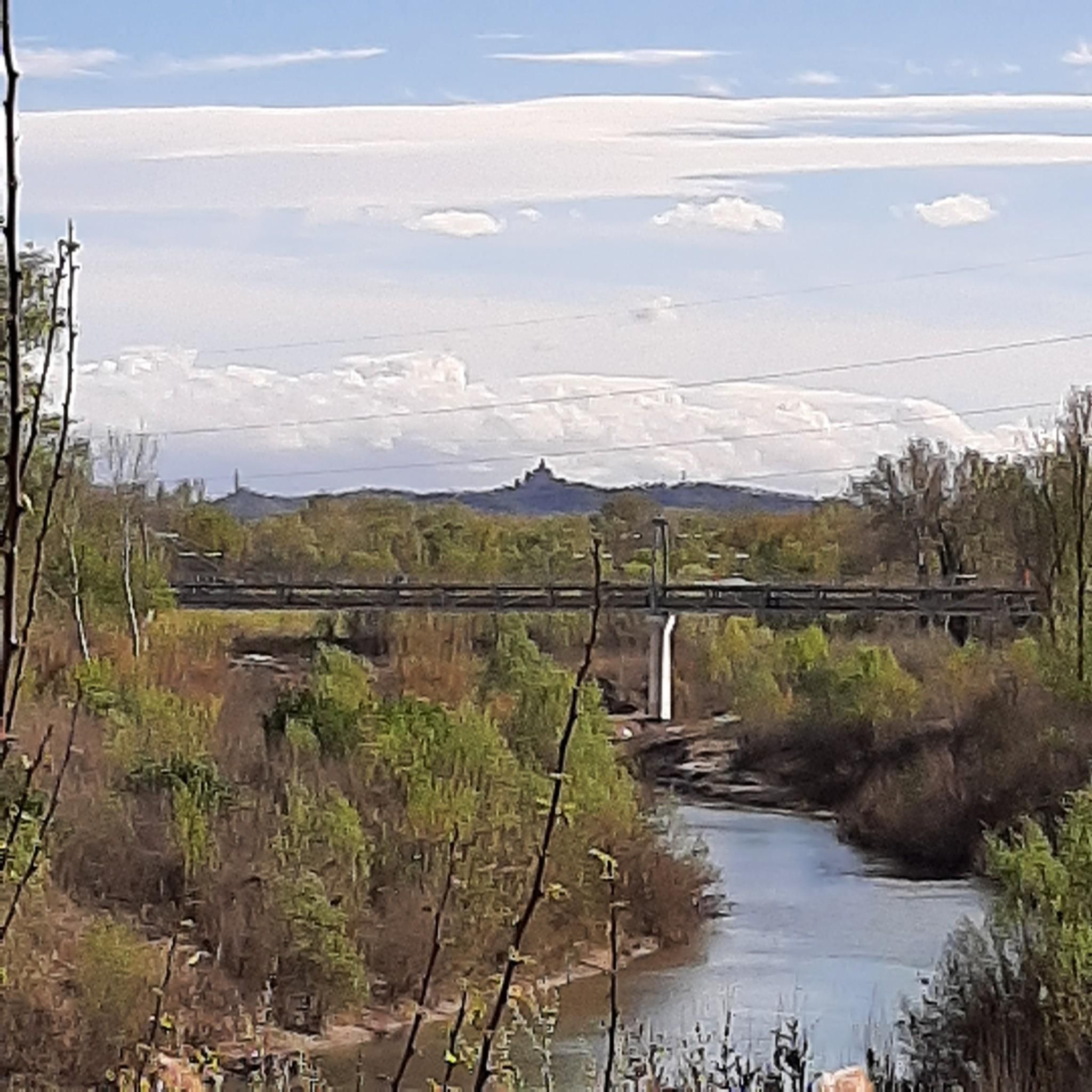
The Ciclovia del Sole is a cycle route that crosses the Bolognese plain, connecting it to the rest of Europe as part of the European EuroVelo7 project, which aims to connect the northernmost point of Europe, North Cape, with Malta, the southernmost point . The part of the cycle route that winds north from Bologna into the heart of the Po Valley follows the former Verona-Bologna railway, fitting in a scenic manner within the rural landscape of these places. The fact that it was a railway line is quite evident, especially in some sections, such as this bridge over the Lavino stream.
1
0

Piazza Maggiore, also known as Piazza Grande thanks to the famous song by Lucio Dalla, is the main square of the city of Bologna. The square is framed by buildings (including the imposing Basilica of San Petronio and the Palazzo Re Enzo, seat of the town hall) and the typical porticoes. Various paths start from here including the Via degli Dei and the Piccola Cassia.
4
0
Frequently Asked Questions
What kind of terrain can I expect on hiking trails around Calderara Di Reno?
The landscape around Calderara Di Reno is predominantly agricultural and flat, shaped by its proximity to the Reno River. You'll find opportunities for leisurely walks through countryside and along potential riverside paths. While generally flat, some routes may offer slight variations in elevation, particularly those connecting to nearby urban areas.
Are there many hiking options available in Calderara Di Reno?
Yes, there are over 500 hiking routes available around Calderara Di Reno. This includes a wide range of options, with more than 280 easy trails, over 210 moderate routes, and around 30 more challenging excursions to explore.
What are some natural features or landmarks to look out for while hiking?
A significant natural feature is the Golena San Vitale Ecological Rebalancing Area, a floodplain along the Reno River known for its diverse plant and animal species. You can also find highlights like Parco della Chiusa (Talon Park), La Bora Nature Reserve, and Giardini Margherita, offering pleasant surroundings for walks and nature observation.
Are there any historical points of interest accessible by foot?
Yes, the region offers historical sites that can be incorporated into walks. The Cippo di Sacerno, marking the site where the Second Triumvirate was formed in 43 BC, is situated along the banks of the Lavino stream. While not directly on hiking trails, historical buildings like the Church of Sant'Elena di Sacerno and Villa Donini with its park also provide cultural points of interest for walks.
What do other hikers say about the trails in Calderara Di Reno?
The routes in Calderara Di Reno are highly rated by the komoot community, with an average score of 4.4 stars from over 2,300 reviews. Hikers often praise the accessibility of the trails, the peaceful agricultural scenery, and the opportunities to combine nature walks with historical exploration.
Are there any family-friendly hiking routes suitable for children?
Given the predominantly flat and agricultural landscape, many of the easy trails are suitable for families. Routes that explore the ecological areas or riverside paths, such as those near the Golena San Vitale, offer gentle terrain for children. For a shorter, easy option, consider the Meloncello Arch – Portico di San Luca loop from Stadio Renato Dall'Ara, which is about 3.7 miles long.
Can I bring my dog on the hiking trails?
Many trails in the Calderara Di Reno area are dog-friendly, especially those through agricultural fields and along riverbanks. It's always recommended to keep dogs on a leash, particularly in ecological rebalancing areas like Golena San Vitale, to protect local wildlife. Always check specific trail regulations if posted.
Are there circular hiking routes available?
Yes, many of the routes in the area are designed as loops, allowing you to start and end at the same point. An example of a moderate circular route is the Ponte della Bionda – Corticella Support loop from Bologna Centrale, which covers about 5.2 miles.
What is the typical duration for hikes in this region?
Hike durations vary widely depending on the route's length and your pace. Many easy strolls can be completed in under an hour or two, while moderate routes like the Piazza Maggiore – Basilica of San Petronio loop from Lazzaretto, which is 8 miles long, might take around 4 hours. There are options for both short walks and longer excursions.
Is public transport available to access hiking trails?
Calderara Di Reno is located near Bologna, which has good public transport connections. While specific trailheads might require a short walk from bus stops, many routes, especially those connecting to urban landmarks, are accessible via public transport. For example, routes starting from Bologna Centrale or Stadio Renato Dall'Ara are well-connected.
Are there any longer, more challenging routes for experienced hikers?
While the region is largely flat, there are some longer moderate routes that offer a good workout. For instance, the Basilica of San Petronio – Piazza Maggiore loop from Stadio Renato Dall'Ara is a moderate 6.4-mile trail that provides a longer exploration of the area. For more significant elevation, you might need to venture slightly further from the immediate Calderara Di Reno area.
What is the best time of year to go hiking in Calderara Di Reno?
The best time to hike in Calderara Di Reno is typically during spring (April-May) and autumn (September-October) when the weather is mild and pleasant. These seasons offer comfortable temperatures for walking through the agricultural landscapes and along the rivers, with spring bringing blooming flora and autumn showcasing vibrant colors.
Most popular routes around Calderara Di Reno
Most popular attractions around Calderara Di Reno

Get inspired with the komoot mobile app


Explore more
Browse the best Hikes in other regions.
