The best walks and hikes around Averara
4.4
(353)
1,889
hikers
37
hikes
Hiking around Averara offers access to the diverse and mountainous landscape of the Bergamo Orobie region in Italy. The area features impressive peaks, scenic passes, and a network of trails. Hikers can explore high-altitude routes, historic paths, and trails connecting various villages. This region is characterized by its alpine terrain and varied elevation changes.
Best hiking trails around Averara
- The most popular hiking route is To the Laghetti di Ponteranica from Passo San Marco, a 8.3 miles (13.3 km) trail that takes 5 hours 44 minutes to complete. This route leads to alpine lakes from a notable mountain pass.
- Another top favourite among local hikers is Historic Via Mercatorum from Caprile Inferiore to Passo San Marco (CAI 110), a difficult 9.2 miles (14.9 km) path. This historic trail follows an ancient trade route through the mountains.
- Local hikers also love the From the Cantoniera di San Marco to the Bocchetta d'Orta, a 3.6 miles (5.8 km) trail leading through mountain terrain, often completed in about 2 hours 9 minutes.
- Hiking around Averara is defined by impressive peaks, scenic passes, and historic routes. The network offers options for easy, moderate, and difficult ability levels.
- The routes in Averara are highly rated by the komoot community with an average score of 4.5 stars from nearly 300 reviews. More than 1,700 hikers have used komoot to explore Averara's varied terrain.
Last updated: October 10, 2026
4.6
(34)
152
hikers
13.3km
05:44
660m
660m
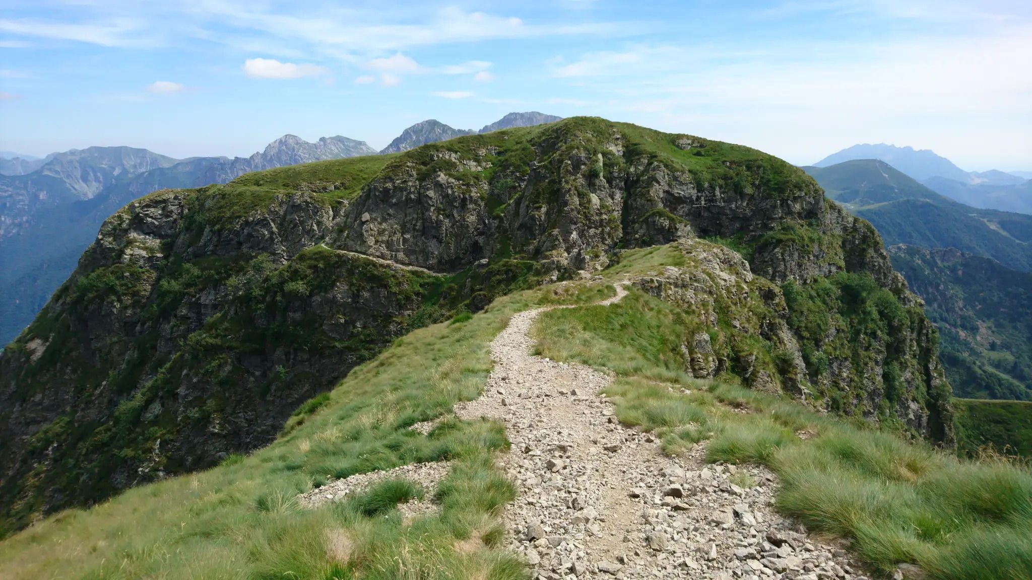
Embark on Stage 3 of the Western Orobie Trail, a difficult hiking route that challenges you with 2171 feet (662 metres) of elevation gain over 8.3 miles (13.3 km). This demanding section takes approximately 5 hours and 43 minutes to complete, guiding you through rugged alpine passes and dramatic ridges. As you hike, you will encounter diverse landscapes, from lush meadows to high-altitude terrain, with expansive views of the surrounding valleys. Keep an eye out for the serene Ponteranica Lakes, nestled among craggy peaks, offering a picturesque visual landmark along your journey.
To plan your visit, consider that the best time to hike this stage is typically from May to October, when the mountain refuges are open and snow has receded from the higher elevations. The route is clearly marked with trail number 101, making navigation straightforward. Be prepared for challenging terrain, including some sections that are slightly exposed, requiring good physical fitness and sure-footedness. Always check local conditions before you set out, especially regarding weather and trail accessibility.
This stage of the Western Orobie Trail offers a deep dive into the Parco delle Orobie Valtellinesi, showcasing its unique alpine environment. You will gain insights into the region's geology as you traverse high-altitude passages, providing glimpses into the Taleggio, Valsassina, and Valtellina valleys. The trail's challenging nature and stunning vistas make it a notable part of the larger Western Orobie Trail, appealing to hikers seeking a rewarding alpine experience.
4.2
(13)
60
hikers
5.80km
01:50
250m
240m
Easy hike. Great for any fitness level. Easily-accessible paths. Suitable for all skill levels.

4.6
(9)
45
hikers
14.9km
06:19
1,030m
1,030m
Historic merchant trail through Val Mora with alpine views, cheese farms, and medieval mining traces.
4.4
(10)
38
hikers
7.92km
03:43
760m
760m
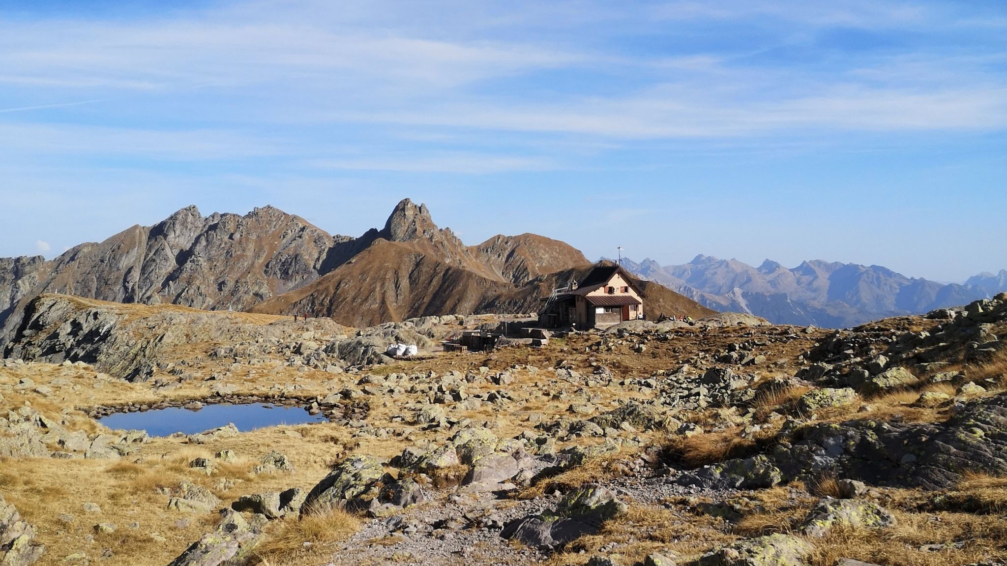
Hike 4.9 miles (7.9 km) to Rifugio Alpe Cantedoldo via Trail 133, gaining 2496 feet (761 metres) through forests and alpine pastures.
4.8
(4)
28
hikers
14.4km
05:57
770m
770m
Embark on a challenging hike from Rifugio Ca' San Marco to Rifugio Salmurano, a difficult route covering 8.9 miles (14.4 km) with a significant elevation gain of 2517 feet (767 metres). This journey typically takes around 5 hours and 57 minutes to complete. You will traverse the beautiful Val di Bomino, passing Lago del Verrobbio, whose waters shift from turquoise to emerald green. The trail then leads through the narrow Forcellino pass before descending to Lago di Pescegallo, offering varied terrain and stunning mountain views.
To begin your adventure, you can park at the large lot directly in front of Rifugio Ca' San Marco in Mezzoldo. This historic rifugio also serves traditional mountain cuisine, making it a good spot for a pre-hike meal or a post-hike celebration. Be prepared for a full day on the trail, as the duration suggests, and ensure you have adequate supplies for this demanding route.
This trail follows CAI trail 161 and offers a glimpse into history with remnants of World War I trenches along the Cadorna Line at Passo di Verrobbio. Stone fortifications from the Great War still mark the landscape, providing a unique historical context to your hike. The route also takes you through areas with golden larches and alpine meadows, showcasing the natural beauty and peaceful quiet of these high mountain regions.
Get access to more routes and recommendations from other explorers.
Already have an account?
Our route recommendations are based on thousands of hikes, rides, and runs completed by other people on komoot.
Start today with a free account
Your next adventure awaits.


Tips from the Community

be careful with the bike pump abroad! the pressure gauge does not work and the attachment on presta valves does not work correctly
0
0

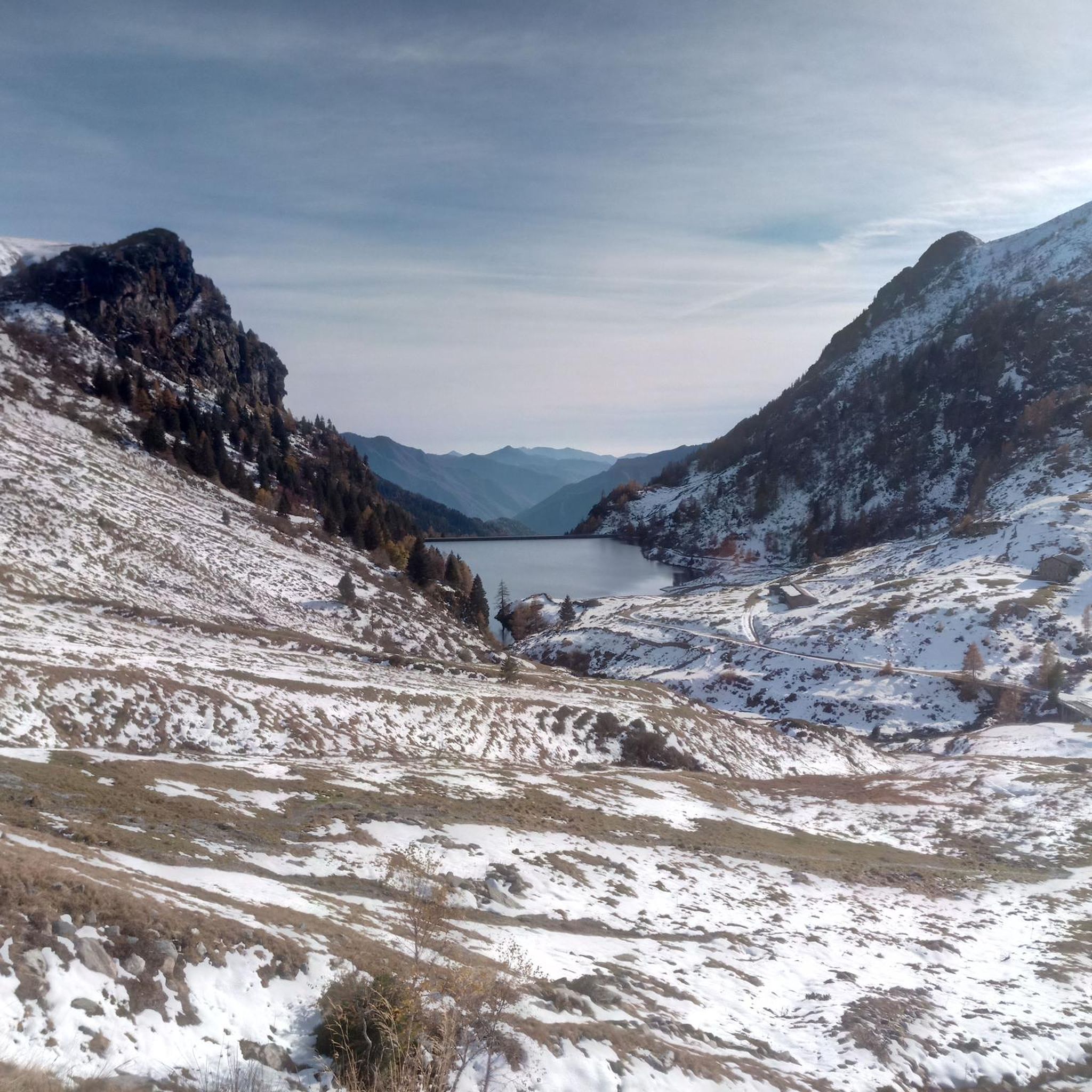
Beautiful alpine lakes with crystal clear waters. Easy to reach (always in the snow-free period) both from Casa Cantoniera di San Marco and from Rifugio dell'Avaro.
0
0


We passed the beginning of the walk
0
0
We met them during our excursion
0
0
We parked here for our hike (free parking) popped in for a coffee on the way back, nice and welcoming
0
0
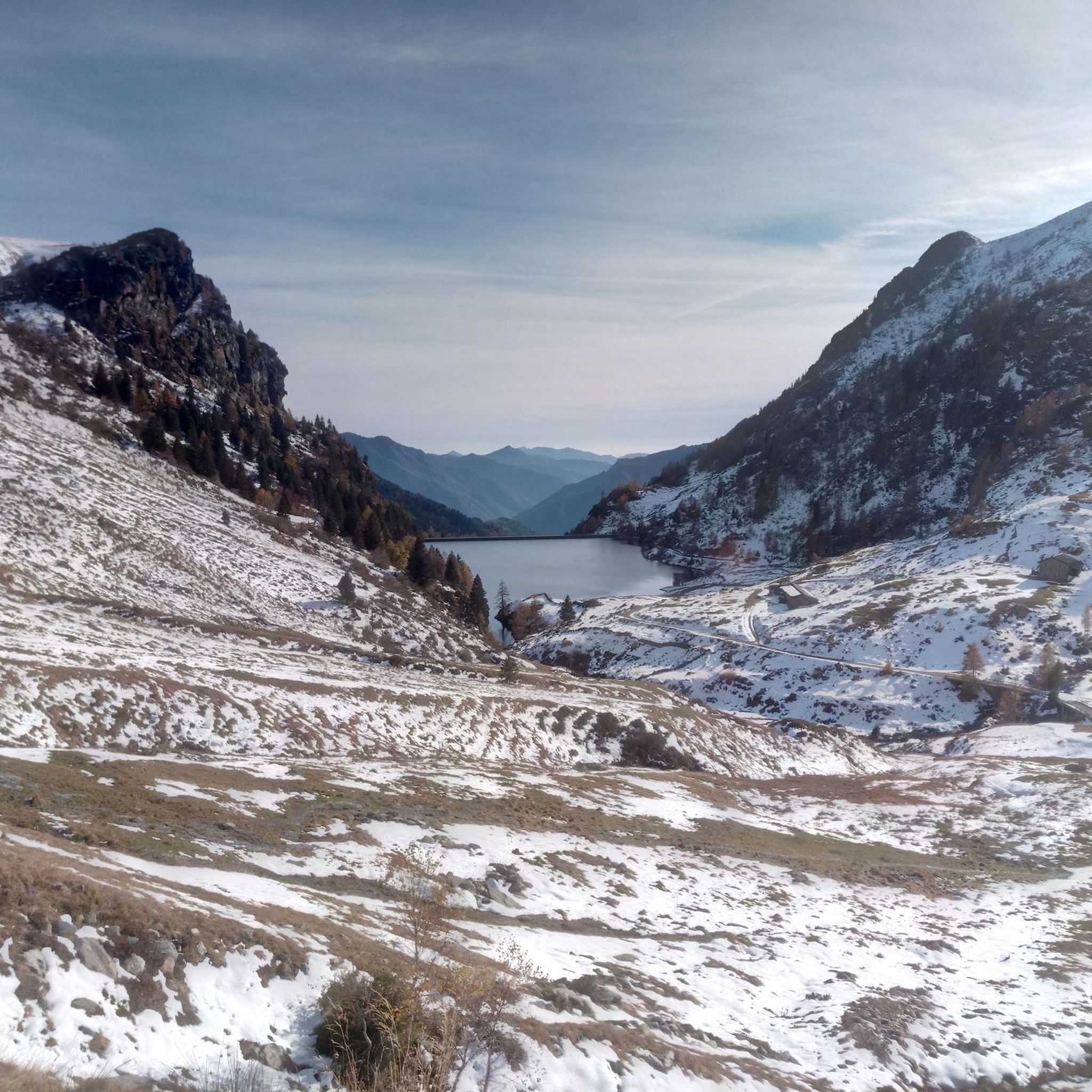
Beautiful artificial lake below the San Marco Pass
0
0
Frequently Asked Questions
How many hiking trails are available around Averara?
There are nearly 40 hiking trails around Averara, offering a wide range of options for different skill levels and preferences. The komoot community has explored over 1,700 routes in the area.
What types of terrain can I expect on hikes in Averara?
The region around Averara is characterized by its diverse and mountainous landscape. You'll find impressive peaks, scenic passes, and a network of trails that range from high-altitude routes to historic paths connecting various villages. The terrain is alpine, with varied elevation changes.
Are there any easy hiking trails suitable for beginners in Averara?
Yes, Averara offers several easy hiking options. For example, the route From Rifugio Passo San Marco to Algo di Valmora is an easy trail that provides a pleasant experience without significant challenges.
What are some challenging hikes for experienced trekkers in Averara?
For experienced trekkers, Averara offers several difficult routes. The Historic Via Mercatorum from Caprile Inferiore to Passo San Marco (CAI 110) is a challenging path following an ancient trade route. Another demanding option is From Rifugio Ca' San Marco to Rifugio Salmurano (via CAI trail 161), which also involves significant elevation changes.
What natural attractions can I see along the hiking trails in Averara?
Hikers in Averara can discover several natural attractions. You might encounter beautiful alpine lakes like the Ponteranica Lakes or the Porcile Lakes. The region also features impressive summits such as Pizzo dei Tre Signori, and scenic gorges like Val Taleggio.
Are there any notable mountain passes to explore near Averara?
Yes, Averara is surrounded by several notable mountain passes offering spectacular views. You can visit Tartano Pass, which provides views of both the Bergamo Orobie and Valtellina mountains, or San Simone Pass. Other passes include Baciamorti Pass and Toro Pass.
What do other hikers enjoy most about hiking in Averara?
The hiking routes in Averara are highly rated by the komoot community, with an average score of 4.5 stars from nearly 300 reviews. Hikers often praise the diverse and mountainous landscape, the impressive peaks, and the scenic passes that offer rewarding panoramic views.
Are there any family-friendly hiking options in Averara?
While specific family-friendly routes are not highlighted, the presence of easy and moderate trails suggests that some paths could be suitable for families. It's advisable to check the difficulty and length of individual routes to ensure they match your family's capabilities.
Is Averara a good destination for dog-friendly hikes?
Averara's natural and mountainous environment generally welcomes dogs on trails. However, it's always recommended to keep dogs on a leash, especially in protected areas or near livestock, and to check local regulations for specific routes or nature reserves.
What is the best time of year to go hiking in Averara?
Given its mountainous terrain, the best time for hiking in Averara is typically from late spring through early autumn (May to October). During these months, the weather is generally more stable, and trails are free of snow, offering optimal conditions for exploring the peaks and passes.
Are there any routes that lead to alpine lakes from a mountain pass?
Yes, a popular route that fits this description is To the Laghetti di Ponteranica from Passo San Marco. This trail leads to the beautiful alpine lakes from the notable Passo San Marco.
Can I find routes that explore the cultural and historical aspects of the region?
Yes, the region around Averara features trails that allow you to explore the cultural and historical aspects of the Alta Val Brembana's mountains. The Historic Via Mercatorum from Caprile Inferiore to Passo San Marco (CAI 110) is a prime example, following an ancient trade route.
Most popular attractions around Averara

Get inspired with the komoot mobile app


Explore more
Browse the best Hikes in other regions.
