The best walks and hikes around Cingia De' Botti
4.3
(20)
55
hikers
7
hikes
Hiking around Cingia De' Botti offers access to the Oglio River and the Oglio Sud Regional Park, characterized by a flat, riverine landscape. The terrain features lowland forests, wetlands, and agricultural fields, with numerous canals and riverbanks providing pathways. This area in Lombardy, Italy, is defined by its fluvial environment, offering generally gentle gradients suitable for walking.
Best hiking trails around Cingia De' Botti
- The most popular hiking route is Along the banks of the Oglio River in Piadena,…
Last updated: July 1, 2026
4.5
(6)
9
hikers
19.7km
04:59
50m
50m
Moderate hike. Good fitness required. Easily-accessible paths. Suitable for all skill levels.
3.5
(2)
5
hikers
7.57km
01:55
20m
20m
Easy hike. Great for any fitness level. Easily-accessible paths. Suitable for all skill levels.

Sign up for free
5.0
(2)
3
hikers
7.86km
01:59
20m
20m
Easy hike. Great for any fitness level. Easily-accessible paths. Suitable for all skill levels.
5.0
(1)
4
hikers
8.88km
02:15
20m
20m
Moderate hike. Good fitness required. Easily-accessible paths. Suitable for all skill levels.
4
hikers
10.3km
02:35
10m
10m
Moderate hike. Good fitness required. Easily-accessible paths. Suitable for all skill levels.
Get access to more routes and recommendations from other explorers.
Sign up for free
Already have an account?
Our route recommendations are based on thousands of hikes, rides, and runs completed by other people on komoot.
Start today with a free account
Your next adventure awaits.
Login or Signup


Tips from the Community

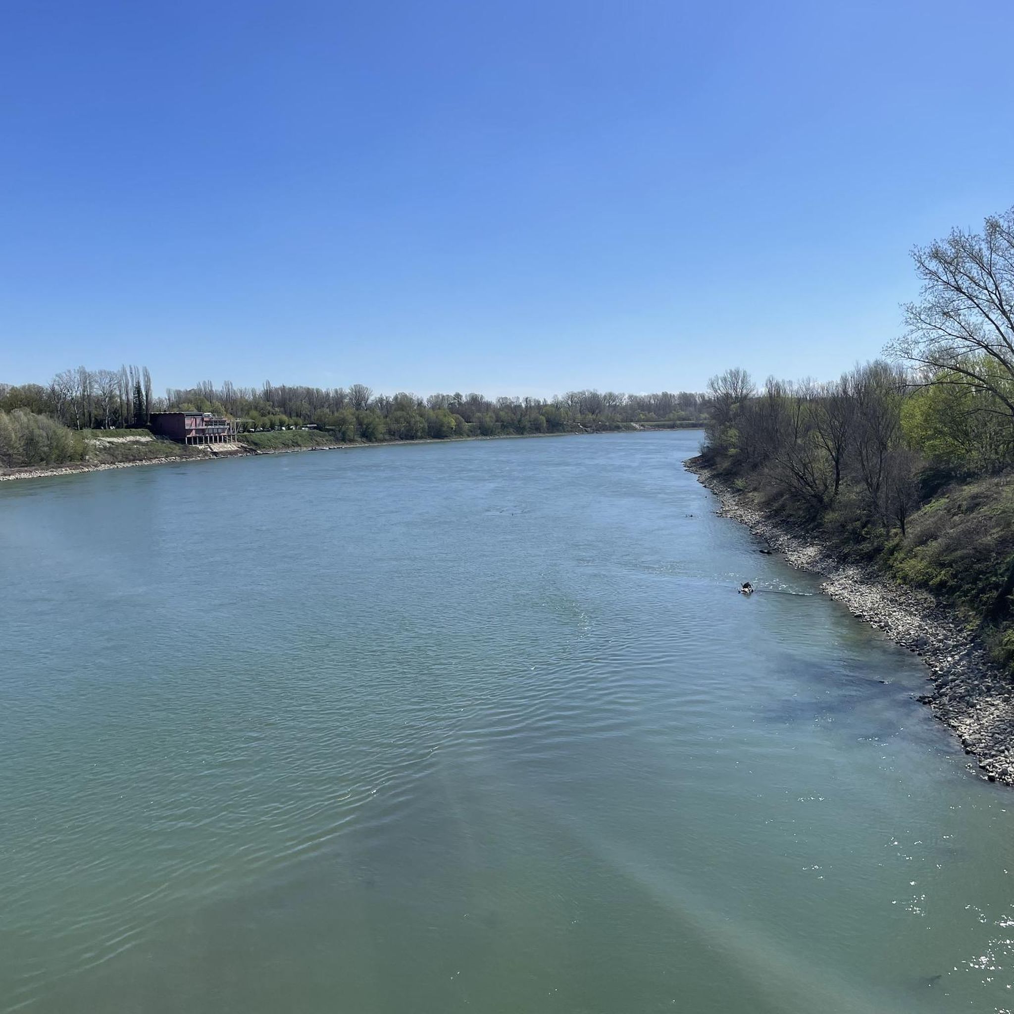
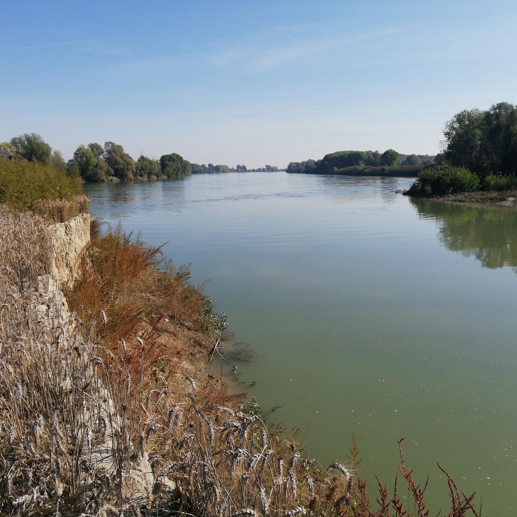
Splendid glimpse of the Oglio river
1
0
Le bine is an area protected as a natural reserve by WWF Italy.
2
0
Old mill overlooking the Oglio river.
1
0

Nature reserve - Educational farm - Agriturismo
0
0
Frequently Asked Questions
How many hiking trails are available around Cingia De' Botti?
There are 7 hiking trails around Cingia De' Botti, offering a variety of experiences. These routes are primarily easy to moderate, with 3 easy and 4 moderate options, making the area accessible for different skill levels.
What kind of landscape can I expect on hikes near Cingia De' Botti?
Hikes around Cingia De' Botti primarily feature a flat, riverine landscape within the Oglio Sud Regional Park. You'll encounter lowland forests, wetlands, and agricultural fields, with many trails following the Oglio River and its canals. The environment is characterized by its serene fluvial setting.
Are there any easy hiking trails suitable for beginners or families?
Yes, there are 3 easy hiking trails around Cingia De' Botti. A great option for families or beginners is the Abandoned Mill – Old Mill on the Oglio River loop from Vho, which is 4.4 miles (7.1 km) long and explores the riverbanks, passing an old mill.
Can I find circular hiking routes in the area?
Yes, several routes around Cingia De' Botti are circular. For example, the Chapel – Historic Church loop from Isola Dovarese is an 11.4 miles (18.3 km) circular trail that takes you through riverine landscapes and past historical sites.
What are some interesting places to explore or landmarks to see along the trails?
The area offers several points of interest. You can visit Piazza Matteotti, Isola Dovarese, a historical site once surrounded by the Oglio River. Nearby, you might also find Roccabianca Castle or Villa Sommi Picenardi, known for its historic park, which can be incorporated into longer excursions.
What do other hikers enjoy most about hiking in Cingia De' Botti?
The hiking trails around Cingia De' Botti are highly rated by the komoot community, with an average score of 4.2 stars from 19 reviews. Hikers often praise the serene riverine landscapes, the peaceful atmosphere of the Oglio Sud Regional Park, and the accessibility of the trails for various activity levels.
Are the hiking trails in Cingia De' Botti suitable for dogs?
The Oglio Sud Regional Park, which encompasses many of the trails, is a natural area. While specific regulations for dogs on every trail may vary, generally, well-behaved dogs on a leash are welcome on most public footpaths. Always ensure to clean up after your pet and respect local wildlife.
Is there public transport available to reach the trailheads?
While Cingia De' Botti is a smaller locality, public transport options in the wider Cremona province might connect to nearby towns like Piadena or Isola Dovarese, which serve as starting points for some routes. It's advisable to check local bus schedules for connections to specific trailheads, as direct access might be limited.
Are there any rest areas or facilities along the hiking routes?
Yes, facilities like L'Attacco Rest Area are available in the broader region. These spots, equipped with picnic tables, grills, and sometimes a bar, provide convenient places for breaks during your outdoor adventures.
What is the best time of year to go hiking in Cingia De' Botti?
The region's flat terrain and riverine environment make it suitable for hiking across many seasons. Spring and autumn offer pleasant temperatures and vibrant natural colors. Summer can be warm, but riverside trails provide some shade. Winter hiking is also possible, with the landscape taking on a different, often tranquil, character.
Are there any long-distance paths or greenways that connect to the Cingia De' Botti trails?
Yes, the Oglio River forms part of the broader Oglio River Green Way, which offers extensive pathways along the riverbanks and canals. This greenway provides opportunities for longer excursions and connects various points of interest within the Oglio Sud Regional Park. You can find more information about the Oglio River Green Way here.
What is the longest moderate hike available?
The longest moderate hike is Along the banks of the Oglio River in Piadena. This trail covers 12.2 miles (19.7 km) and typically takes around 5 hours to complete, offering extensive views of the river's floodplain environment.
Most popular routes around Cingia De' Botti
Most popular attractions around Cingia De' Botti

Get inspired with the komoot mobile app


Explore more
Browse the best Hikes in other regions.
