The best walks and hikes around Nereto
3.9
(100)
928
hikers
40
hikes
Hiking around Nereto offers access to diverse landscapes in Italy's Abruzzo region. The area is characterized by rolling green hills, vineyards, and olive groves of the Val Vibrata, extending towards the Adriatic coast. To the west, the region is within reach of the Gran Sasso and Monti della Laga National Park, featuring high peaks, vast plateaus like Campo Imperatore, and diverse ecosystems. This combination provides a variety of terrain for hiking, from gentle slopes to more challenging mountain environments.
Best…
Last updated: June 24, 2026
4.0
(2)
7
hikers
4.72km
01:21
110m
120m
Easy hike. Great for any fitness level. Easily-accessible paths. Suitable for all skill levels.
4.0
(1)
14
hikers
7.58km
02:04
120m
120m
Moderate hike. Good fitness required. Easily-accessible paths. Suitable for all skill levels.

Sign up for free
3.0
(1)
13
hikers
7.18km
01:49
20m
20m
Easy hike. Great for any fitness level. Easily-accessible paths. Suitable for all skill levels.
3.0
(2)
4
hikers
6.38km
01:37
10m
10m
Easy hike. Great for any fitness level. Easily-accessible paths. Suitable for all skill levels.
5.0
(3)
11
hikers
8.54km
02:18
110m
110m
Moderate hike. Good fitness required. Easily-accessible paths. Suitable for all skill levels.
Get access to more routes and recommendations from other explorers.
Sign up for free
Already have an account?
Our route recommendations are based on thousands of hikes, rides, and runs completed by other people on komoot.
Start today with a free account
Your next adventure awaits.
Login or Signup

Tips from the Community

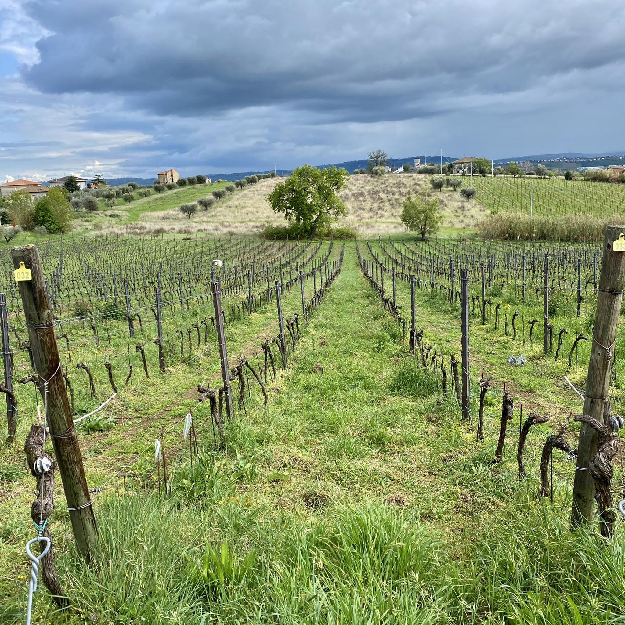
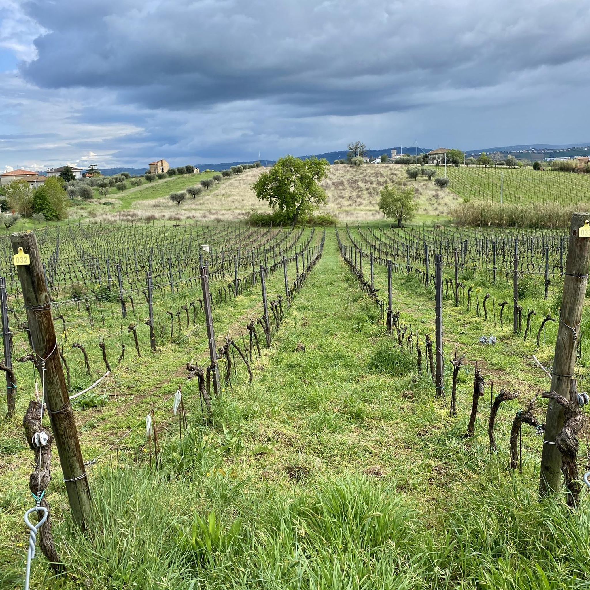
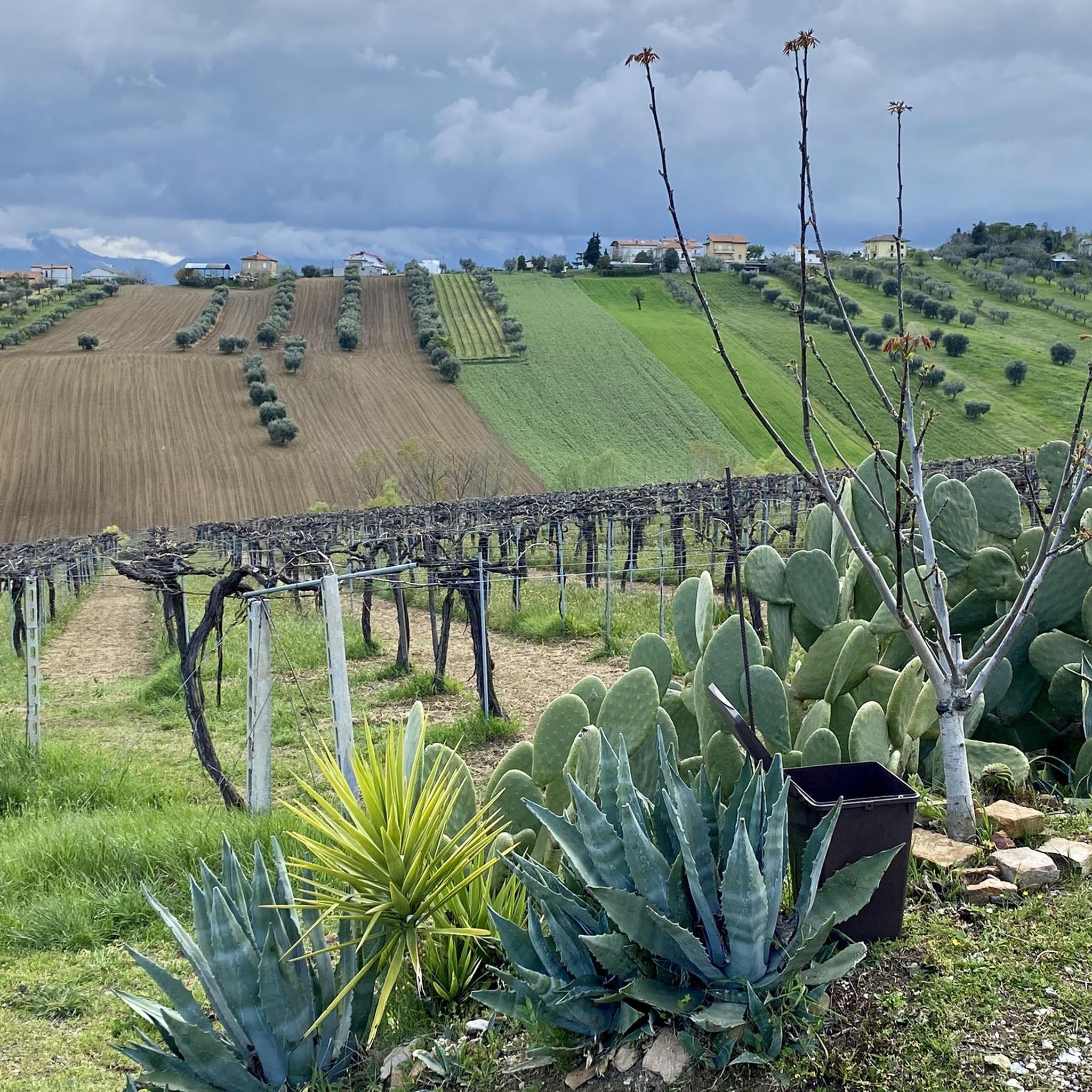
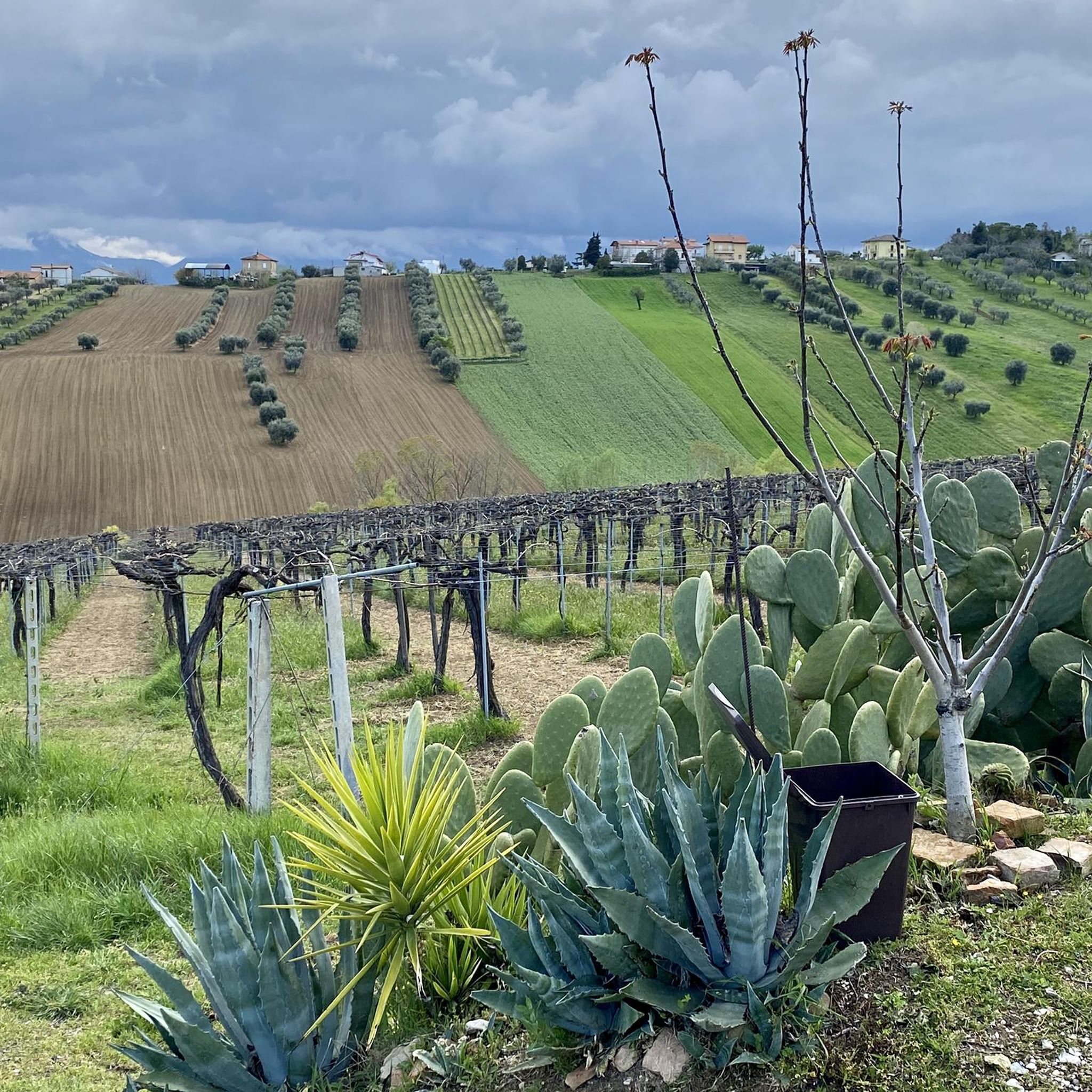
Hillside village of Controguerra, an area rich in vineyards and with a view of the Monti della Laga and the Adriatic Sea.
1
0

Entrance (upstream) of the cycle/pedestrian path of the Badia a Corropoli, near the historic center of the city.
0
0

Beautiful departure but beware of the blowholes in the streets
2
0
Colonnella is an Italian commune (comune) with 3734 inhabitants (as of 31 December 2015) in the province of Teramo in Abruzzo. The municipality is located about 27.5 kilometers northeast of Teramo, about 22.5 kilometers east of Ascoli Piceno and about 4.5 kilometers west to the Adriatic coast in Val Vibrata. Colonnella is immediately adjacent to the province of Ascoli Piceno, this northern municipality boundary forms the Tronto. The area around Colonnella was already described by Pliny the Elder. For the first time Colonnella is first mentioned in documents between 936 and 962 in the chronicles of Farfa. Wikipedia
2
1
Controguerra is an Italian commune of the province of Teramo in the Abruzzo region. It is located in the extreme north of the region on the border with the Marche, only 8 km from the coast of the Adriatic Sea. It has 2436 inhabitants called Controguerresi. The municipality gives its name to the winegrowing area of Controguerra. In the surroundings of the municipality also Montepulciano vines are grown for the DOC wine Montepulciano d'Abruzzo. Wikipedia
4
0
From here it goes steadily downhill but with little slope
3
0
A rather small mountain village.
3
0
With this shadow cookie you can cool off enjoying the view
2
0
Frequently Asked Questions
How many hiking trails are available around Nereto?
There are over 40 hiking routes available around Nereto, offering a diverse range of experiences. These include easy walks through local woodlands and more moderate paths with scenic countryside views.
What kind of terrain can I expect on hikes near Nereto?
Hikes around Nereto primarily feature rolling green hills, vineyards, and olive groves characteristic of the Val Vibrata. You can also find routes through local woodlands. For more challenging mountain environments, the Gran Sasso and Monti della Laga National Park is within reach, offering high peaks and vast plateaus.
Are there easy hiking options suitable for beginners around Nereto?
Yes, approximately half of the trails around Nereto are rated as easy. An excellent option for a gentle walk is the Forest Path loop from San Giuseppe, which is an easy 2.9-mile (4.7 km) loop through local woodlands.
Are there more challenging or strenuous hikes available near Nereto?
While many routes around Nereto are easy to moderate, the region's proximity to the Gran Sasso and Monti della Laga National Park provides access to more strenuous mountain treks. Within the immediate area, you can find moderate trails like the Hiking loop from Corropoli, which offers a good workout with scenic views.
What natural features or landmarks can I see while hiking near Nereto?
Hiking near Nereto offers views of the rolling hills of Val Vibrata, vineyards, and olive groves, with the Gemelli peaks in the distance. You can also enjoy panoramic views stretching towards the Adriatic coast. For historical sights, consider visiting the village of Controguerra or the Historic Center of Colonnella, both offering stunning vistas.
Are there any circular hiking routes around Nereto?
Yes, many of the trails around Nereto are circular. Popular options include the Forest Path loop from San Giuseppe and the Lago di Oz loop from Stella, which takes you through the local landscape.
What do other hikers enjoy most about hiking in Nereto?
The hiking trails around Nereto are highly rated by the komoot community, with an average score of 4.1 stars. Hikers often praise the diverse landscapes, from gentle hills to distant mountain views, and the variety of routes suitable for different ability levels.
Is Nereto a good base for exploring the Gran Sasso and Monti della Laga National Park?
Yes, Nereto's location makes it an excellent base for accessing the Gran Sasso and Monti della Laga National Park. This vast park offers diverse ecosystems, from high peaks like Corno Grande to plateaus like Campo Imperatore, providing a wide array of trails for all abilities. You can find more information about the park here.
Are there family-friendly hiking trails near Nereto?
Many of the easy trails around Nereto are suitable for families. The gentle slopes and well-defined paths through woodlands and agricultural landscapes provide a pleasant experience for all ages. The Forest Path loop from San Giuseppe is a good example of an easy, family-friendly option.
What is the best time of year to go hiking near Nereto?
The Val Vibrata region, where Nereto is located, is generally pleasant for hiking during spring and autumn when temperatures are mild. Summer can be warm, especially in the open hills, but higher altitude trails in the nearby Gran Sasso National Park offer cooler conditions. Winter hiking is possible, but conditions in the mountains can be challenging and require appropriate gear.
Are there any trails that offer views of both the mountains and the sea?
Yes, the Val Vibrata region around Nereto is known for its suggestive routes and panoramic points that allow hikers to enjoy views encompassing both the majestic Apennine mountains, including the Gemelli peaks, and the sparkling Adriatic Sea. Towns like Colonnella offer particularly magnificent views.
Most popular attractions around Nereto

Get inspired with the komoot mobile app


Explore more
Browse the best Hikes in other regions.
