Routes

Planner

Features

Updates

App

Login or Signup

Get the App

Login or Signup

Routes
Road cycling routes
Denmark
Central Denmark

Struer

The best road cycling routes in Struer

4.6

(12)

417

riders

56

rides

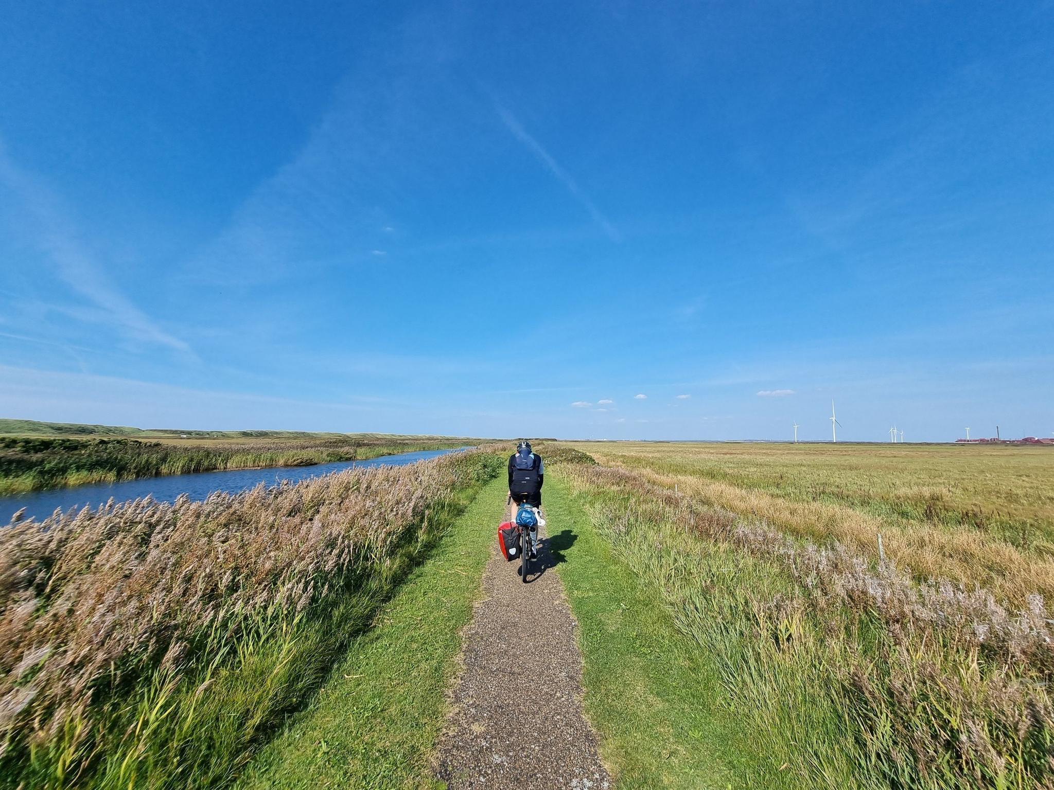
Road cycling in Struer offers diverse landscapes, characterized by its proximity to the Limfjord and a network of paved routes. The region features gentle undulations rather than significant climbs, making it accessible for various skill levels. Cyclists can explore scenic coastal paths, traverse rural areas, and ride through tranquil forests. The terrain predominantly consists of quiet roads, main roads, and dedicated cycleways.

Best road cycling routes in Struer

  • The most popular road cycling route is Aa-Mølle – Aa-Mølle Historic Water Mill loop from Struer, a 37.4 miles (60.2 km) trail that takes 2 hours 27 minutes to complete. This moderate route explores the surroundings of an historic water mill.
  • Another top favourite among local road cyclists is Thyborøn-Agger Ferry Bridge loop from Struer, a moderate 34.4 miles (55.3 km) path. This route offers coastal scenery and views of the Limfjord, including a ferry bridge crossing.
  • Local road cyclists also love the Kæmpehøjen loop from Nørby, a 28.7 miles (46.2 km) trail leading through rural landscapes and past Kæmpehøjen, often completed in about 1 hour 54 minutes.
  • Road cycling in Struer is defined by coastal paths along the Limfjord, rural areas, and forests. The network offers options for both relaxed rides and more challenging long-distance routes, catering to different ability levels.
  • The routes in Struer are highly rated by the komoot community with an average score of 4.6 stars from more than 9 reviews. More than 399 road cyclists have used komoot to explore Struer's varied terrain.

Last updated: August 18, 2026

5.0

(2)

33

riders

#1.

Lemvig Dry Dock – Aa-Mølle Historic Water Mill loop from Struer

61.7km

02:32

360m

360m

Moderate road ride. Good fitness required. Mostly well-paved surfaces and easy to ride.

Navigate with device

Send to Phone

Save

Moderate

Moderate road ride. Good fitness required. Mostly well-paved surfaces and easy to ride.

Moderate
guide_signup
Let us show you the way with the komoot mobile app
With a free komoot account, you can easily find, customize, and navigate endless outdoor adventures.

Sign up for free

5.0

(2)

23

riders

Moderate road ride. Good fitness required. Mostly well-paved surfaces and easy to ride.

Moderate

4.5

(2)

20

riders

Moderate road ride. Good fitness required. Some segments of this route may be unpaved and difficult to ride.

Moderate

Moderate road ride. Good fitness required. Some segments of this route may be unpaved and difficult to ride.

Moderate
Sign up for free to see 52 more rides in Struer.

Get access to more routes and recommendations from other explorers.

Sign up for free

Already have an account?

Our route recommendations are based on thousands of hikes, rides, and runs completed by other people on komoot.

Start today with a free account

Your next adventure awaits.
Login or Signup

Popular around Struer

The Danish coast-to-coast – Limfjord Route

Hiking in Struer

Cycling in Struer

MTB Trails in Struer

Running Trails in Struer

Gravel biking in Struer

Other adventures in Struer

The Danish coast-to-coast – Limfjord Route

Cycling Collection by

Michele Pelacci

Tips from the Community

Andreas
June 4, 2026, Sarpsborgpigen

The city of Sarpsborg in Norway gifted the sculpture to the city of Struer in 1948, in gratitude for the food that the starving Norwegians received from local farmers shortly after World War II. Today, the sculpture is Struer's landmark. https://www.visitdenmark.dk/danmark/explore/skulptur-sarpsborgpigen-struer-gdk606441

Translated by Google

0

0

Andreas
May 31, 2026, Struer Museum

This is about sound and listening, in connection with the well-known brand Bang & Olufsen. https://www.destinationlimfjorden.de/limfjord/der-guide/struer-museum-gdk606559

Translated by Google

0

0

Absolutely worth seeing and beautiful place.

Translated by Google

1

0

Carsten Froh
December 14, 2023, Lemvig Dry Dock

Climatorium

Translated by Google

1

0

Happens again and again. The power of nature.

Translated by Google

4

0

The port is very beautiful. But unfortunately the water sometimes rises higher. You need protection there.

Translated by Google

5

0

The new flood protection in the port of Lemvig "Le Mur" was inaugurated on December 16, 2012. "Le Mur" is an abbreviation of "Lemvig" and "mur", the Danish word for wall. At the same time, the name draws attention to the wall's function of providing protection. Le Mur protects the port and the city in the hinterland against flooding at high tide up to a height of 2.10 m above sea level in the central part of the port and up to a height of 2.45 m in the east port. Before Le Mur there was a wooden flood defense from 2000, but it was worn out and only protected against floods up to a height of 1.74 m at the lowest point. After several extreme flood situations in the first decade of this century, including the January storm in 2005 with floods of up to 1.84 m, it gradually became clear that a new, higher and more durable solution is required. Le Mur stretches across the central port square, opening up a space for parking and recreational development. In addition, the wall was equipped with tables and benches. At the fish shop, it becomes a ramp into the shop and a platform for the historic mountain railway. The ceramic mosaic decorations on the wall were made by fine art classes from Lemvig Municipality's elementary schools. There are openings in the wall at the alleys leading to the city's pedestrian zone, which ensures the view between the port and the city under normal conditions. In the event of extreme flood warnings, the openings are closed manually by gates hanging from the wall. Any waves crashing over the wall are handled by pumps.

Translated by Google

4

1

1. Unusual Marriage Behavior On Saturday November 23, 1963, the bride Grete Holm had to balance on a footbridge over the flooded Østergade. It became a run-in and photographers from the country's photo magazines were on hand. 2. Unlucky parking Lemvig's east harbor turned out to be a bad parking lot on Dec. 3-4, 1999. At that time one of the most violent storms devastated Denmark and flooding hit Lemvig. 3. Corridor in the auction room In 1965, the fish boxes had to be emptied in a hurry when a mixture of salt and sewage sludge rose up in the large fish auction hall by the water. 4. intruder On December 5, 2013, storm Bodil hit the port of Lemvig. It smashed the port's west breakwater and when the storm subsided left 6 boats sunken. 5. Tourist attraction In the 1960s, the frequent floods in Lemvig were a tourist attraction, attracting motorists from large parts of Jutland to 'Sunday drives'. Some were also allowed to demonstrate the vintage car on the same occasion. 6. All men to the pumps During the major floods in the 1960s, the civil defense stepped in with its large pumps. They could absorb 2,000 liters of water per minute. The civil defense also helped lay sandbags and walkways. 7. Post gondola After a violent westerly storm soaked the mail on October 18, 1967, it was hauled out in a rowboat. It was unusual for the postman to get help from civil defense. 8. Vehicles in the city streets When the water receded, a major cleanup often awaited. Boats, fishing boxes and other things were scattered across the harbor area and sometimes as far as the church square. 9. Where is the harbor edge? The fishmonger had to be visited in rubber boots or waders, and entering the harbor at high tide could be dangerous as the quay wall was difficult to see. 10. Forward with the trowel Many doors along the harbor promenade were not secured with a shutter, which was able to keep some of the vandals out. Merchant Søe's shop was particularly vulnerable as the entrance was low. 11. A thirsty soul The sight of all that water can make you thirsty. Here a rowboat is moored at the Girls' Staircase, one of the town's taverns.

Translated by Google

3

1

Frequently Asked Questions

How many road cycling routes are available in Struer?

Struer offers a wide selection of road cycling routes, with nearly 60 routes available on komoot. These routes cater to various preferences, including 25 easy and 34 moderate options, ensuring there's something for every skill level.

What is the best time of year for road cycling in Struer?

The months of July and August are particularly good for road cycling in Struer. During this period, the weather is generally favorable for exploring the diverse landscapes and extensive network of cycling routes around the Limfjord.

What kind of terrain can I expect on road cycling routes in Struer?

Road cycling in Struer is characterized by diverse and accessible terrain. You'll find gentle undulations rather than significant climbs, making it suitable for various skill levels. Routes predominantly feature paved surfaces, including quiet roads, main roads, and dedicated cycleways, often winding along scenic coastal paths, through rural areas, and tranquil forests.

Are there road cycling routes suitable for beginners or families in Struer?

Yes, Struer offers many road cycling routes suitable for beginners and families. With 25 easy routes available, you can enjoy relaxed rides on well-maintained paths. The region's gentle topography and extensive network of dedicated cycleways make it an ideal destination for less experienced cyclists.

What do other cyclists say about road cycling in Struer?

The road cycling routes in Struer are highly rated by the komoot community, with an average score of 4.6 stars from more than 9 reviews. Over 399 road cyclists have used komoot to explore Struer's varied terrain, often praising the scenic coastal paths along the Limfjord and the well-maintained routes through rural areas and forests.

What natural features or landmarks can I see along road cycling routes in Struer?

Many road cycling routes in Struer integrate with or pass by significant natural and cultural points of interest. You can enjoy expansive views of the Limfjord, traverse charming rural areas and serene forests, and pass by features like the Klosterheden Forest Lake Picnic Area or Møllesøen (Mill Lake). The island of Venø, accessible by ferry, also offers unique cycling experiences.

Are there any historical sites or cultural attractions near the road cycling routes?

Yes, several routes offer glimpses of historical and cultural sites. For example, the Aa-Mølle – Aa-Mølle Historic Water Mill loop from Struer explores the surroundings of an historic water mill. You might also encounter the historic Nørre Vosborg Manor or the Oddesundtarnet, adding a cultural dimension to your ride.

Are there options for long-distance road cycling in Struer?

Struer is an excellent starting point for long-distance road cycling. The region is part of the Limfjord Route, a national cycling route spanning over 600 kilometers, allowing for extensive journeys. Longer options like 'Asp til Fredrikshavn' (203.6 km) or a 'Søndags tur' (138 km) are also available for those seeking more challenging, multi-hour rides.

Can I find road cycling routes with sea views in Struer?

Absolutely. Struer's location by the Limfjord means many road cycling routes offer stunning coastal scenery and expansive sea views. Routes like the Thyborøn-Agger Ferry Bridge loop from Struer provide continuous views of the Limfjord, including a ferry bridge crossing, making for a picturesque ride.

Is parking available near the road cycling routes in Struer?

Yes, parking is generally available in and around Struer, especially near popular starting points for cycling routes. Many routes begin in or near towns, where public parking facilities can be found. It's advisable to check specific route details on komoot for recommended parking spots.

Are there cafes or places to stop for refreshments along the road cycling routes?

Yes, many road cycling routes in Struer pass through or near charming villages and towns where you can find cafes, restaurants, and shops for refreshments. The Limfjord area is known for its hospitality, offering opportunities to refuel and relax during your ride.

Are there any circular road cycling routes in Struer?

Yes, Struer offers several excellent circular road cycling routes. Examples include the popular Aa-Mølle – Aa-Mølle Historic Water Mill loop from Struer, the scenic Thyborøn-Agger Ferry Bridge loop from Struer, and the rural Kæmpehøjen loop from Nørby. These loops allow you to start and end your ride in the same location, often exploring diverse landscapes.

Most popular routes in Struer

Hiking in Struer

Most popular attractions in Struer

Places to see

Store rating

Get inspired with the komoot mobile app

With a free komoot account, you can easily find, customize, and navigate endless outdoor adventures.

or

Join komoot Now

Store rating

Explore more

Browse the best Road cycling routes in other regions.

AarhusThors SkovRingkøbing-SkjernSyddjursSilkeborgOdderKobskovBrassøSilkeborg LangsøØrnsøVejlsøAlmind SøLemvigLysbro SkovNationalpark MolsSkanderborgHorsensHolstebroVest Stadil FjordStadil FjordMollerup SkovHørret skovViborgBrabrand LakeSøndersøRiis SkovStilling-Solbjerg SøRandersHerningØlgryde PlantageHolstebro VandkraftsøNorddjursKronhede PlantageVorbjærge SkovRy Mølle SøKnudsøRavnsøGudensøHedenstedEgå EngsøFuglsang SøSamsøNorsminde Fjord VildtreservatFerring SøMoesgård SkovHornsøHusby KlitplantageIkast-BrandeGlenstrup SøLisbjerg SkovKatholm SkovSophie-Amaliegård SkovRosenholm SkovØjesøStubbe SøFavrskovBorre SøNordskovenJulsøSlåensøSminge SøMossøFløjstrup SkovKilenBærmoseskovSkjern EngeHareskov PlantageHestehaveFrijsenborgskoveneThorsøRindsholm SkovVesterskovUlfborg PlantageOverskovSkanderborg SøÅrslev EngsøMorville PlantageDalgas PlantageSalten LangsøLillering SkovMattrup SkovTange SøVedsøØrslevkloster SøGjern BakkerHald SøTrue skovAarslev SkovHalle SøBorbjerg PlantageLiebes PlantageHvalskovVallum søSøbygård SøNipgård SøRamten SkovHinge SøYding SkovSkærbæk PlantagePalsgård SkovSønder Lem VigAlling SøVelling SkovNørresøHastrup PlantageStendal Og Havredal PlantageLøvenholm SkovViskum SkovKlosterhede PlantageEmmedsbo PlantageGludsted plantageLading søNedergård SkovRørbæk SøVester KratStigsholm SøLindum SkovKlejtrup SøTorsted PlantageTjele LangsøDejbjerg PlantageStråsø PlantageStenholt Skov Og Stenholt MoseVestbirk SøHoverdal PlantageSevel PlantageBorbjerg Mølle SøKompedal PlantageNordre Feldborg PlantageBølling lakeAaskov

Nearby adventure guides

Things to Do around Kilen

background

Get ready to conquer new peaks

Sign up for Free

Explore
RoutesRoute plannerFeaturesRedeem a voucherHikesMTB TrailsRoad cycling routesBikepackingSitemap
Download the app
Follow Us on Socials

© komoot GmbH

Privacy Policy