The best mountain hikes around Rivamonte Agordino
4.9
(12)
100
hikers
9
hikes
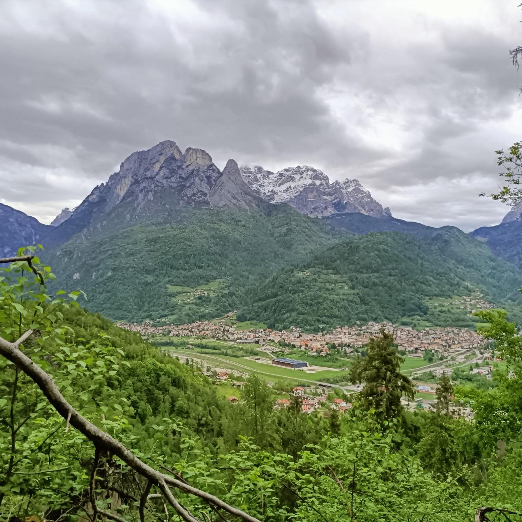
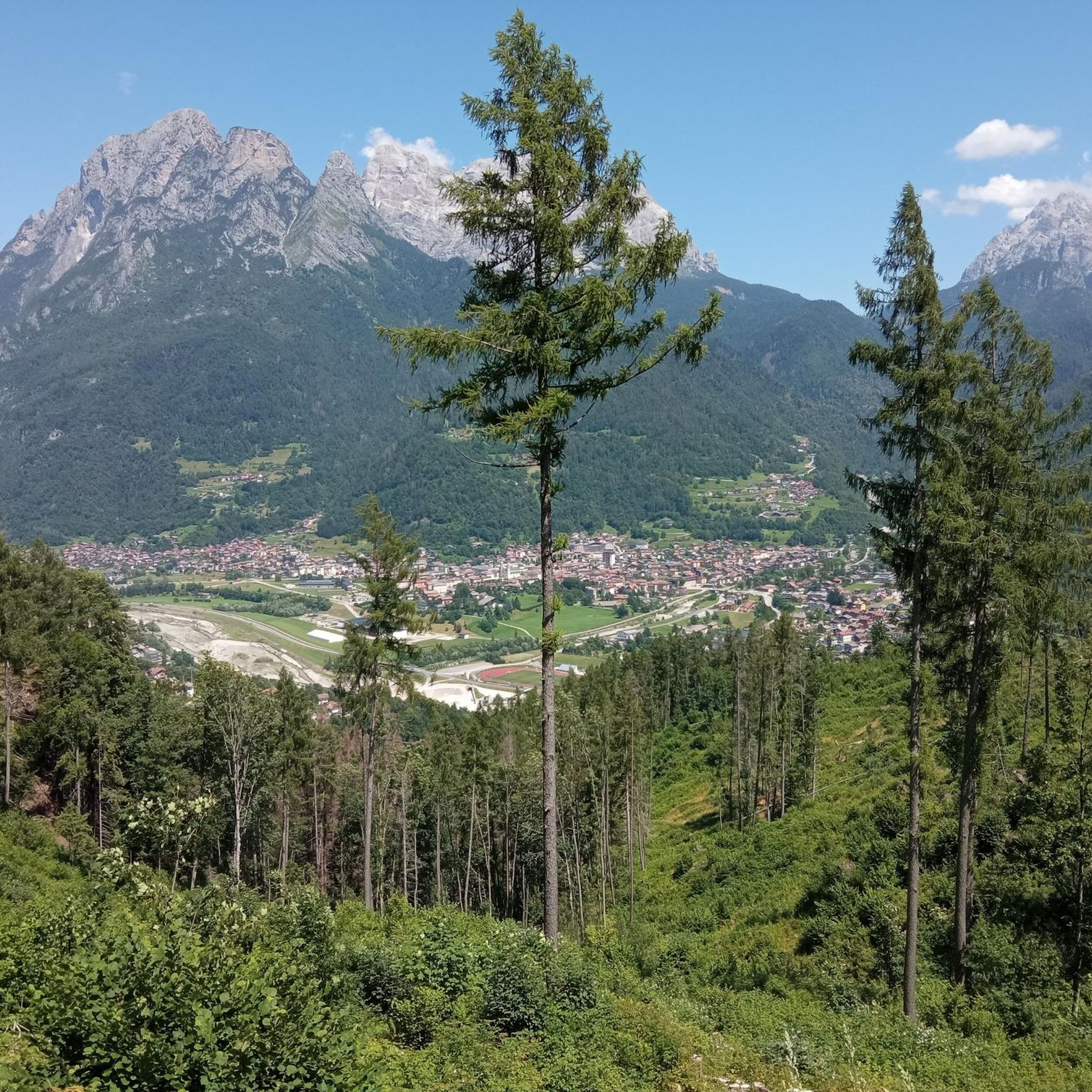
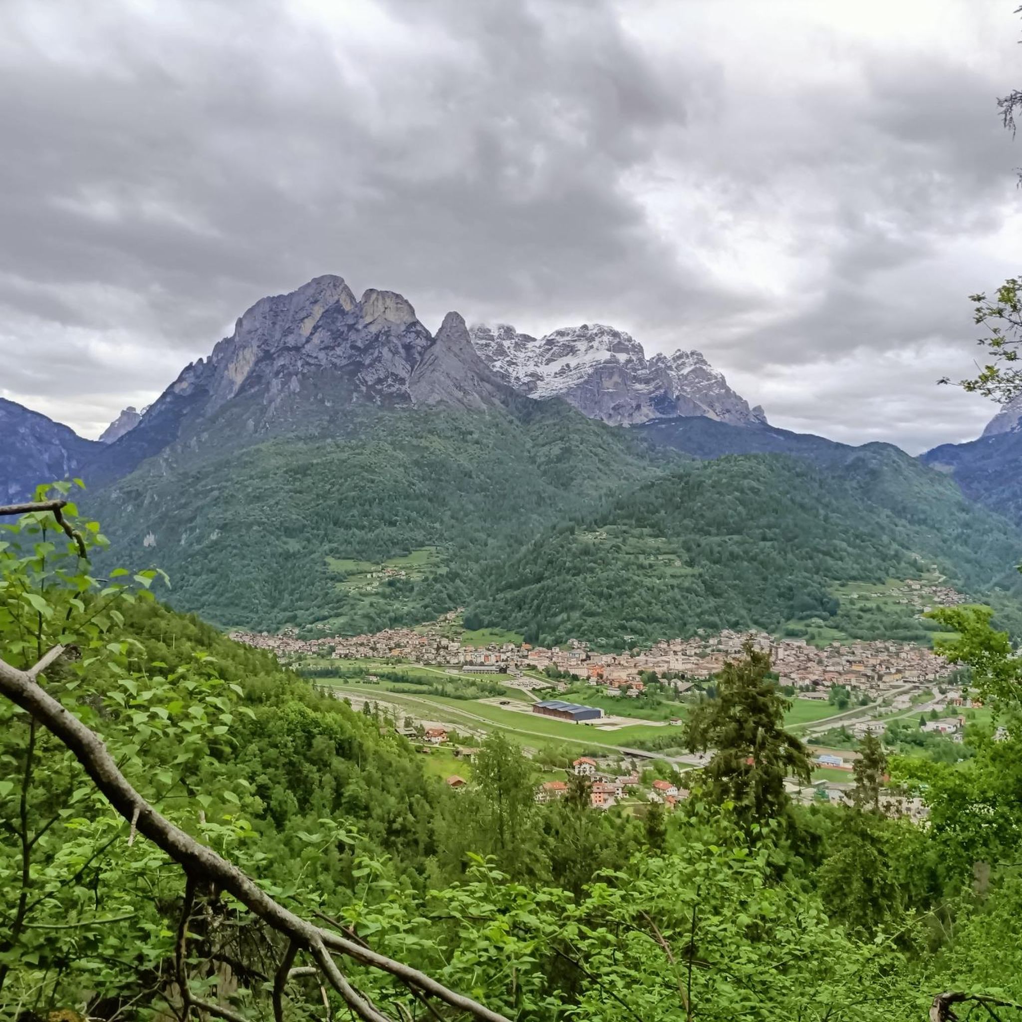
Mountaineering routes Rivamonte Agordino are situated within the Dolomites, a UNESCO World Natural Heritage Site characterized by dramatic limestone peaks, deep valleys, and alpine meadows. The region is nestled at the base of the Agner – Croda Granda chain, part of the Pala Group, and offers views of the imposing Civetta-Moiazza group. A significant portion of the area lies within the National Park of the Belluno Dolomites, preserving diverse ecosystems from high-altitude rock faces to dense forests and the Cordevole…
Last updated: October 8, 2026
5.0
(3)
16
hikers
12.0km
07:29
1,140m
1,140m
Hard mountaineering route. Very good fitness required. Sure-footedness, sturdy shoes and alpine experience required.
5.0
(1)
16
hikers
12.2km
04:38
770m
770m
Hard mountaineering route. Good fitness required. Sure-footedness, sturdy shoes and alpine experience required.

12
hikers
Moderate mountaineering route. Good fitness required. Easily-accessible paths. Suitable for all skill levels.
5.0
(1)
7
hikers
10.6km
03:59
660m
660m
Moderate mountaineering route. Good fitness required. Mostly accessible paths. Sure-footedness required.
4.3
(3)
13
hikers
5.01km
01:39
220m
220m
Moderate mountaineering route. Great for any fitness level. Mostly accessible paths. Sure-footedness required.
Get access to more routes and recommendations from other explorers.
Already have an account?
Our route recommendations are based on thousands of hikes, rides, and runs completed by other people on komoot.
Start today with a free account
Your next adventure awaits.
Tips from the Community

A place like I like it that preserves the true soul of RIFUGIO, not many are left.
0
0

MOUNTAIN GROUP: Civetta TYPE OF REFUGE: Alpine ELEVATION: 1714 m LOCATION: Col Negro di Pelsa MUNICIPALITY: Taibon Agordino (BL) CAI SECTION: Conegliano TELEPHONE: 0437 660008 - 3288867114 E-MAIL: rifugiovazzoler@gmail.com WEB: www.rifugiovazzoler.com OPENING PERIOD: June 13 - September 30 BEDS: 50 EMERGENCY PLATFORM PLACES: 34 EMERGENCY SHELTER: 10 MANAGER: Doris Corazza MANAGER PHONE: 328 8867114 Source: https://www.caiveneto.it/rifugio/vazzoler
1
0
The Rifugio Capanna Trieste (1135 meters above sea level) is a cozy alpine hut in the Dolomites, a UNESCO World Heritage Site, located in Val Corpassa at the foot of the Molazza–Civetta group in the territory of the Municipality of Taibon Agordino in the Province of Belluno, Veneto Region. Located at the entrance of Val Corpassa coming from the hamlet of Listolade, Rifugio Capanna Trieste represents the preferential access from an excursionist point of view to the alpine environment of Val Civetta and its incredible heritage of panoramas and wonders to discover coming from the Conca Agordina. Besides being a very convenient access to Val Civetta, Val Corpassa is famous for sport climbing and in winter for ice climbing. The area also enjoys some popularity among MTB enthusiasts. The Rifugio Capanna Trieste is normally open from April to November; for any needs, however, we invite you to contact the management and the local Information Office (contacts below) in order to obtain more up-to-date information on the correct opening dates of the facility. Rifugio Capanna Trieste Tel. 0437 660122 rifugiocapannatrieste@gmail.com Tourist Office of Agordo Tel. 0437 62105 ufficioturistico@agordo.net https://www.agordinodolomiti.it/it_IT/cosa-vedere/rifugi-malghe-e-casere-in-agordino/rifugi-in-agordino/rifugio-capanna-trieste-agordino-dolomiti/
0
0

Beautiful tour with wonderful views and good paths.
0
0

The Carestiato Refuge (1,834 m) stands on the panoramic Còl dei Pass, at the base of the southern faces of the Moiazza. It was built after World War II thanks to a courageous initiative by the Agordina Section of the Italian Alpine Club (CAI). The project was largely supported by the Carestiato family, in memory of their young son Bruto (1921-1943), who died in the Civetta massif. Còl dei Pass, chosen for the refuge, was at that time accessible only by a path used by herds from the nearby mountain pasture: all the necessary materials were therefore carried on the shoulders of endless teams of volunteers who ascended from Passo Duràn. Later, the collaboration of the Alpine troops from the XXII Marzo 1848 Barracks, who intervened several times with their pack animal unit, proved providential. Only the framework was prepared by sourcing wood from the adjacent wooded area and transported to the hill via rudimentary cableways. Over the years, the refuge has undergone technical and structural modernizations to provide logistical assistance to its numerous hikers. The current access (trail 549) was completed in 1978 and subsequently expanded several times. A unique feature is the crossing of the enormous Val di Vie gravel flow, which often blocks the dirt road. The water intake for the refuge's aqueduct is located here, supplied by a modern pumping station. The old structure underwent a radical renovation in 2005-2006, bringing the refuge to a modern and efficient standard through the expansion and modernization of the sleeping accommodations, kitchen area, and outdoor terrace. These works began under the presidency of Giorgio Fontanive and were completed thanks to funding from the Veneto Region, along with funds acquired from the sale of the "Cesare Tomè" refuge at Passo Duràn. The Carestiato Refuge has 8 bedrooms, each with 4 bunk beds, and an additional 4 bedrooms in the annex at the back. From here, the view sweeps across the Agordina Valley and its surrounding mountains: Monte Célo, Monti del Sole, Vette Feltrine, and the Croda Granda-Agnèr mountain range. www.rifugiocarestiato.com
1
0

impressive view of the Trieste tower
0
0

Amazing refuge, open for long periods even in winter. Great food, great view.
2
0

For the view and when the refuge is open, for the welcome
1
1
Frequently Asked Questions
What kind of terrain can I expect on mountaineering routes around Rivamonte Agordino?
Mountaineering routes in Rivamonte Agordino traverse rugged Dolomite peaks, deep valleys, and alpine meadows. You'll encounter dramatic limestone formations, extensive via ferrata networks, and protected national park landscapes within the Belluno Dolomites National Park. The area is known for its challenging ascents and stunning panoramic views.
Are there any easy mountaineering routes suitable for beginners?
Yes, there are options for various ability levels. An easier route is the Mountaineering loop from Lago del Mis. This 4.2 km trail takes about 1 hour 28 minutes and leads through the picturesque Valle del Mis.
What natural attractions can I see along the mountaineering routes?
The region offers several natural attractions. You can explore the artificial Lake del Mis, known for its emerald green waters, and the remarkable Cadini del Brenton Natural Pools, a series of gorges with potholes formed by water erosion. The Soffia Waterfall is another notable feature, where water creates refreshing sprays within a grotto.
Are there any historical paths or landmarks to explore?
Yes, the region has historical significance. You can explore paths like the "Path of the Coal Miners" and "La Montagna Dimenticata," which connects the Tagliata di San Martino Fort with Bivacco Le Mandre. The Monte Celo World War I Bunker and San Martino Bunker are also points of interest.
Can I find circular mountaineering routes in Rivamonte Agordino?
Yes, many routes are designed as loops. For example, the Via ferrata Stella Alpina loop from Voltago Agordino is a challenging 12.2 km route. Another option is the Mountaineering loop from Voltago Agordino, a moderate 10.4 km trail.
What is the best time of year for mountaineering in this area?
The best time for mountaineering in Rivamonte Agordino is typically from late spring through early autumn (May to October), when trails are generally free of snow and weather conditions are more stable. Always check local weather forecasts and trail conditions before heading out, especially for higher elevations.
Are there mountain huts or bivouacs available for overnight stays?
Yes, for multi-day treks, you can find several mountain huts and bivouacs. Notable options include the Pramper Mountain Hut, the Baita Valentino Angelini Bivouac at Scarselóign, the Bruto Carestiato Hut, and the Treviso Hut in Val Canali.
What do other mountaineers say about the routes in Rivamonte Agordino?
The mountaineering routes in Rivamonte Agordino are highly rated by the komoot community, with an average score of 4.7 stars from over 10 reviews. Mountaineers often praise the rugged Dolomite peaks, the extensive via ferrata networks, and the protected national park landscapes.
Do I need a permit for mountaineering in the Belluno Dolomites National Park?
Generally, permits are not required for hiking or mountaineering on marked trails within the Belluno Dolomites National Park. However, specific regulations might apply to certain activities or protected zones. It's always advisable to check the official park website or local tourist information for the most current guidelines before your trip.
Are there any routes that include a via ferrata?
Yes, the region is known for its via ferrata networks. A challenging option is the Via ferrata Stella Alpina loop from Voltago Agordino. Another moderate route featuring a via ferrata is the Via ferrata Gianni Costantini loop from Passo Duran.
Where can I find more information about Lake Mis and its surroundings?
For more details on Lake Mis and its natural features, including the Cadini del Brenton and Soffia Waterfall, you can visit the official tourism website: visitdolomitibellunesi.com.
Most popular routes around Rivamonte Agordino
Most popular attractions around Rivamonte Agordino

Get inspired with the komoot mobile app


Explore more
Browse the best Mountain Hikes & Routes in other regions.
