Top 14 Mountain Passes around Verghereto
Best mountain passes around Verghereto are situated in the Tuscan-Romagnolo Apennines, a region known for its natural landscapes. Verghereto serves as a base for exploring the surrounding mountains, including Monte Fumaiolo, which hosts the sources of the Savio and Tiber rivers. The area offers access to various mountain passes that connect valleys and provinces. These passes provide opportunities for outdoor activities and offer views of the Apennine range.
Best mountain passes around Verghereto
- The most popular mountain passes is Monte…
Last updated: July 10, 2026
Monte Fumaiolo Pass
Highlight • Mountain Pass
Translated by Google •
Tip by

Passo dei Lupatti
Highlight • Mountain Pass
Translated by Google •
Tip by

Sign up now to discover places like this
Get recommendations on the best single tracks, peaks, & plenty of other exciting outdoor places.
Sign up for free
Passo di Viamaggio
Highlight (Segment) • Mountain Pass
Translated by Google •
Tip by

Viamaggio Pass (1050 m)
Highlight • Mountain Pass
Translated by Google •
Tip by

Valico dello Spino
Highlight • Mountain Pass
Translated by Google •
Tip by

Sign up for free to discover even more mountain passes around Verghereto.
Sign up for free
Already have an account?
Start today with a free account
Your next adventure awaits.
Login or Signup
Popular around Verghereto
Camaldoli to Carpegna – Alta Via dei Parchi (part 5)
Grand Tour Valle del Savio – between hills, water and cycling
Cycling from the source to the mouth of the Tiber — the Regina Ciclarum
Hiking around Verghereto
MTB Trails around Verghereto
Road Cycling Routes around Verghereto
Cycling around Verghereto
Running Trails around Verghereto

Gravel biking around Verghereto
Other adventures around Verghereto


Tips from the Community

The photo is a bit old.. the sign has been literally covered by travelers' stickers
0
0

the climb through the woods begins, quite tough in some parts!!
0
0

starting point of the classic Balze loop ═════════════════ 182nd excursion and 16th time in the Balze area | loop starting from Valico Monte Fumaiolo passing through Rifugio Moia and Rifugio Giuseppe ════════════════ 👇 here is the video in 4K 👇 https://youtu.be/kt9FOoGmOZc
0
0

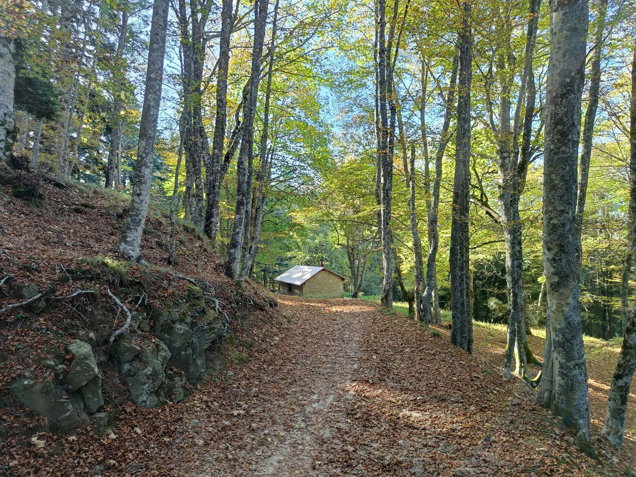
Passo dei Lupatti (altitude 1171) where majestic beech trees stand and where we cross the 00 ridge path coming from Passo dei Mandrioli and heading to Passo della Crocina: the stretch of the railway that went from Passo dei Lupatti to Cancellino was slightly downhill and for this reason the wagons loaded with wood were slowed down in their run by specially trained men called "brakemen". Now from Passo dei Lupatti to Lama the road will always continue downhill: immersed in the forest we walk crossing the slopes of Mount Cucco and Poggio Rovino until we reach Pian della Saporita (altitude 1051) Beautiful dirt road immersed in an immense beech forest with the possibility of many variations, 90% of the routes are suitable for everyone.
0
0

Compact gravel road @cesare pastorelli?
0
0

Mount Fumaiolo pass: starting point for trekking, routes, excursions and paths.
0
0
The Viamaggio Pass is a pass (983 m) in the Tuscan-Romagna Apennines located on the border between the municipalities of Pieve Santo Stefano and Badia Tedalda, in the province of Arezzo. The pass, which connects the Tiber Valley to the Marecchia Valley, is crossed by the Marecchiese State Road which connects Sansepolcro (Arezzo) with Rimini. Known and frequented since ancient times, in Roman times the Via Ariminensis passed through it, an ancient road connecting Arezzo and the colony of Rimini. This non-consular road, however, did not follow the current route of the Strada Marecchiese, but headed towards Pieve Santo Stefano and passed through the valley of the Sinigiola stream (the current Via Cerbaiolo, with the hermitage of the same name, which joins a few dozen of meters from the pass)
0
0

The Valico dello Spino (or Passo dello Spino, or simply Lo Spino) is a pass located on the SP N°208 which connects Chiusi della Verna to Pieve Santo Stefano. At the pass the road sign says that it has an altitude of 1005 m, but in reality the height is 1054 m. From the pass the view opens towards the Tiber Valley. The climb from Chiusi is modest, while the one from Pieve Santo Stefano is decidedly challenging.
1
0
Frequently Asked Questions
What makes the mountain passes around Verghereto unique?
The mountain passes around Verghereto are nestled in the Tuscan-Romagnolo Apennines, offering a blend of natural beauty, historical significance, and diverse outdoor activities. Many passes provide stunning panoramic views, connect important valleys, and are part of ancient routes or national parks like the Casentinesi Forests.
Are there mountain passes suitable for cycling around Verghereto?
Yes, the region is popular with cyclists. Monte Fumaiolo Pass, at 1,350 meters, was part of the Giro d'Italia in 2017 and offers a challenging climb with rewarding views. Another celebrated destination for motorcyclists and cyclists is Passo del Muraglione, known for its well-maintained, winding roads and panoramic vistas.
Which mountain passes offer historical insights?
Several passes have rich historical backgrounds. Viamaggio Pass, for instance, marks the border between Romagna and Tuscany and was part of an ancient Roman road. Passo Serra was historically part of the 'via peregrinorum,' an ancient mule track used by pilgrims, now a marked CAI trail (n° 177).
What kind of natural features can I expect to see at these passes?
You'll find diverse natural landscapes. Passo dei Mandrioli is notable for the 'Scalacci,' an impressive geological formation of marlstone and sandstone layers, and leads into the Casentinesi Forests National Park. Passo della Calla is within the same national park and offers access to Monte Falterona and Monte Falco, the highest peaks in the Romagnolo Apennines. Passo dei Lupatti is surrounded by majestic beech trees.
Are there family-friendly mountain walks near Verghereto's passes?
Yes, Passo dei Lupatti is categorized as family-friendly, with 90% of its routes suitable for everyone. The area around this pass features a beautiful dirt road immersed in an immense beech forest, offering many variations for walks.
What outdoor activities can I do near these mountain passes?
The region offers a variety of outdoor activities. You can find numerous road cycling routes, including challenging climbs to passes like Monte Fumaiolo Pass. There are also many running trails and MTB trails, such as those around the Sources of the Savio and Tiber rivers. For more details on routes, explore the Road Cycling Routes around Verghereto, Running Trails around Verghereto, and MTB Trails around Verghereto guides.
Which passes are good starting points for longer treks?
Passo della Calla is a popular starting point for excursions to Monte Falterona and Monte Falco, offering routes like a 10 km trail to Camaldoli. Passo dei Mandrioli connects to paths like the GEA (Grande Escursione Appenninica) and Passo dei Lupatti, making it ideal for trekking and mountain biking.
Are there refreshment options available at the mountain passes?
Yes, at the summit of Monte Fumaiolo Pass, there are shelters where you can eat and drink. This provides a convenient stop for those undertaking longer cycling or hiking trips.
What is the highest road pass in the Tuscan-Romagnolo Apennines?
Passo della Calla, at 1296 meters above sea level, holds the distinction of being the highest road pass in the Tuscan-Romagnolo Apennines. It connects the Bidente and Arno valleys and offers stunning views.
What do visitors enjoy most about the mountain passes around Verghereto?
Visitors appreciate the diverse opportunities for outdoor activities, from challenging cycling climbs to serene hiking trails through ancient forests. The stunning panoramic views, the historical significance of ancient routes, and the natural beauty of areas like the Casentinesi Forests National Park are frequently highlighted.
Can I find challenging hiking routes near Verghereto's mountain passes?
Yes, for advanced hikers, the area offers demanding routes. For example, the climb to Valico dello Spino from Pieve Santo Stefano is described as decidedly challenging. Additionally, many of the running and MTB trails in the region are rated as difficult, providing ample challenge for experienced outdoor enthusiasts.
Which pass is known for its geological formations?
Passo dei Mandrioli is particularly known for the 'Scalacci,' an impressive geological formation consisting of marlstone and sandstone layers. These formations are of significant geological interest and add a unique natural element to the pass's scenic beauty.
Most popular routes around Verghereto
Most popular attractions around Verghereto

Get inspired with the komoot mobile app


Explore more
See even more epic mountain passes by checking out these guides around Verghereto:
