The best running trails around Cartosio
4.7
(10)
441
runners
57
runs
Jogging around Cartosio offers a diverse landscape of rolling hills, lush valleys, and extensive trails in the Piedmont region of Italy. The area features varied inclines and descents, with routes often weaving through cultivated fields, meadows, and dense woods of oak and chestnut trees. Joggers can experience panoramic views from elevated points and traverse charming olive groves and vineyards characteristic of the Italian countryside.
Best jogging routes around Cartosio
- The most popular jogging route is Castello dei Paleologi – Roman…
Last updated: October 11, 2026
11
runners
7.99km
00:54
110m
110m
Moderate run. Good fitness required. Mostly paved surfaces. Suitable for all skill levels.
6
runners
11.5km
01:16
110m
120m
Moderate run. Good fitness required. Mostly paved surfaces. Suitable for all skill levels.

5
runners
12.1km
01:17
150m
140m
Moderate run. Good fitness required. Mostly paved surfaces. Suitable for all skill levels.
4
runners
11.9km
01:27
220m
220m
Moderate run. Good fitness required. Mostly paved surfaces. Suitable for all skill levels.
6
runners
8.56km
01:04
280m
280m
Moderate run. Good fitness required. Mostly paved surfaces. Suitable for all skill levels.
Get access to more routes and recommendations from other explorers.
Already have an account?
Our route recommendations are based on thousands of hikes, rides, and runs completed by other people on komoot.
Start today with a free account
Your next adventure awaits.
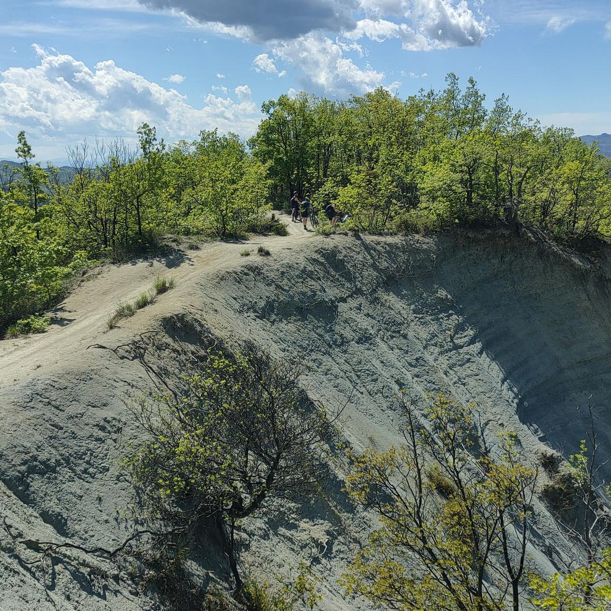
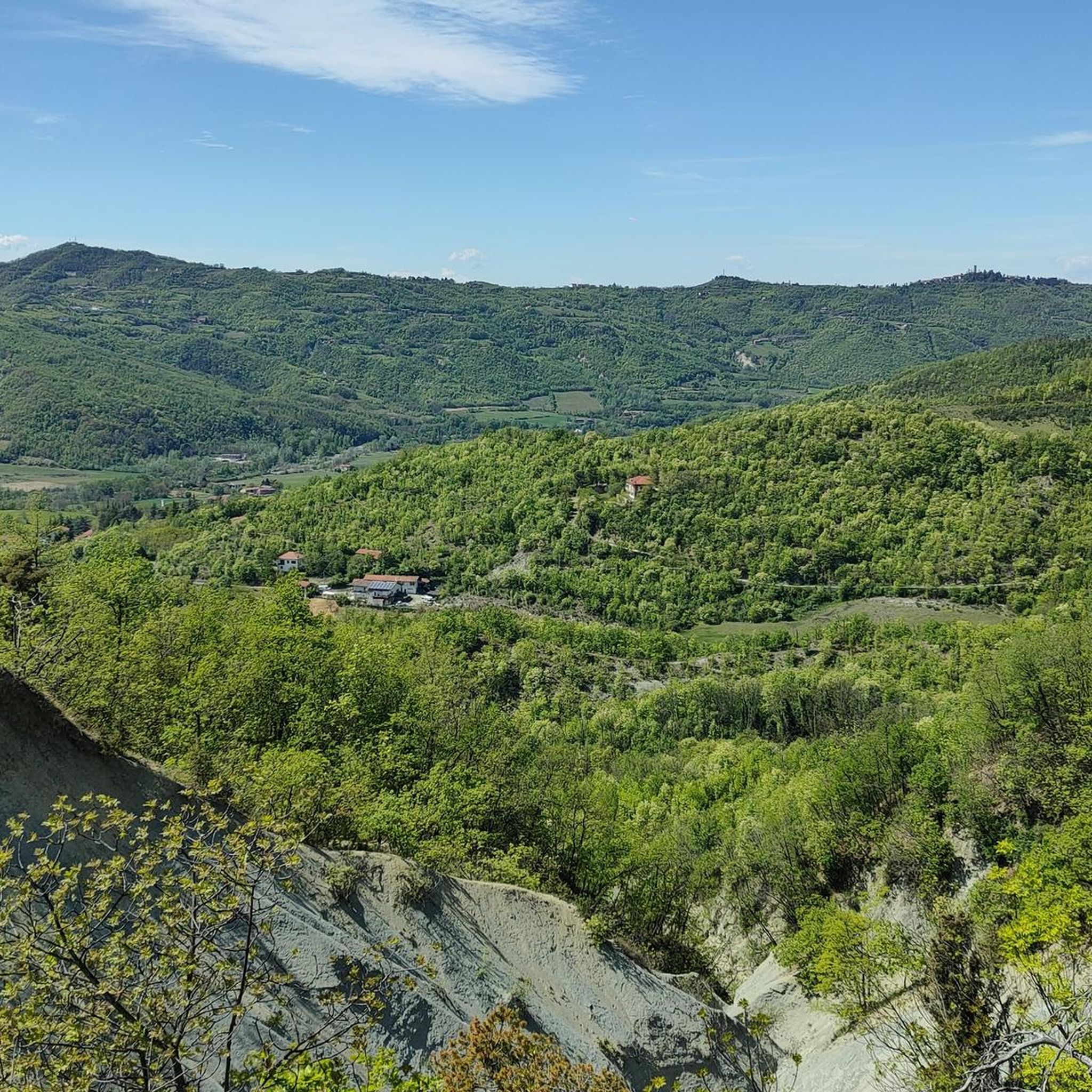
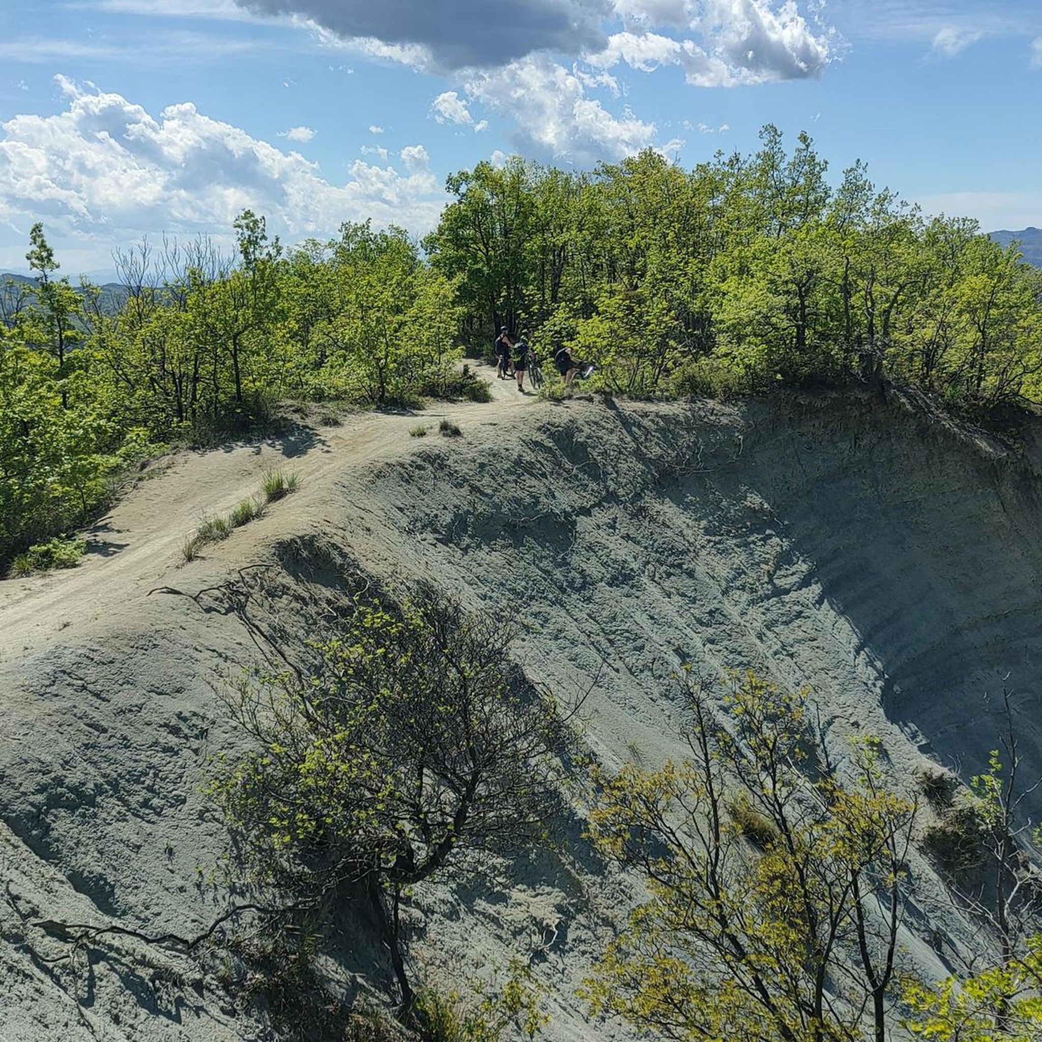
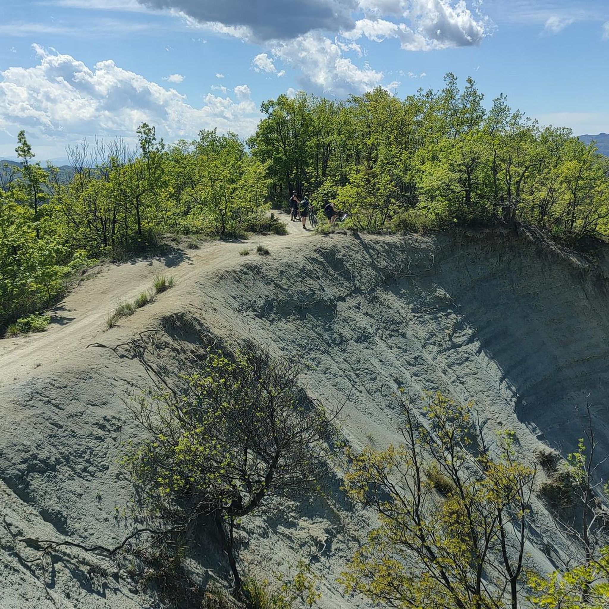

Tips from the Community

Monastero Bormida is a charming Italian medieval village located in the province of Asti, in Piedmont, nestled in the picturesque landscapes of the Langa Astigiana. The village was founded around the year 1050, when a group of Benedictine monks was called by Marquis Aleramo to clear and repopulate the lands devastated by Saracen raids.
0
0

The Castle of Monastero Bormida was not originally built as a defensive structure but as a Benedictine monastery, founded around 1050 by monks from the Abbey of Fruttuaria, called by the Aleramici Marquises to reclaim the lands devastated by Saracen raids. The 27-meter tower still visible today was originally the bell tower, and the river flowing a few meters from the southern tower confirms the non-military nature of the building. In 1393, the Benedictines abandoned the monastery, and its feudal history began: the fief passed to the Del Carretto marquises, who in the 15th century added the first defensive structures, transforming it into a castle. The building is a quadrangular structure with an internal courtyard, protected by towers on multiple sides and connected to the former bell tower by a small suspension bridge. On the south facade, there is a two-arched Renaissance loggia with a small stone column. Inside, the rooms on the main floor—transformed in the 17th century—feature mosaic floors and sail and cross vaults with frescoes of floral and geometric motifs. The castle later passed to the Della Rovere family and subsequently to the Genoese Polleri family, finally becoming the property of the Municipality starting in 1880. Today it is open to visitors and is part of the regional circuit "Castelli Aperti".
1
0

Beautiful old arched bridge.
4
1

Pareto is a high hill town located on the Ligurian Apennines in the southernmost part of the province of Alessandria, at the end of the so-called "Via dei Calanchi", immersed in nature and surrounded by an enchanting panorama; on clear days or at sunset you can enjoy perhaps one of the most beautiful views of the nearby Langhe, the wooded heights of the Savona pre-Apennines and, in the distance, the Monviso chain.
24
0

"Castle" of Monastero Bormida Place of tourist, historical, architectural and cultural interest Piazza Castello, 1, 14058 Monastero Bormida AT http://www.comune.monasterobormida.at.it/ 014488450
4
0

The tower joined to the castle by a medieval arch
3
0

The Southern Piedmont path is a network of paths and secondary roads that extends across the Piedmontese Apennines.
1
0

Refuge located in an oasis of peace, not guarded but open to shelter and possibly sleep independently. Respect for the Refuge and the surrounding environment is recommended.
0
0
Frequently Asked Questions
How many running routes are available around Cartosio?
There are over 45 running routes around Cartosio, offering a diverse range of options for joggers of all levels. These trails wind through rolling hills, lush valleys, and dense woods, characteristic of the Piedmont region.
What are the different difficulty levels for running trails in Cartosio?
The running trails in Cartosio cater to various fitness levels. You'll find 4 easy routes perfect for a relaxed jog, 27 moderate trails for those seeking a bit more challenge, and 17 difficult routes for experienced runners looking for a strenuous workout.
What kind of landscape can I expect while jogging in Cartosio?
Jogging in Cartosio offers a captivating experience through diverse landscapes. You'll traverse rolling hills, lush valleys, and extensive networks of trails weaving through cultivated fields, meadows, and dense woods of oak and chestnut trees. Many routes also pass through charming olive groves and vineyards, providing picturesque scenery.
Are there running routes that offer panoramic views in Cartosio?
Yes, many running routes in Cartosio provide breathtaking panoramic views. From elevated points, you can often take in 360-degree vistas of the surrounding hills and even the distant Alpine arc on clear days. Trails like the Running loop from Castelletto d'Erro offer scenic overlooks over the Alessandria area.
Are there any easy running routes suitable for beginners in Cartosio?
Yes, Cartosio offers several easy running routes ideal for beginners or those looking for a less strenuous run. These trails typically feature gentler inclines and well-maintained paths, allowing you to enjoy the beautiful Piedmont countryside at a comfortable pace.
Can I find challenging running trails in Cartosio?
Absolutely. For experienced runners seeking a challenge, Cartosio has 17 difficult routes. One such trail is the Monte Marino Summit Cross – Monte Stregone loop from Acqui Terme, which covers over 12 km with significant elevation gain, offering a demanding workout amidst stunning natural beauty.
What interesting landmarks or natural features can I see along the running routes?
Many running routes in the Cartosio area pass by fascinating landmarks and natural features. You might encounter historical sites like the Roman Aqueduct of Acqui Terme, or natural wonders such as the La Bollente Hot Spring Fountain. Some trails also offer views of unique geological formations like the 'Calanchi' badlands.
Are there circular running routes in Cartosio?
Yes, many of the running paths around Cartosio are designed as loops, allowing you to start and finish at the same point. For instance, the Running loop from Bistagno is a moderate 8 km circular path that winds through the region's characteristic rolling hills and countryside.
What do other runners enjoy most about the trails in Cartosio?
The running trails in Cartosio are highly rated by the komoot community, with an average score of 4.6 stars from 8 reviews. Runners often praise the diverse terrain, the beautiful panoramic views, and the opportunity to explore the region's natural beauty and charming villages.
Is it possible to combine a run with a visit to a nearby town or village?
Yes, several running routes connect to or pass through charming towns and villages, allowing you to combine your run with exploration. For example, the Monastero Bormida loop from Monastero Bormida leads through the Bormida Valley, offering a chance to experience the local culture and perhaps find a cafe after your run.
Are there any running routes that pass by significant historical sites?
Yes, you can find running routes that incorporate historical sites. The Castello dei Paleologi – Roman Aqueduct of Acqui Terme loop from Acqui Terme is a popular 14.9 km trail that offers views of the historic Roman Aqueduct, providing a blend of physical activity and cultural sightseeing.
Most popular attractions around Cartosio

Get inspired with the komoot mobile app


Explore more
Browse the best Running Trails & Routes in other regions.
