The best cycling routes around Auletta
4.5
(5)
91
riders
27
rides
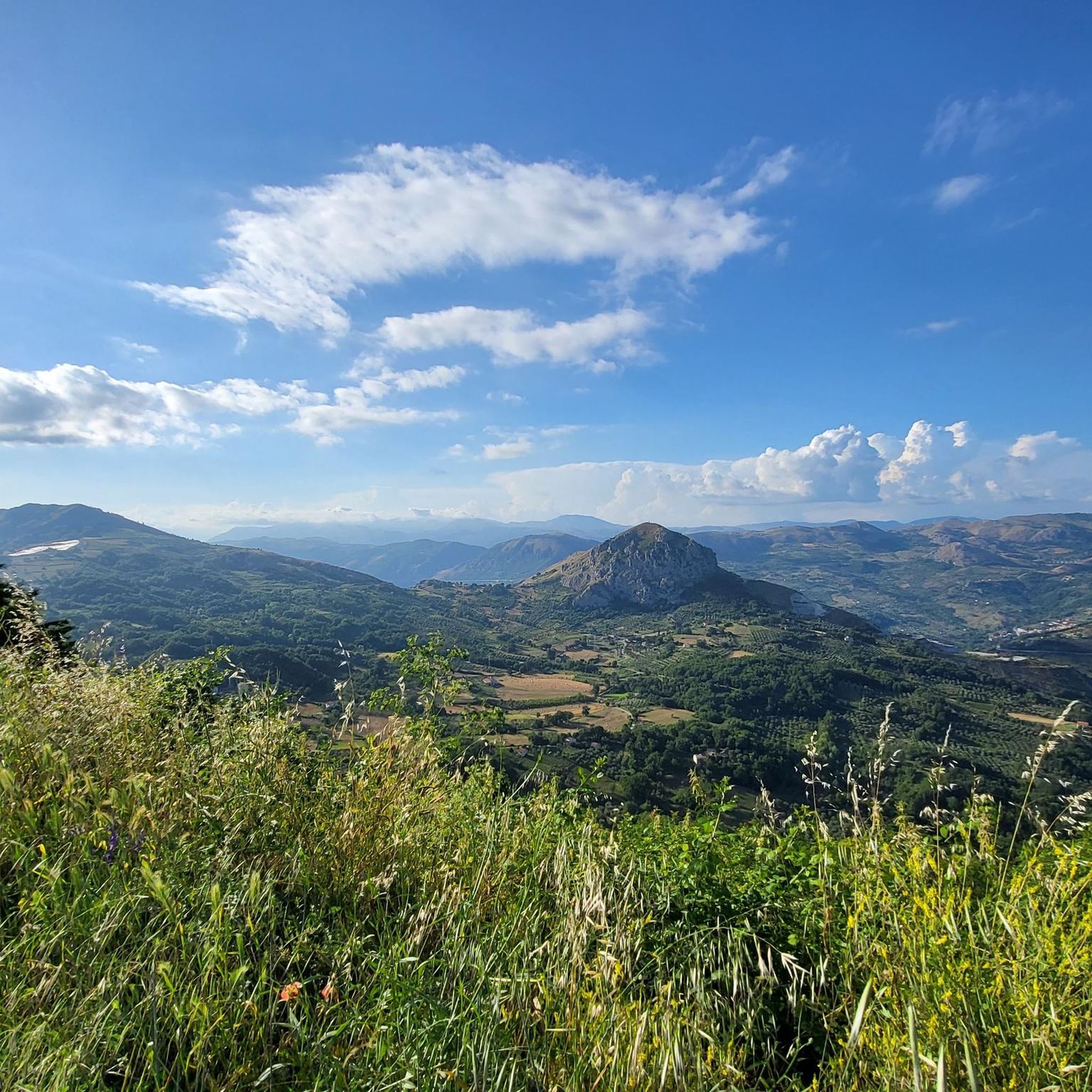
Touring cycling routes around Auletta are situated within the Cilento, Vallo di Diano and Alburni National Park, a UNESCO World Heritage Site. The region features diverse landscapes, including wild mountain valleys, deep gorges, and ancient olive groves, with the Tanagro River flowing through the Valle del Tanagro. Terrain varies from well-maintained roads to challenging inland climbs, offering views of the Alburni and Cervati mountain ranges. Woodlands of oaks, chestnut, and beeches are also present across the area.
Best touring cycling…
Last updated: June 24, 2026
5.0
(1)
15
riders
59.1km
04:33
1,570m
1,570m
Hard bike ride. Very good fitness required. Mostly paved surfaces. Suitable for all skill levels.
13.5km
01:06
380m
380m
Moderate bike ride. Good fitness required. Mostly paved surfaces. Suitable for all skill levels.

Sign up for free
17
riders
65.6km
04:53
1,560m
1,560m
Hard bike ride. Very good fitness required. Mostly paved surfaces. Suitable for all skill levels.
4.0
(4)
14
riders
56.5km
03:59
1,120m
1,120m
Hard bike ride. Very good fitness required. Mostly paved surfaces. Suitable for all skill levels.
6
riders
61.4km
05:01
1,860m
1,860m
Hard bike ride. Very good fitness required. Mostly paved surfaces. Suitable for all skill levels.
Get access to more routes and recommendations from other explorers.
Sign up for free
Already have an account?
Our route recommendations are based on thousands of hikes, rides, and runs completed by other people on komoot.
Start today with a free account
Your next adventure awaits.
Login or Signup
Popular around Auletta

Tips from the Community

Spectacular passage through the mountains
0
0
Characteristic mountain village, nice to wander through the alleys of the old part
0
0
Suggestive structure in the old part
0
0

Starting point for climbing Monte Puglie. Parking for 2-3 cars is available. Monte Puglie (sometimes called Cocuzzo delle Puglie) is a peak approximately 1,465-1,475 meters high located in Campania, within the Cilento, Vallo di Diano and Alburni National Park. Known for its wild nature and expansive views, it can be reached via challenging hiking trails, often starting from Passo della Sentinella (San Rufo) or San Paolo di Teggiano, passing through places such as Sella del Corticato and the Bosco Vetusto del Cozzo del Rosieddo. Here are the main details about Monte Puglie: Location and Characteristics: It is located in the province of Salerno. The relief features elongated ridges and, in some areas, beech forests. Hiking: The trails are generally considered difficult or for experts, with steep and sometimes exposed sections. A common route is the ring that touches the Cozzo del Rosieddo (1427 m) and Monte Puglie.
2
0

Petina is perhaps one of the most mountainous villages in Campania. It sits directly on the slopes of the Alburni Mountains, completely surrounded by centuries-old chestnut groves. The village is very small and offers a grocery store, almost always open and well-stocked, a restaurant renowned for its local dishes, and a bar with tables in a beautiful courtyard.
1
0

Pertosa is a small village in the Tanagro Valley, known for its connection to the nearby Pertosa-Auletta Caves. Its stone houses, quiet streets, and valley viewpoints lend it a welcoming, rural atmosphere. Strolling through the center, you'll discover internal courtyards, ancient fountains, and glimpses of the Alburni Mountains.
0
0
Auletta is a village overlooking the Tanagro Valley, characterized by a stone historic center, medieval alleys, and panoramic terraces overlooking the Alburni Mountains. Walking or cycling through its streets, you'll find ancient buildings, small squares, and the tranquil atmosphere of the Salerno hinterland.
0
0
The Pertosa-Auletta Caves, also known as the Angel Caves, are one of the most fascinating speleological complexes in Campania, famous for their navigable underground river: the only one in Italy and one of the few in Europe. The cave system extends for over three kilometers beneath the Alburni Mountains, through immense chambers, ancient concretions, and natural light effects. For information on admission, guided tours, and opening hours, visit: https://fondazionemida.com/grotte-pertosa-auletta
1
0
Frequently Asked Questions
How many touring cycling routes are available around Auletta?
There are over 20 touring cycling routes available around Auletta, offering a wide range of experiences within the Cilento, Vallo di Diano and Alburni National Park. These include 3 easy, 3 moderate, and 17 difficult routes, catering to various skill levels.
What kind of terrain can I expect on touring cycling routes in Auletta?
The terrain around Auletta is incredibly diverse, ranging from well-maintained roads in the scenic Valle del Tanagro to challenging inland climbs through the Alburni and Cervati mountain ranges. You'll encounter wild mountain valleys, deep gorges, vineyards, and ancient olive groves. While most roads are well-paved, some routes offer significant elevation gain, such as the difficult View of Ottati Village – Sant'Angelo a Fasanella loop from Sant'Angelo a Fasanella.
Are there any family-friendly touring cycling routes in Auletta?
Yes, Auletta offers some routes suitable for families, particularly those exploring the scenic Valle del Tanagro. While many routes involve significant climbs, there are 3 easy and 3 moderate routes that might be more appropriate for a family outing. For example, the Caves of Pertosa-Auletta and Valle del Tanagro route is a moderate 13.5 km path that explores the valley.
What are some notable landmarks or natural features to see along the cycling routes?
Auletta's touring cycling routes are rich with natural and historical sights. You can explore the famous Pertosa-Auletta Caves, cycle through woodlands of oaks and chestnut groves, or enjoy views of the Alburni and Cervati mountain ranges. Highlights include the Il Figliolo Summit, the Summit of Monte Panormo, and the historic settlement of Sant'Angelo a Fasanella.
What is the best time of year for touring cycling in Auletta?
Auletta benefits from a mild climate, making it suitable for touring cycling for much of the year. Spring and autumn generally offer the most pleasant temperatures for exploring the diverse landscapes, avoiding the peak heat of summer and the cooler, potentially wetter conditions of winter. This allows for comfortable rides through vineyards, olive groves, and mountain passes.
Are there any long-distance or multi-day touring cycling options?
Yes, Auletta is part of the renowned Via Silente, a dedicated bicycle route spanning nearly 600 kilometers across 15 medium-length legs. This route offers a significant physical challenge and allows riders to immerse themselves in the local culture over several days. While individual routes around Auletta are typically day trips, they can be combined for longer tours.
What do other touring cyclists say about the routes in Auletta?
The touring cycling routes in Auletta are highly rated by the komoot community, with an average score of 4.5 stars. Cyclists often praise the varied terrain, from moderate valley rides to challenging mountain climbs, and the opportunity to explore the stunning landscapes of the Cilento, Vallo di Diano and Alburni National Park.
Are there any circular touring cycling routes available?
Yes, many of the touring cycling routes around Auletta are designed as loops, allowing you to start and finish in the same location. An example is the challenging Eastern Alburni Mountains – Sant'Angelo a Fasanella loop from Sant'Angelo a Fasanella, which covers 65.9 km through mountainous terrain.
Can I find places to eat or stay near the cycling routes?
Auletta and the surrounding villages offer opportunities to refuel and find accommodation. The region is known for its local gastronomy, including traditional 'pizza chiena' and renowned extra-virgin olive oil. You'll find cafes, pubs, and restaurants in the historic centers of towns like Auletta and Sant'Angelo a Fasanella, perfect for a break during your ride.
What are the most challenging touring cycling routes in the area?
The Auletta region is home to several difficult touring cycling routes, particularly those venturing into the Alburni and Cervati mountain ranges. These routes often feature significant elevation gains and cover longer distances. Examples include the La Via Silente: Monti Alburni Loop (59.1 km with 1570m elevation gain) and the Village of Petina – Sant'Angelo a Fasanella loop from Antece (60.1 km with over 1800m elevation gain).
Are there any routes that offer views of the coast or other distant landmarks?
While Auletta is inland, the region's higher elevations, such as Monte Stella, can offer stunning panoramic views stretching towards the Amalfi Coast and even Capri on clear days. Many routes provide expansive vistas of the Alburni and Cervati mountain ranges and the picturesque Valle del Tanagro.
Most popular attractions around Auletta

Get inspired with the komoot mobile app


Explore more
Browse the best Cycling routes in other regions.
