The best MTB trails around San Mango Piemonte
4.5
(209)
1,231
riders
146
rides
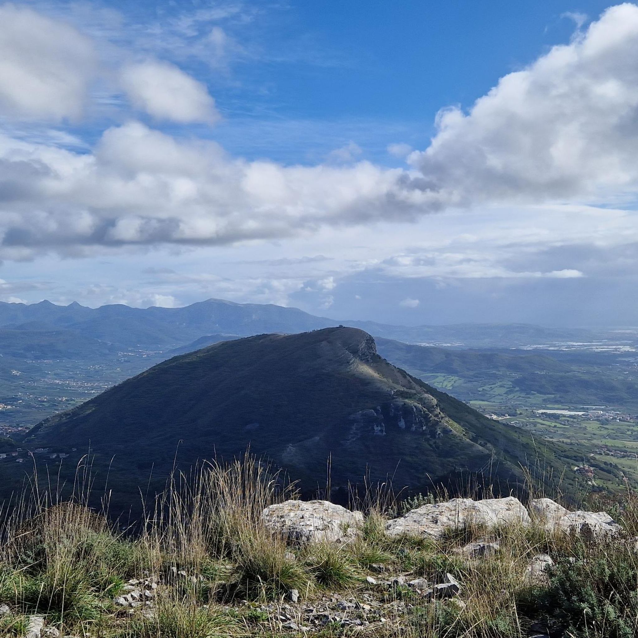
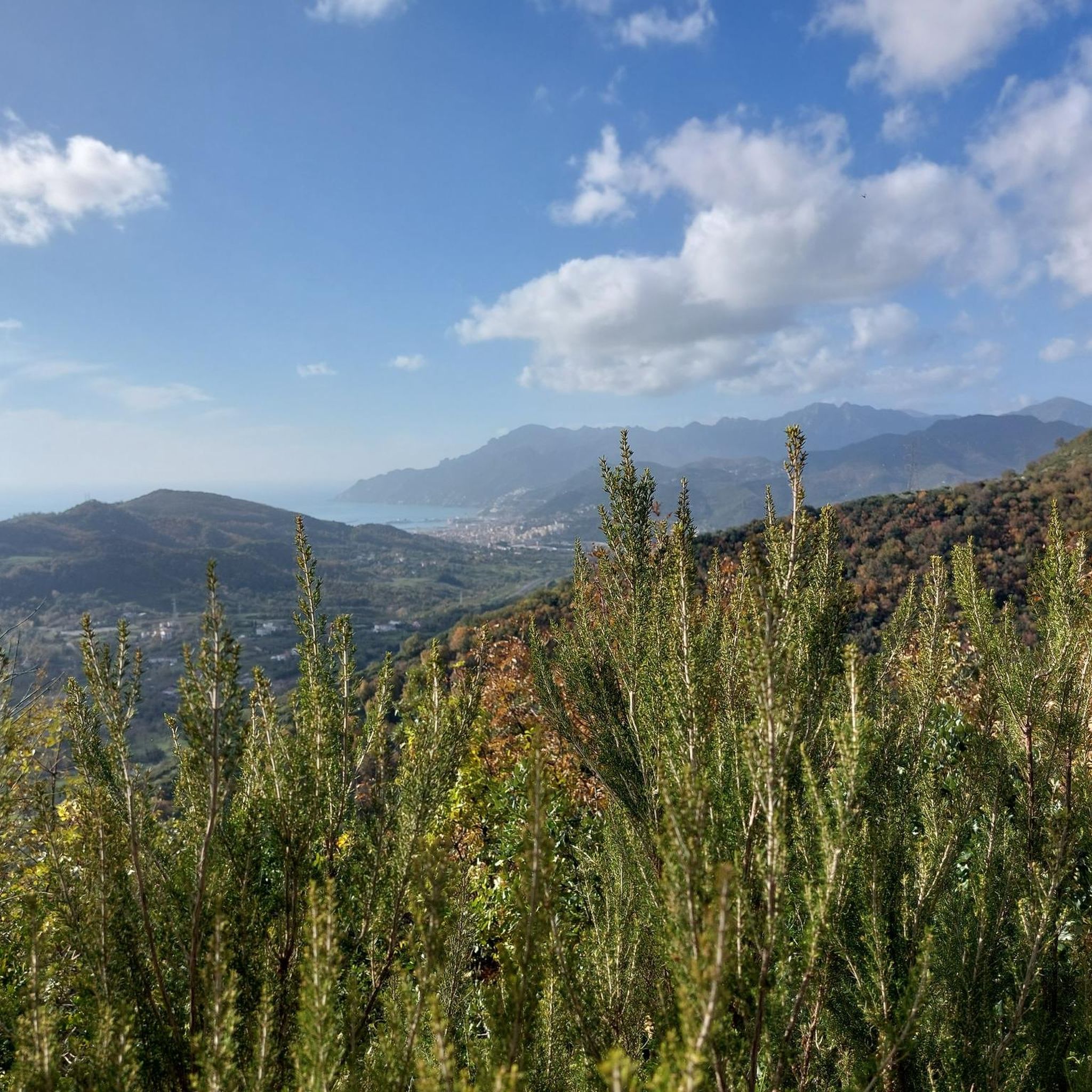
Mountain bike trails around San Mango Piemonte are situated within the Monti Picentini Regional Park, offering a diverse natural landscape for outdoor enthusiasts. The region is characterized by varied terrain, ranging from the foothills of Mount Stella, San Magno, and Tubenna, with altitudes from 88 meters up to 800 meters on Monte San Magno. This area features unspoiled flora, including holm oaks, downy oaks, maples, and chestnuts, alongside Mediterranean scrub. The challenging peaks and scenic vistas, such as those overlooking…
Last updated: June 24, 2026
4.3
(4)
36
riders
28.3km
02:26
670m
670m
Hard mountain bike ride. Good fitness required. Advanced riding skills necessary. Some portions of the route may require you to push your bike.
4.5
(2)
30
riders
42.1km
03:29
940m
940m
Hard mountain bike ride. Very good fitness required. Advanced riding skills necessary. Some portions of the route may require you to push your bike.

Sign up for free
3.3
(4)
22
riders
38.6km
03:31
1,060m
1,060m
Hard mountain bike ride. Very good fitness required. Suitable for all skill levels.
4.5
(2)
18
riders
32.5km
03:06
930m
930m
Hard mountain bike ride. Very good fitness required. Suitable for all skill levels.
5.0
(2)
21
riders
56.7km
03:33
710m
710m
Moderate mountain bike ride. Good fitness required. Suitable for all skill levels.
Get access to more routes and recommendations from other explorers.
Sign up for free
Already have an account?
Our route recommendations are based on thousands of hikes, rides, and runs completed by other people on komoot.
Start today with a free account
Your next adventure awaits.
Login or Signup
Tips from the Community

Locality "La Cappelluccia", here there is a small chapel, a picnic area and an intersection for the WWF Frassineto oasis and the path that leads to Monte Stella
0
0

The church is located at the end of a path that leads to the cycle path of the Acigliano reservoir. More suitable for MTB like almost all the dirt roads in the area, but with large and properly deflated tires it is very fun.
0
0

I didn't take any photos but this is the part that is less practicable due to the rose garden and vegetation
0
0
doable road...then the single track is full of rose bushes...unfortunately the vegetation is the master
0
0
Initially simple trail, but as you continue there are technical passages that are not exactly simple, pay attention, but very fun.
0
0
Going up from Pellezzano to the panoramic point, on the right you can see an access to the Foce-Taborre path, which goes down to Coperchia... I don't know what state it is in currently.
5
0

The start of the path is on the right on light stony ground. The path has been partly cleaned and tidied up. Most of it is cycleable, but it has some technical passages and several sections are very narrow and need to be tackled with extreme caution. It was not possible to continue to the end, therefore it is not recommended to venture alone.
17
0

Definitely technical trail at times very flowy, pay attention!
1
0
Frequently Asked Questions
How many mountain bike trails are available around San Mango Piemonte?
There are over 120 mountain bike trails around San Mango Piemonte, offering a wide range of options for different skill levels and preferences within the Monti Picentini Regional Park.
Are there mountain bike trails for different skill levels in San Mango Piemonte?
Yes, the region caters to various skill levels. You'll find 8 easy trails, 61 moderate trails, and 57 difficult trails, ensuring options for beginners, intermediate riders, and experienced mountain bikers looking for a challenge.
Can I find mountain bike loop trails in San Mango Piemonte?
Absolutely. Many routes in the area are designed as loops. For example, you could try the challenging Dead Horse Beach – Saracen Tower in Amalfi loop from Pontecagnano, or the Santa Teresa Beach – Croce loop from Torrione, which offers coastal views.
What scenic viewpoints can I expect on mountain bike trails near San Mango Piemonte?
The trails often lead to breathtaking panoramic views. From peaks like Pizzo San Michele and Monte Mai, you can see the Gulf of Salerno, the Lattari Mountains, the Gulf of Naples, and even Vesuvius on clear days. The diverse terrain of the Monti Picentini Regional Park provides many opportunities for stunning vistas.
Are there any historical or natural attractions to see along the mountain bike trails?
Yes, the region is rich in attractions. You can explore historical sites like the Castello di Arechi, offering views of Salerno and the Gulf. Natural features include the Casone De Fazio, a historic hut with the Acqua Carpegna spring, and the protected Area Naturalistica Frassineto.
When is the best time of year for mountain biking in San Mango Piemonte?
The Mediterranean climate means mild temperatures, making spring and autumn ideal for mountain biking. Summers can be dry and warm, while rainfall is concentrated between autumn and winter. Always check local weather conditions before heading out.
Are there any long-distance mountain bike routes in the area?
Yes, for those seeking longer rides, there are several options. The Dead Horse Beach – Saracen Tower in Amalfi loop from Pontecagnano is a significant route, covering 88.9 km and typically taking over 6 hours to complete.
What do other mountain bikers enjoy the most about mountain biking in San Mango Piemonte?
The area is highly rated by the komoot community, with an average score of 4.4 stars from over 180 reviews. Riders often praise the diverse terrain, the dense woodlands, and the panoramic views of the Gulf of Salerno, highlighting the unique blend of challenge and natural beauty.
Are there mountain bike trails suitable for families in San Mango Piemonte?
While many trails in the Monti Picentini Regional Park can be challenging, there are 8 easy routes available that might be more suitable for families or those looking for a less strenuous ride. These often feature gentler gradients and less technical terrain.
Is it possible to access mountain bike trails using public transport in San Mango Piemonte?
Information on direct public transport access to specific trailheads is limited. San Mango Piemonte is a small comune, and while local buses may serve the town, reaching more remote trail starting points within the Monti Picentini Regional Park often requires personal transport. It's advisable to check local bus schedules for connections to nearby towns or park entrances.
Where can I find parking when mountain biking in San Mango Piemonte?
Parking availability varies depending on the specific trailhead. In San Mango Piemonte itself, you can usually find parking in the town center. For trails deeper within the Monti Picentini Regional Park, look for designated parking areas near popular access points or naturalistic areas like Frassineto.
Are there any mountain bike routes that pass by cafes or restaurants?
While many routes venture into natural, less developed areas, some trails may start or end near the town of San Mango Piemonte or other nearby villages where cafes and restaurants are available. It's recommended to plan your route and check for amenities in advance, especially for longer rides.
Most popular attractions around San Mango Piemonte

Get inspired with the komoot mobile app


Explore more
Browse the best MTB trails in other regions.
