The 20 Most Amazing Peaks around Laghi
Best mountain peaks around Laghi are found in a region characterized by prominent lakes at the foothills of the Alps. This area, encompassing Italy's Lake District and western Trentino, features diverse mountain landscapes. It offers a variety of experiences, from challenging climbs to accessible viewpoints. The peaks provide extensive panoramas of the lakes, surrounding Alps, and distant plains.
Best mountain peaks around Laghi
- The most popular mountain peaks is Mount Cengio, a summit that offers a unique panorama of…
Last updated: October 11, 2026
Street of Heroes
Highlight (Segment) • Trail
Translated by Google •
Tip by

Monte Maggio
Highlight • Summit
360 * panorama once you reach the top.
Translated by Google •
Tip by

Sign up now to discover places like this
Get recommendations on the best single tracks, peaks, & plenty of other exciting outdoor places.
Mount Cengio
Highlight • Summit
Translated by Google •
Tip by

Mount Palon
Highlight • Summit
Translated by Google •
Tip by
Italian Tooth
Highlight • Summit
Translated by Google •
Tip by

Sign up for free to discover even more peaks around Laghi.
Already have an account?
Start today with a free account
Your next adventure awaits.

Tips from the Community

Be very careful if you want to enter the underground tunnels.
0
0

DO NOT GO UP TO MONTE MAGGIO BY THE TRACK ⚠️ but take the dirt road from Passo Coe, changing the track👍
1
0

This sacred place is part of our history
0
0

Beautiful trek for lovers of historical trekking
0
0

Dente Italiano, immersed in the history of our country.
0
0

The Dente Italiano and the Dente Austriaco are two rocky towers of equal altitude facing each other, separated by a saddle but sadly united by history: during the First World War, they were the point on Pasubio where enemy lines were closest. With the Strafexpedition of 1916, the imperial army reached the Dente Austriaco, but was blocked by royal troops who had arrived on the Dente Italiano. A grueling and bloody standoff began, with several attempts to break through, all in vain. The impending winter prevented further fighting, and both sides began to fortify their positions and make them more livable... In the Dente Italiano, the Army Corps of Engineers created a veritable underground citadel. It could accommodate 500 men, with all the necessary means of subsistence: shelters, storage facilities, a cistern for drinking water, a generator for lighting, dressing stations, and command posts. The armament consisted of five machine guns, two cannons, and one flamethrower, supported by artillery from the nearby Palon and Cogolo Alto peaks. In contrast, the Austrian Tooth was transformed into an impregnable fortress, thanks to its elongated, square shape, with fire on three sides. There were 10 machine gun emplacements and six artillery emplacements in the cave, complemented by the armament arrayed along the trenches at the summit: 18 grenade launchers, 12 grenade launchers, four flamethrowers, five cannons, and 10 machine guns. Here, too, the bowels of the mountain housed the troops with all the logistical and survival equipment: shelters, storage facilities, lighting, ventilation, a cistern, a telephone exchange, searchlights, etc. Faced with the impossibility of advancing, both commands believed the only solution was to blow up the enemy stronghold from the ground up: thus began the war of mines and countermines, with a dense network of underground tunnels. Between the autumn of 1917 and the spring of 1918, there were 10 explosions, five Austrian and five Italian, until the gigantic 50-ton Austrian dynamite charge on March 13, 1918, which shattered the northern slope of the Dente Italiano, altering its morphology and causing casualties on both sides. After years of war and thousands of deaths, the great war on Pasubio ended with the front line virtually unchanged! To pass between the two Denti, one passes through the chasm created by the mine, amidst enormous boulders and debris: impressive.
0
0
Cima Palon (the highest peak in the Pasubio massif, at 2,232 meters) offers a spectacular 360° panorama, from the Veneto Plain to the Adamello glaciers, all the way to the peaks of Alto Adige. During the Great War, it became the main fulcrum of the entire Italian defensive line on Pasubio. However, exposure to enemy artillery fire forced troops to burrow into tunnels that, over the months, became increasingly larger and more complex. The Galleria Papa, named after the general who ordered its construction, was dug deep within Cima Palon. Its levels and branches formed a veritable underground fortress. The main tunnel, still accessible today, allowed access to the Dente Italiano, the tip of the front line, sheltered from enemy fire. In the various branches there were 4 field guns, 7 machine guns, 2 flamethrowers, ammunition reserves, an observatory, a generator for lighting, a telephone exchange, shelters for approximately 250 men, a dressing station, a command post and a large cistern for drinking water.
0
0
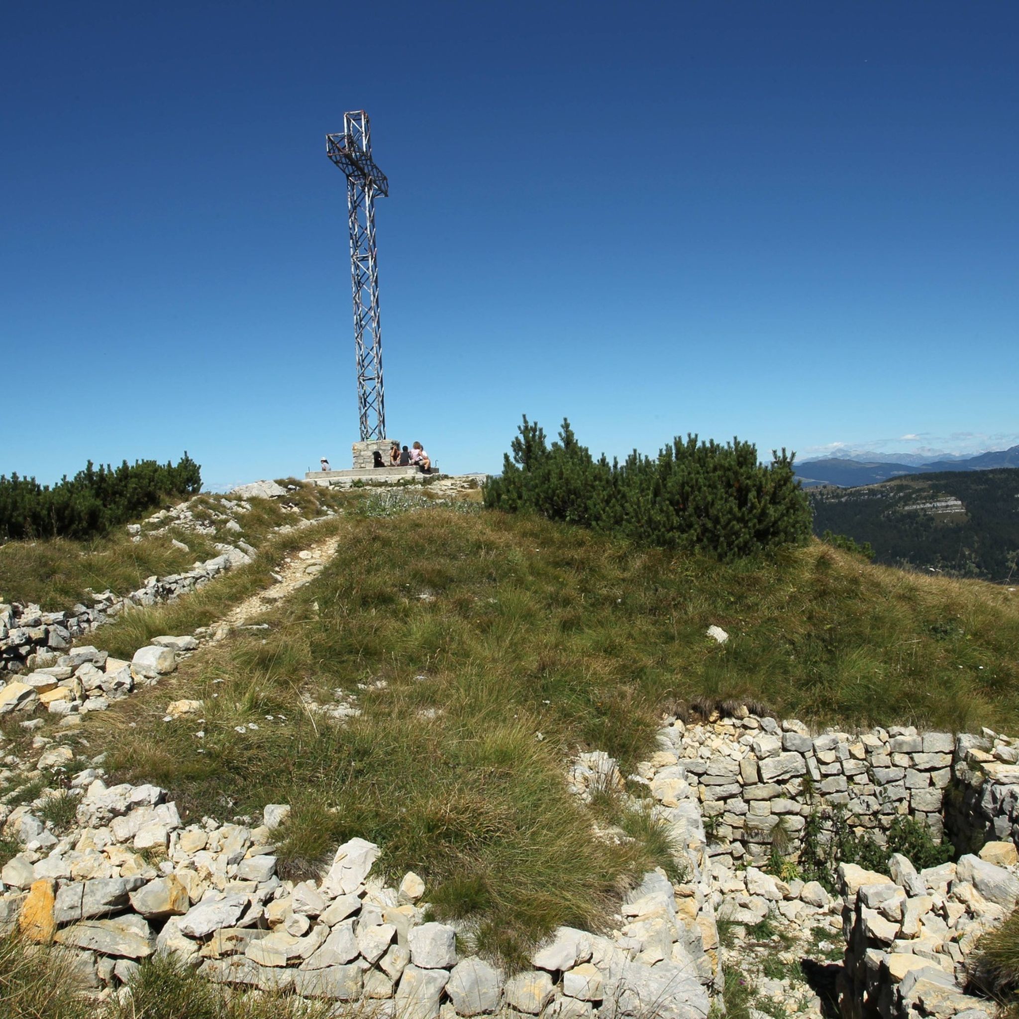
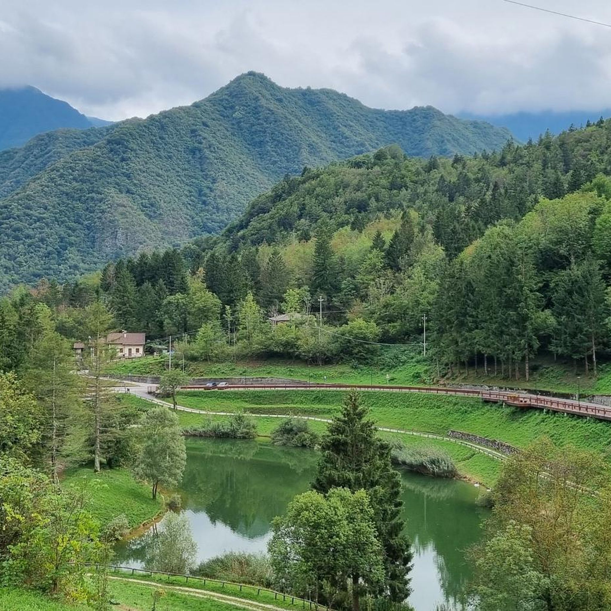
From the summit of Monte Maggio (1853 m) the view is majestic: on one side the view extends over the Passo Coe, the Alpe Cimbra, the Becco di Filadonna, and beyond; on the other, over the underlying basin of Laghi, the Tonezza plateau and the Asiago plateau, the Pasubio, the Novegno, up to the glimpse of the Venetian plain that widens at lower altitudes. During the First World War, Monte Maggio was disputed from the beginning of the conflict, given that the border between the Austro-Hungarian Empire and the Kingdom of Italy (today between Trentino and Vento) passed on its crest: trenches and cave shelters are still clearly visible all around. https://it.wikipedia.org/wiki/Monte_Maggio
0
0
Frequently Asked Questions
Which mountain peaks around Laghi offer the most expansive views?
For truly spectacular panoramas, consider Mount Palon, the highest peak in the Pasubio massif, which provides a 360-degree vista from the Veneto Plain to the Adamello glaciers. Similarly, Monte Maggio Summit Cross offers a full 360-degree panorama after a gentle climb from Passo Coe. In the Lake Como area, Monte Legnone provides a 360-degree view including hundreds of peaks like Ortler and Monte Rosa.
Are there mountain peaks around Laghi with historical significance?
Yes, several peaks hold significant history, particularly from World War I. Mount Palon was a crucial strategic point for the Italian army, featuring extensive tunnels like the Galleria Papa. The nearby Italian Tooth is also a historical site marked by the efforts of soldiers during the war. Mount Cengio is another historical site, offering views of the Vicenza Valley.
What are some accessible mountain peaks for moderate hikes around Laghi?
For moderate efforts, Mount Cengio is an intermediate summit offering beautiful views. Monte Maggio Summit Cross can be reached via a gentle, constant climb from Passo Coe. Monte Palanzone near Lake Como is also accessible with moderate effort, known for its grassy pyramid shape and 360-degree panoramas.
Which mountain peaks are popular for challenging climbs or experienced hikers?
For those seeking a challenge, Cornetto Peak summit cross requires good preparation, featuring an exposed final stretch and a short via ferrata. Monte Legnone, the highest peak directly by Lake Como, involves a demanding hike with over 1200 meters of elevation gain. Monte Grona, also near Lake Como, offers a challenging yet rewarding hike with well-marked trails.
Can I find family-friendly mountain trails near the Laghi region?
While many peaks offer challenging routes, some areas provide easier alternatives. For instance, near Monte Legnone by Lake Como, its smaller counterpart, Monte Legnoncino, offers an easier hike. Monte Barro, south of Lecco, is a natural park with a network of marked hiking trails suitable for various levels.
What outdoor activities can I do near these mountain peaks?
The Laghi region offers diverse outdoor activities. You can explore gravel biking routes like the 'Generale D'Havet Tunnel – General Achille Papa Refuge loop' or road cycling routes such as the 'Passo della Borcola and Forcella Valbona Loop'. For runners, there are trails like the 'Road of 52 Tunnels and Scarubbi Road Loop'. Find more details on these activities in the Gravel biking around Laghi, Road Cycling Routes around Laghi, and Running Trails around Laghi guides.
Are there mountain peaks around Lake Garda with great views?
Absolutely. Monte Baldo, on the eastern side of Lake Garda, is renowned for its stunning views of the lake and can be accessed via a cable car from Malcesine. Monte Pizzocolo, on the western shore, also offers breathtaking panoramic ridgelines and views of the entire Lake Garda basin and surrounding Alps.
Which mountain peaks around Lake Como are worth visiting?
Lake Como is framed by many peaks offering incredible views. Monte San Primo is the highest in the Larian Triangle, providing exceptional views of Lake Como's distinctive 'Y' shape. Monte Grona is popular for its views over the central part of Lake Como, and Monte Moregallo offers a fantastic perspective over the Lake Como mountains.
What kind of natural features can I expect to see on these mountain peaks?
You'll encounter diverse natural features, from the distinctive 'Y' shape of Lake Como visible from Monte San Primo to the panoramic ridgelines of Monte Pizzocolo overlooking Lake Garda. Many peaks, like Mount Cengio and Italian Tooth, are also recognized as natural monuments, showcasing the region's rugged beauty.
What do visitors enjoy most about the mountain peaks around Laghi?
Visitors frequently praise the breathtaking 360-degree panoramas and the sense of accomplishment after reaching a summit. The historical significance of many peaks, particularly those related to WWI, also deeply resonates with visitors, offering a unique blend of natural beauty and poignant history. The diverse range of trails, from gentle climbs to challenging via ferratas, ensures there's something for every adventurer.
Are there mountain peaks around Lake Maggiore?
Yes, Lake Maggiore also offers mountainous terrain. The Mottarone mountain range provides striking views of the Po Valley and the Alps, including Mont Rosa. Gradoni (also known as Monte Limidario) offers awe-inspiring views of Lago Maggiore, and Monte Sasso del Ferro can be reached via a thrilling bucket lift from Laveno Mombello, providing stunning vistas.
What is the best time to visit the mountain peaks around Laghi?
The region offers diverse experiences throughout the year. Summer is ideal for hiking, with many peaks like Monte San Primo being popular hiking destinations. In winter, some areas, such as Monte San Primo, transform into ski resorts. The best time depends on your preferred activity, but generally, spring to autumn offers excellent conditions for exploring the trails.
Most popular attractions around Laghi

Get inspired with the komoot mobile app


Explore more
See even more amazing summits around Laghi with these guides:
