The best walks and hikes around Gallinaro
4.4
(312)
1,491
hikers
56
hikes
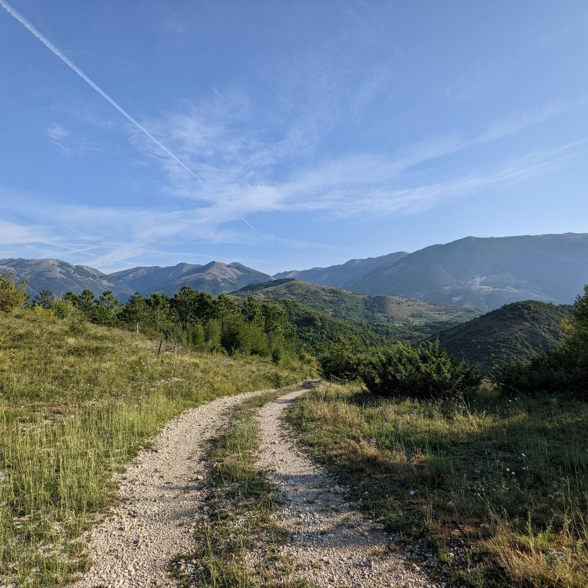
Hiking around Gallinaro offers routes through diverse landscapes, characterized by plateaus, mountain passes, and varied elevation changes. The region features both open terrain and areas with tree cover, providing different environments for exploration. Trails often lead through natural settings, connecting points of interest like high-altitude viewpoints and valleys.
Best hiking trails around Gallinaro
- The most popular hiking route is Macchiarvana Plateau – Forca d'Acero Pass loop from Ristorante Duca d'Aosta, a 7.2 miles (11.6 km) trail that takes 3 hours 27 minutes to complete. This route features a mix of plateau and mountain pass terrain.
- Another top favourite among local hikers is Valico della Portella – Monte Bellavista (2061 m) loop from Melfa, a difficult 12.0 miles (19.3 km) path. This trail includes significant elevation gain and leads to a mountain peak.
- Local hikers also love the Hiking loop from Picinisco, a 5.1 miles (8.2 km) trail leading through varied local scenery, often completed in about 2 hours 21 minutes.
- Hiking around Gallinaro is defined by mountain passes, plateaus, and opportunities for both moderate and challenging ascents. The network offers options for different ability levels, from shorter loops to longer, more demanding routes.
- The routes in Gallinaro are highly rated by the komoot community with an average score of 4.5 stars from over 200 reviews. More than 1000 hikers have used komoot to explore Gallinaro's varied terrain.
Last updated: June 21, 2026
5.0
(6)
24
hikers
18.0km
06:29
920m
920m
Hard hike. Very good fitness required. Mostly accessible paths. Sure-footedness required.
4.3
(3)
23
hikers
10.6km
03:13
350m
350m
Moderate hike. Good fitness required. Easily-accessible paths. Suitable for all skill levels.

Sign up for free
5.0
(3)
19
hikers
15.2km
04:39
490m
490m
Moderate hike. Good fitness required. Easily-accessible paths. Suitable for all skill levels.
4.8
(4)
14
hikers
5.93km
02:36
540m
540m
Moderate hike. Good fitness required. Easily-accessible paths. Suitable for all skill levels.
3.0
(1)
8
hikers
21.1km
06:30
770m
770m
Hard hike. Very good fitness required. Easily-accessible paths. Suitable for all skill levels.
Get access to more routes and recommendations from other explorers.
Sign up for free
Already have an account?
Our route recommendations are based on thousands of hikes, rides, and runs completed by other people on komoot.
Start today with a free account
Your next adventure awaits.
Login or Signup

Tips from the Community

Beautiful place for a quiet walk
0
0
point where you can see the artificial lake of Grottacampanaro
0
0

In 1985, Pope John Paul II who spent the night in the area prayed on the banks of the waterfall, and therefore in his honor today the waterfall bears his name.
1
0
The Canneto sanctuary is located at 1010m in the National Park of Abruzzo, Lazio and Molise. Here there are also parking lots and even a public toilet.
1
0

Frequently Asked Questions
What types of hiking trails can I find around Gallinaro?
Gallinaro offers a diverse range of hiking trails, characterized by plateaus, mountain passes, and varied elevation changes. You'll find routes through both open terrain and areas with tree cover, connecting high-altitude viewpoints and valleys. The region provides options for different ability levels, from moderate loops to more demanding ascents.
Are there easy hiking trails suitable for beginners or casual walkers?
Yes, Gallinaro has a good selection of easier trails. There are 11 easy routes available, perfect for those looking for a less strenuous walk. These trails often feature gentler gradients and shorter distances, allowing for a relaxed exploration of the local scenery.
Are there any challenging hikes for experienced trekkers?
Absolutely. For experienced hikers, Gallinaro offers 20 difficult routes. One notable challenging trail is the Valico della Portella – Monte Bellavista (2061 m) loop from Melfa, which is 12.0 miles (19.3 km) long and includes significant elevation gain, leading to a mountain peak.
Can I find circular hiking routes in the Gallinaro area?
Yes, many of the trails around Gallinaro are circular, allowing you to start and end at the same point. An example is the Hiking loop from Picinisco, which is 5.1 miles (8.2 km) and takes about 2 hours 21 minutes to complete, offering varied local scenery.
What kind of natural attractions can I see along the trails?
The hiking trails around Gallinaro often lead to beautiful natural attractions. You might encounter features like Lake Posta Fibreno, the dramatic Melfa Gorge – Tracciolino of Roccasecca, or the scenic Monks' Pass. Some routes also offer views of prominent peaks like Mount La Meta.
What do other hikers enjoy most about the trails in Gallinaro?
The hiking routes in Gallinaro are highly rated by the komoot community, with an average score of 4.5 stars. Hikers often praise the diverse terrain, from plateaus to mountain passes, and the opportunities for both moderate and challenging ascents. The variety of landscapes and well-maintained paths are frequently highlighted.
Are there any long-distance hiking options available?
While many routes are day hikes, some trails offer longer distances for those seeking extended adventures. For instance, the Valico della Portella – Monte Bellavista (2061 m) loop from Melfa covers 12.0 miles (19.3 km), providing a substantial trek through the mountainous landscape.
What is the best time of year to go hiking in Gallinaro?
The best time for hiking in Gallinaro generally depends on the specific trail and your preferences. Spring and autumn offer pleasant temperatures and vibrant scenery, ideal for most routes. Summer can be warm, especially at lower elevations, while higher mountain passes might offer cooler conditions. Winter hiking is possible, but some higher routes may require appropriate gear for snow and ice.
Is there parking available near the trailheads?
Parking availability varies by trailhead. Many popular starting points, especially those near villages or restaurants, typically offer designated parking areas. It's advisable to check the specific route details on komoot for information regarding parking at your chosen trailhead.
Are there any family-friendly hiking trails in the area?
Yes, with 11 easy routes available, many are suitable for families. These trails are generally shorter and have less elevation gain, making them enjoyable for children and those looking for a leisurely walk. Look for routes described as 'easy' on komoot for family-friendly options.
Can I bring my dog on the hiking trails around Gallinaro?
Generally, dogs are welcome on many hiking trails in the Gallinaro region, especially in natural, open areas. However, regulations can vary, particularly in protected areas or on private land. It's always best to keep your dog on a leash and ensure they are well-behaved, especially when encountering wildlife or other hikers.
What kind of wildlife might I encounter while hiking?
The diverse landscapes around Gallinaro, including forests and open plateaus, are home to various wildlife. Depending on the season and specific location, you might spot birds of prey, small mammals, or even larger animals like deer. Observing wildlife from a distance and respecting their natural habitat is always recommended.
Most popular attractions around Gallinaro

Get inspired with the komoot mobile app


Explore more
Browse the best Hikes in other regions.
