The best walks and hikes around San Biagio Platani
4.1
(18)
76
hikers
11
hikes
Hiking around San Biagio Platani offers exploration of Sicily's Agrigento province, characterized by its rural landscapes. The area is situated on a slope overlooking the Platani and Turvoli river valleys, featuring gentle hills and agricultural land with pistachio, almond, cereal, and olive tree cultivations. It is surrounded by the Sicani Mountains, providing diverse terrain and panoramic views.
Best hiking trails around San Biagio Platani
- The most popular hiking route is Pizzo della Rondine – loop hike in the Parco dei…
Last updated: July 5, 2026
4.2
(5)
24
hikers
5.72km
02:13
250m
250m
Hard hike. Good fitness required. Sure-footedness, sturdy shoes and alpine experience required.
4.5
(4)
18
hikers
Hard hike. Great for any fitness level. Sure-footedness, sturdy shoes and alpine experience required.

Sign up for free
4.0
(1)
7
hikers
Moderate hike. Good fitness required. Easily-accessible paths. Suitable for all skill levels.
3.0
(1)
3
hikers
3.29km
00:59
100m
100m
Easy hike. Great for any fitness level. Easily-accessible paths. Suitable for all skill levels.
4.0
(2)
3
hikers
13.4km
04:05
460m
460m
Moderate hike. Good fitness required. Easily-accessible paths. Suitable for all skill levels.
Get access to more routes and recommendations from other explorers.
Sign up for free
Already have an account?
Our route recommendations are based on thousands of hikes, rides, and runs completed by other people on komoot.
Start today with a free account
Your next adventure awaits.
Login or Signup
Popular around San Biagio Platani
Tips from the Community

This itinerary of about 23.4 km connects the hilltop village of Sant’Angelo Muxaro to the Cattolica Eraclea plain, in a hiking trip full of contrasts and suggestions. It is a long and immersive route, designed for expert walkers who want to cross the most authentic Sicily, far from the tourist routes. Starting from Sant’Angelo Muxaro, the path winds through rural paths, wooded stretches, natural canyons and vast cultivated plains. The landscape changes several times: from rocky reliefs to gentle slopes and finally to open plains, breathing in the history and culture of peasant civilization. The arrival in Cattolica Eraclea, a village overlooking the countryside and near the sea, concludes a physical and sensorial experience that gives satisfaction and connection with the territory. Route difficulty: Difficult – Requires physical resistance, orientation and adequate equipment. Travel tips: • Suitable for expert hikers. • Plan intermediate stops or a local guide. • Ideal in spring or autumn to avoid intense heat.
0
0

The route was done with gym equipment… But we recommend at least trekking shoes as a basic item of clothing for greater grip on the steepest sections… Not particularly challenging…
0
0

the Statue of Santa Rosalia and cross is next to the car park positioned high on the hill overlooking the vast beautiful countryside below towards Castronovo di Sicilia and Lake Fanaco From here it’s a lovely walk downhill to The Hermitage of Santa Rosalia best visited when fewer tourists attending, especially if your intent is paying a visit into the grotto where you have to prostrate yourself a bit to access the sleeping saint --- the Statue of Santa Rosalia and cross is next to the car park positioned high on the hill overlooking the vast beautiful countryside below towards Castronovo di Sicilia and Lake Fanaco From here it’s a lovely walk downhill to The Hermitage of Santa Rosalia, best visited when fewer tourists are attending, especially if your intent is paying a visit into the grotto where you have to prostrate yourself a bit to access the sleeping saint
1
0

It was not open when we were there end of September
0
0

The Hermitage of Santa Rosalia alla Quisquina, located on the slopes of Mount Quisquina in Santo Stefano Quisquina in Sicily, is near the cave where Santa Rosalia spent much of her life.
7
0
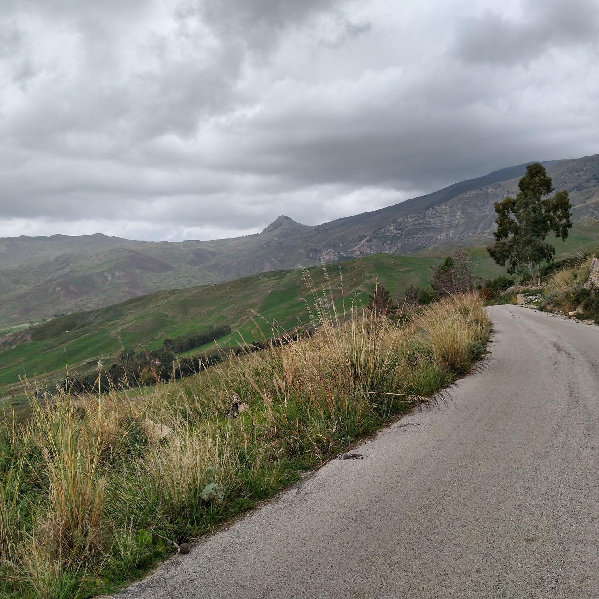
At this point, at the beginning of the climb towards Pizzo della Rondina, you can enjoy a beautiful view of what will be the destination of the day.
1
0
Lake Fanaco is a beautiful artificial basin in Sicily, created in 1953. It is home to flora, fauna and serves for drinking water. The road along the lake is very quiet.
0
0

It is an artificial basin in Sicily which falls within the municipality of Castronovo di Sicilia. The reservoir, built between 1951 and 1953 by damming the Platani river, is located in the southern area of a wide valley, in the center of an immense natural concavity between two long chains of mountains running parallel to each other. The lake is 3.5 km long and 1 km wide at its widest point and can accommodate 20.7 million cubic meters at its maximum reservoir level.
0
0
Frequently Asked Questions
How many hiking trails are available around San Biagio Platani?
San Biagio Platani offers a selection of over 10 hiking routes, catering to various preferences and skill levels. These trails explore the rural landscapes, river valleys, and the surrounding Sicani Mountains.
What kind of terrain can I expect on the hiking trails near San Biagio Platani?
The terrain around San Biagio Platani is diverse, ranging from gentle hills and agricultural land with pistachio, almond, cereal, and olive tree cultivations to the more rugged and diverse landscapes of the Sicani Mountains. You'll find paths along river valleys and ascents to panoramic viewpoints.
Are there any family-friendly hiking trails in San Biagio Platani?
Yes, there are several easier options suitable for families. For instance, the View of Pizzo della Rondine loop from Casa Prussiano is an easy 3.3 km hike that offers scenic views without significant difficulty, making it a good choice for a family outing.
What are the natural features and landmarks I can see while hiking?
The region is rich in natural beauty. You can explore the Platani River valley, the second-longest river in Sicily, and enjoy views of the Sicani Mountains. Notable landmarks include the Saint Rosalia Hermitage at Quisquina and the serene Castello Lake, which is excellent for nature lovers and birdwatching. For mountain enthusiasts, trails lead towards Monte Cammarata and Monte Gemini.
Are there any challenging hikes for experienced trekkers?
Yes, for those seeking a challenge, the area provides more demanding routes within the Sicani Mountains. Trails leading to Monte Gemini (1397 m) and Monte Cammarata (1578 m) offer alpine sections and are suited for intermediate to difficult level hikers. An example is the Pizzo della Rondine – loop hike in the Parco dei Monti Sicani, which is classified as difficult.
Can I find circular hiking routes in the area?
Many of the trails around San Biagio Platani are designed as loops, allowing you to start and end at the same point. A popular circular option is the Piazza Umberto I – Le Due Grotticelle loop from Sant'Angelo Muxaro, which covers 11.5 km through varied terrain.
What is the best time of year to go hiking in San Biagio Platani?
The region is generally pleasant for hiking during spring and autumn when temperatures are milder. These seasons offer comfortable conditions to explore the rural landscapes and mountain trails. Summer can be hot, while winter might bring cooler, potentially wetter weather, especially at higher elevations in the Sicani Mountains.
What do other hikers say about the trails in San Biagio Platani?
The hiking routes in San Biagio Platani are highly regarded by the komoot community, holding an average rating of 4.3 stars from over 10 reviews. Hikers often appreciate the varied terrain, panoramic views of the Sicani Mountains, and the opportunity to experience Sicily's rural beauty.
Are there any trails that pass by lakes or water features?
Yes, the region features Castello Lake, an artificial lake that provides a tranquil setting for excursions and nature observation. The Lake Fanaco loop from Eremo di Santa Rosalia alla Quisquina is a moderate 13.4 km hike that allows you to explore the area around a significant water body.
Is it possible to find accommodation or places to eat near the hiking trails?
San Biagio Platani and nearby villages offer options for accommodation, cafes, and restaurants where you can refuel after your hikes. While specific establishments are not listed on the trails themselves, the local communities provide amenities for visitors.
Can I bring my dog on the hiking trails?
Generally, dogs are welcome on many outdoor trails in Sicily, especially in rural and natural park areas like the Sicani Mountains. However, it's always advisable to keep your dog on a leash, especially in agricultural areas or near wildlife, and to check for any specific local regulations or protected areas that might have restrictions.
What are the options for parking when accessing the hiking trails?
While specific parking areas for each trailhead are not detailed, you can typically find parking in or near the villages and starting points of the trails. It's recommended to check local maps or komoot tour details for the most convenient parking spots closest to your chosen route.
Most popular routes around San Biagio Platani
Most popular attractions around San Biagio Platani

Get inspired with the komoot mobile app


Explore more
Browse the best Hikes in other regions.
