Routes

Planner

Features

Updates

App

Login or Signup

Get the App

Login or Signup

Routes
Hikes
Italy
Piedmont
Cuneo

Bellino

The best walks and hikes around Bellino

4.6

(576)

3,416

hikers

70

hikes

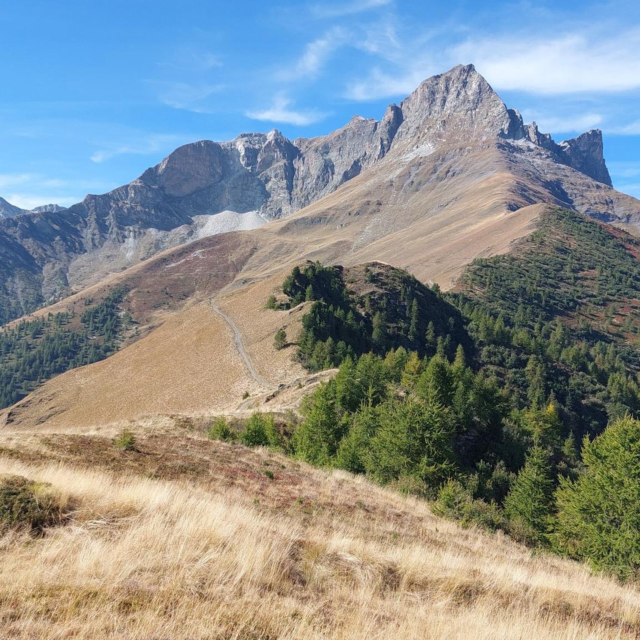
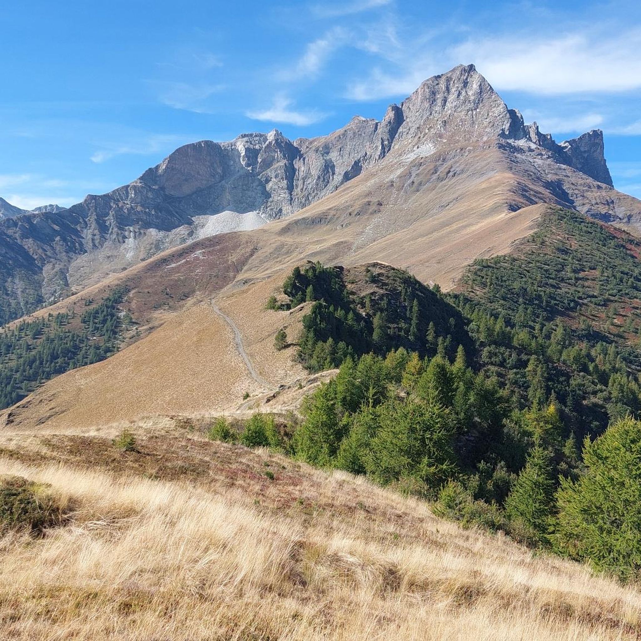
Hiking around Bellino, nestled in Italy's Piedmont region, offers diverse landscapes within the upper Varaita Valley, bordering France. The terrain features challenging mountain trails, alpine pastures, and transitions from forests to rocky scree slopes. Hikers encounter jagged rock faces, towering peaks, and several mountain passes connecting different valleys. The area is characterized by its natural features, including the Pelvo d'Elva peak and the source of the Maira stream.

Best hiking trails around Bellino

  • The most popular hiking route is Bivacco Boerio – Valle Varaita, a difficult 9.2 miles (14.8 km) trail that takes about 7 hours 24 minutes to complete. This route features significant elevation gain towards a mountain bivouac.
  • Another top favourite among local hikers is Cima Mongioia – Valle Varaita, a difficult 10.5 miles (16.9 km) path. This trail offers sustained climbing to a prominent peak with expansive views.
  • Local hikers also love the Monte Salza and Bric de Rubren Loop, a difficult 11.1 miles (17.9 km) trail leading through varied alpine terrain, often completed in about 8 hours 55 minutes.
  • Hiking around Bellino is defined by challenging mountain trails, alpine pastures, and high mountain passes. The network offers options for different ability levels, from moderate paths to strenuous multi-day itineraries.
  • The routes in Bellino are highly rated by the komoot community with an average score of 4.6 stars from over 500 reviews. More than 3000 hikers have used komoot to explore Bellino's varied terrain.

Last updated: June 23, 2026

4.8

(51)

296

hikers

#1.

Bivacco Boerio – Valle Varaita

14.8km

07:24

1,220m

1,220m

Embark on a difficult hiking adventure to Bivacco Boerio in Valle Varaita, a challenging route that spans 9.2 miles (14.8 km) and climbs 3988 feet (1216 metres). This demanding trail, which typically takes around 7 hours and 24 minutes to complete, leads you through the scenic Vallone del Rui with its small stone huts and vibrant mountain flowers. As you ascend, the terrain becomes more alpine, featuring unpaved sections, steep scree fields, and rocky paths, culminating in the dramatic, almost lunar landscape around the bivouac and the stunning Lago Mongioia.

Planning your visit requires good fitness, sure-footedness, and alpine experience, as some sections can be technical or hazardous. The trail usually starts from Sant'Anna di Bellino, where you can find parking, following paths U26 and U67. Be prepared for a continuous and steep climb, especially in the latter parts of the route. This area is best explored when conditions are clear, allowing you to fully appreciate the panoramic views and navigate the varied terrain safely.

The Bivacco Franco Boerio, inaugurated in 1992, is a key landmark on this route, offering 10 beds and serving as an excellent base for further ascents of peaks like Monte Mongioia and Monte Salza. This octagonal wooden structure, recently restored, sits just above Lago Mongioia, providing spectacular views of the surrounding Cozie Alps. Along the way, you might also discover historical elements like former military strongpoints near Grange Cruset, and if you are lucky, spot ibex near the bivouac in the late afternoon.

Navigate with device

Send to Phone

Save

Hard

4.8

(46)

278

hikers

16.9km

08:34

1,410m

1,410m

Embark on a difficult hiking adventure to Cima Mongioia, a challenging route spanning 10.5 miles (16.9 km) with a significant elevation gain of 4627 feet (1410 metres), typically taking 8 hours and 33 minutes to complete. The trail begins on a dirt road before ascending through switchbacks into the picturesque Vallone del Rui, an idyllic place dotted with small stone huts and vibrant mountain flowers. As you climb higher, the path becomes steeper, leading you through scree and rocky sections, especially on the demanding ascent from Lago Mongioia to the summit, where you will find stupendous panoramic views of the southwestern Alps, including Monte Bianco and Monviso.

This difficult trail requires very good physical fitness, sure-footedness, sturdy hiking shoes, and alpine experience. You should be prepared for potentially technical, difficult, or hazardous terrain, and be aware that snow can be present at higher elevations, particularly early in the summer season. The hike commonly starts from Sant'Anna di Bellino, where parking is available, and the Bivacco Boerio, located near Lago Mongioia, serves as a crucial base for those attempting the summit.

Cima Mongioia itself stands at 3,340 meters, marking the watershed between Italy's Valle Varaita and France's Ubaye valley, offering expansive 360-degree vistas. The region is celebrated for its extraordinary biodiversity, and the Valle Varaita is known for its wide, shaded, and lush landscapes, featuring charming stone-and-wood villages. You can also observe the geological interest of the upper reaches, composed of schists with ophiolites and serpentinites, and pass by Grange Cruset, a historic mountain hamlet that was a significant strongpoint during World War II.

Hard
guide_signup
Let us show you the way with the komoot mobile app
With a free komoot account, you can easily find, customize, and navigate endless outdoor adventures.

Sign up for free

4.8

(42)

258

hikers

Embark on the Monte Salza and Bric de Rubren Loop, a difficult hike spanning 11.1 miles (17.9 km) with a significant 4613 feet (1406 metres) of elevation gain. This demanding route will take you around 8 hours and 55 minutes to complete, offering a true alpine experience. You will traverse rugged terrain, passing by the serene Lago Mongioia, and witness dramatic glacial moraines. The high mountain atmosphere is palpable as you climb towards panoramic vistas.

This challenging loop is best suited for experienced hikers ready for a demanding day in the mountains. You can typically begin your adventure from either Sant'Anna di Bellino or Chianale, so plan your access accordingly. Be aware that in snowy conditions, the trail requires mountaineering experience and specific equipment like crampons and ice axes. Always check local conditions before you set out.

This route offers more than just a physical challenge; it provides a deep dive into the alpine environment. From the Monte Salza Summit, you will be treated to expansive views over the surrounding valleys, including the Varaita di Rui and Vallon du Loup. The trail also passes by the Bivacco Boerio, a notable landmark in this remote region, adding to the sense of exploration.

Hard

4.9

(29)

185

hikers

Embark on a challenging hike along the Elio Bonfante Bivouac Trail, a demanding route that stretches 8.5 miles (13.6 km). You will gain 1714 feet (522 metres) in elevation, requiring an estimated 5 hours and 18 minutes to complete. As you traverse the alpine landscape, you'll encounter the Elio Bonfante Bivouac, a key landmark offering a rugged resting point. This difficult trail promises an immersive experience in high mountain terrain, with spectacular views of Monviso unfolding as you climb.

Since this is a point-to-point route, you should plan your logistics carefully for both the start and end points. Always check local conditions before you go, especially regarding weather and trail accessibility in the high alpine environment. Confirm parking availability at the trailhead in advance to ensure a smooth start to your adventure. Being prepared for variable conditions will make your hike more enjoyable.

This route is known as the T06 Alpine Traverse to Bivacco Bonfante, offering a rewarding experience for experienced hikers in the Monviso region. Beyond the bivouac, you can also discover the natural monument of Fonte Nera, adding to the scenic variety of this journey. It stands out as a significant alpine traverse, connecting you deeply with the natural beauty and ruggedness of the area.

Hard

4.7

(30)

181

hikers

5.37km

02:38

480m

480m

Embark on the Rocca Senghi Trail, a moderate hike that takes you through the scenic Valle Varaita. This route covers 3.3 miles (5.4 km) and involves a steady climb of 1576 feet (480 metres), offering rewarding views as you ascend. You can expect to complete this journey in about 2 hours and 38 minutes, making it a good option for a half-day adventure. The trail provides a wonderful sense of immersion in the mountain landscape, with the striking Rocca Senghi rock formation often in sight.

When planning your visit, be aware that conditions can vary, especially during the shoulder seasons. The west-facing sections near the summit might hold snow or ice, so check forecasts and consider appropriate gear if you are hiking early or late in the year. The trail typically begins from Sant'Anna di Bellino, which serves as a convenient starting point for your exploration. Remember to carry a headlamp if you intend to explore the old military tunnel, as it is completely dark inside.

This trail is notable for its blend of natural beauty and historical elements. As you hike, you will pass by the ancient Grange Cruset mountain hamlet, where you can see traditional architecture set against a dramatic backdrop. The prominent Rocca Senghi itself is a unique geological feature, rising like an isolated boulder with a distinct reddish cliff face. The route also offers glimpses into the region's past through features like the military tunnel, adding an extra layer of interest to your outdoor experience.

Moderate
Sign up for free to see 66 more hikes around Bellino.

Get access to more routes and recommendations from other explorers.

Sign up for free

Already have an account?

Our route recommendations are based on thousands of hikes, rides, and runs completed by other people on komoot.

Start today with a free account

Your next adventure awaits.

Login or Signup

Popular around Bellino

GTA South Piedmont — Hiking in Italy's Occitan valleys
Where birds of prey swoop – 8 peaks over 3,000 metres in Monviso
Varaita Valley Trekking – a journey into the lands of Italy’s Monviso
Cycling around Bellino

MTB Trails around Bellino

Road Cycling Routes around Bellino

Running Trails around Bellino
Mountain Hikes around Bellino

Gravel biking around Bellino

Other adventures around Bellino

GTA South Piedmont — Hiking in Italy's Occitan valleys

Hiking Collection by

Marika Abbà

Tips from the Community

Yazz
January 4, 2026, Bivacco Boerio at Lake Mongioia

The night at the Boerio refuge is worth the hike alone; ibex approach the refuge as early as late afternoon. For the return to Maljasset, it's best to do a loop via the Salsa pass and descend via Lac du Loup (+200m elevation gain and 1.5 hours extra). The route descends through the northern scree slopes of Rubren, where snow patches linger late in the season; the terrain is extremely rocky!

Translated by Google

0

0

The Elio Bonfante bivouac is located in the Maira Valley, in the municipality of Prazxo, at the foot of Chersogno and Rocca La Marchisa, at 2,630 meters above sea level. It has 12 beds.

Translated by Google

0

0

stunning view with the fortress overlooking the valley

Translated by Google

0

0

Cristian
May 26, 2025, Rocca Senghi

Beautiful excursion to reach the summit at 2450m, passing through a series of hairpin bends on a very steep slope, an old military bunker and a dark tunnel that can be travelled through in via ferrata mode.

Translated by Google

0

0

The highest sundial in the Bellino Valley. 2020 meters.

Translated by Google

0

0

Perceval
September 6, 2024, Cima Mongioia

Magnificent summit at 3340m. We left the day before from Maljasset where we then slept in the Bivacco Boerio refuge at 3080m I highly recommend.

Translated by Google

0

0

Marco Riba
July 28, 2024, Fonte Nera

Spring with fresh water

Translated by Google

0

0

Ivan Lucini
December 12, 2023, Tratti esposti

Some exposed and challenging sections lead to Cima Mongioia, be careful.

Translated by Google

1

0

Frequently Asked Questions

What types of hiking trails can I expect to find in Bellino?

Bellino offers a diverse range of hiking trails, from challenging mountain routes with significant elevation gain to more moderate paths. The terrain transitions from beautiful alpine pastures and forests to rocky scree slopes and high mountain passes. You'll encounter jagged rock faces, towering peaks, and streams, providing varied experiences for different skill levels.

Are there any easy or family-friendly hiking options in Bellino?

While Bellino is known for its challenging alpine trails, there are some easier options available. The region offers 2 easy and 23 moderate tours, which can be suitable for families or those looking for a less strenuous experience. For example, the Rocca Senghi Trail is a moderate 5.4 km path with panoramic views and historical sites, suitable for most fitness levels.

Can I hike with my dog in Bellino?

Bellino's natural environment is generally welcoming for dogs, but it's always recommended to keep your dog on a leash, especially in alpine pastures where livestock may be present, or near wildlife. Always carry water for your dog and be mindful of their endurance on longer or more challenging trails. Check specific trail regulations if you plan to enter protected areas.

Are there any circular hiking routes around Bellino?

Yes, Bellino offers several circular hiking routes. A notable example is the Monte Salza and Bric de Rubren Loop, an 17.9 km difficult trail that takes you through varied alpine terrain, offering a comprehensive experience of the area's landscapes. The region also features parts of the Varaita Trek, which is a valley circular hiking route.

What natural features or landmarks can I see while hiking in Bellino?

Bellino's trails lead to numerous natural features and landmarks. You can explore iconic peaks like Pelvo d'Elva, and mountain passes such as Colle di Bellino and Colle della Battagliola. The area is also home to the source of the Maira stream. For stunning views, consider hikes around Colle Greguri, which offers vistas of Cima Provenzale's vertical wall. You can also find several waterfalls in the vicinity, such as the Antolina Waterfall and the Ponte delle Combe Waterfall.

Are there mountain huts or bivouacs available for overnight stays?

Yes, the Bellino region is well-equipped with mountain huts and bivouacs that serve as excellent stopovers or destinations. Options include the Vallanta Hut, ideal for those undertaking the Giro del Monviso, and the Bagnour Hut, situated in the Alevé forest. The Elio Bonfante Bivouac also provides stunning views and accommodation for hikers.

What is the best time of year to go hiking in Bellino?

The best time to hike in Bellino is typically from late spring to early autumn (June to September) when the weather is most favorable and trails are generally clear of snow. During these months, you'll experience pleasant temperatures and vibrant alpine flora. Some higher-altitude routes may have snow patches lingering late into the season, so always check conditions before heading out. Winter hiking is possible but requires specialized equipment and experience.

How long do hikes around Bellino typically take?

Hiking durations in Bellino vary significantly depending on the trail's length and difficulty. Shorter, moderate trails like the Rocca Senghi Trail can take a few hours, while more demanding routes such as the Bivacco Boerio – Valle Varaita (14.8 km) can take over 7 hours. The most challenging hikes, like Cima Mongioia – Valle Varaita (16.9 km), can require a full day of hiking, often exceeding 8 hours.

What do other hikers say about the trails in Bellino?

The hiking trails in Bellino are highly regarded by the komoot community, with an average rating of 4.6 stars from over 500 reviews. Hikers often praise the breathtaking alpine vistas, the sense of awe from jagged rock faces and towering peaks, and the diverse terrain that transitions from forests to rocky scree slopes. The challenging nature of many routes is also a highlight for experienced hikers seeking adventure.

Is there parking available at the trailheads in Bellino?

Parking is generally available in Bellino and at various trailheads throughout the Varaita Valley. Specific parking information can vary by starting point, especially for more remote routes. It's advisable to check local signage or online resources for designated parking areas before your hike, particularly during peak season.

Are there any waterfalls to visit near Bellino?

Yes, the area around Bellino features several beautiful waterfalls. You can find the Trail to the Stroppia Waterfalls, which leads to impressive cascades. Other notable waterfalls include the Antolina Waterfall and the Ponte delle Combe Waterfall, offering picturesque spots for a break or photo opportunity.

What kind of accommodation and dining options are available in Bellino?

Bellino and its surrounding villages in the Varaita Valley offer various accommodation options, including traditional mountain huts, guesthouses, and small hotels. You can find places to eat, such as cafes, restaurants, and pubs, that serve local Piedmontese cuisine. Many of these establishments provide a cozy atmosphere after a day of hiking.

Most popular routes around Bellino

Cycling around Bellino
Most popular attractions around Bellino

Places to see

Store rating

Get inspired with the komoot mobile app

With a free komoot account, you can easily find, customize, and navigate endless outdoor adventures.

or

Join komoot Now

Store rating

Explore more

Browse the best Hikes in other regions.

Parco Naturale delle Alpi MarittimeValdieriAcceglioEntracquePontechianaleCrissoloParco Naturale Regionale del MonvisoCanosioVinadioParco Naturale del MarguareisParco naturale della Alta Valle Pesio e TanaroLimone PiemonteChiusa Di PesioLake artificiale di CastelloCastelmagnoRoccaforte MondovìArgenteraOrmeaVernantePietraporzioGaressioSampeyreOncinoFrabosa SottanaStroppoBriga AltaElvaMarmoraPradlevesDemonteBovesSambucoMoiolaFrabosa SopranaMonterosso GranaLa MorraPaesanaPrazzoMacraSan Damiano MacraIsascaMelleBacino del ChiotasPriolaRoburentRoaschiaMonforte D'AlbaRiserva Naturale Delle Grotte Di BosseaBaroloMagliano AlpiRoccabrunaNeiveCastellino TanaroPrieroRobilanteSanfrontBrossascoLesegnoNeviglieRiserva Naturale Di Rocca San Giovanni - SabenOstanaValloriateMarsagliaTreisoCapraunaDroneroTrezzo TinellaValmalaPeveragnoPerloCasteldelfinoBeinetteCamoAlbaVillar San CostanzoMontaldo Di MondovìMontemale Di CuneoEnvieAltoPamparatoPocapagliaIglianoSinioVenascaLequio BerriaBuscaCeresole AlbaBergoloBorgo San DalmazzoAlbaretto Della TorreLake della RovinaAisoneLeviceRoascioRoddinoMangoRittanaFrassinoCastinoMonasterolo CasottoLake della PiastraFeisoglioSant'Albano SturaMonchieroBrondelloCastellinaldo D'AlbaMurazzanoSale Delle LangheCostigliole SaluzzoCastelnuovo Di CevaValgranaRoccavioneMontelupo AlbeseBattifolloCelle Di MacraNucettoTorre BormidaBorgomaleSanto Stefano RoeroSaluzzoMartiniana PoFossanoLequio TanaroPiascoPerlettoMontàCastellarParoldoRocca CiglièRocchetta BelboBagnascoVillafallettoVerzuoloTorresinaCartignanoCortemiliaPagnoGambascaVottignascoMombasiglioVezza D'AlbaNarzoleBagnolo PiemonteLagnascoScagnelloPezzolo Valle UzzoneBelvedere LangheCiglièCissoneVicoforteRodelloMantaSanto Stefano BelboBarbarescoBastia MondovìMonastero Di VascoRossanaCastiglione FallettoTrinitàSommariva Del BoscoPiobesi D'AlbaNiella TanaroMonesiglioSerralunga D'AlbaBossolascoTarantascaRoccasparveraVignoloNovelloRevelloRoburentGaiolaCastagnitoMontezemoloBernezzoDiano D'AlbaBraCherascoArguelloGrinzane CavourMonteu RoeroCervascaMondovìBargeBaldissero D'AlbaViolaSale San GiovanniLisioSomanoFariglianoCervereCevaSalicetoBonvicinoMombarcaroCaraglioTorre San GiorgioFauleRoddiMorettaGottaseccaGenolaBene VagiennaMontaneraClavesanaMorozzoGuareneMontaldo RoeroTorre MondovìBenevelloVillanova SolaroRocca De' BaldiSommariva PernoCerretto LangheBosiaPianfeiBriagliaCravanzanaNature Reserve delle Sorgenti del BelboCanaleCameranaPrioccaRiserva Naturale Di Crava-MorozzoDoglianiCardèMonasterolo Di SaviglianoMonticello D'AlbaSan Benedetto BelboSalmourRiserva Naturale Della Confluenza Del VaraitaMargaritaSanfrèCossano BelboCorneliano D'AlbaSaviglianoGovoneRiserva Naturale Speciale Di BenevagiennaVillanova MondovìCastelletto UzzoneCastiglione Tinella

Nearby adventure guides

Things to Do around Lake artificiale di Castello

background

Get ready to conquer new peaks

Sign up for Free

Explore
RoutesRoute plannerFeaturesHikesMTB TrailsRoad cycling routesBikepackingSitemap
Download the app
Follow Us on Socials

© komoot GmbH

Privacy Policy