The best running trails around Borgomaro
3.9
(34)
658
runners
80
runs
Jogging around Borgomaro offers a diverse landscape for runners, characterized by centuries-old olive groves, lush chestnut woods, and pathways along the Impero river. The region features varied topography, including ancient mule tracks and rural paths that connect charming medieval villages. Elevation changes vary from gentle routes to more challenging ascents, providing options for different fitness levels.
Best jogging routes around Borgomaro
- The most popular jogging route is Ring of the Dolcedo Hamlets and Municipal Forest, a 5.9 miles (9.6…
Last updated: October 2, 2026
27
runners
21.3km
02:43
720m
720m
Hard run. Very good fitness required. Sure-footedness, sturdy shoes and alpine experience required.
17
runners
Moderate run. Good fitness required. Mostly paved surfaces. Suitable for all skill levels.

13
runners
11.0km
01:12
220m
220m
Moderate run. Good fitness required. Mostly paved surfaces. Suitable for all skill levels.
3.3
(4)
11
runners
7.45km
00:54
260m
260m
Moderate run. Good fitness required. Mostly paved surfaces. Suitable for all skill levels.
11
runners
4.77km
00:32
110m
110m
Moderate run. Good fitness required. Mostly paved surfaces. Suitable for all skill levels.
Get access to more routes and recommendations from other explorers.
Already have an account?
Our route recommendations are based on thousands of hikes, rides, and runs completed by other people on komoot.
Start today with a free account
Your next adventure awaits.

Tips from the Community

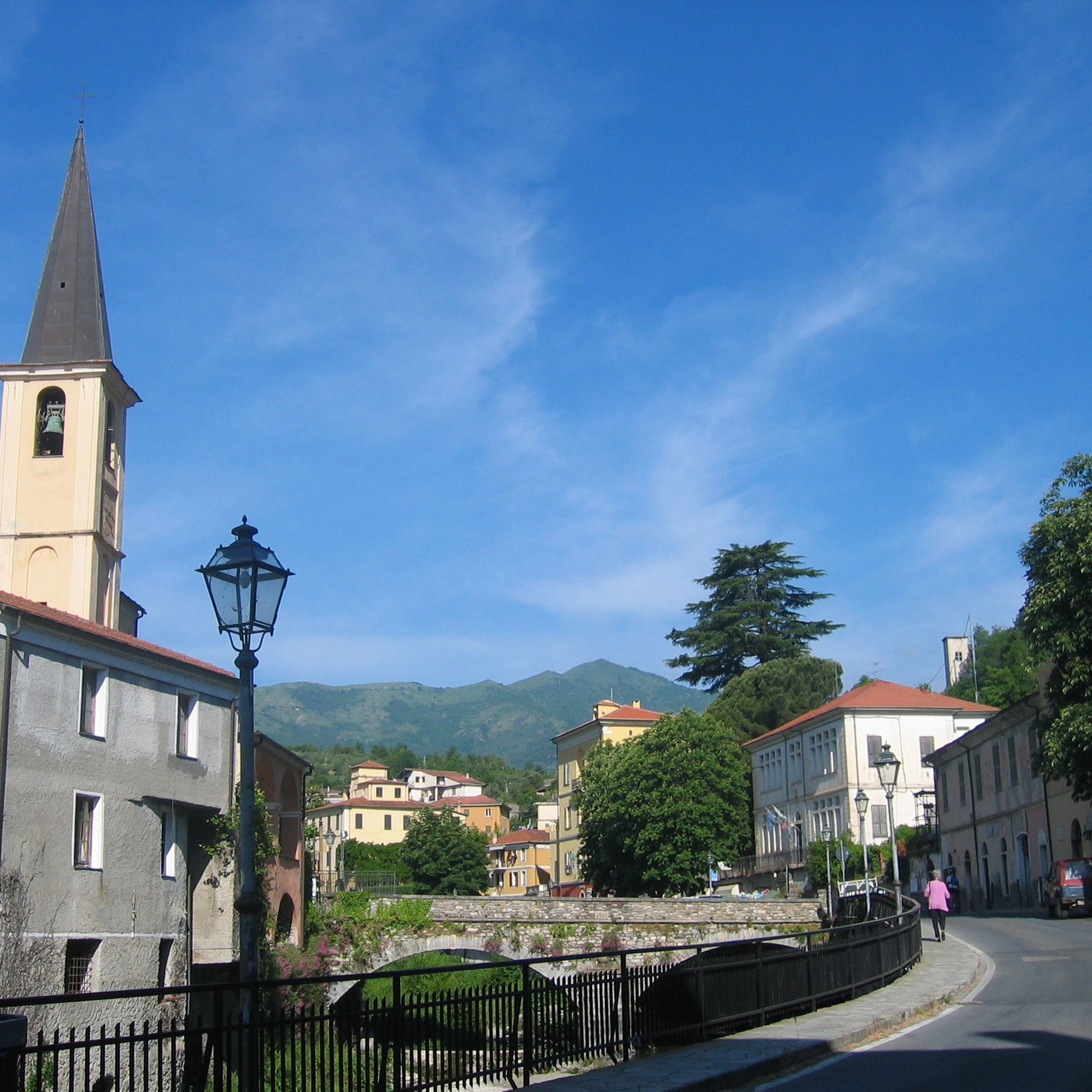
Vasia is a very beautiful town, once very rich. You can tell by the very tall bell tower, a symbol of the town, the adjoining baptistery, and some stately villas in the town.
0
0

Getting up here is challenging....but very rewarding, for the view and for the satisfaction of having pedaled among the olive trees in perfect solitude, listening to the rhythm of your breathing, with your legs pushing. Priceless emotions!!
0
0
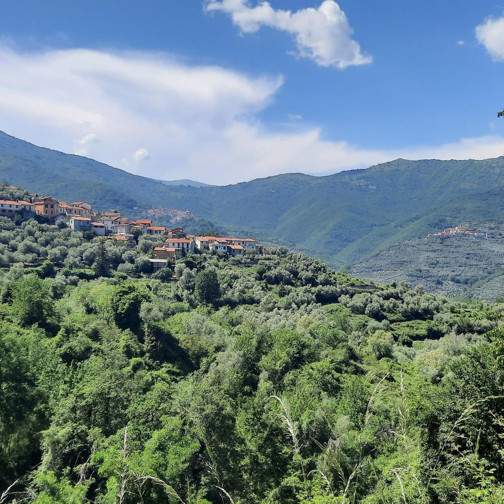
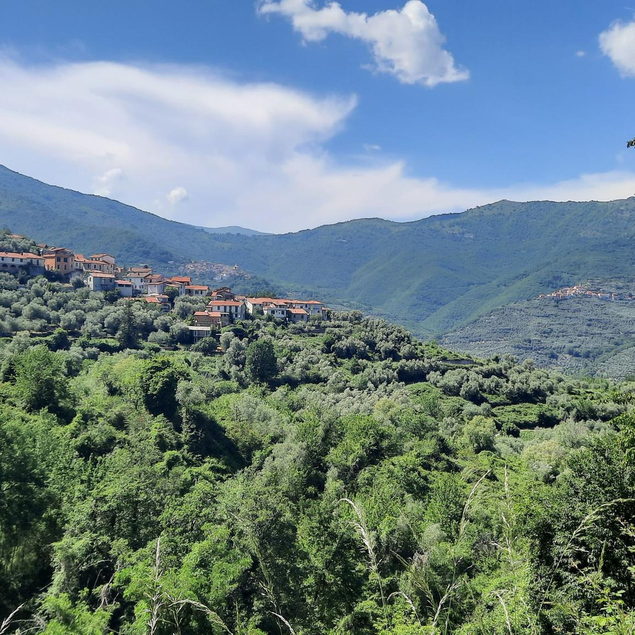
Villatalla: perhaps of origin prior to the Roman occupation. The toponyms with the Semitic-Aryan root "tala", "tel", "tula" which means "mountain, support" date back to the first inhabitants of the area. The toponym for some is of Provençal origin "small bicocca" or fortress, castle, located on the top of the mountain. - for observation, defense, fortress, etc., for others it means "flowered villa" from taleia which in Greek means flowered, but for most, and very probably with some foundation, Villa della Vallata from a total German etymology ... Wilhelm-thal, from the Lombard thal. Its parish church, already separated from the matrix of S. Giacomo di Prela in 1341, is dedicated to St. Michael the Archangel, a saint beloved by the Lombards, to whom they attributed their victory of Siponto in 663 over the Saracens. Note: until the 17th century, the Piedmontese used to call the Western Ligurians "i ficoni" meaning eaters, planters, fig traders. In Villatalla, an area behind the parish church is still called "vizzai" because in those lands the "vizze" (woven reeds) were placed with figs on top to dry in the sun. Cycling-wise, however, the view is worth all the effort to get to the village.
0
0
Worthy of note here is the ancient Maro Castle, of which only four stones remain. In ancient times, along with the less ruined Prelà Castello, it guarded the Via del Sale. It is of enormous historical importance. The village is truly beautiful, and I recommend a bike tour. Also noteworthy are the Doria Palace and the beautiful church square.
0
0
Central square of Vasia. Fountain and a little shade
1
0
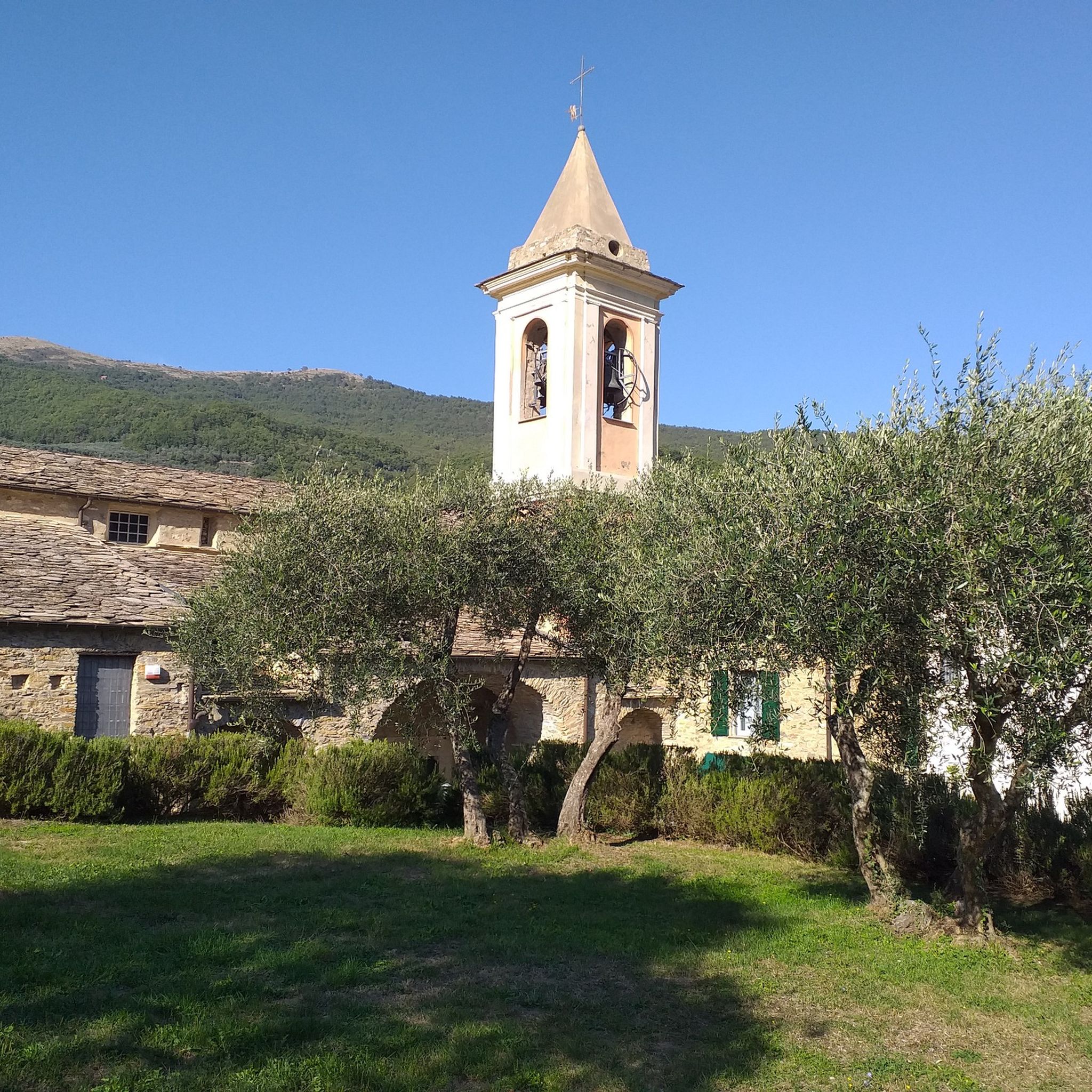
Built by prisoners at the beginning of the century, as a fine, it is a beautiful church, but not particularly decorated. However, you can always see the inside. The location is panoramic, ruined by tall trees. It's worth ringing the bell in front for good luck, at full volume!
0
0
From here the view extends over the Prino valley to the sea. The sanctuary is a characteristic example of a neo-medieval building, finished in 1934, with historical memory value for the fallen of the First World War and for the prisoners who lent their work there, supported by their chaplain don Abbo, who died in concept of holiness. It is auspicious to ring the bell placed on the church square
0
0
Frequently Asked Questions
What kind of terrain can I expect on the running trails around Borgomaro?
The running trails in Borgomaro offer a diverse landscape, ranging from centuries-old olive groves and lush chestnut woods to paths along the Impero river. You'll encounter varied topography, including ancient mule tracks and rural paths connecting charming medieval villages. Expect a mix of shaded sections, open stretches, and elevation changes, providing options for different fitness levels.
Are there running routes suitable for beginners or those looking for an easier jog?
Yes, while Borgomaro features many challenging routes, there are also options for moderate difficulty. For example, the Moltedo - ring tour is a moderate 8.5 km path with manageable elevation changes, offering a scenic loop suitable for a less strenuous run. The region has 16 moderate routes out of 50 total.
Can I find circular running routes in the Borgomaro area?
Absolutely. Many of the running routes around Borgomaro are designed as circular loops, allowing you to start and finish in the same location. Examples include the Moltedo - ring tour and the Church of San Tommaso, Dolcedo – Oratory of San Carlo loop from Dolcedo, which are popular choices among local runners.
What natural features or viewpoints can I discover along the running paths?
Borgomaro's running paths often lead to stunning natural features and panoramic viewpoints. You can find routes along the Impero river, sometimes leading to natural pools and small waterfalls. Higher vantage points may offer breathtaking views stretching from mountain ridges to the Ligurian Sea. Specific highlights include the Lecchiore Ponds, which are accessible from some trails.
Are there any historical landmarks or villages to see while running?
Yes, the routes frequently pass through or near charming medieval villages and historical sites. You might run past ancient mills, votive chapels, and historic churches. The Church of San Tommaso, Dolcedo – Oratory of San Carlo loop from Dolcedo, for instance, takes you through historical villages and natural scenery. The village of Conio, known for its medieval character, is also connected by these historical paths.
What do other runners say about the trails in Borgomaro?
The running routes in Borgomaro are highly regarded by the komoot community, holding an average rating of 4.2 stars from over 10 reviews. Runners often praise the varied terrain, the charm of the ancient olive groves, and the historical mule tracks that define the region's unique running experience.
Is Borgomaro a good destination for family-friendly running or walking?
Borgomaro offers a range of routes, and while some are challenging, others are more moderate and could be suitable for families looking for a scenic walk or a gentle jog. The varied terrain and historical villages provide an engaging environment for all ages. Look for routes with less elevation gain for a more family-friendly experience.
What is the best time of year to go running in Borgomaro?
The Maro Valley generally experiences mild temperatures, making many of its trails enjoyable almost all year round. Spring and autumn offer particularly pleasant conditions with comfortable temperatures and vibrant scenery. Even in summer, the presence of shaded paths through chestnut woods and along the Impero river provides refreshing options.
Are there any specific routes that lead to lakes or natural pools?
Yes, some running routes in the area lead to picturesque water features. The Impero river, which flows through the valley, has paths that can take you to natural pools and small waterfalls. The Lecchiore Ponds are a notable highlight that can be incorporated into a running adventure.
How many running routes are available in the Borgomaro region?
There are over 50 dedicated running routes available around Borgomaro, offering a wide variety of distances and difficulty levels. This includes 16 moderate routes and 34 more challenging options, ensuring there's a trail for every type of runner.
Can I find cafes or places to rest along the running routes?
While the routes themselves are primarily natural paths, they often connect or pass through charming rural villages like Conio, Aurigo, Lucinasco, and Borgomaro itself. These villages typically offer opportunities to find cafes, small shops, or places to rest and refuel, allowing you to combine your run with a local experience.
Are there any long-distance running options for experienced runners?
For experienced runners seeking a challenge, Borgomaro offers numerous difficult routes, with 34 out of 50 trails falling into this category. These often feature significant elevation gains and varied terrain. An example is the Ring of the Dolcedo Hamlets and Municipal Forest, a difficult 9.6 km route with over 440 meters of elevation gain.
Most popular attractions around Borgomaro

Get inspired with the komoot mobile app


Explore more
Browse the best Running Trails & Routes in other regions.
