The best walks and hikes in Sierra Pelada Y Rivera Del Aserrador
4.5
(53)
200
hikers
11
hikes
Hiking in Sierra Pelada Y Rivera Del Aserrador offers diverse landscapes within the Sierra Morena foothills, characterized by linear mountain ranges and deep riverine forests. The region features significant geological formations like the granite outcrop Piedras del Diablo and the Pelada Peak, which reaches 654 meters. The Rivera del Aserrador River carves through the area, creating gorges and supporting woodlands of cork and holm oaks. This protected area provides a remote setting for exploring varied terrain.
Best hiking trails in…
Last updated: July 9, 2026
5.0
(2)
5
hikers
Easy hike. Great for any fitness level. Easily-accessible paths. Suitable for all skill levels.
4.5
(2)
5
hikers
Easy hike. Great for any fitness level. Easily-accessible paths. Suitable for all skill levels.

Sign up for free
4.9
(16)
69
hikers
8.26km
02:25
230m
230m
Moderate hike. Good fitness required. Easily-accessible paths. Suitable for all skill levels.
5.0
(3)
11
hikers
14.9km
04:30
500m
500m
Moderate hike. Good fitness required. Easily-accessible paths. Suitable for all skill levels.
4.0
(1)
10
hikers
6.38km
01:50
160m
160m
Easy hike. Great for any fitness level. Easily-accessible paths. Suitable for all skill levels.
Get access to more routes and recommendations from other explorers.
Sign up for free
Already have an account?
Our route recommendations are based on thousands of hikes, rides, and runs completed by other people on komoot.
Start today with a free account
Your next adventure awaits.
Login or Signup



Tips from the Community

Town located in slightly uneven terrain and dedicated to agriculture and livestock, with areas of pines and eucalyptus trees. It has an extensive forest that takes its name from the stream that runs through its land. This is the reason for the economy of this town based on forestry and forest exploitation.
0
0
As you walk through the streets of Cortegana you will see various examples of monumental heritage that have survived to this day in an excellent state of preservation. You must see the Medieval Castle of Cortegana, the Hermitage of Nuestra Señora de la Piedad, the church of Divino Salvador, the hermitage of San Sebastián, the hermitage of Jesús Nazareno, the bullring, and La Casa Mudéjar.
1
0

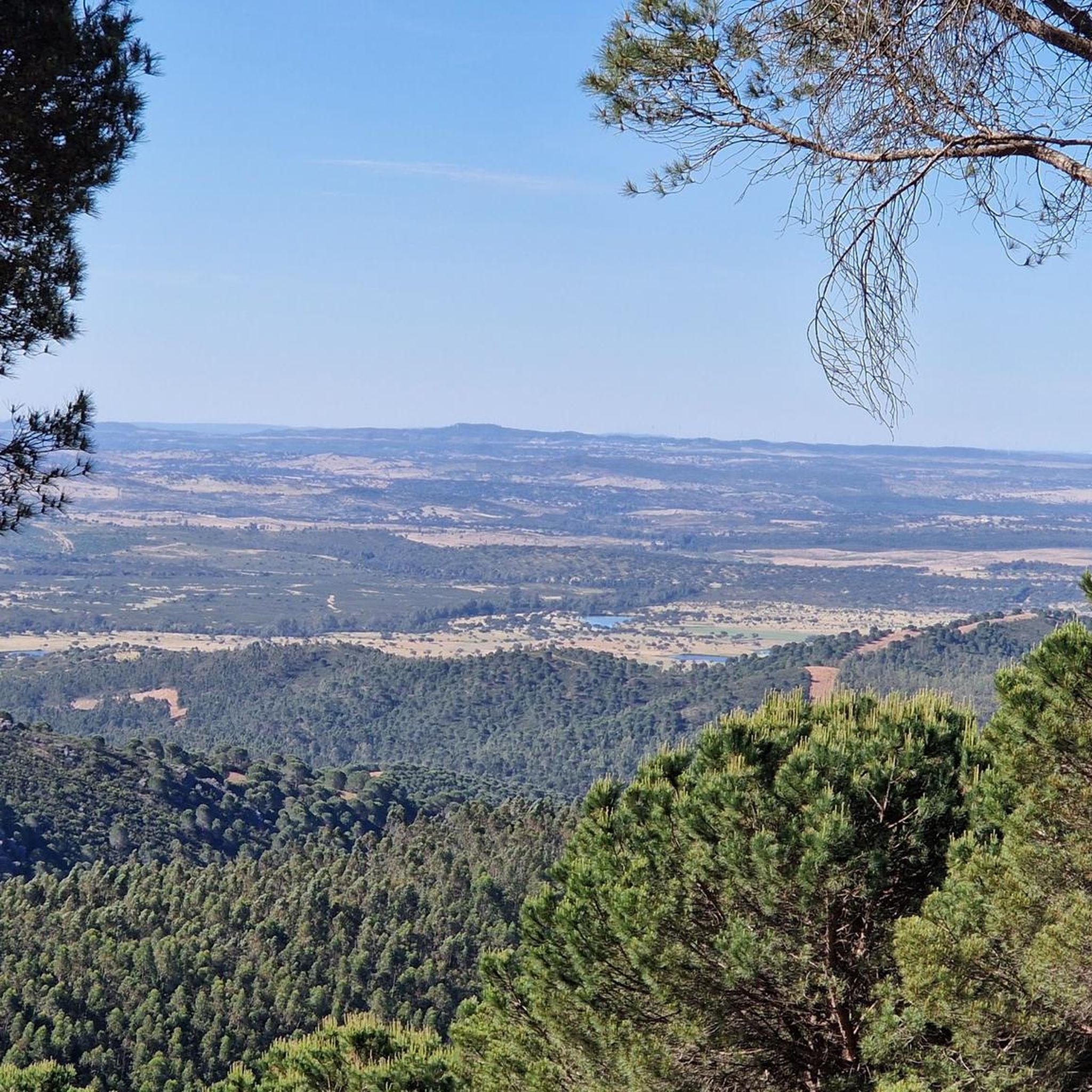
Before entering Cortegana, it is worth stopping at this viewpoint to enjoy the fantastic views of the town.
1
0
Frequently Asked Questions
What is the general difficulty level of hiking trails in Sierra Pelada y Rivera del Aserrador?
The hiking trails in Sierra Pelada y Rivera del Aserrador offer a range of difficulties, primarily focusing on easy to moderate options. Out of 8 available tours, 2 are rated as easy and 6 as moderate, making the area accessible for various fitness levels. You won't find any difficult trails here, ensuring a pleasant experience for most hikers.
Are there any easy hiking trails suitable for beginners or casual walkers?
Yes, Sierra Pelada y Rivera del Aserrador features several easy trails. For instance, the Camping Ribera del Chanza loop from Cortegana is a 4.0-mile (6.4 km) route that takes about 1 hour 50 minutes, leading through pleasant riverine landscapes. Another easy option is the View of Sierra de Aracena – Cortegana Castle loop from Cortegana, which is 3.7 miles (5.9 km) long.
Can I bring my dog on the hiking trails in Sierra Pelada y Rivera del Aserrador?
Sierra Pelada y Rivera del Aserrador is a protected natural area, and while specific regulations for dogs can vary, generally, dogs are permitted on trails if kept on a leash. This helps protect the diverse wildlife, including otters, wildcats, and a significant colony of black vultures. Always ensure your dog is under control and respect local signage.
What kind of wildlife can I expect to see while hiking?
The region is a Special Protection Zone for Birds (ZEPA) and is renowned for its birdlife, including one of Andalusia's largest colonies of black vultures. You might also spot golden and booted eagles, black storks, and various owls, especially from peaks like Pelada, Mármol, and Mojón. Mammals such as otters, wildcats, mongoose, wild boar, and deer also inhabit the area.
Are there any circular hiking routes available?
Yes, many of the trails in Sierra Pelada y Rivera del Aserrador are designed as loops. For example, the popular View of Sierra de Aracena – View of Sierra de Aracena loop from Cortegana is a moderate 5.1-mile (8.3 km) route. Another option is the Cortegana Viewpoint loop from Cortegana, a longer moderate path at 9.2 miles (14.9 km) with significant elevation gain.
What is the best time of year to go hiking in Sierra Pelada y Rivera del Aserrador?
The varied topography and lush vegetation make Sierra Pelada y Rivera del Aserrador enjoyable across seasons. Spring and autumn generally offer the most pleasant hiking conditions with milder temperatures and vibrant landscapes. Summer can be hot, but the riverine forests provide shade. Winter hiking is also possible, offering a serene and quiet experience.
Are there any notable geological features or landmarks to look out for?
Absolutely. A central geological highlight is the spectacular granite outcrop known as the Piedras del Diablo (Devil's Rocks). The area also features other impressive slate and quartzite rock formations. The Rivera del Aserrador River carves deep gorges through the landscape, adding to the dramatic scenery.
How long do hikes typically take in this region?
Hikes in Sierra Pelada y Rivera del Aserrador vary in length and duration. Easy trails, like the Camping Ribera del Chanza loop, can be completed in under two hours. Moderate routes, such as the Vila Verde de Ficalho loop from Vila Verde de Ficalho (7.4 miles / 11.9 km), typically take around 3 hours 15 minutes, while longer moderate trails can extend to over 4 hours.
What do other hikers say about the trails in Sierra Pelada y Rivera del Aserrador?
The routes in Sierra Pelada y Rivera del Aserrador are highly rated by the komoot community, with an average score of 4.7 stars from over 40 reviews. Hikers often praise the tranquil and remote atmosphere, the diverse landscapes featuring riverine forests and oak woodlands, and the opportunity for wildlife observation, particularly birdwatching.
Is public transport available to access the hiking areas?
Sierra Pelada y Rivera del Aserrador is known for its remoteness. While some nearby towns like Cortegana, Almonaster La Real, and Aroche may have limited public transport connections, direct access to trailheads within the natural area via public transport is generally limited. It is often more convenient to access the area by car.
Where can I find parking for hiking trails?
Given the area's remote nature, designated parking areas might be limited. However, you can typically find parking in or near the villages that serve as starting points for many trails, such as Cortegana or Vila Verde de Ficalho. Always check local signs for parking regulations and availability.
Are there any challenging hikes for experienced hikers?
While there are no trails rated as 'difficult' in the komoot guide for Sierra Pelada y Rivera del Aserrador, some moderate routes offer a good challenge. The Cortegana Viewpoint loop from Cortegana, at 9.2 miles (14.9 km) with nearly 500 meters of elevation gain, provides a substantial workout and panoramic views for those seeking a longer, more strenuous outing.
Most popular routes in Sierra Pelada Y Rivera Del Aserrador

Get inspired with the komoot mobile app


Explore more
Browse the best Hikes in other regions.
