The best walks and hikes around Río Támega
4.2
(7)
51
hikers
22
hikes
Hiking around Río Támega offers diverse landscapes, from narrow mountain gorges to wide river valleys. The region is characterized by prominent mountain ranges, including Aboboreira, Marão, and Montemuro, which provide varied terrain. Along the Río Támega, hikers encounter picturesque riverine scenery, calm reservoirs, and lush green forests. Rural villages and terraced vineyards also dot the area, adding cultural context to the natural environment.
Best hiking trails around Río Támega
- The most popular hiking route is San Mamede loop from Rebordechau…
Last updated: August 22, 2026
7
hikers
11.8km
04:16
740m
740m
Moderate hike. Good fitness required. Easily-accessible paths. Suitable for all skill levels.
10
hikers
10.6km
02:56
180m
180m
Moderate hike. Good fitness required. Easily-accessible paths. Suitable for all skill levels.

Sign up for free
4.0
(2)
11
hikers
7.19km
02:01
130m
130m
Moderate hike. Good fitness required. Easily-accessible paths. Suitable for all skill levels.
5
hikers
13.4km
03:45
270m
270m
Moderate hike. Good fitness required. Easily-accessible paths. Suitable for all skill levels.
3
hikers
5.37km
01:22
20m
20m
Easy hike. Great for any fitness level. Easily-accessible paths. Suitable for all skill levels.
Get access to more routes and recommendations from other explorers.
Sign up for free
Already have an account?
Our route recommendations are based on thousands of hikes, rides, and runs completed by other people on komoot.
Start today with a free account
Your next adventure awaits.
Login or Signup
Tips from the Community

The Cabreiroá Spa is one of Galicia's most emblematic thermal resorts, renowned for the quality of its mineral-medicinal waters and a history that blends science, modernist architecture, and thermal tradition. As early as the 19th century, a pool existed there, used by locals to treat stomach and bladder problems, and to promote wound healing.
2
1


Regional strategic city on the old trade route to Portugal and a stopping point on the Camino de la Plata. Do not forget to see the Castillo de Monterrei overlooking the town.
1
0
A 12th-century defensive fortress of Castillo de Monterrey sits on a hill overlooking the town of Verín, near the border between Galicia and Portugal. The national monument is the best preserved fortress in Galicia. There are fantastic views from the castle over the surrounding Galician plateau.
1
0

Located in the village of Cabreiroá, is the Cabreiroá Spa, made up of a spring, the mineral water bottling facilities and the spa itself. Currently, it is closed, but it is possible to visit part of the enclosure. Admission for your visit is free, although you must check the opening hours, as these may vary.
2
1
Magnificent waterfall in the Rego das Quintas, a tributary of the Abedes River that rises on Mount Fraga de Lobos. Due to the large rocks that surround the well, it is impossible to see the full magnitude of this great waterfall. A sign, next to the sound of water, indicates the descent to the river. Although the path is quite accessible, you have to be careful not to slip on rainy days. To be able to see the waterfall, you have to look below, in an opening between the stones.
2
2
Castle of Monterey. Recreational public parking space. The Parador de Verín hotel at the top of the hill has a cafeteria and a restaurant
1
1

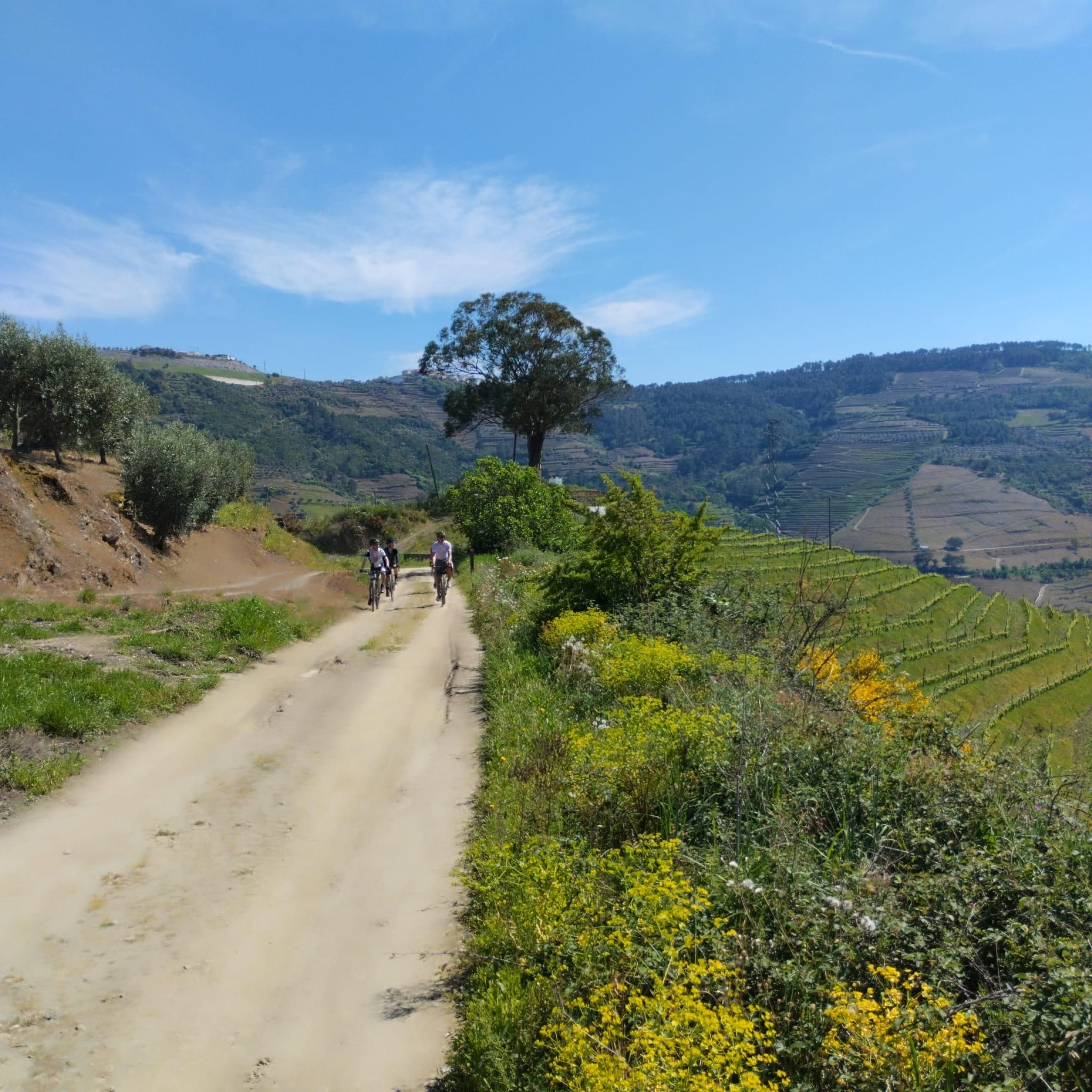
gravel and mtb tracks to the fullest
1
0
Frequently Asked Questions
How many hiking trails are available around Río Támega?
There are 11 hiking routes available around Río Támega, offering a range of experiences from easy riverside strolls to more challenging mountain ascents. The region's diverse topography includes narrow mountain gorges, wide river valleys, and picturesque riverine scenery.
What are the different difficulty levels for hiking trails in Río Támega?
The hiking trails around Río Támega cater to various fitness levels. You'll find 3 easy routes, 7 moderate routes, and 1 difficult route. This variety ensures options for casual walkers and experienced hikers alike, with terrain ranging from gentle river paths to more demanding mountain ascents.
Are there any family-friendly hiking options in Río Támega?
Yes, Río Támega offers several easy routes suitable for families. For instance, the Chaves Old Town – Nadir Afonso Foundation loop from Chaves is an easy 7 km trail that takes you through historic areas. Another easy option is the Pilgrim's Corner Café loop from A Alberguería, which is just under 3.5 km.
What kind of natural features can I expect to see on hikes in Río Támega?
Hiking in Río Támega offers diverse natural beauty. You'll encounter narrow mountain gorges, wide river valleys, and lush green forests. The region is defined by prominent mountain ranges like Aboboreira, Marão, and Montemuro, providing stunning panoramic views. Picturesque river landscapes, calm reservoirs, and charming river islands are also common sights.
Are there any trails that feature waterfalls in the Río Támega area?
Yes, one notable trail that includes a waterfall is the Balneario de Cabreiroá – Pozo do Demo Waterfall loop from Verín. This moderate 10 km path follows riverside routes and leads directly to the Pozo do Demo Waterfall, offering a refreshing natural highlight.
What historical landmarks or cultural sites can be explored on hikes in Río Támega?
The region is rich in historical and cultural heritage. You can explore routes that pass through traditional villages and historic centers. For example, the Verín – Castle of Monterrei loop from Verín leads directly to the historic Castle of Monterrei. The town of Amarante, known for its São Gonçalo Bridge and 16th-century Monastery of São Gonçalo, also serves as an excellent base for exploring such sites.
Are there any circular hiking routes available in Río Támega?
Many of the trails in Río Támega are designed as circular routes, allowing you to start and end in the same location. Examples include the challenging Pico San Mamede loop from Rebordechau, the moderate Balneario de Cabreiroá loop from Verín, and the easy Alto da Medorra loop from Cortegada.
What do other hikers enjoy most about the trails in Río Támega?
The trails around Río Támega are highly rated by the komoot community, with an average score of 5.0 stars from over 3 reviews. Hikers often praise the diverse landscapes, from the challenging mountain views to the serene riverine scenery, and the opportunity to explore rural villages and historical sites.
Is there a long-distance trail in the Río Támega region?
Yes, the Tâmega Ecotrail (Ecopista do Tâmega) is a significant long-distance option, stretching for nearly 40 kilometers. It connects Amarante to Cabeceiras de Basto, passing through Celorico de Basto. This trail guides adventurers through the Tâmega Valley, alongside the Marão Mountain Range, and into the Nature Park of Alvão and Terras de Basto.
What is the best time of year to go hiking in Río Támega?
The Río Támega region offers pleasant hiking conditions for much of the year. Spring and autumn generally provide mild temperatures and vibrant scenery, making them ideal for exploration. Summers can be warm, especially in the valleys, while winters are cooler but still offer opportunities for hiking, particularly on lower elevation trails.
Are there any trails that offer significant elevation gain for a more challenging hike?
For those seeking a challenge with significant elevation gain, the San Mamede loop from Rebordechau is an excellent choice. This 12.1 km trail features over 750 meters of ascent, offering expansive views of the surrounding mountains. Another demanding option is the Pico San Mamede loop from Rebordechau, which covers 23.1 km with over 850 meters of elevation gain.
Most popular routes around Río Támega

Get inspired with the komoot mobile app


Explore more
Browse the best Hikes in other regions.
