Top 3 Lakes around Unorganized North Algoma
Best lakes around Unorganized North Algoma are found in a vast region of northeastern Ontario, Canada, characterized by abundant natural beauty and numerous lakes. This area is a significant part of the Great Lakes basin, offering diverse recreational opportunities. The landscape features rugged coastlines, dense forests, and geological formations, making it a destination for nature enthusiasts. It is known for its wilderness character and opportunities for various outdoor activities.
Best lakes around Unorganized North Algoma
- The most popular lakes is St. Mary's Island, an other natural area that is a popular tourist destination in the Whitefish Channel on the St. Mary's River. It is known for its wild animals such as beavers, muskrats, and minks, as well as numerous water and songbirds.
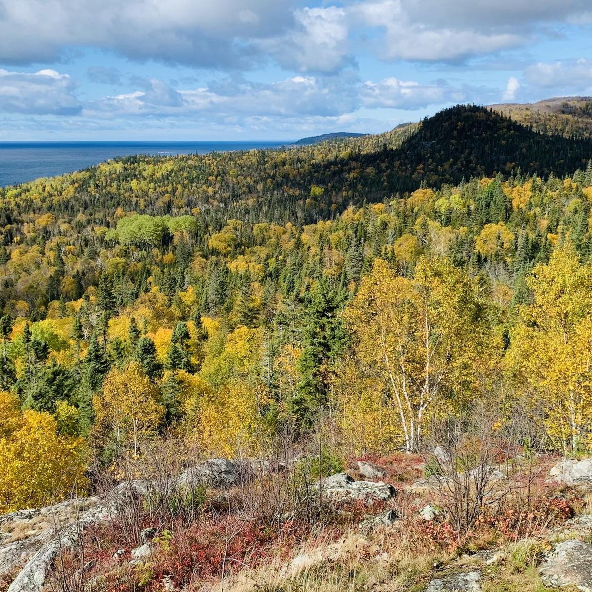
- Another must-see spot is Lake Superior Provincial Park, an other natural area covering more than 160,000 hectares along the rugged Lake Superior shoreline. Visitors can expect dramatic cliffs, sandy beaches, waterfalls, and inland lakes, offering world-class hiking, paddling, and trout fishing.
- Visitors also love Lake Superior Provincial Park, an other natural area stretching along a wild section of Superior’s coastline. This part of the park mixes rugged granite headlands, quiet beaches, and dense northern forest, with a trail network ranging from easy lakeside walks to tougher routes with rocky scrambles and big lake views.
- Unorganized North Algoma is known for large freshwater lakes, provincial parks, and secluded inland lakes. The region offers a variety of lakes to explore, from vast expanses like Lake Superior to more tranquil, remote bodies of water.
- The lakes around Unorganized North Algoma are appreciated by the komoot community, with 3 upvotes and 2 photos shared by visitors.
Last updated: August 24, 2026
Agawa Rock Pictographs
Highlight • Historical Site
Although the glyphs are only a short distance from the parking area this is not a hike one should attempt during inclement weather since you need to negotiate a narrow rock shelf right at the water level in order to access the site.
Tip by

St. Mary's Island
Highlight • Natural
Translated by Google •
Tip by

Sign up now to discover places like this
Get recommendations on the best single tracks, peaks, & plenty of other exciting outdoor places.
Sign up for free
Old Woman Bay
Highlight • Beach
Tip by

Orphan Lake
Highlight • Lake
The Orphan Lake depends on precipitation water and the rivulets that flow from the surrounding hills into the lake. The lake drains to the northwest via a stream into the Baldhead River.
Access to Orphan Lake on the south and north shores is via the Orphan Lake Trail.
(Visit on May 31, 2026)
Showing Translation
Tip by

Agawa River Mouth
Highlight • River
(Visit on May 30, 2026)
Showing Translation
Tip by
Sign up for free to discover even more lakes around Unorganized North Algoma.
Sign up for free
Already have an account?
Start today with a free account
Your next adventure awaits.
Login or Signup


Other adventures around Unorganized North Algoma

Tips from the Community

Old Woman Bay is located in the north of Lake Superior Provincial Park – about 25 kilometers away from the small town of Wawa. Access is via Highway 17 (Trans-Canada Highway), which runs directly past the bay. The South Old Woman River flows into Lake Superior on the sandy beach. The name Old Woman Bay comes from a distinctive rock formation in the bay. Viewed from a distance and from a certain angle, the contours of the rock cliffs form the profile of an old woman's face. The popular Nokomis Trail begins at the parking lot by the bay. (Visit on June 2, 2026)
0
0
The Orphan Lake is one of the many small lakes in Lake Superior Provincial Park, whose formation dates back to the last Ice Age. The ice sheets moved across the terrain, creating depressions depending on the different bedrock. As the glaciers retreated, the depressions filled with water and the small lakes formed. The Orphan Lake depends on precipitation water and the rivulets that flow from the surrounding hills into the lake. The lake drains to the northwest via a stream into the Baldhead River. Access to Orphan Lake on the south and north shores is via the Orphan Lake Trail. (Visit on May 31, 2026)
0
0
The visit to the rock art site is a short walk steeply down to the coast. Everywhere there are signs with warnings indicating the dangerous undertaking. The somewhat steep, walkable rocks are extremely exposed to water; during storms and wet conditions, there is a risk to life. People have died or been injured during visits when they were washed into the water. It looks as if there used to be a walkable platform. However, during our visit on May 31, 2026, none of this is an issue: with calm seas and a bright blue sky, we can view the somewhat faded paintings together. The passage on Highway 17 is closed today; since we have already been in Lake Superior Provincial Park since yesterday and will be staying for a few more days, we are not affected by the road closure.
0
0

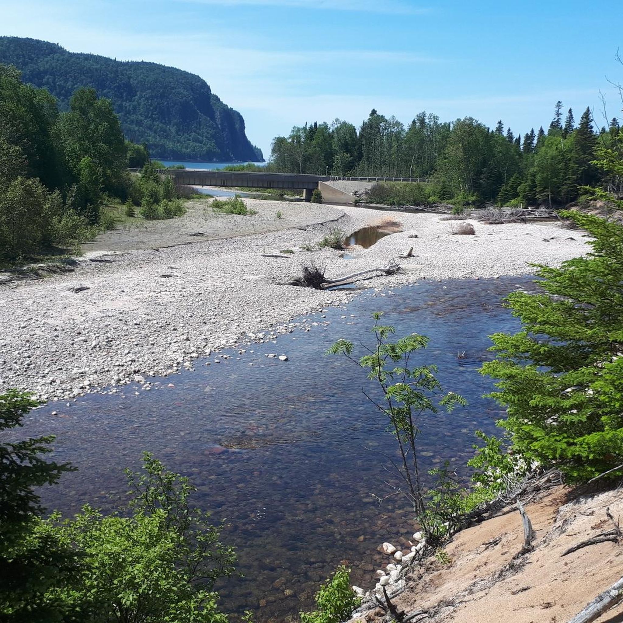
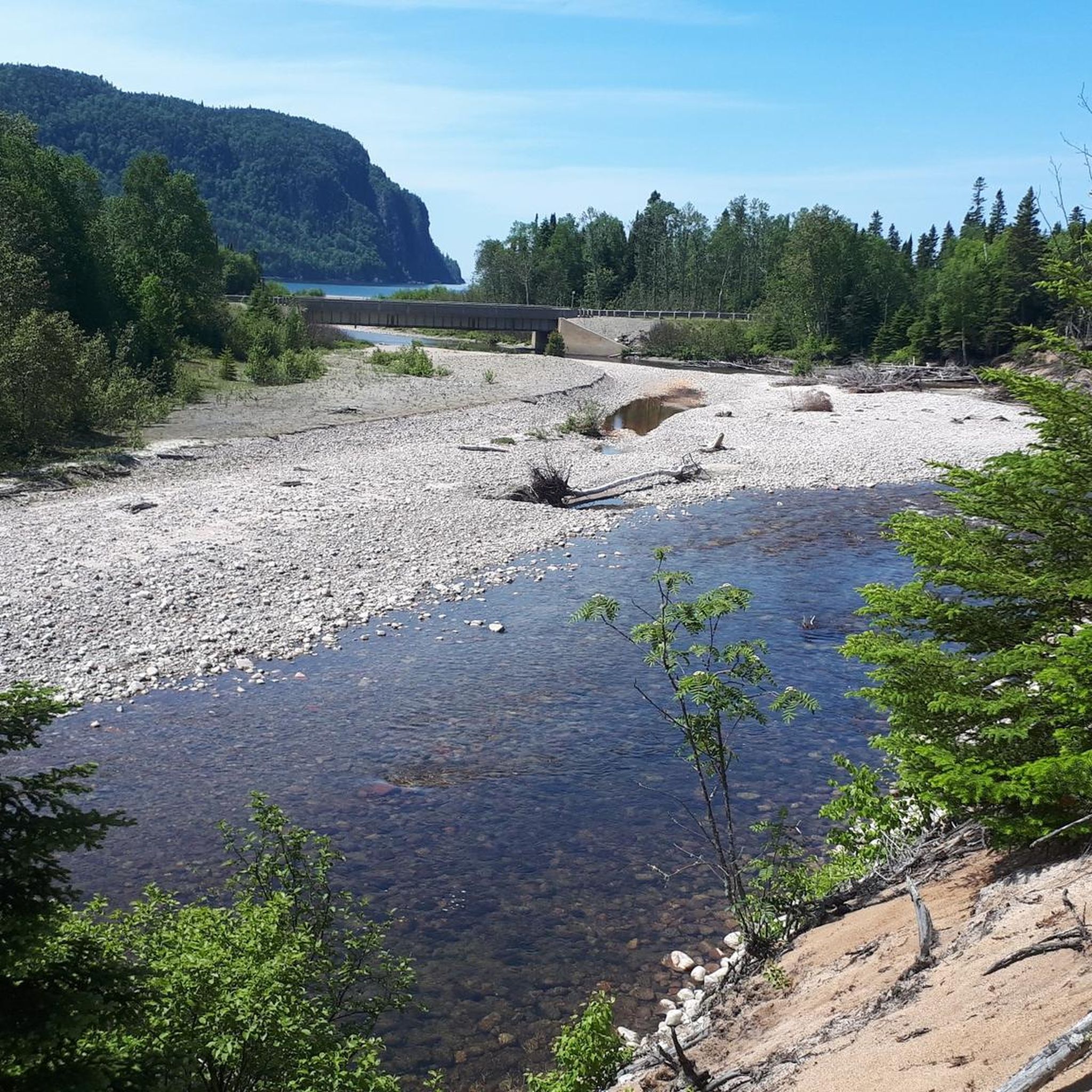
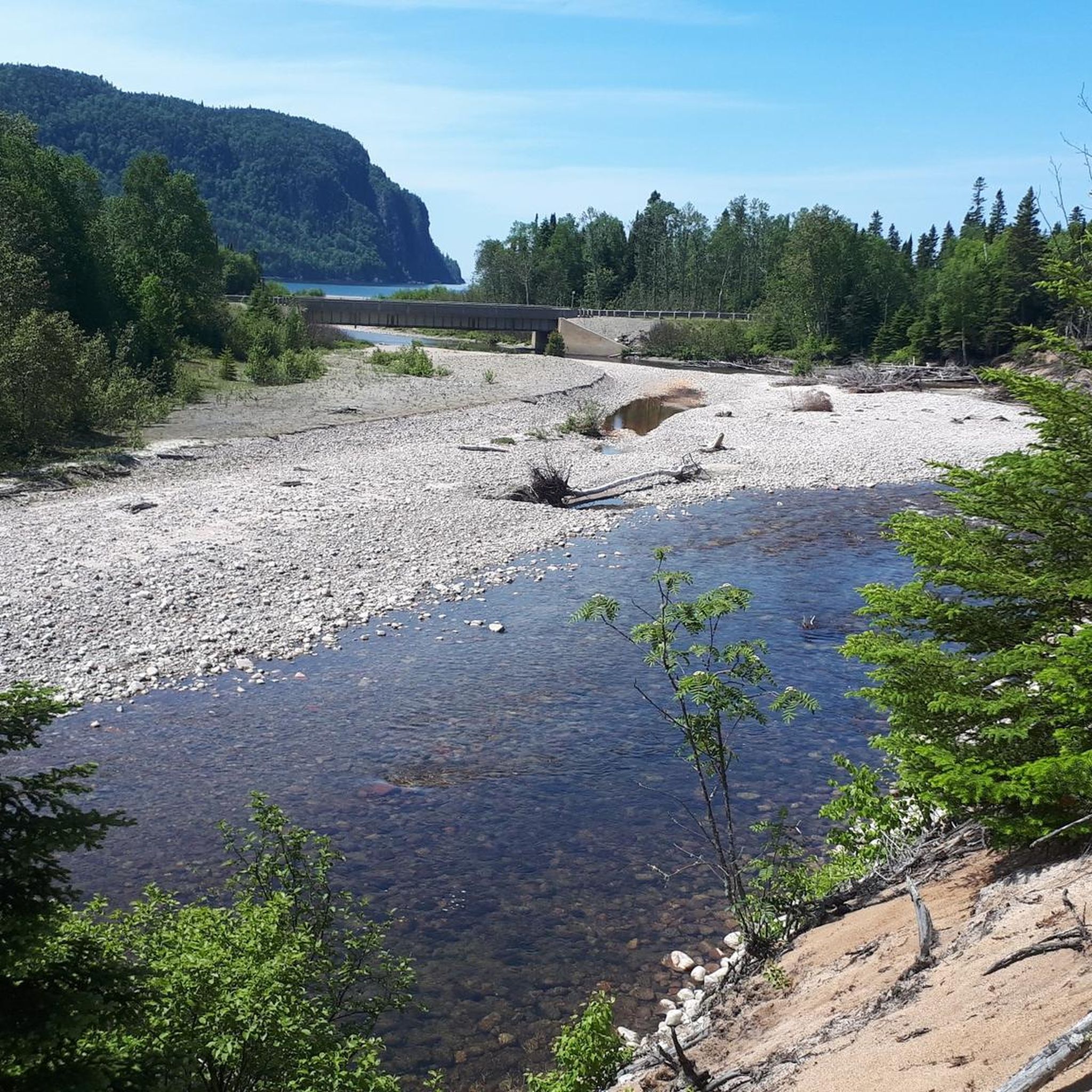
The beach at Agawa Bay ends to the north at the mouth of the Agawa River into Lake Superior. On the Voyageur Trail, a section of the Trans Canada Trail or the Lake Superior Coastal Trail, we reach the mouth area from the campground through a pine forest, a confusing and only partially accessible wetland. For us, the walk ends at Highway 17 a few hundred meters before the road bridge over the river. (Visit on May 30, 2026)
0
0
On the Canadian side, two islands lie in the river, St. Marys Island and Whitefish Island. The islands were an important meeting place for the Anishinaabe First Nation for fishing and trade between Lake Huron and Lake Superior until colonization by Europeans and were called Baawaating, place of the rapids. To make the St. Marys River navigable for trade, especially with furs, a huge canal was built through St. Marys Island at the end of the 19th century; it was the longest lock in the world at the time. There is a height difference of approx. 7 meters between Lake Superior and Lake Huron. (Visit on May 27, 2026)
0
0

The Agawa Rock Pictographs are a collection of 35 red-ochre paintings on the face of Lake Superior's towering granite cliffs. In Ojibwe, the area is known as Mazinaubikinguning, meaning "the adorned rock of Lake Agawa". Although the glyphs are only a short distance from the parking area this is not a hike one should attempt during inclement weather since you need to negotiate a narrow rock shelf right at the water level in order to access the site.
0
0

Frequently Asked Questions
What natural features can I explore around the lakes in Unorganized North Algoma?
The region is rich in natural beauty. You can find dramatic cliffs, pristine sandy beaches, and numerous waterfalls, especially within Lake Superior Provincial Park. The park also features ancient forests and diverse landscapes, including clifftop vistas and serene inland lakes. St. Mary's Island offers views of the St. Mary's River and its surrounding natural environment.
Are there good hiking opportunities near the lakes?
Yes, there are excellent hiking opportunities. Lake Superior Provincial Park offers world-class hiking trails, from easy lakeside walks to tougher routes with rocky scrambles and big lake views. Trails like the Awausee Trail provide panoramic views of Lake Superior, while the Orphan Lake Trail showcases diverse landscapes. For more options, you can explore easy hikes or family-friendly hikes in the area, including routes like Robertson Cliffs via Ila’s Loop and the Lake Superior Coastal Trail.
Which lakes are suitable for family visits?
Many areas are family-friendly. St. Mary's Island is noted as a family-friendly spot where you can observe wildlife. Lake Superior Provincial Park also offers accessible areas with sandy beaches like Agawa Bay Beach and Pancake Bay Beach, which are great for families. The park has a mix of accessible and remote landscapes, catering to various family needs.
Can I go kayaking or paddling on these lakes?
Absolutely. The lakes in Unorganized North Algoma, particularly Lake Superior, are renowned for paddling. Sea kayaking on Lake Superior is considered among the best in North America due to its rugged coastline and pristine waters. Many inland lakes also offer serene environments for canoeing and kayaking.
What historical or cultural sites are there near the lakes?
The region has some interesting historical connections. Lake Superior Provincial Park, established in 1944, offers insights into the region’s rich cultural history at the Agawa Bay Visitor Centre. Additionally, Island Lake, near Heyden, is part of a community with historical significance, having hosted Canadian military installations and a train station for the Algoma Central and Hudson Bay Railway.
When is the best time to visit the lakes in Unorganized North Algoma?
The lakes are beautiful year-round, but for vibrant fall colors, visiting during autumn is highly recommended, especially for areas like Agawa Canyon, which is accessible by train and showcases spectacular landscapes. Summer offers ideal conditions for water activities like swimming, kayaking, and hiking.
Are there any secluded or quiet lakes for a peaceful experience?
Yes, for those seeking tranquility and a remote experience with minimal crowds, Fushimi Lake Provincial Park is an excellent choice. The Achilles Lake Trail within the park leads to a serene lake view, focusing on the natural beauty of water, trees, and sky.
What kind of wildlife can I expect to see near the lakes?
The region is home to diverse wildlife. On St. Mary's Island, you can spot wild animals like beavers, muskrats, and minks, along with numerous water birds and songbirds. The vast wilderness of Unorganized North Algoma and its provincial parks provide habitats for a wide array of species, making wildlife viewing a common activity.
Are there options for accommodation near the lakes?
Yes, accommodation options are available. For instance, lakeside cottages are available for rent around Island Lake, offering a relaxing getaway. Within Lake Superior Provincial Park, backcountry camping is an option for those looking for a more immersive nature experience.
What other outdoor activities can I do besides hiking around the lakes?
Beyond hiking, the lakes and surrounding areas offer a variety of outdoor activities. You can enjoy world-class paddling, especially sea kayaking on Lake Superior, and trout fishing. The region also supports mountain biking, running, and ATVing. For running enthusiasts, there are several running trails around Unorganized North Algoma, including routes around Sault Ste. Marie.
Are there any beaches for swimming or relaxing by the lakes?
Yes, Lake Superior Provincial Park is known for its pristine sandy beaches, such as Agawa Bay Beach, Old Woman Bay Beach, and Pancake Bay Beach, which are perfect for swimming and relaxation. The rugged coastline also features many quiet beaches along the Superior shoreline.
What makes Lake Superior Provincial Park a significant destination?
Lake Superior Provincial Park is significant for its vast size (over 160,000 hectares), dramatic cliffs, sandy beaches, waterfalls, and numerous inland lakes. It offers world-class hiking, paddling, and trout fishing, with diverse trails and opportunities for backcountry camping. Its mix of accessible and remote landscapes, along with its rich cultural history, makes it a spectacular destination for nature lovers and adventure seekers.
Is there a lake with a unique historical context?
Island Lake, situated in the Aweres local services board, holds a unique historical context. It's part of a rural settlement that once hosted Canadian military installations and a train station for the Algoma Central and Hudson Bay Railway, offering a blend of natural beauty and historical intrigue.
Most popular routes around Unorganized North Algoma
Most popular attractions around Unorganized North Algoma

Get inspired with the komoot mobile app


Explore more
Still not found your perfect lake around Unorganized North Algoma? Check out the guides of these regions to see even more beautiful places.
