The best dog-friendly hikes and walks in Fannin County
4.8
(75)
1,216
hikers
4
hikes
Dog friendly hiking trails in Fannin County traverse the Blue Ridge Mountains, offering varied terrain within the Chattahoochee-Oconee National Forest. The region features elevations from 1,760 to over 4,000 feet, with routes winding through diverse forests and along the Toccoa River. This landscape provides a range of hiking experiences, from river valleys to higher mountain sections.
Best dog friendly hiking trails in Fannin County
- The most popular dog friendly hiking route is Benton MacKaye & Duncan Ridge Trail to Toccoa River, a 3.6 miles (5.8 km) trail that takes 1 hour 49 minutes to complete. This moderate route follows a section of the Benton MacKaye Trail alongside the Toccoa River.
- Another top favourite among local hikers is Toccoa River – Toccoa River Swinging Bridge loop from Wallalah Mountain, a moderate 7.0 miles (11.3 km) path. This loop includes the scenic Toccoa River Swinging Bridge and offers views of the surrounding forest.
- Local hikers also love the Benton MacKaye Trail: GA 60 to Wilscot Gap, a 11.1 miles (17.9 km) trail leading through the Chattahoochee-Oconee National Forest, often completed in about 5 hours 49 minutes.
- Hiking in Fannin County is defined by the Blue Ridge Mountains, the Toccoa River, and extensive sections of the Chattahoochee-Oconee National Forest. The network offers options for different ability levels, from moderate river walks to more challenging mountain ascents.
- The routes in Fannin County are highly rated by the komoot community with an average score of 4.9 stars from over 54 reviews. More than 894 hikers have used komoot to explore Fannin County's varied terrain.
Last updated: October 10, 2026
2
hikers
5.79km
01:50
200m
230m
Embark on a moderate hike along the Benton MacKaye & Duncan Ridge Trail to Toccoa River, a 3.6-mile (5.8 km) route that takes you through the diverse North Georgia wilderness. You will gain 649 feet (198 metres) in elevation, typically completing the journey in about 1 hour and 49 minutes. As you traverse the path, you will encounter thickets of laurel and rhododendron, leading you to the impressive 270-foot-long Toccoa River Swinging Bridge. From the bridge, enjoy expansive views of the wide, flowing Toccoa River, and keep an eye out for a small, cascading waterfall on the opposite bank. The trail offers a rewarding experience, especially in fall and winter when thinning foliage reveals spectacular mountain vistas. To begin your adventure, you can find convenient parking available at the Tooni Gap Trailhead. This trail is accessible year-round, but the cooler months offer clearer views and a pleasant hiking environment. If you are considering an extended trip, camping is permitted along the Toccoa River near the swinging bridge. Always check local conditions before you head out to ensure a smooth visit. This section of the trail is part of the much larger Benton MacKaye Trail, which stretches for nearly 300 miles through the Appalachian Mountains. It provides a taste of the extensive network of paths available in the Chattahoochee-Oconee National Forest. The route is notable for its blend of forest immersion and the unique experience of crossing the Toccoa River on its iconic swinging bridge. It offers a perfect opportunity to connect with nature and explore the rich ecosystem of North Georgia.
1
hikers
17.9km
05:49
830m
710m
Prepare for a difficult hiking challenge on the Benton MacKaye Trail: GA 60 to Wilscot Gap, a route spanning 11.1 miles (17.9 km) with an elevation gain of 2721 feet (829 metres). This section, estimated to take around 5 hours and 49 minutes, leads you through the Southern Appalachian Mountains. You'll experience an undulating terrain, passing through diverse forest types, from vibrant hardwood stands of Poplar, Maple, and Hickory to areas dominated by Pine trees. Keep an eye out for abundant wildflowers as you traverse this remote and peaceful section, with winter views revealing adjacent ridges and pastoral valleys. The journey offers a true sense of solitude as you navigate past features like Wallalah Mountain and Licklog Mountain.
Access this section of the Benton MacKaye Trail from Wilscot Gap, conveniently located on GA 60. While the trail is generally accessible, planning your visit during optimal weather conditions will enhance your experience. If you are considering an overnight trip, a well-maintained, level, and open grassy area near Ledford Gap provides a suitable spot for camping. Always check local conditions before heading out, especially for seasonal changes that might affect trail access or visibility. Parking is typically available near the trailhead, but it's wise to arrive early on busy days.
This segment of the Benton MacKaye Trail offers a deep dive into the Chattahoochee-Oconee National Forest, showcasing the rich biodiversity of the Southern Appalachian Mountains. The trail's remote character provides a unique opportunity to disconnect and immerse yourself in nature. You'll encounter a variety of ecosystems, from dense forests to more open areas, reflecting the region's varied topography. This route is a testament to the enduring beauty of Georgia's wilderness, providing a challenging yet rewarding experience for dedicated hikers.

494km
153:32
18,040m
18,170m
Embark on the Benton MacKaye Trail, a difficult 307.2-mile (494.3 km) hiking route that winds through the Southern Appalachian Mountains. You will experience a rugged journey through dense temperate forests, often passing through mountain laurel slicks and rhododendron tunnels. The trail offers glorious ridgeline views, countless mountain stream crossings, and the beauty of waterfalls like Long Creek Falls. A memorable highlight is crossing the Toccoa River on a picturesque swinging bridge, providing unique perspectives of the landscape. Expect to gain 59191 feet (18041 metres) in elevation, with an estimated duration of 153 hours and 31 minutes to complete the entire route. This trail promises an immersive and challenging adventure for experienced hikers.
Planning your visit requires careful preparation due to the trail's remoteness and minimal infrastructure; self-reliance is essential. Be ready for frequent elevation changes and sections that can become overgrown, adding to the wild feel of the journey. It is important to note that creek crossings may become impassable after heavy rains, so always check conditions before you set out. Consider the time of year for your hike, as weather can significantly impact trail conditions and water levels. Proper gear, navigation tools, and sufficient supplies are crucial for a safe and enjoyable experience on this demanding path.
The Benton MacKaye Trail stands out as a more remote and less crowded alternative to its famous counterpart, the Appalachian Trail. It offers a unique opportunity to explore the natural beauty of the Southern Appalachians, including a significant portion within Great Smoky Mountains National Park. The trail's design emphasizes solitude and a deeper connection with nature, making it ideal if you seek a challenging long-distance hike away from the crowds. Its distinct character and challenging terrain make it a notable destination for serious hikers looking for an extended wilderness experience. This route provides a profound journey through one of America's most cherished natural landscapes.
7
hikers
11.3km
03:35
430m
430m
Moderate hike. Good fitness required. Mostly accessible paths. Sure-footedness required.
Our route recommendations are based on thousands of hikes, rides, and runs completed by other people on komoot.
Start today with a free account
Your next adventure awaits.




Tips from the Community

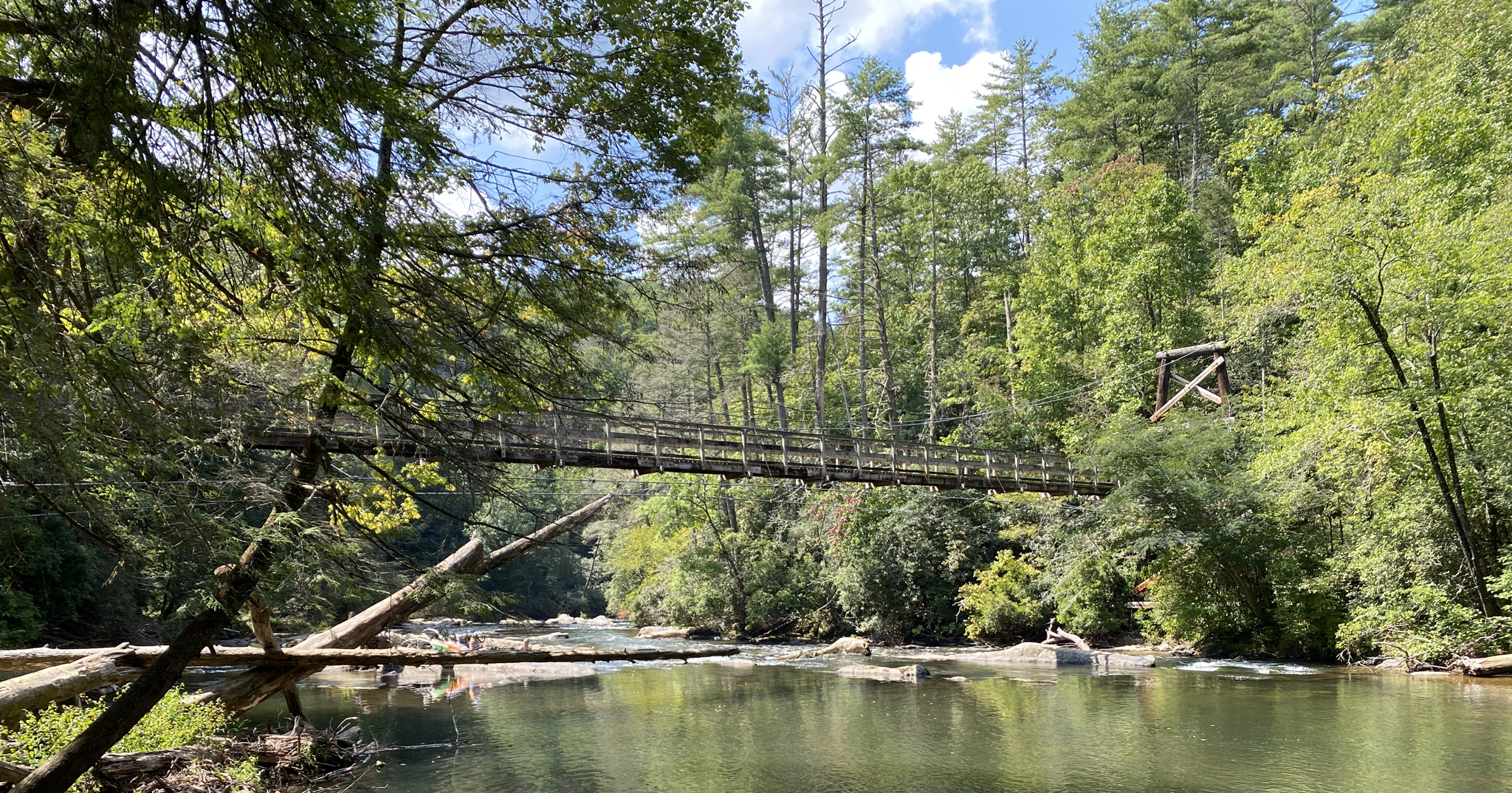
The Benton MacKaye Trail crosses the Toccoa River on a long suspension bridge, one of the highlights of the route. It’s a peaceful spot to rest by the water, listen to the current, and enjoy the surrounding forest before continuing on.
0
0
This small waterfall is a reliable spot to refill your bottles and a peaceful place to pause and take in the surrounding forest.
0
0
A peaceful spot where three mountain streams come together in the Blue Ridge Wildlife Management Area. The sound of rushing water makes it a perfect place to pause, refill your bottles, or even camp nearby. The shaded forest and cool air from the streams offer welcome relief on a long day of hiking.
0
0

Like much of the Duncan Ridge Trail, the terrain around Licklog Mountain is characterized by steep ascents and descents. At 3,472 feet, you are at one of the highest peaks of the area. There are too many trees to really enjoy the views, but some scenery does peak through.
1
0
This mountain reaches an elevation of approximately 3,278 feet, making it an excellent vantage point to see the surrounding area. From here you can look down to the Toccoa River valley.
1
0
Built in 1977 by the USDA Forest Service in collaboration with the Appalachian Trail Club, it's recognized as the longest swinging bridge east of the Mississippi River, stretching an impressive 270 feet.
1
0
Wallalah Mountain and the surrounding Duncan Ridge area provide beautiful views of the Blue Ridge Mountains, and the Taccoa River valley, especially when the trees are bare. It's quite a hike to get here, but well worth it!
1
0
From this point, you have access to Duncan Ridge Trail and Benton MacKaye Trail, which follow the same trail for quite some distance. South to Toccoa River or north to Rhodes Mountain. The approach involves a particularly steep ascent, but you are rewarded with amazing views along the way, although they may be partially obstructed by trees, especially in the summer. Dispersed camping is allowed throughout the trail, but there is an established campground less than a mile west on Morganton Highway, called Skeenah Campground.
0
0
Frequently Asked Questions
How many dog-friendly hiking trails are available in Fannin County?
Komoot features several dog-friendly hiking routes in Fannin County, offering a range of experiences for you and your canine companion. The region itself boasts over 300 miles of trails, many of which are suitable for dogs.
What kind of terrain can I expect on dog-friendly hikes in Fannin County?
Fannin County's dog-friendly trails traverse diverse landscapes within the Blue Ridge Mountains and the Chattahoochee-Oconee National Forest. You can expect forested hills, river valleys, and varied elevations ranging from 1,760 to over 4,000 feet. Trails often feature mature hardwoods, rhododendron thickets, and hemlock, providing a rich natural environment for you and your dog.
Are there any easy dog-friendly trails suitable for shorter walks or older dogs?
While our current selection focuses on moderate to difficult trails, the region offers many easier options. For example, the Benton MacKaye & Duncan Ridge Trail to Toccoa River is a moderate 5.8 km hike that offers a pleasant experience. The Aska Adventure Area Trails also offer shorter, less strenuous options, some of which lead to Lake Blue Ridge.
Are there any challenging dog-friendly hikes for experienced hikers and their dogs?
Yes, Fannin County offers challenging trails for those seeking a more strenuous adventure with their dogs. The Benton MacKaye Trail: GA 60 to Wilscot Gap is a difficult 17.9 km route with significant elevation changes. For an even longer challenge, consider sections of the full Benton MacKaye Trail, which spans nearly 500 km.
Can I find dog-friendly trails with waterfalls in Fannin County?
Absolutely! Fannin County is home to several beautiful waterfalls accessible via dog-friendly trails. Long Creek Falls is a multi-tiered waterfall that can be reached via an easy path. Falls Branch Falls and Jacks River Falls are other notable options in the region, offering scenic spots for you and your dog to enjoy.
Are there any circular dog-friendly routes in Fannin County?
Yes, you can find circular routes suitable for dogs. The Toccoa River – Toccoa River Swinging Bridge loop from Wallalah Mountain is a moderate 11.3 km loop that takes you past the popular Toccoa River Swinging Bridge, offering a great outing for you and your dog.
What natural landmarks or points of interest can I see on dog-friendly trails?
Many dog-friendly trails in Fannin County lead to significant natural landmarks. You can visit Springer Mountain, the southern terminus of the Appalachian Trail, or explore the scenic Benton MacKaye Trail Segment. The Toccoa River and Lake Blue Ridge also offer beautiful waterside views. Don't miss Brawley Mountain Lookout Tower for panoramic views.
What is the best time of year to hike with my dog in Fannin County?
Fannin County offers great hiking opportunities year-round. Spring brings blooming rhododendrons and mountain laurel, while fall showcases stunning foliage. Summer can be warm, so early morning or late afternoon hikes are best, especially near water sources. Winter offers crisp air and fewer crowds, though some higher elevation trails might have ice or snow.
Are there any trails where my dog can swim or cool off in water?
The Toccoa River flows through Fannin County, and trails like the Benton MacKaye & Duncan Ridge Trail to Toccoa River offer access to its banks. Lake Blue Ridge also provides opportunities for dogs to cool off, particularly along trails in the Aska Adventure Area. Always check local regulations and water conditions before allowing your dog to swim.
What do other hikers say about dog-friendly trails in Fannin County?
The komoot community highly rates the hiking experiences in Fannin County, with an average score of 4.9 stars. Reviewers often praise the quiet woodlands, well-maintained paths, and the stunning natural beauty, making it a favorite destination for hikers and their dogs.
Are there specific parking considerations for dog-friendly trails?
Parking availability varies by trailhead. Many popular trailheads, especially those for the Appalachian and Benton MacKaye Trails, have designated parking areas. It's always a good idea to check the specific route details on komoot for parking information before you head out. Some areas within the Chattahoochee-Oconee National Forest may require a parking pass.
Most popular routes in Fannin County
Most popular attractions in Fannin County

Get inspired with the komoot mobile app


Didn’t find what you were looking for?
Check out more Hikes throughout Fannin County below and find the perfect route in your destination.
Explore more
Browse the best Hikes in other regions.
