The best family-friendly hikes and walks in Page County
4.7
(686)
7,402
hikers
62
hikes
If you've ever tried to plan hiking in Page County, you know how quickly the options can feel overwhelming. With so many trails crisscrossing the Shenandoah Valley, it's tough to tell which routes are genuinely worth your time and effort, and which are just filler. We get it – you want the real highlights, not just a list of every path on the map. That's where komoot comes in. Our community has explored, mapped, and reviewed countless routes here, so we've done the legwork to bring you a curated shortlist of the very best.
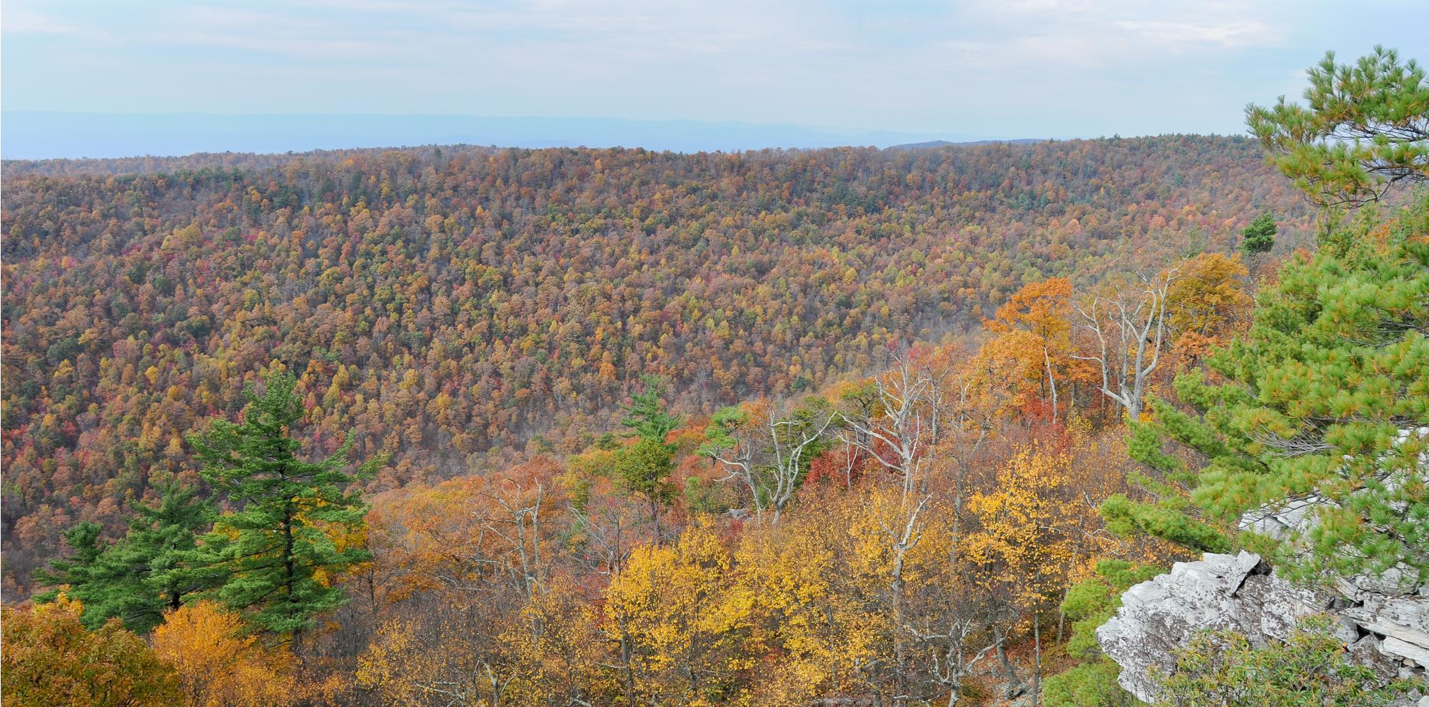
Hiking in Page County is defined by its stunning location, nestled in the Shenandoah Valley with the majestic Blue Ridge Mountains to the east and the Massanutten Mountains to the west. This means you'll find everything from gentle river valley strolls to forested paths and more demanding mountain ridge climbs. Significant portions of Shenandoah National Park and George Washington National Forest are right on your doorstep, offering diverse terrain for all abilities, from easy walks to moderate ascents.
If you only do one hike, we'd point you straight to the Stony Man and Little Stony Man Loop. At just 1.8 miles (2.9 km), it offers some of the most rewarding panoramic views for minimal effort, making it a perfect family-friendly win. For a slightly longer, tranquil forest experience that leads to a historic site, the Mill Prong Trail to Rapidan Camp is a top favorite, covering 2.7 miles (4.4 km) through beautiful woodlands. With more than 7,000 hikers already exploring Page County with komoot, you're in good company. Dive in and discover your next favorite trail!
Last updated: May 11, 2026
4.8
(4)
35
hikers
7.90km
02:23
260m
290m
The Sugarloaf Loop in Shenandoah National Park offers a delightful escape into a "big forest feel," winding through diverse terrain of compacted dirt, roots, and stones. You'll experience stream crossings and sections of the famed Appalachian Trail, where rocky outcrops provide stunning, wide-open mountain and valley views, including the Hogback Overlook. This moderate 4.9-mile (7.9 km) hike, with 864 feet (263 metres) of elevation gain, is a rewarding journey through nature's quiet beauty, typically taking around 2 hours and 22 minutes.
To plan your visit, head to the North District of Shenandoah National Park. This trail is known for being less crowded than some other park routes, so you might find parking more easily, but an early start is always recommended. The east-facing viewpoints are perfect for catching a sunrise, and the trail is particularly beautiful in spring with wildflowers or early summer when mountain laurel blooms.
This specific Sugarloaf Loop is a fantastic option if you're looking for a substantial hike without the crowds often found on more popular routes. It combines the serene atmosphere of a deep forest with the grandeur of mountain vistas, offering a true taste of Shenandoah's natural splendor. It's a great choice for those seeking a moderate challenge and scenic rewards.
4.5
(2)
7
hikers
5.20km
02:07
0m
690m
The Cedar Run Trail offers a truly immersive experience, winding through a narrow, rocky gorge filled with the sounds and sights of flowing water. You'll encounter a continuous display of cascades and miniature waterfalls, culminating in the impressive 34-foot Cedar Run Falls and a unique 40-foot natural water slide. This 3.2-mile (5.2 km) hike, despite its 0 feet (0 metres) of elevation gain, is rated moderate due to its rugged terrain, requiring careful footing over rocks and roots, and takes around 2 hours and 7 minutes to complete.
To tackle this challenging route, plan to arrive early at the Hawksbill Gap parking area, especially during peak season, as spots can be limited. Sturdy hiking boots with good ankle support are highly recommended for the steep and rocky sections, and hiking sticks can provide extra stability. While the trail is accessible, its rough nature means it's best enjoyed by those with good physical condition and a love for rugged, natural paths.
What truly sets Cedar Run Trail apart is its exceptional array of water features, providing a more intimate and wild feel compared to some of the park's larger, more crowded falls. Often combined with the Whiteoak Canyon Trail for a strenuous loop, it offers a true wilderness experience within Shenandoah National Park, showcasing a continuous flow of beautiful scenery and a sense of adventure.

Sign up for free
7
hikers
9.87km
02:59
300m
200m
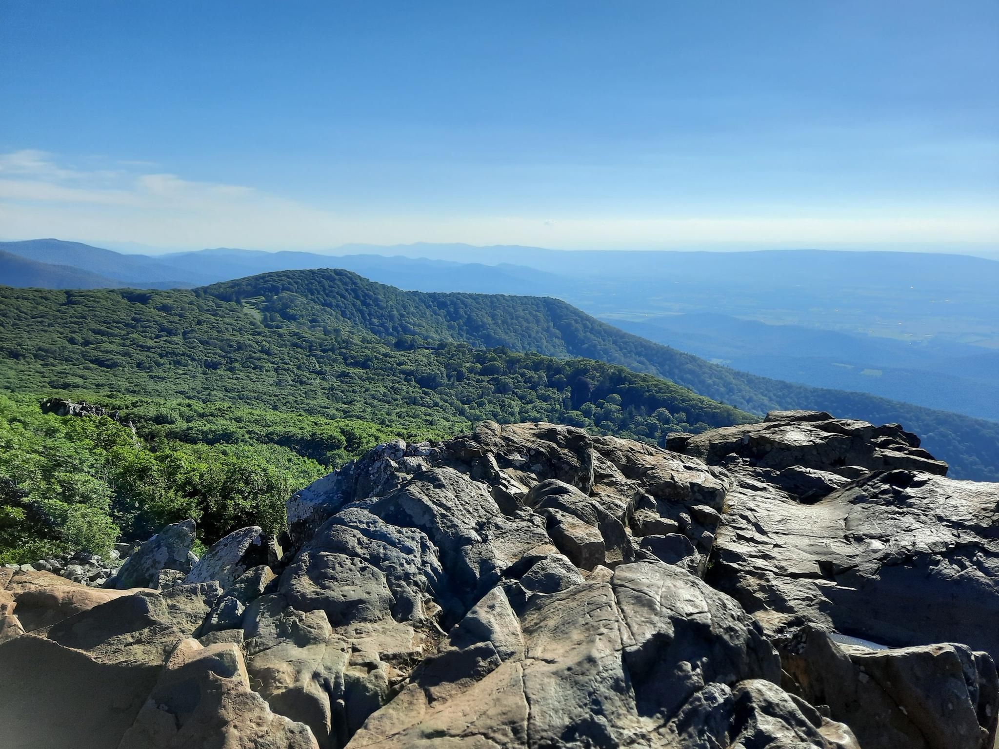
The Hawksbill Mountain via Appalachian Trail offers a classic Shenandoah National Park experience, leading you through a vibrant hardwood forest dotted with rhododendron and laurel. The path features a steady, often steep incline, including some rocky sections and a distinctive "staircase of stones" as you approach the summit. Once at Hawksbill Summit, you're treated to magnificent 360-degree panoramic views of the Shenandoah Valley, the Blue Ridge Mountains, and the Virginia Piedmont, making the climb well worth the effort.
This moderate hiking route covers 6.1 miles (9.9 km) with 986 feet (300 metres) of elevation gain, typically taking just under 3 hours to complete. Access is convenient from the Hawksbill Gap parking area. It's wise to check the weather before you go, as the trail can become slippery after rain, and arriving early can help you secure a parking spot during peak times.
Hawksbill Mountain holds the distinction of being the highest point in Shenandoah National Park, standing at 4,049 feet. This makes it a prime location for exceptional east and west-facing views, often including distant glimpses of Skyline Drive. The trail's integration with the iconic Appalachian Trail also adds a unique appeal for those looking to experience a piece of this legendary long-distance route.
3.0
(1)
2
hikers
2.90km
00:57
220m
20m
The Stony Man and Little Stony Man Loop offers some of Shenandoah National Park's most iconic views without a strenuous climb. This easy 1.8-mile (2.9 km) hiking route takes you through peaceful hardwood forests before opening up to breathtaking panoramas from Little Stony Man Lookout and Stony Man Lookout. You'll gain about 717 feet (218 metres) in elevation over approximately 57 minutes, making it a fantastic option for families or those seeking a quick, rewarding outing with expansive vistas of the Shenandoah Valley and Blue Ridge Mountains.
To ensure the best visual experience, aim for a clear, haze-free day when planning your visit. While the trail is generally well-maintained, be prepared for some rocky sections and moderate uphill climbs, including switchbacks, especially when traversing between the two peaks. Note that dogs are not allowed on the final section to the Stony Man summit, so if you're hiking with a canine companion, you'll need to adjust your route.
This popular loop incorporates a section of the famous Appalachian Trail, adding a touch of hiking history to your journey. Little Stony Man Cliffs are also a known hotspot for rock climbing, so you might even spot climbers scaling the rock face. Keep an eye out for wildlife, as deer, various birds, and chipmunks are common sightings along the trail.
3
hikers
4.41km
01:15
10m
250m
The Mill Prong Trail to Rapidan Camp offers a delightful blend of natural beauty and presidential history within Shenandoah National Park. You'll follow well-maintained rock and dirt paths alongside the Mill Prong, enjoying lush ferns and wildflowers in spring. The highlight is Big Rock Falls, a charming 15-foot cascade, before reaching the historic Rapidan Camp where two creeks converge.
This easy 2.7-mile (4.4 km) hike with only 34 feet (10 metres) of elevation gain takes about 1 hour and 15 minutes. While generally straightforward, be ready for a few stream crossings that might require rock-hopping, especially after rain. Consider visiting in spring for the best chance to see wildflowers and enjoy the mild weather.
Rapidan Camp, the trail's destination, was President Herbert Hoover's rustic retreat and the first presidential camp. You can explore the partially restored site, including Hoover's "Brown House," and learn about its significance through informational placards. Seasonal ranger-led tours offer even more historical context, making this a unique experience among Shenandoah trails.
Get access to more routes and recommendations from other explorers.
Sign up for free
Already have an account?
Our route recommendations are based on thousands of hikes, rides, and runs completed by other people on komoot.
Start today with a free account
Your next adventure awaits.
Login or Signup


Tips from the Community

This high-elevation meadow, perched atop a mountain, may come as a bit of a surprise after the miles of lush, green forests that make up most of Shenandoah National Park. It's a must-see for every visitor.
0
0
The river is crossed over stones and tree trunks
0
0

Great spot on the exit to Skyland, where there is a restuarant and nice restrooms.
0
0

Hawksbill Summit in Shenandoah National Park offers stunning 360-degree views of the Shenandoah Valley, Blue Ridge Mountains, and Virginia Piedmont from its 4,050-foot elevation. As the park's highest point, it also marks the highest spot in Madison and Page counties. The north face drops 2,500 feet into Timber Hollow, the park’s largest elevation change. Hikers can also spot rare balsam fir trees at the summit. A stone observation platform, built by the National Park Service, enhances the experience's panoramic views.
1
0
The climb to Little Stony Man Cliffs is short, leading to a popular spot for rock climbing on the Appalachian Trail. The cliffs offer a few routes for climbing and rappelling, and it's great to watch the climbers from here. From the overlook at Little Stony Man Cliffs, you can see the profile of the Stony Man to the south, resembling a face.
0
0

The Stony Man Lookout area is the most popular viewpoint in this part of Shenandoah National Park, and for good reason. The views are of the Shenandoah Valley and the Blue Ridge Mountains and go for miles. This viewpoint is also pretty close to a nearby parking area, so it's easily accessible even if you aren't doing a full-on hike.
2
0

If you were planning a bike-and-hike adventure, this is a good spot to stash the bike. Hiking even partway up nearby Hawksbill Mountain—the highest point in Shenandoah National Park—offers really beautiful panoramic views of nearby hills and mountains.
0
0

This is the longest overlook in the area, stretching nearly a quarter mile. To the north, you'll be greeted with breathtaking views of Gimlet Ridge, Allegheny Mountains, and Mathews Arm.
0
0
Frequently Asked Questions
How many family-friendly hiking trails can I find in Page County?
Page County offers a wide variety of outdoor experiences, with over 60 family-friendly hiking trails available. These range from easy strolls to more moderate adventures, ensuring there's something for every family.
What makes Page County a great destination for family hikes?
Page County is nestled between the Blue Ridge and Massanutten Mountains, with the Shenandoah River flowing through it, offering diverse landscapes. It's home to significant portions of Shenandoah National Park and George Washington National Forest, providing extensive networks of well-maintained trails suitable for families. The region's natural beauty, including stunning views and varied terrain, makes it ideal for outdoor exploration.
What do other hikers say about the family-friendly trails in Page County?
The family-friendly trails in Page County are highly rated by the komoot community, with an average score of 4.7 stars. Hikers frequently praise the beautiful scenery, well-marked paths, and the variety of options suitable for different ages and abilities.
Are there any easy, short hikes suitable for families with young children or toddlers?
Yes, Page County has several easy and short trails perfect for families with young children. For a gentle walk with rewarding views, consider the Stony Man and Little Stony Man Loop. Another excellent option is the Mill Prong Trail to Rapidan Camp, which is mostly flat and leads to a historic site.
When is the best time of year to go hiking with family in Page County?
While hiking is enjoyable year-round, spring and fall are particularly popular for family hikes in Page County. Spring brings blooming wildflowers and pleasant temperatures, while fall offers spectacular foliage. Summer can be warm, but shaded trails provide relief, and winter offers a quieter, serene experience, though some trails may have icy patches.
Are there any family-friendly trails with waterfalls in Page County?
Yes, the region is known for its beautiful waterfalls. While not explicitly listed in the provided routes, the Rose River Falls Loop and Dark Hollow Falls Trail in Shenandoah National Park are popular choices for families seeking waterfall views. Always check trail conditions and accessibility before heading out.
Can I bring my dog on these family-friendly trails?
Many trails in Page County, especially those within Shenandoah National Park and George Washington National Forest, are dog-friendly, but regulations vary. Dogs are generally permitted on trails if kept on a leash. However, some specific trails or areas might have restrictions. It's always best to check the specific park or trail guidelines before you go. For Shenandoah National Park, you can find detailed information on their website: nps.gov/shen.
Are there circular routes suitable for families?
Yes, many family-friendly trails in Page County are designed as loops, offering varied scenery without retracing your steps. The Sugarloaf Loop is a moderate option, and the Stony Man and Little Stony Man Loop provides an easier circular path with fantastic views.
What scenic viewpoints or landmarks can we explore along family hikes?
Page County offers breathtaking views. Along your hikes, you can discover stunning viewpoints like Stony Man Lookout and Little Stony Man Lookout, both offering panoramic vistas of the Shenandoah Valley. The Hawksbill Summit, the highest point in Shenandoah National Park, also provides incredible 270-degree views. For a unique underground experience, consider visiting Luray Caverns, a registered Natural Landmark in the area.
Is parking available at the trailheads for family hikes?
Yes, most popular trailheads for family hikes in Page County, especially within Shenandoah National Park and George Washington National Forest, offer designated parking areas. However, during peak seasons or holidays, these can fill up quickly, so arriving early is recommended.
How can I reach the family-friendly hiking trails using public transport?
Public transportation options directly to trailheads in Page County are limited. Most visitors access the trails by car, particularly those within Shenandoah National Park via Skyline Drive. Luray, the county seat, is recognized as a 'hiker-friendly' gateway community, but direct public transit to specific trailheads is not widely available. Planning for private vehicle access is generally recommended.
Where can we find food or accommodation near the hiking trails?
Page County offers various options for food and accommodation, particularly in and around Luray. You'll find cafes, restaurants, and lodging ranging from hotels to cabins and campgrounds. For more information on local amenities, you can visit the official tourism website: visitluraypage.com.
Most popular routes in Page County
Most popular attractions in Page County

Get inspired with the komoot mobile app


Didn’t find what you were looking for?
Check out more Hikes throughout Page County below and find the perfect route in your destination.
Explore more
Browse the best Hikes in other regions.
