The best family-friendly hikes and walks in Providence County
4.6
(35)
438
hikers
80
hikes
Family friendly hiking trails in Providence County, Rhode Island, traverse a landscape characterized by a mix of urban green spaces and natural preserves. The terrain features dense woodlands, tranquil ponds, and scenic river walks, with gentle elevation changes. Notable geological formations include rocky outcrops and glacial boulders, remnants of the last Ice Age.
Best family friendly hiking trails in Providence County
- The most popular family friendly hiking route is Buck Hill and Benson Mountain Trail Loop, a 4.8 miles (7.7 km) trail that takes 2 hours 1 minute to complete. This moderate route features gentle climbs over hills and through forested areas.
- Another top favourite among local hikers is Seekonk Sanctuary via Seekonk Meadows, an easy 2.4 miles (3.8 km) path. This trail offers flat terrain through meadows and along the Seekonk River.
- Local hikers also love the North South Trail: Chepachet to Burrillville, a 7.2 miles (11.5 km) trail leading through varied woodlands, often completed in about 3 hours 3 minutes.
- Hiking in Providence County is defined by dense woodlands, river views, and glacial features, offering a network of trails suitable for various ability levels.
- The routes in Providence County are highly rated by the komoot community with an average score of 4.7 stars from more than 30 reviews. More than 400 hikers have used komoot to explore Providence County's varied terrain.
Last updated: July 8, 2026
4
hikers
7.66km
02:01
70m
70m
The Buck Hill and Benson Mountain Trail Loop offers a delightful blend of scenery, winding through peaceful wooded areas, past wetlands, and alongside agricultural land. You'll traverse mixed-surface paths, some rocky sections, and even doubletrack, with notable features like Wallum Lake and groves of hemlock and mountain laurel. This moderate 4.8-mile (7.7 km) hike, with 214 feet (65 metres) of elevation gain, is a great way to spend about 2 hours and 1 minute immersed in nature, offering a varied and engaging experience.
Planning your visit is straightforward, as the trail is generally accessible without specific permits or fees mentioned. Parking is typically available at the trailhead, making it easy to start your adventure. Since it's a multi-use area, you might encounter mountain bikers or disc golf players, so stay aware of your surroundings. This route is well-suited for active individuals or families looking for a rewarding outdoor experience that doesn't demand an entire day.
One of the most unique aspects of this trail is the opportunity for a Three-State Crossing, allowing you to briefly step through Massachusetts, Rhode Island, and Connecticut all within a single hike. The area is also a significant wildlife haven, with dedicated nesting boxes for wood ducks and marshes attracting various wetland species, making it excellent for birdwatching. The trail integrates into a broader network, intersecting with paths like the Midstate Trail, adding to its regional significance.
2
hikers
3.79km
00:58
10m
10m
Discover the easy Seekonk Sanctuary via Seekonk Meadows route, a pleasant hike spanning 2.4 miles (3.8 km) with a gentle elevation gain of just 42 feet (13 metres). You can expect to complete this tranquil journey in about 58 minutes, immersing yourself in expansive meadows and lush greenery. As you walk, the trail offers serene views, particularly around Gammino Pond, providing a peaceful escape into nature.
When planning your visit, remember that the trails are open from dawn until dusk, giving you ample time to explore. You are welcome to bring your pets along, but please keep them on a leash for the safety and comfort of all visitors. A convenient picnic area is located right at the trailhead, perfect for enjoying a snack before or after your hike.
This unique area was once a landfill, now beautifully transformed into a vibrant natural space. Keep an eye out for local wildlife, including various bird species, butterflies, and turtles, making it an excellent spot for nature observation. The transformation of this land into a conservation area highlights a successful effort to reclaim and restore natural habitats for the community to enjoy.

Sign up for free
1
hikers
11.5km
03:04
130m
100m
This section of the North South Trail from Chepachet to Burrillville offers a genuine taste of rural Rhode Island, winding through varied landscapes. You'll traverse quiet woodlands, pass by old farmland with stone walls, and enjoy attractive lakeshores like Richardson Pond. Expect a mix of singletrack and double tracks, with some rolling, rocky hills that keep the scenery engaging on this moderate 7.2-mile (11.5 km) hike.
Planning your visit is straightforward, as the trail is well-marked with blue blazes. This route covers 412 feet (126 metres) of elevation gain and typically takes around 3 hours and 3 minutes to complete. Be aware that hunting season in Rhode Island runs from September to March, so wearing blaze orange is a crucial safety measure during those months.
Part of the larger 77-mile (124 km) North South Trail, this segment showcases the natural features of the state's northwest corner, including areas around Buck Hill and George Washington State Campground. It provides a remarkably rural experience, immersing you in New England's natural beauty and historical elements like colonial-era stone foundations, despite Rhode Island's small size.
1
hikers
13.3km
03:35
170m
170m
The Buck Hill Management Area Loop offers a journey through a surprisingly diverse landscape, from well-drained oak and hickory uplands to dense stands of white pine and mountain laurel. You'll encounter old woods roads, rocky sections, and even a dammed wildlife marsh, providing a secluded feel that can make you forget you're just a short drive from civilization. This 8.2-mile (13.3 km) loop, with its 557 feet (170 metres) of elevation gain, is rated moderate and typically takes about 3 hours and 34 minutes to complete, making it a solid half-day adventure.
Parking is readily available at the trailhead for this popular route. While much of the path is easily accessible, some sections feature difficult inclines and rocky terrain, especially when leaves obscure the ground, so sturdy footwear is a must. Dogs are permitted, but always check for local leash regulations. If you're hiking during hunting season, remember to wear blaze orange for your safety.
One of the most unique aspects of the Buck Hill Management Area is the opportunity to visit the tri-state border monument, allowing you to stand in Massachusetts, Rhode Island, and Connecticut simultaneously. The area is also a haven for wildlife, with white-tailed deer, wild turkeys, and various bird species often spotted near the small ponds and the actively managed fields designed to attract more animals. It's a fantastic option for those seeking a blend of natural beauty, varied terrain, and a touch of geographical novelty.
17.2km
04:24
70m
60m
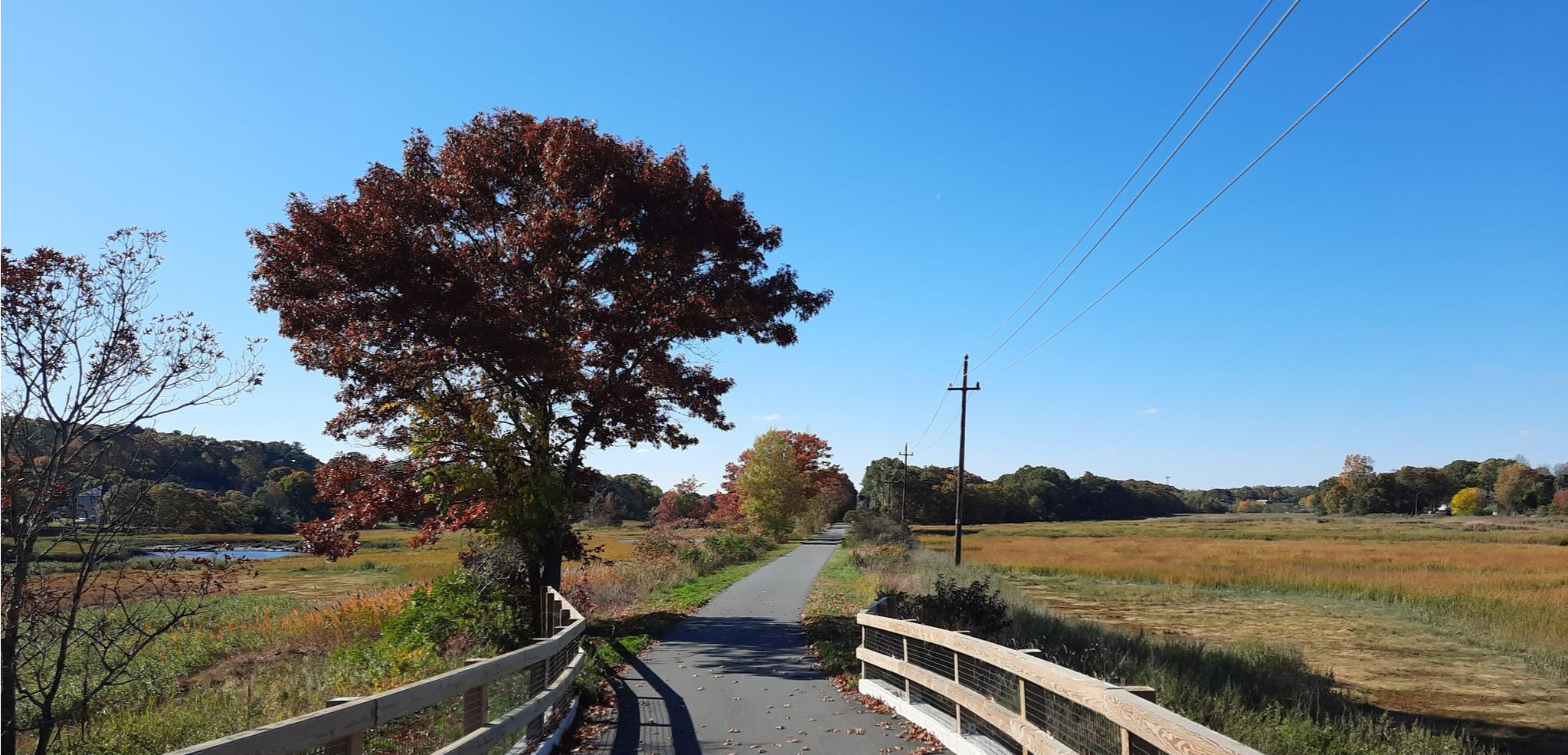
Embark on a moderate hike along the Blackstone River Bikeway, a 10.7-mile (17.2 km) route that takes approximately 4 hours and 23 minutes to complete. You will gain 245 feet (75 metres) in elevation as you explore a landscape rich in both natural beauty and industrial history. The path offers continuous views of the Blackstone River and historic Blackstone Canal, where you can spot waterfalls and marshes. You will also pass historic mills, such as the Ashton Mill, and enjoy wooded sections that are particularly vibrant with fall foliage.
When planning your visit, be aware that while much of the Blackstone River Bikeway is off-road, some segments utilize marked on-road routes, including shared bike-vehicle lanes. Parking is readily available at several trailheads, making it easy to access the route. For instance, you can find convenient parking at the Blackstone River Bikeway Woonsocket Trailhead. Consider starting your hike early to enjoy the full duration of 4 hours and 23 minutes, especially if you plan to explore the entire 10.7 miles (17.2 km).
The Blackstone River Bikeway offers a unique journey through the John H. Chafee Blackstone River Valley National Heritage Corridor. This area is notable for its blend of natural environment and significant industrial heritage. As you hike, you will gain insight into the region's past, observing how the river and canal shaped its development. It is an ideal route for those interested in combining outdoor activity with historical exploration.
Get access to more routes and recommendations from other explorers.
Sign up for free
Already have an account?
Our route recommendations are based on thousands of hikes, rides, and runs completed by other people on komoot.
Start today with a free account
Your next adventure awaits.
Login or Signup
Popular around Providence County

Family-friendly hikes in Powder Mill Ledges Wildlife Refuge

Family-friendly hikes in Lincoln Woods State Park
Family-friendly hikes in Pulaski State Park

Family-friendly hikes in Diamond Hill State Park

Family-friendly hikes around Providence

Family-friendly hikes around East Providence

Family-friendly hikes around Greenville
North-South Trail — The Smallest State's Longest Walk
East Coast Greenway — An unforgettable ride along the Atlantic Seaboard


Tips from the Community

George Washington State Campground sits in the 4,000-acre George Washington Management Area, along the shores of Bowdish Reservoir. This 100-acre primitive camping facility offers 45 gravel campsites for tents, trailers, and RVs. Shared water spigots are available, and bathrooms consist of outhouses or pit toilets. The campground, however, lacks electrical hookups and showers. Two Adirondack-style shelters can be reserved for group camping, accommodating up to 20 people each. There are also seven hike-in sites along the Angell Loop, with a 12'x12' tent platform, limited to four people and two tents per site. Campers can enjoy food and drinks just 0.3 miles south at Cady's Tavern.
0
0
The North-South Trail in Rhode Island begins at the Massachusetts/Rhode Island state line in Burrillville and connects to the Midstate Trail in Massachusetts. The Midstate Bench, located right on the state border, is a resting spot for hikers, serving as both a trail terminus and a scenic break point.
0
0

You get great views of the viaduct from below from the trailhead and East Coast Greenway. The viaduct was built in the mid-1930s and is notable for its open spandrel design. The spandrel is the space between the arch and the road, which here is hollowed out to form many more smaller arches.
0
0

This is the main trailhead for the start of the Blackstone River Bikeway in Woonsocket. Although the whole Blackstone River Bikeway technically connects Worcester, Massachusetts to Providence, Rhode Island, the Woonsocket to Central Falls section is the only part on a completely dedicated bike path. At the trailhead there is a large parking lot with river views.
0
0

One of the numerous bodies of water in the George Washington Memorial State Forest area, you can enjoy the views from Notre Dame. For a closer look, dismount your bike and take a short hike to reach the shore.
1
0

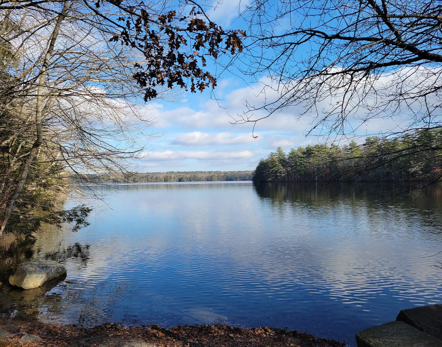
Richardson Pond serves as a great stop while hiking along the North-South Trail. The lake doesn't feature any amenities, but is certainly worth a visit while in the area.
0
0

Wide, clear, well-packed dirt for a little gravel stretch - great if it's your first time or want a more scenic route!
0
0

Gammino Pond is part of the Gammino Pond Conservation Area. A peaceful small lake surrounded by green, lush forests, taking a hike around the Gammino Pond is a sure decision for serenity.
0
0
Frequently Asked Questions
How many family-friendly hiking trails are available in Providence County?
Providence County offers a wide selection of family-friendly hiking options, with over 70 routes specifically curated for families. These trails range from easy strolls to more moderate adventures, ensuring there's something for every age and ability.
What is the best time of year for family hiking in Providence County?
While pleasant in spring, the fall season is particularly ideal for hiking in Providence County. The cooler temperatures and vibrant autumn foliage create a beautiful and comfortable environment for families to explore the trails.
Are there any stroller-friendly trails in Providence County?
Yes, several parks and greenways in Providence County offer paved or well-maintained, flat paths suitable for strollers. For example, parts of Roger Williams Park and the Blackstone River Bikeway provide accessible options for families with young children in strollers.
What kind of natural features can we expect to see on family hikes?
Providence County's trails showcase diverse natural beauty. You can expect to encounter dense woodlands, tranquil ponds, scenic river views, and unique geological formations like glacial boulders, especially in areas like Lincoln Woods State Park. Many trails also offer opportunities for birdwatching and spotting small woodland animals.
Are there any trails with waterfalls or scenic viewpoints?
Yes, for a lovely waterfall experience, consider the Blackstone River Bike Path Waterfall. For scenic views, India Point Park offers vistas of the Seekonk and Providence Rivers, and Neutaconkanut Hill Park provides panoramic city views from Providence's highest point.
Are dogs allowed on family hiking trails in Providence County?
Many trails in Providence County are dog-friendly, provided your furry companion is kept on a leash. Popular spots like Roger Williams Park and Lincoln Woods State Park generally welcome dogs. Always check specific park regulations before you go.
What are some good options for short, easy family walks?
For shorter, easy walks, consider trails within Roger Williams Park, which offers various loops around its ponds and gardens. The Seekonk Sanctuary via Seekonk Meadows route is another excellent easy option, providing a pleasant walk through natural surroundings.
Are there any loop trails suitable for families?
Yes, loop trails are great for families as they bring you back to your starting point. The Buck Hill and Benson Mountain Trail Loop offers a moderate loop experience through forested areas. Many parks also feature shorter, easy loop paths ideal for younger children.
What do other hikers enjoy most about the trails in Providence County?
The trails in Providence County are highly rated by the komoot community, with an average score of 4.7 stars. Reviewers often praise the accessibility of the trails, the beautiful natural settings, and the variety of options suitable for all ages, making it a favorite for family outings.
Are there any family-friendly trails with nearby parking?
Most major parks and trailheads in Providence County offer dedicated parking facilities, making access convenient for families. For instance, Lincoln Woods State Park and Roger Williams Park have ample parking available close to their trail entrances.
What should we bring for a family day hike in Providence County?
For a comfortable family day hike, remember to bring plenty of water, snacks, sun protection (hats, sunscreen), insect repellent, and comfortable walking shoes. A small first-aid kit is always a good idea, and don't forget binoculars for birdwatching or spotting wildlife!
Can we find places to eat or get coffee near the trails?
Yes, many of Providence County's popular hiking areas, especially those closer to urban centers like Roger Williams Park or the Providence River Walk, are conveniently located near cafes, restaurants, and picnic spots. You'll find various options for a post-hike treat or meal.
Most popular routes in Providence County
Most popular attractions in Providence County

Get inspired with the komoot mobile app


Didn’t find what you were looking for?
Check out more Hikes throughout Providence County below and find the perfect route in your destination.
Explore more
Browse the best Hikes in other regions.
