The best hikes from bus stations around Encartaciones
4.5
(3263)
20,537
hikers
27
hikes
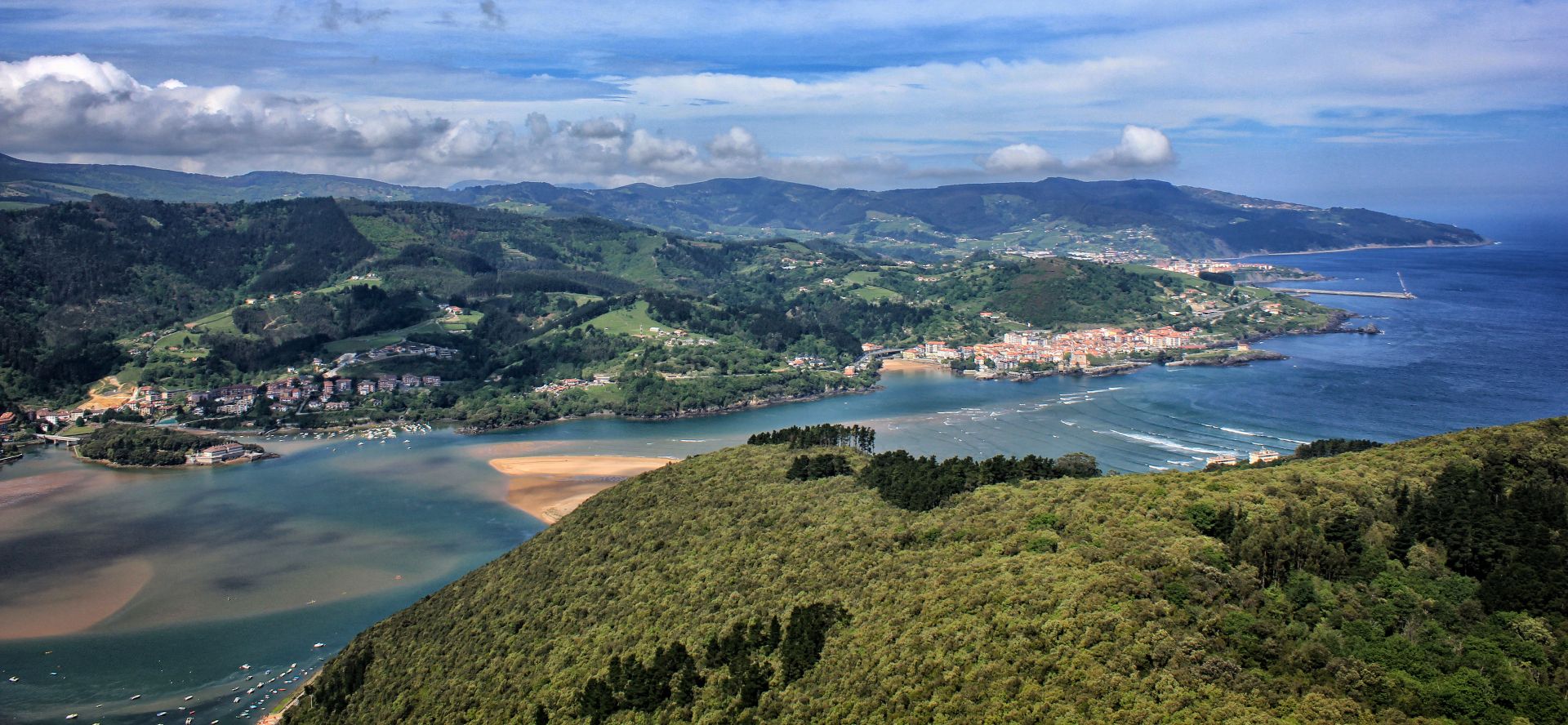
Hiking around Encartaciones offers diverse landscapes in the westernmost part of Bizkaia, characterized by deep valleys, mountains, and extensive forests. The region features karstic terrain with unique limestone formations, particularly within Armañón Natural Park, alongside numerous rural paths. Mountain peaks like Ganekogorta and Pico La Cruz provide elevated viewpoints, while the Karrantza Valley showcases monumental natural beauty. The area also includes coastal paths near Playa de La Arena, offering varied hiking environments.
Best bus station hiking trails around Encartaciones
- The most popular bus station hiking route is Cotobasero and Bernalta Loop from Aldeacueva, a 7.3 miles (11.8 km) trail that takes 3 hours 28 minutes to complete. This moderate route explores the local hills and valleys.
- Another top favourite among local hikers is Sorrondegi Summit (666 m) – Armañón Summit loop from El Suceso, a moderate 9.2 miles (14.8 km) path. This trail ascends to significant summits, offering panoramic views of the surrounding natural park.
- Local hikers also love the Pico La Cruz – Ganeran Summit loop from Galdames, a 7.7 miles (12.4 km) trail leading through mountainous terrain, often completed in about 4 hours 25 minutes.
- Hiking around Encartaciones is defined by karstic mountains, deep valleys, and dense woodlands. The network offers options for different ability levels, from moderate ascents to longer loops.
- The routes in Encartaciones are highly rated by the komoot community with an average score of 4.5 stars from over 3000 reviews. More than 20000 hikers have used komoot to explore Encartaciones's varied terrain.
Last updated: July 7, 2026
5.0
(1)
3
hikers
11.8km
03:28
340m
340m
Moderate hike. Good fitness required. Easily-accessible paths. Suitable for all skill levels.
5.0
(4)
21
hikers
14.8km
04:47
630m
630m
Moderate hike. Good fitness required. Easily-accessible paths. Suitable for all skill levels.

Sign up for free
5.0
(2)
6
hikers
12.4km
04:25
710m
710m
Moderate hike. Good fitness required. Easily-accessible paths. Suitable for all skill levels.
4.7
(3)
17
hikers
12.1km
03:51
440m
440m
Moderate hike. Good fitness required. Mostly accessible paths. Sure-footedness required.
4.0
(4)
11
hikers
10.2km
02:58
260m
260m
Moderate hike. Good fitness required. Easily-accessible paths. Suitable for all skill levels.
Get access to more routes and recommendations from other explorers.
Sign up for free
Already have an account?
Our route recommendations are based on thousands of hikes, rides, and runs completed by other people on komoot.
Start today with a free account
Your next adventure awaits.
Login or Signup



Other adventures around Encartaciones


Tips from the Community

Just a 10-meter detour from the path, but not worth the effort (branches and ferns).
0
0
You have to do some very simple climbs (and I'm very clumsy at climbing) to go up/down.
0
0
Many confuse the name with the previous peak, Ganeran.
1
0
Of all the surrounding peaks, this is the most comfortable.
1
0

nice climb passing through the Eretza
0
0

A bit complicated to follow as it is not very clear. Watch out for cows.
0
0
Frequently Asked Questions
How many bus station hiking trails are available in Encartaciones?
There are over 25 hiking routes accessible from bus stations in Encartaciones, offering a variety of experiences for different skill levels. You'll find 5 easy routes, 16 moderate, and 6 difficult trails to explore.
What do other hikers say about the bus-accessible trails in Encartaciones?
The komoot community highly rates the bus-accessible trails in Encartaciones, with an average score of 4.5 out of 5 stars from over 3,000 ratings. Hikers often praise the diverse landscapes, from mountain peaks to lush valleys, and the convenience of reaching trailheads via public transport.
What kind of terrain can I expect on bus-accessible hikes in Encartaciones?
Encartaciones offers a diverse landscape, even on bus-accessible routes. You can expect a mix of deep valleys, forested paths, and ascents to mountain peaks like Ganekogorta or Kolitza. Some areas, particularly around Armañón Natural Park, feature unique 'lapiaz' limestone formations and karstic scenery. Trails often follow rural paths, offering a serene experience.
Are there easy hiking options accessible by bus in Encartaciones?
Yes, there are 5 easy routes available from bus stations in Encartaciones. These trails are generally shorter and have less elevation gain, making them suitable for beginners or those looking for a relaxed walk. Look for routes that explore the region's valleys and rural paths.
Are there circular routes available from bus stations in Encartaciones?
Yes, many of the bus-accessible trails in Encartaciones are circular routes, allowing you to start and end your hike at the same point, often conveniently located near a bus stop. An example is the Cotobasero and Bernalta Loop from Aldeacueva, which offers a moderate challenge.
Can I bring my dog on these bus-accessible trails?
Many trails in Encartaciones are dog-friendly, especially those in natural areas and rural paths. However, it's always recommended to check local regulations for specific natural parks or protected areas, such as Armañón Natural Park, regarding dogs. Ensure your dog is on a leash and you carry waste bags.
Are there family-friendly bus station hikes in Encartaciones?
Yes, Encartaciones has several family-friendly options accessible by bus. These routes tend to be shorter, with gentler inclines, and often pass by interesting natural features or charming villages. The Vía Verde (Greenway) network, accessible from various villages, offers flat, easy paths suitable for families.
What natural features or viewpoints can I see on these bus-accessible hikes?
Many bus-accessible hikes lead to stunning natural features and viewpoints. You can reach summits like Gallarraga Summit (901 m) or Pagero Summit, offering panoramic views. The region is also known for its extensive holm oak forests and the unique karstic landscapes of Armañón Natural Park. The Karrantza Valley, with its monumental natural beauty, is also a highlight.
Are there any historical or cultural attractions near the bus-accessible hiking routes?
Absolutely. Encartaciones is rich in history. You can find medieval towns like Balmaseda, with its Old Bridge of Balmaseda and Church of San Severino, or the charming village of Lanestosa. The mining town of La Arboleda also offers historical insights. Many bus routes connect these cultural hubs, allowing you to combine hiking with cultural exploration.
Can I find cafes or places to eat near the bus-accessible hiking routes?
Yes, many of the bus-accessible routes either start or pass through villages and towns where you can find local cafes, restaurants, and bars. Towns like Balmaseda, Karrantza, and Lanestosa are good places to look for refreshments and traditional Basque cuisine after your hike.
What is the best time of year to hike in Encartaciones using public transport?
Spring (April-June) and Autumn (September-November) are generally the best times for hiking in Encartaciones. The weather is milder, and the landscapes are particularly beautiful with spring blooms or autumn colors. Summer can be pleasant, but some trails might be warm. Winter hikes are possible, especially on lower elevation routes, but higher peaks may require appropriate gear due to colder temperatures or occasional snow.
Are there any bus-accessible routes that offer views of the coast?
While most of Encartaciones is inland, the region does include Playa de La Arena, its only beach. Some bus routes might connect to this coastal area, offering opportunities for coastal walks or starting points for hikes with sea views. However, the majority of bus-accessible trails focus on the inland mountains and valleys.
Most popular routes around Encartaciones
Most popular attractions around Encartaciones

Get inspired with the komoot mobile app


Didn’t find what you were looking for?
Check out more Hikes throughout Encartaciones below and find the perfect route in your destination.
Explore more
Browse the best Hikes in other regions.
