The best traffic-free bike rides around Orpierre
4.7
(78)
1,181
riders
16
rides
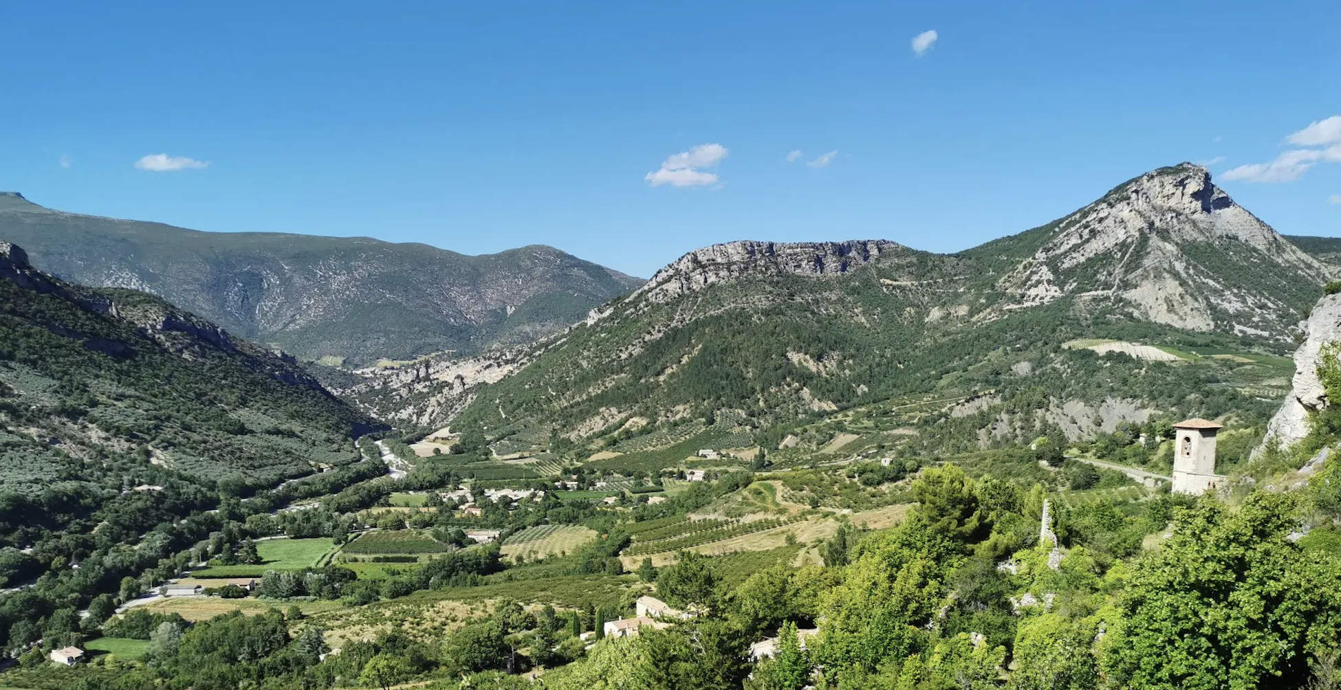
No traffic touring cycling routes around Orpierre are set within the dramatic landscapes of the Hautes-Alpes department in Southern France. The region is characterized by imposing limestone cliffs, wild valleys, and mid-mountain terrain, offering varied elevation changes. Orpierre is situated within the Baronnies Provençales Regional Natural Park, providing a backdrop of unspoiled nature and diverse physical features for cyclists. The area includes serene valleys like the Céans and mountain passes such as Col de Perty, connecting to the Durance valley.
…Last updated: July 5, 2026
4.9
(7)
45
riders
23.6km
01:36
380m
380m
Moderate bike ride. Good fitness required. Mostly paved surfaces. Suitable for all skill levels.
45
riders
102km
07:09
2,000m
2,000m
Hard bike ride. Very good fitness required. Mostly paved surfaces. Suitable for all skill levels.

Sign up for free
5.0
(1)
31
riders
35.9km
02:28
640m
640m
Hard bike ride. Very good fitness required. Mostly paved surfaces. Suitable for all skill levels.
5.0
(1)
28
riders
46.3km
03:25
960m
960m
Hard bike ride. Very good fitness required. Mostly paved surfaces. Suitable for all skill levels.
4.0
(2)
20
riders
31.9km
01:55
240m
240m
Moderate bike ride. Good fitness required. Mostly paved surfaces. Suitable for all skill levels.
Get access to more routes and recommendations from other explorers.
Sign up for free
Already have an account?
Our route recommendations are based on thousands of hikes, rides, and runs completed by other people on komoot.
Start today with a free account
Your next adventure awaits.
Login or Signup



Tips from the Community

For cyclists: * West side (Montauban-sur-l’Ouvèze / La Combe): 11-12.5 km with an average gradient of around 5%, maximum about 9%. Steady climb, never extreme. * East side (Laborel): 8.5 km at 5.6% on average, with peaks up to 7.7%. This is the shorter and smoother side.
10
0
Saint-Auban is a small and characteristic village in the Provence-Alpes-Côte d'Azur region, located at an altitude of about 1,100 meters, at the foot of the spectacular Tracastel rock face.
5
0
For cyclists it's a climb: * Length: approx. 7 km * Elevation gain: approx. 320 m * Average gradient: 4.6% * Maximum gradient: approx. 5%
5
0
The Col de Perty (1,302 m) is located in the Baronnies Provençales massif, on the border between the departments of Drôme and Hautes-Alpes, in the southeast of France. It connects the Ouvèze valley with that of Orpierre and is one of the most popular passes for cyclists in the area.
9
0
The Col de Soubeyrand (987–994 m, depending on the map source) is located in the Drôme department, in the Auvergne-Rhône-Alpes region, within the Baronnies provençales massif. It connects the Eygues valley with the Ennuye valley, between the villages of Rémuzat and Sainte-Jalle.
7
0
The Col de Peyruergue (794 m) is a pass located in the Drôme department, within the Parc naturel régional des Baronnies provençales. It connects the Ennuye valley with that of the Ouvèze, near Saint-Sauveur-Gouvernet.
6
0
Building maintained in excellent condition.
8
0
Verclause is a small commune in the Drôme, in the Auvergne-Rhône-Alpes region, in the southeast of France. It is located in the Eygues river valley, at the foot of the Prealps, in a quiet area much appreciated by cyclists and motorcyclists for its numerous scenic roads and mountain passes. It is close to the border with the Hautes-Alpes department, not far from locations such as Orpierre and Séderon.
6
0
Frequently Asked Questions
How many no-traffic touring cycling routes are available around Orpierre?
There are 14 dedicated no-traffic touring cycling routes around Orpierre. These routes offer a variety of distances and elevations, ensuring options for different skill levels.
What kind of terrain can I expect on the no-traffic touring cycling routes near Orpierre?
The no-traffic touring cycling routes around Orpierre offer diverse terrain, ranging from serene wild valleys and rich farmlands to mid-mountain ascents and sections across the Prealps. You can expect a mix of landscapes, including challenging mountain passes like the Col de Perty and Col de Saint-Jean, which provide breathtaking panoramas.
Are there any circular no-traffic touring cycling routes in Orpierre?
Yes, many of the no-traffic touring cycling routes around Orpierre are designed as loops, allowing you to start and finish in the same location. For example, consider the Orpierre village centre – Church in Les Begues loop or the more challenging Perty Pass – Orpierre loop.
Are there any easy or family-friendly no-traffic touring cycling routes around Orpierre?
While many routes in the region are considered difficult, there are 2 easy and 3 moderate no-traffic touring cycling routes available. These routes often follow quieter valley roads or less steep sections, making them suitable for families or those seeking a more relaxed ride. The Céans valley, with its rich farmlands, is known for its serene cycling opportunities.
What natural features or landmarks can I see along the no-traffic touring cycling routes?
Orpierre's no-traffic routes are rich in natural beauty and landmarks. You can explore the dramatic Méouge Gorge Route, a classified Natura 2000 site known for its turquoise waters. Other highlights include the View from the Summit of Rocher de Saint-Michel, the Chamouse Mountain, and the scenic Saint-Ange Pass. The region is also part of the Baronnies Provençales Regional Natural Park.
When is the best time of year to go touring cycling in Orpierre?
The best time to visit Orpierre for touring cycling is generally during the spring and autumn months. These seasons offer pleasant temperatures, less crowded routes, and beautiful natural scenery, such as the blooming lavender fields if you visit in early summer. Summers can be hot, especially in the valleys, while winters can bring colder temperatures and snow at higher elevations.
Are there options for parking near the no-traffic touring cycling routes in Orpierre?
Yes, Orpierre, being a hub for outdoor activities, typically offers parking options within or near the village center, providing convenient access to the start points of many touring cycling routes. Specific parking details may vary, but general village parking is usually available.
What do other touring cyclists enjoy most about the no-traffic routes in Orpierre?
The no-traffic touring cycling routes around Orpierre are highly rated by the komoot community, with an average score of 4.67 stars. Cyclists often praise the tranquility of the routes, the stunning natural landscapes, and the sense of escape offered by the car-free environment. The challenging climbs and rewarding panoramic views from passes like Col de Perty are frequently highlighted.
Can I find cafes or accommodation near the no-traffic touring cycling routes?
Orpierre village itself offers cafes and accommodation options, being a popular destination for outdoor enthusiasts. As you venture onto the routes, particularly in more remote areas, services may be less frequent. It's advisable to plan your stops in advance, especially for longer rides like the Orpierre – Espréaux Pass loop.
Are there any routes that connect Orpierre to broader cycling networks?
Yes, Orpierre is strategically located on significant cycling itineraries. It is part of the "P'tites Routes du Soleil" (Little Sunshine Routes), an itinerary that spans from Lake Geneva to the Mediterranean. You can find more information about this broader network at francevelotourisme.com. The Durance valley also forms part of a magnificent cycle touring route connecting the French Alps to the lavender fields of Provence.
Most popular attractions around Orpierre

Get inspired with the komoot mobile app


Explore more
Browse the best Cycling routes in other regions.
