The best traffic-free bike rides around Corme-Écluse
4.8
(12)
81
riders
13
rides
No traffic gravel bike trails around Corme-Écluse are found in a region characterized by its position between the Seudre river and the Gironde estuary. The landscape features extensive agricultural fields, gentle valleys, and forests, providing varied terrain for cycling. Proximity to the Atlantic coast means some routes offer access to coastal areas and natural sites like the Forêt de Suzac. The area provides a network of paths suitable for exploring the natural beauty of Nouvelle-Aquitaine.
Best no traffic gravel bike…
Last updated: August 27, 2026
5.0
(2)
12
riders
Easy gravel ride. Great for any fitness level. Mostly paved surfaces. Suitable for all skill levels.
4
riders
Hard gravel ride. Very good fitness required. Mostly paved surfaces. Suitable for all skill levels.

Sign up for free
3.0
(1)
5
riders
Easy gravel ride. Great for any fitness level. Mostly paved surfaces. Suitable for all skill levels.
4.0
(1)
6
riders
74.6km
04:30
390m
390m
Moderate gravel ride. Good fitness required. Mostly paved surfaces. Suitable for all skill levels.
9
riders
27.2km
01:36
40m
40m
Easy gravel ride. Great for any fitness level. Mostly paved surfaces. Suitable for all skill levels.
Get access to more routes and recommendations from other explorers.
Sign up for free
Already have an account?
Our route recommendations are based on thousands of hikes, rides, and runs completed by other people on komoot.
Start today with a free account
Your next adventure awaits.
Login or Signup
Popular around Corme-Écluse
Tips from the Community

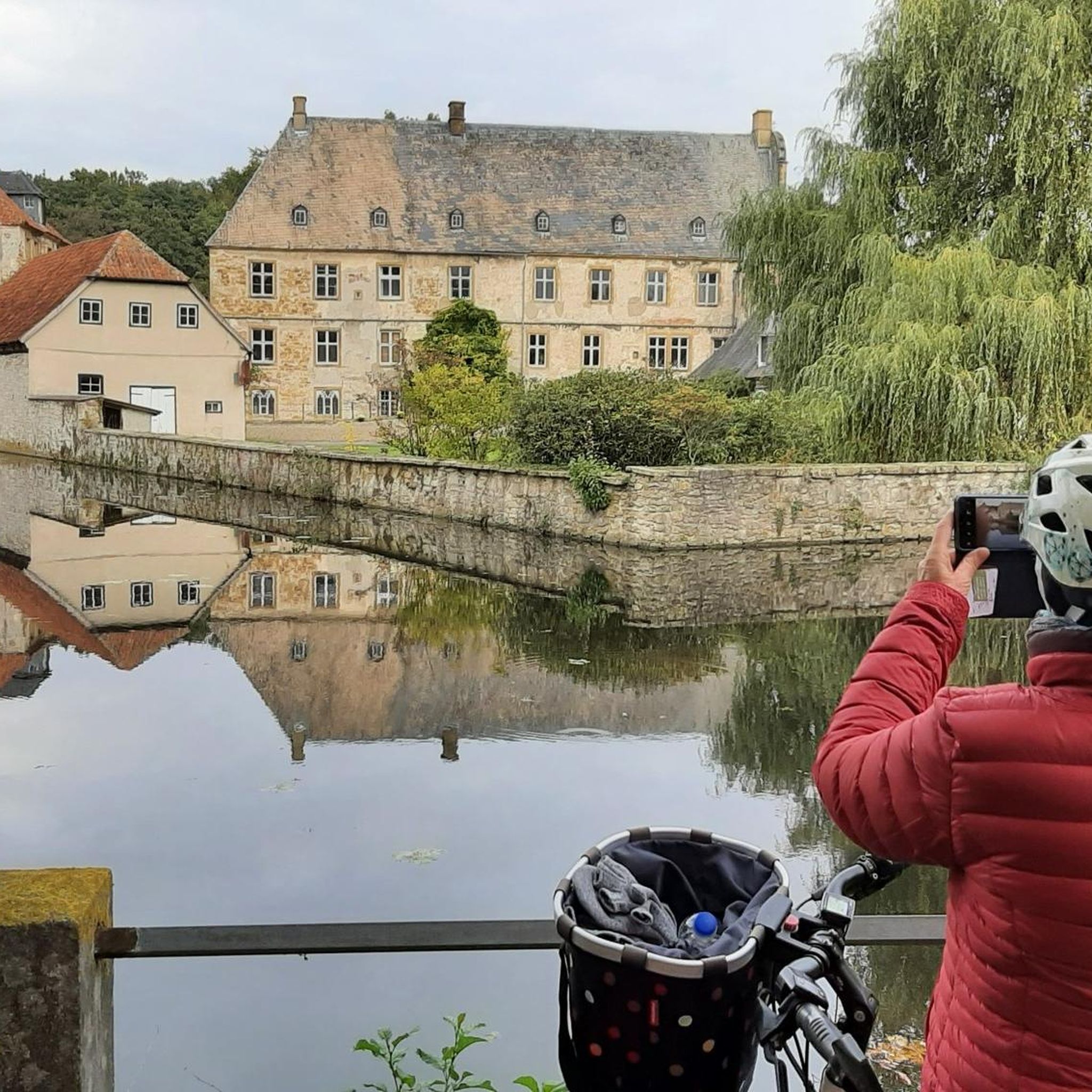
🏛️ Construction: 18-19 AD The arch was built around 18-19 AD, during the reign of Emperor Tiberius. It stood at the entrance to the Roman bridge crossing the Charente, at the outlet of the Via Agrippa, which connected Lyon to Saintes. It is therefore not truly a "triumphal arch": it was both a road monument and a monumental gate marking the entrance to Mediolanum Santonum, the capital of Roman Aquitaine. 👤 Who had it built? The arch was financed by Caius Julius Rufus, a Romanized notable from Saintonge. He dedicated it to Tiberius as well as his nephew Germanicus. The inscriptions engraved on the entablature still allow us today to know the figures to whom it was dedicated. The name "Arch of Germanicus" therefore comes from this dedication, and not from the fact that Germanicus personally had the arch built or crossed it. 🏗️ A rather exceptional monument The arch has two bays, likely allowing for the differentiation of traffic flows. It measures approximately 15 m high by 16 m wide. Its Corinthian and composite capitals bear witness to particularly meticulous Roman architecture. It constituted a true demonstration of the power and Romanization of Saintes. ⚠️ The moment the arch almost disappeared This is probably the most interesting episode in its history. For centuries, the arch was always located at the level of the Roman bridge and then the medieval bridge, on the right bank of the Charente. In the 19th century, the old bridge had become dilapidated. When it was decided to demolish it, around 1843, the arch was also threatened with destruction. It was then that Prosper Mérimée, Inspector General of Historical Monuments, intervened. He advocated for its preservation and arranged for its dismantling, relocation, and reassembly on the new bank. Another figure is also associated with this preservation: Victor Hugo, who stayed in Saintes in September 1843 and intervened in favor of the monument's conservation with Mérimée. 📍 Why is the arch no longer exactly in its ancient location? The arch we see today, on Place Bassompierre, is therefore no longer in its original location. It was moved a few dozen meters during the transformation of the quays and the disappearance of the old bridge. It was dismantled stone by stone and then reassembled in order to preserve it. It is now located in the immediate vicinity of the ancient Roman bridge crossing. 🏛️ Protection The Arch of Germanicus was finally classified as a historical monument in July 1905. An interesting detail The Crazannes quarries, located near Saintes, supplied a limestone widely used in the region's ancient constructions. Crazannes stone was notably used for monuments such as the Arch of Germanicus. In summary: 18-19 → construction of the arch at the entrance to the Roman bridge ↓ Antiquity → Middle Ages → the arch remains associated with the crossing of the Charente ↓ 1843 → demolition of the old bridge and threat to the arch ↓ 1843-1844 → Mérimée's intervention and relocation of the arch ↓ 1905 → classified as a Historical Monument
0
0

For this nature and its church
0
0
Very nice walk or bike ride
0
0
The port of Ribérou is a major heritage site in Saujon, bearing witness to a prosperous maritime past linked to the salt and wine trade. Transformed in the 19th century by ambitious works, it has now been reinvented as a place for living, relaxation, and preserving local history. 🛶 Origins and the Middle Ages The port of Ribérou takes its name from the Latin word ripa ("riverbank") or the Occitan word ribèira ("river"). It is located at the head of the Seudre estuary. It existed as early as the 11th century and became an important river and sea port thanks to its strategic position at the head of the estuary, used particularly for the salt trade—then called "white gold"—a highly sought-after product for preserving food. 🚢 Medieval Period and International Trade With the opening of British markets during the reigns of Eleanor of Aquitaine and Henry II Plantagenet, ships laden with wool, salt, wine, and other goods flocked to Ribérou. In the 16th century, the port exported local wines (such as cognac and pineau) throughout Europe. In 1577, during the Wars of Religion, the port was a strategic site: troops were stationed there, and battles took place. 🏗️ Decline, Reconstruction, and the 19th Century The estuary gradually silted up, making navigation difficult. By 1691, only smaller vessels could dock there. During the French Revolution, the sale of the tidal mill, which helped remove sediment, worsened the silting, leading to the port's decline. A modernization project began in 1822, but it wasn't until 1839 that an ambitious program was launched under the impetus of Jules Dufaure—a native of Saujon and Minister of Public Works—with the construction of sturdy quays, slipways, a lock bridge (marking the boundary between fresh and salt water), and reception facilities. In 1842, the work was completed, and the main quay was named Quai Dufaure in honor of this political support. 📉 Gradual Decline and Modernization The arrival of the railway in 1876 and the persistent problems of silting led to a decline in the port's traditional commercial activity, already facing competition from other transport networks. In the 20th century, the port gradually lost its economic importance but remained active for traditional fishing and became a place for pleasure boating, leisure, and local culture. Urban and tourism development projects (particularly in 2011–2012) modernized the port while preserving its historical charm. 🌊 Today The port of Ribérou is now a small fishing and pleasure port, much appreciated for its walks along the Seudre River, water sports (canoeing, kayaking, paddleboarding, etc.), and seasonal events.
0
0

The flushing lock is located at the head of the port, between the north bank's embankment and the south bank's quay. A retention basin, occupying the non-navigable Seudre riverbed as far as Saujon, follows the flushing lock. Within the retention basin, rubble stone embankments extend the lock's return walls for a few meters. The lock itself forms a bridge carrying a road. The lock bridge consists of two piers, forming three arches, each housing two gates. On the upstream side of the lock, the piers have semicircular cutwaters. The three bands are stacked and terminate in clamps. The lock ends with a cornice resting on modillions. The cornice follows the shape of the cutwaters. A metal balustrade, also semicircular in shape, is fixed to the top of the lock. This balustrade is framed by two stone moldings. The sluice gate and its upstream and downstream return walls are constructed of dressed stone. The masonry is of medium and regular quality, except for the coping of the return walls, which features large and regular masonry. The upstream north return wall is lower than the one on the south bank. A small parapet of recently constructed white rubble masonry surmounts it. The sluice gate is equipped with metal gates, the modern racks of which are visible. The first sluice gate was built around 1825 on the site of a former tidal mill. During the works carried out between 1839 and 1842, the sluice gate's embankment was modified to allow the passage of vehicles. Between 1847 and 1853, the lock was enlarged to allow for larger flushes, and the reservoir was excavated. Return walls were also built to connect the flushing lock to the riprap. It was then restored in 1865 and completely rebuilt between 1868 and 1869. The lock is 10.50 m wide, and its gates are each 1.50 m wide. The reservoir is 700 m long and has an average width of 30 m.
0
0

Frequently Asked Questions
How many no-traffic gravel bike trails are available around Corme-Écluse?
There are 5 dedicated no-traffic gravel bike trails around Corme-Écluse. These routes offer a variety of experiences, from easy rides to more challenging adventures, all designed to keep you away from vehicular traffic.
What kind of terrain can I expect on the no-traffic gravel bike trails near Corme-Écluse?
The terrain around Corme-Écluse for gravel biking is quite varied. You'll find white gravel paths, forest trails, and routes through agricultural fields. The region is known for its diverse cycling canvas, often leading through vineyards and open beaches, generally without significant climbs, making it accessible for various fitness levels.
Are there any easy, traffic-free gravel routes suitable for beginners or families?
Yes, there is an easy, traffic-free gravel route perfect for beginners or families. The L'Éguille-sur-Seudre – Riberou Port loop from Saujon is a great option, covering approximately 21.9 km with minimal elevation gain, ensuring a relaxed and enjoyable ride away from cars.
What are some interesting landmarks or natural features I can see along these routes?
Many routes offer scenic views and access to natural features. You might encounter the gentle Seudre river, agricultural fields, and even coastal areas. For specific points of interest, consider routes that pass near the Saint-Georges-de-Didonne Beach or the Marsh Cycle Path in Meschers-sur-Gironde. The region is also close to the Forêt de Suzac and the Gironde estuary.
Are there any circular no-traffic gravel bike routes around Corme-Écluse?
Yes, all the no-traffic gravel bike trails listed are circular routes, allowing you to start and end at the same point. For example, the View of the La Roche cliff – Boulevard du Marais loop from Saint-Georges-de-Didonne offers a substantial loop of over 42 km, providing a comprehensive tour of the area without retracing your steps.
What is the best time of year to go gravel biking in Corme-Écluse?
The Charente-Maritime department generally offers pleasant conditions for cycling for much of the year. Spring and autumn provide mild temperatures and beautiful scenery, ideal for exploring the white gravel paths, forest trails, and coastal areas. Summers can be warm but are still enjoyable, especially for rides near the coast or through shaded areas.
Where can I find parking for these no-traffic gravel bike trails?
While specific parking details for each trailhead are best checked on the individual route pages, Corme-Écluse and nearby towns like Saint-Georges-de-Didonne, Saujon, and Arces typically offer public parking options. Look for parking near the starting points mentioned for routes like the Pirelonge Tower – Riberou Port loop from Les Fourneaux.
What do other gravel bikers enjoy most about the no-traffic trails in Corme-Écluse?
The area is highly rated by the komoot community, with an average score of 4.3 stars. Reviewers often praise the tranquility of the routes, the diverse landscapes ranging from marshes to vineyards, and the opportunity to explore the region's natural beauty and historical sites away from traffic.
Are there any challenging no-traffic gravel routes for experienced riders?
Yes, for experienced riders seeking a challenge, the View of the La Roche cliff – Boulevard du Marais loop from Église Réformée is a difficult route spanning over 96 km with significant elevation gain. It offers a demanding yet rewarding experience through varied terrain.
Can I access these gravel trails using public transport?
Corme-Écluse is a peaceful commune, and while direct public transport links to specific trailheads might be limited, regional bus services connect Corme-Écluse to larger towns like Royan and Saintes. From these towns, you might be able to cycle to the starting points of some routes. Planning ahead with local transport schedules is recommended.
Are there any viewpoints or particularly scenic sections on these car-free gravel routes?
Absolutely. The region, nestled between the Seudre river and the Gironde estuary, offers numerous scenic spots. Routes often provide views of agricultural fields, the gentle Seudre river, and glimpses of the coastline. The View of the La Roche cliff – Boulevard du Marais loop, for instance, suggests scenic vistas, and the proximity to the Bunkers at Pointe de Suzac with a View of the Gironde Estuary indicates potential for stunning outlooks.
Most popular routes around Corme-Écluse
Most popular attractions around Corme-Écluse

Get inspired with the komoot mobile app


Explore more
Browse the best Gravel rides in other regions.
