The best traffic-free bike rides around Cerro Maggiore
4.2
(763)
22,286
riders
159
rides
No traffic road cycling routes around Cerro Maggiore are situated in the Metropolitan City of Milan, within the Po Valley. The terrain primarily consists of fertile plains and rolling hills, offering a mix of flat and gently undulating paths. The region is characterized by agricultural areas, green spaces, and historic waterways like the Villoresi Canal, providing varied landscapes for road cyclists. Dedicated cycling paths and country roads connect several local parks, ensuring routes with minimal vehicle traffic.
Best no traffic…
Last updated: October 17, 2026
4.4
(28)
506
riders
65.5km
02:52
540m
540m
Moderate road ride. Good fitness required. Mostly well-paved surfaces and easy to ride.
90
riders
98.2km
04:32
1,070m
1,070m
Hard road ride. Very good fitness required. Mostly well-paved surfaces and easy to ride.

26
riders
42.8km
01:40
90m
90m
Moderate road ride. Great for any fitness level. Some segments of this route may be unpaved and difficult to ride.
23
riders
67.3km
03:00
620m
620m
Moderate road ride. Good fitness required. Mostly well-paved surfaces and easy to ride.
19
riders
Easy road ride. Great for any fitness level. Mostly well-paved surfaces and easy to ride.
Get access to more routes and recommendations from other explorers.
Already have an account?
Our route recommendations are based on thousands of hikes, rides, and runs completed by other people on komoot.
Start today with a free account
Your next adventure awaits.
Popular around Cerro Maggiore
Tips from the Community

The Villoresi Canal Cycle Path is a flat and protected route of about 85-90 km that connects the Panperduto dam (Somma Lombardo, on the Ticino river) to Groppello d'Adda (Cassano d'Adda, on the Adda river).
0
0
The path and cycle path along the Villoresi Canal offer a flat route of about 80-86 km that connects the Ticino river (Panperduto dam) to the Adda (Groppello d'Adda), passing north of Milan and Turismo Monza.
0
0
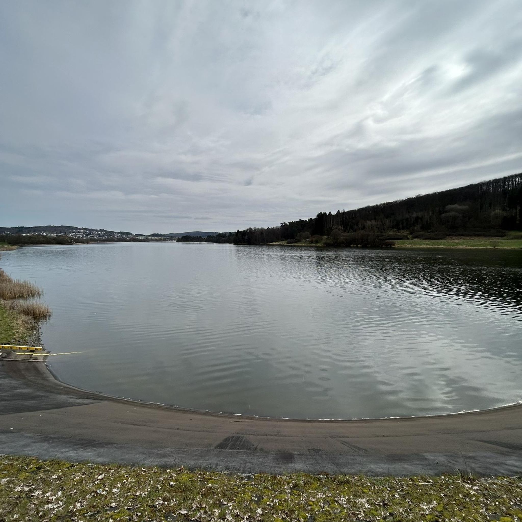
Il Laghetto di Menedrago (also known as Oasi di Menedrago) is an artificial body of water located in the municipality of Marcallo con Casone, in the Metropolitan City of Milan, in Lombardy. The basin, curiously born from the excavations for the embankment of the high-speed railway line (TAV), filled up naturally thanks to an underground spring, transforming the area into a green oasis.
0
0

This mural depicts the historic "Gamba de Legn" tram in Ossona, near Milan. The work was created by artist Vincenzo Gornati, inspired by old photographs and local memories. The painting celebrates the historical memory of the tram line that connected Milan to Castano Primo
0
0
The Valle Olona offers a cycle and pedestrian path of about 50 km that develops mainly on flat ground along the river. However, for those who love a challenge, the surrounding hills offer climbs and descents with challenging gradients of up to 10%.
0
0
The High-Speed Cycle Path (T.A.V.) is a route of about 26 km that runs parallel to the Milan-Turin railway line. In Boffalora sopra Ticino, the path ends (or begins) on the bridge over the Naviglio Grande, connecting directly to the cycle route of the Naviglio itself.
1
0
Parco Rile Tenore Olona (RTO), located between the provinces of Varese and Como, is famous for its dense network of woodland paths, vicinal roads, and historic winding connections that skirt the streams and climb the terraces of the Olona Valley. Among the most iconic road sections and routes that fit this description, the renowned "Piccolo Stelvio" in Gornate Olona stands out, an asphalted road within the park known to all cyclists for its close hairpin bends that recall the famous alpine pass in miniature.
0
0
Parco Rile Tenore Olona (RTO), located between the provinces of Varese and Como, is famous for its dense network of woodland paths, local roads, and historic winding connections that run along the streams and climb the terraces of the Olona Valley. Among the most iconic road sections and routes that fit this description, the famous "Piccolo Stelvio" in Gornate Olona stands out, an asphalt road within the park known to all cyclists for its tight hairpin bends that are a miniature reminder of the famous Alpine pass.
0
0
Frequently Asked Questions
How many no-traffic road cycling routes are available around Cerro Maggiore?
There are over 160 dedicated no-traffic road cycling routes around Cerro Maggiore. These routes offer a variety of experiences, from easy, flat rides to more moderate challenges, ensuring options for different skill levels.
What kind of terrain can I expect on the traffic-free road cycling routes in this area?
The terrain around Cerro Maggiore, typical of the Po Valley, features a mix of flat and gently undulating landscapes. You'll find routes along historic waterways like the Villoresi Canal, through cultivated fields, parks, and forests. Some routes, particularly those venturing into areas like Parco del Roccolo, might include sections with uneven terrain or small hills, while others offer mostly well-paved surfaces.
Are there any easy, beginner-friendly traffic-free road cycling routes?
Yes, many routes are suitable for beginners and families. The Canale Villoresi Cycle Path loop from Parabiago is an excellent example, offering an easy and flat ride along the historic Villoresi Canal. Overall, 74 of the routes in the area are classified as easy.
What are the typical distances and durations for these no-traffic road cycling routes?
Route distances vary significantly. For instance, an easy ride like the Path Along the Villoresi Canal – Isolino di Parabiago loop from Legnano covers about 35 km and takes around 1 hour 20 minutes. More moderate routes, such as the Canale Villoresi Cycle Path – Large Beech Tree Near the Highway loop from Origgio, can extend to over 50 km, requiring about 2 hours 10 minutes.
Are there any advanced or more challenging no-car road cycling paths in the Cerro Maggiore area?
While the region is largely characterized by gentle terrain, there are a few routes that offer more challenge. For example, the Steep Path and Dirt Track – Bergoro Climb loop from Legnano includes a significant elevation gain, making it a moderate option for those seeking a more demanding ride. There are 2 routes classified as difficult in the area.
What natural attractions or landmarks can I see along the no-traffic road cycling routes?
Many routes pass by beautiful natural features. You can explore areas like the Rosa Camuna Pond or the Laghetto La Fametta. The Villoresi Canal itself is a historic waterway, and routes often traverse green spaces like Parco del Roccolo and Parco Alto Milanese, offering views of cultivated fields and forests.
Are there family-friendly traffic-free bike trails suitable for children?
Absolutely. The Villoresi Canal Cycle Path is particularly well-suited for families due to its flat, easy terrain and dedicated path. It offers a safe and enjoyable environment for cyclists of all ages to explore the Lombard countryside.
What is the best time of year for no-traffic road cycling around Cerro Maggiore?
Spring and autumn generally offer the most pleasant conditions for cycling, with mild temperatures and beautiful scenery. Summer can be warm, but early mornings or late afternoons are still enjoyable. The flat nature of many routes makes them accessible for much of the year, weather permitting.
Are there many loop road bike routes that are car-free?
Yes, many of the no-traffic road cycling routes around Cerro Maggiore are designed as loops, allowing you to start and end your ride in the same location without retracing your steps. This is common for routes along the Villoresi Canal and within the various parks.
What do other road cyclists enjoy most about cycling in Cerro Maggiore?
The area is highly rated by the komoot community, with an average score of 4.2 stars from over 590 ratings. Reviewers often praise the tranquility of the traffic-free paths, the scenic views of the Lombard countryside, and the accessibility of routes for various fitness levels. The well-maintained paths along the Villoresi Canal are frequently highlighted as a favorite.
Where are good starting points or trailheads for these routes, especially concerning parking?
Many routes conveniently start from towns like Legnano, Parabiago, or Origgio, which are well-connected and likely offer parking facilities. These towns provide easy access to the Villoresi Canal Cycle Path and other local networks, allowing you to begin your car-free cycling adventure directly.
Most popular routes around Cerro Maggiore
Most popular attractions around Cerro Maggiore

Get inspired with the komoot mobile app


Explore more
Browse the best Road cycling routes in other regions.
