The best traffic-free bike rides around Chiusaforte
4.2
(137)
983
riders
7
rides
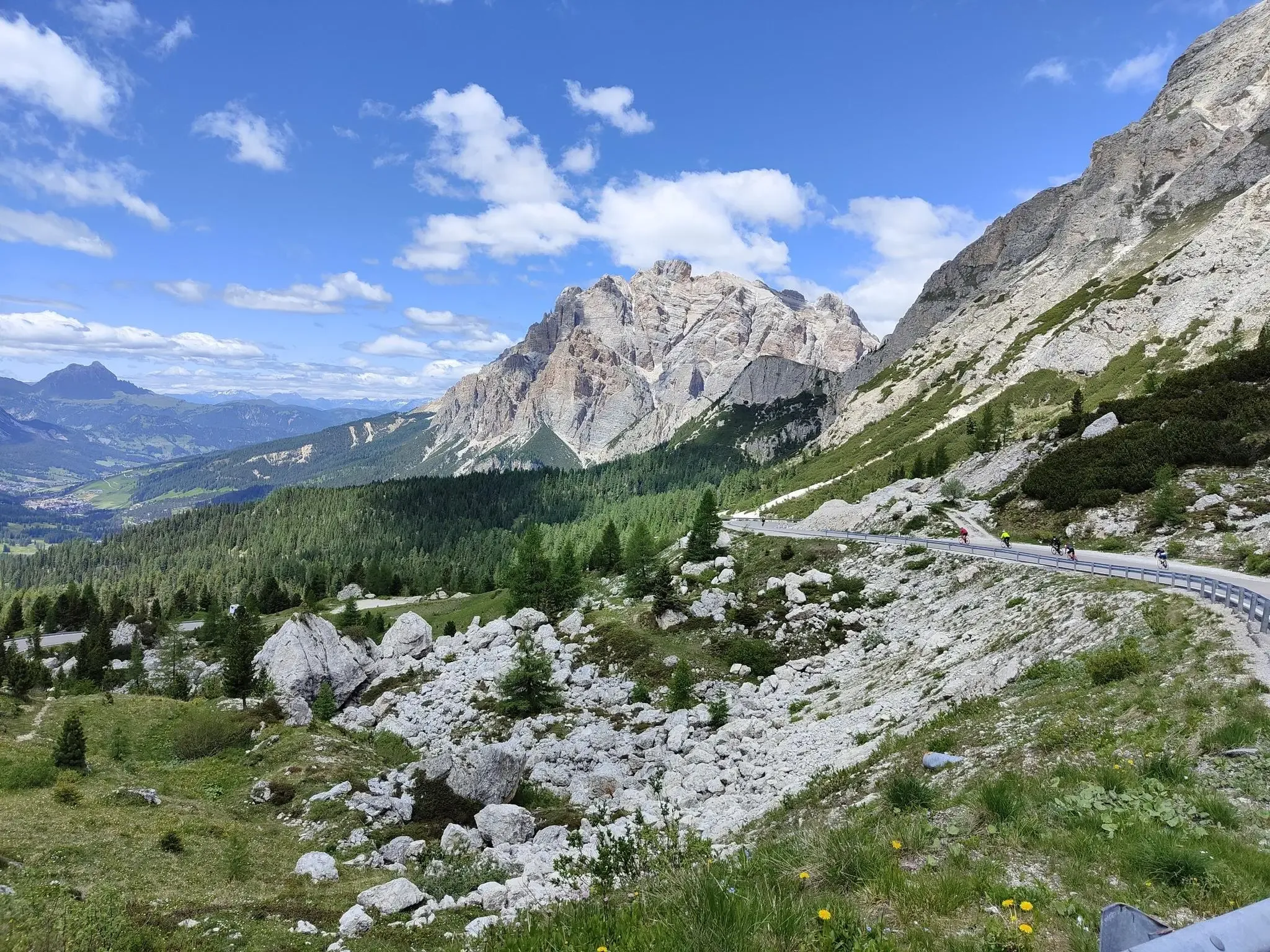
No traffic gravel bike trails around Chiusaforte traverse a landscape shaped by the Julian Pre-Alps Natural Park, featuring deep valleys like the Fella and Raccolana, and mountains composed of dolomite and limestone. The region is characterized by its extensive network of old railway lines, now repurposed for cycling, alongside more challenging unpaved segments and local gravel roads. This diverse terrain offers a mix of moderate and difficult routes, with elevations ranging from valley floors to significant mountain passes.
Best no…
Last updated: November 14, 2026
4.9
(19)
161
riders
62.7km
04:38
1,670m
1,670m
Hard gravel ride. Very good fitness required. Mostly paved surfaces.
4.9
(15)
121
riders
54.6km
03:51
1,200m
1,200m
Hard gravel ride. Very good fitness required. Mostly paved surfaces.

3.3
(14)
71
riders
18.1km
01:04
210m
210m
Moderate gravel ride. Good fitness required. Mostly paved surfaces.
4.4
(20)
103
riders
29.8km
02:00
490m
490m
Hard gravel ride. Very good fitness required. Mostly paved surfaces.
2.5
(2)
16
riders
23.9km
02:10
960m
960m
Hard gravel ride. Very good fitness required. Mostly paved surfaces.
Get access to more routes and recommendations from other explorers.
Already have an account?
Our route recommendations are based on thousands of hikes, rides, and runs completed by other people on komoot.
Start today with a free account
Your next adventure awaits.


Other adventures around Chiusaforte

Tips from the Community

A pleasant ascent in terms of gradient, but with some deep gravel. Occasionally used by jeeps with zipliners
0
0

• You are riding on asphalt as smooth as a table, which was poured exactly on the site of the old single-track Pontebbana railway line, built in 1879 by Austria-Hungary and Italy. The railway was completely closed at the end of the 1990s, when a modern, underground route was built, hidden deep in the bowels of the rocks. The tracks were torn up and the infrastructure was given to cyclists, creating one of the most beautiful cycle paths in the world.
0
0
• The Fella is a classic, unpredictable braided alpine river. Its bed is gigantic and strewn with white pebbles, but for most of the year, there is little water in it. However, during sudden thaws or autumn downpours, the Fella turns into a roaring monster. It was precisely its catastrophic floods (including those in 2003) that regularly destroyed and undermined the old Pontebbana railway line, which ultimately forced engineers to hide the modern tracks deep in tunnels inside the rocks, and the destroyed, above-ground embankment was given over to cyclists.
0
0
• During World War I, the city lay directly on the front line and was almost 100% massacred by artillery fire. When the residents rebuilt it, in 1976 and 1998, powerful earthquakes struck the region, turning hundreds of historic Alpine houses into rubble. The modern town is almost entirely a modern reconstruction on old foundations.
0
0
• This incredibly clear, turquoise water flowed with blood between 1915 and 1917. Along the gorge and the entire valley ran the bloody Isonzo Front. In the murderous trench warfare, over a million soldiers were killed or wounded here. The gorge served as a natural cover, and the rushing current of the river carried away the bodies of the fallen, which could never be buried.
0
0

One of many beautiful suspension bridges over the Soča
0
0

Bovec is the absolute outdoor capital of Slovenia, beautifully situated in the valley of the emerald-green Soča River and surrounded by the mighty peaks of the Julian Alps. The town is the perfect base for adventurers and nature lovers. Main highlights & activities The Soča River is world-renowned for its crystal-clear, turquoise water and spectacular rapids. * **Hiking:** Bovec is the starting point for numerous routes, including parts of the famous Soča Trail and the Alpe-Adria Trail. Explore hidden gorges, natural slides, and babbling waterfalls in the nearby canyons. Take a drive to Slovenia's highest ski resort for panoramic views of the Alps all the way to the Adriatic Sea. Near Bovec, you'll find the Boka Waterfall, one of the country's most impressive and powerful waterfalls.
0
0
Frequently Asked Questions
How many traffic-free gravel bike trails are featured in this guide for Chiusaforte?
This guide highlights five dedicated traffic-free gravel bike routes around Chiusaforte, ranging from moderate to difficult. The broader region, including the Alpe Adria Cycle Path, offers many more opportunities for quiet gravel biking.
What kind of terrain can I expect on these no-traffic gravel routes?
The routes around Chiusaforte offer diverse terrain, from repurposed old railway lines with tunnels and bridges to more challenging mountain paths. You'll encounter a mix of unpaved gravel roads, forest tracks, and some paved sections, all designed to keep you away from vehicle traffic. The landscape is characterized by stunning mountain and river scenery within the Julian Pre-Alps Natural Park.
Are there any family-friendly no-traffic gravel routes in the Chiusaforte area?
While the routes featured in this guide are mostly moderate to difficult, the region offers sections of the Alpe Adria Cycle Path that are generally flatter and more suitable for families. These segments often follow old railway lines, providing a safe and scenic environment away from cars. For a moderate option, consider the Gravel beach on the Soča River – Along the beautiful Soča loop from Soča, which offers a pleasant ride.
Can I bring my dog on these gravel bike trails?
Many of the natural trails and forest roads in the Chiusaforte area are dog-friendly, provided your dog is well-behaved and kept under control, especially around wildlife. Always ensure your dog is accustomed to cycling alongside you and check local regulations for specific areas within the Julian Pre-Alps Natural Park. Remember to carry water for both yourself and your pet.
What natural attractions can I see along the no-traffic gravel routes near Chiusaforte?
Chiusaforte is renowned for its natural beauty, including numerous waterfalls and stunning river valleys. Along your rides, you might encounter highlights such as the Možnica Waterfall and Nemčlja Gorge, the beautiful Soča River, or the impressive Boka Waterfall. The region is also rich in geological formations and diverse flora and fauna.
Are there any historical landmarks or points of interest accessible from these routes?
Yes, the region has a rich history. The Alpe Adria Cycle Path itself is built on an old railway line, featuring historical bridges and tunnels. You can also find traces of World War I, particularly in the Sella Nevea area, with remnants of mule tracks and fortifications. While not directly on every route, the Suspension bridge over the Koritnica Gorge is a notable point of interest nearby.
What is the best time of year to gravel bike in Chiusaforte to avoid traffic?
Spring (April-May) and Autumn (September-October) generally offer the most pleasant conditions for gravel biking in Chiusaforte, with mild temperatures and vibrant scenery. These shoulder seasons also tend to have fewer visitors compared to the peak summer months, ensuring a more tranquil, traffic-free experience on the trails. Always check local weather conditions before heading out.
Are there any circular no-traffic gravel routes available?
Yes, several routes in the area are designed as loops, allowing you to start and end in the same location without retracing your steps. Examples include the challenging Val Bartolo – Bartolo Saddle Border Crossing loop from Ugovizza Valbruna and the Mangart Pass Road – Predil Pass loop from Cave del Predil / Raibl / Rabelj / Rabil, offering varied distances and elevation gains.
What do other gravel bikers say about the no-traffic routes in Chiusaforte?
The komoot community highly rates the gravel biking experience in Chiusaforte, with an average score of 4.2 stars. Reviewers often praise the stunning natural landscapes, the quiet and car-free nature of the trails, and the sense of adventure found on routes like the Val Bartolo – Prati del Bartolo loop from Ugovizza Valbruna.
Is public transport an option to access these gravel trails?
Chiusaforte is located along the Alpe Adria Cycle Path, which often follows old railway lines. While direct public transport access to every specific gravel trail might vary, the main towns in the region are generally connected by bus or train services that can accommodate bikes, especially along the Alpe Adria route. It's advisable to check local transport schedules and bike carriage policies in advance.
Where can I find parking for these no-traffic gravel bike trails?
Parking is typically available in the towns and villages that serve as starting points for these routes, such as Chiusaforte itself, Ugovizza Valbruna, or Cave del Predil. Look for designated parking areas near trailheads or town centers. Always ensure you park responsibly and check for any local parking restrictions or fees.
Most popular routes around Chiusaforte
Most popular attractions around Chiusaforte

Get inspired with the komoot mobile app


Explore more
Browse the best Gravel rides in other regions.
