The best hikes from bus stations around Pöllwitzer Forest
4.6
(6900)
23,667
hikers
629
hikes
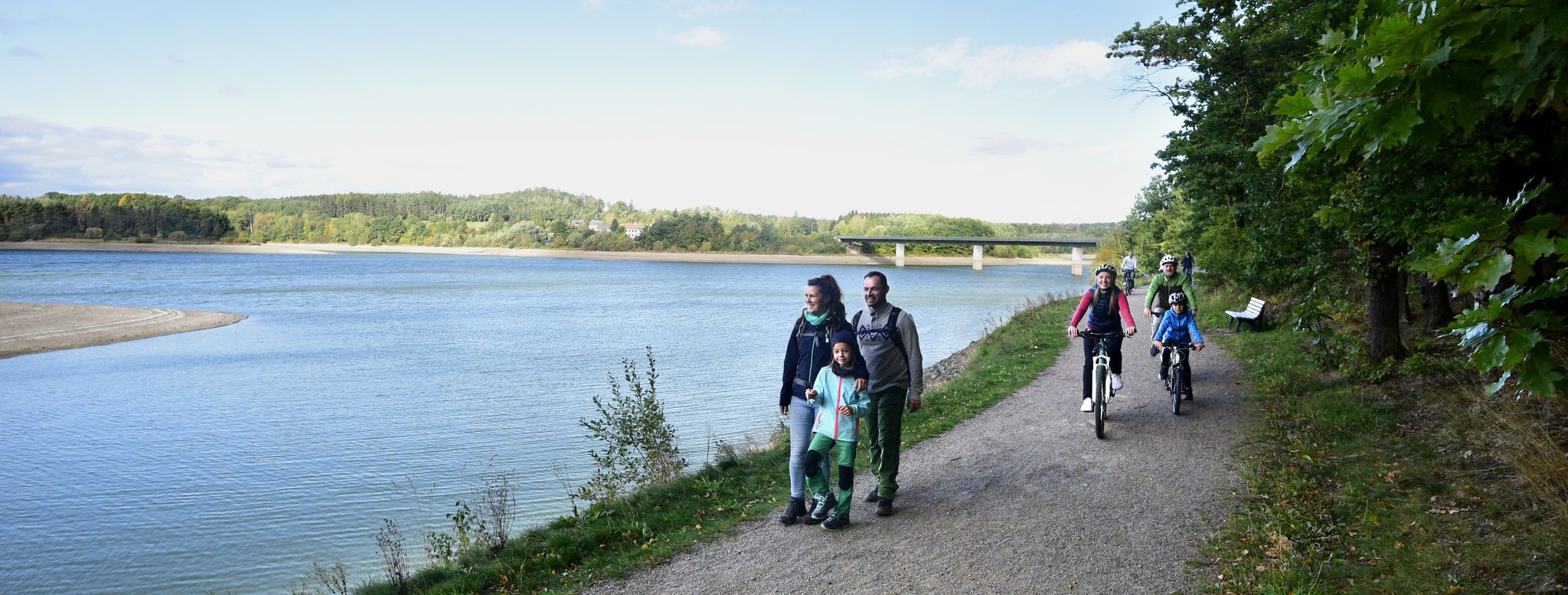
Bus station hiking trails around Pöllwitzer Forest lead through a DBU Natural Heritage Site characterized by diverse natural features. The region encompasses extensive forest areas, including the Pöllwitzer Moor, which features a unique wetland ecosystem. Hikers can expect a tranquil environment with various trails winding through wooded landscapes and past idyllic pipe ponds. The area offers a well-developed network of paths suitable for exploring its natural sanctuary.
Best bus station hiking trails around Pöllwitzer Forest
- The most popular bus station hiking route is Training boundary in the Pölitz Forest – Pöllwitzer Forest Hiking Trail loop from Pöllwitz, a 9.3 miles (14.9 km) trail that takes 3 hours 55 minutes to complete. This moderate route explores the forest's interior.
- Another top favourite among local hikers is Historic Waldspitze – Pöllwitz Bathing Pond loop from Pöllwitz, a moderate 10.4 miles (16.8 km) path. This route offers varied terrain, including forest sections and views of the bathing pond.
- Local hikers also love the Pöllwitz Bathing Pond – Pöllwitzer Pond loop from Pöllwitz, a 5.0 miles (8.1 km) trail leading through forested areas and past local ponds, often completed in about 2 hours 7 minutes.
- Hiking around Pöllwitzer Forest is defined by extensive woodlands, the unique Pöllwitzer Moor, and serene pipe ponds. The network offers options for easy, moderate, and more challenging routes, catering to different ability levels.
- The routes in Pöllwitzer Forest are highly rated by the komoot community with an average score of 4.6 stars from over 1,500 reviews. More than 6,000 hikers have used komoot to explore Pöllwitzer Forest's varied terrain.
Last updated: July 13, 2026
4.4
(24)
79
hikers
14.8km
03:54
120m
120m
Moderate hike. Good fitness required. Easily-accessible paths. Suitable for all skill levels.
4.0
(4)
27
hikers
16.8km
04:28
170m
170m
Moderate hike. Good fitness required. Easily-accessible paths. Suitable for all skill levels.

Sign up for free
4.3
(18)
51
hikers
9.49km
02:29
70m
70m
Moderate hike. Good fitness required. Easily-accessible paths. Suitable for all skill levels.
4.7
(6)
30
hikers
9.58km
02:34
110m
110m
Moderate hike. Good fitness required. Easily-accessible paths. Suitable for all skill levels.
5.0
(5)
22
hikers
10.1km
02:41
100m
100m
Moderate hike. Good fitness required. Easily-accessible paths. Suitable for all skill levels.
Get access to more routes and recommendations from other explorers.
Sign up for free
Already have an account?
Our route recommendations are based on thousands of hikes, rides, and runs completed by other people on komoot.
Start today with a free account
Your next adventure awaits.
Login or Signup
Popular around Pöllwitzer Forest


Tips from the Community

The still closed forest area around Pöllwitz was a military restricted area and NVA troop training ground during GDR times. wikipedia
0
0
The fortified church of St. Nicholas in Pöllwitz was probably built in the early 13th century. It is mentioned in an indulgence letter from 1340. https://www.bachstadt-arnstadt.de/w/opendata/poi/wehrkirche-poellwitz
0
0
A small staircase leads to the monument of the 1st World War on the Schulberg north of Zeulenrodaer Straße towards the church of St. Nicholas. The concrete monument is square, stepped upwards and crowned with a swastika cross. It stands in a small enclosure. Around the top: 1914 - 1918 TO THEIR FALLEN HEROES THE COMMUNITY PÖLLWITZ 1921 Front: In memory of the victims of the 2nd World War 1939 – 1945 http://www.denkmalprojekt.org/2023/poellwitz-dkm_stadt-zeulenroda-triebes_lk-greiz_wk1_th.html
0
0

🐸 just once 💋 Unfortunately it didn't work out for me 🤭
12
0

Here you can find out more about the Legend Trail in the Pöllwitz Forest.
19
0
The sawmill at the Forstteich lake existed before 1597. The current mill building was built in 1866 and was in operation until 1890. Planks, roof shingles, and barrel boards were produced. The buildings have been in a state of disrepair for some time and are being surveyed as part of a research project, with damage and historical findings recorded.
18
0
The boundary stone is located in the entrance area of the Moor Adventure Trail.
19
0
The information board is located at the entrance to the moor adventure trail.
18
0
Frequently Asked Questions
How many bus station hiking trails are available in Pöllwitzer Forest?
There are nearly 630 hiking trails accessible from bus stations around Pöllwitzer Forest, offering a wide range of options for all skill levels.
What are the main natural features to explore on these trails?
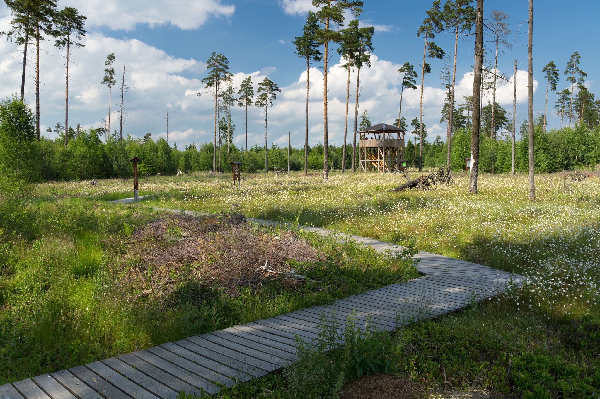
The Pöllwitzer Forest is known for its diverse natural features. A highlight is the Pöllwitzer Moor, which you can explore via the Moor Experience Trail in Pöllwitzer Forest. This trail features a 650-meter-long wooden plank path and a 9-meter-high Pöllwitzer Moor Observation Tower offering panoramic views. You'll also find idyllic Pipe Ponds, which are perfect for a peaceful break.
Are there any family-friendly bus accessible hikes in Pöllwitzer Forest?
Yes, the Moor Experience Trail in Pöllwitzer Forest is particularly family-friendly. It features 20 interactive activity stations and information panels, making it an engaging experience for all ages. The trail is part of the longer Sagenweg (Saga Trail), which is also suitable for families.
What kind of terrain can I expect on hikes from bus stations in Pöllwitzer Forest?
The Pöllwitzer Forest generally offers an impressive landscape with a sense of tranquility. The terrain varies but often includes well-developed forest paths. Routes like the Pöllwitz Bathing Pond – Pöllwitzer Pond loop from Pöllwitz are moderate with gentle elevation changes, making them accessible for many hikers.
Are there any circular routes starting from bus stations?
Yes, many routes are designed as circular walks, allowing you to return to your starting point without retracing your steps. An example is the Forstteich Pöllwitz Reservoir loop from Pöllwitz, which offers a moderate 10.3 km circuit.
What do other hikers enjoy most about hiking in Pöllwitzer Forest?
The Pöllwitzer Forest is highly rated by the komoot community, with an average score of 4.6 stars. Reviewers often praise the peaceful atmosphere, the well-maintained trails, and the unique experience of the Moor, especially the Moor Experience Trail and its observation tower.
Are there any historical landmarks or points of interest along the bus station trails?
While the focus is on natural beauty, you can find interesting points like the Tree trunk cross-section with historical data. Some routes, such as the Historic Waldspitze – Pöllwitz Bathing Pond loop from Pöllwitz, hint at the region's past, which includes its history as a former military training area now transformed into a natural sanctuary.
What is the best time of year to visit Pöllwitzer Forest for hiking?
Pöllwitzer Forest is beautiful year-round, but spring is particularly enchanting when the cotton grass blooms in the moor. The extensive trail network is suitable for various seasons, offering peaceful settings for hikers and cyclists throughout the year.
Are there any longer, more challenging hikes accessible by bus?
While many trails are moderate, you can find longer options. For instance, the Training boundary in the Pölitz Forest – Pöllwitzer Forest Hiking Trail loop from Pöllwitz is a moderate 14.9 km route that provides a good challenge while remaining accessible from public transport.
Can I find viewpoints or observation points on these trails?
Yes, a prominent viewpoint is the 9-meter-high Pöllwitzer Moor Observation Tower, located on the Moor Experience Trail. It offers sweeping views across the unique moor landscape, allowing you to appreciate its vastness and unique flora.
Are there any specific trails that highlight the unique wetland ecosystem?
Absolutely. The Moor Experience Trail in Pöllwitzer Forest is specifically designed to showcase the Pöllwitzer Moor, a DBU Natural Heritage Site. It provides an interactive journey through this important wetland, explaining its significance through information panels and activity stations.
Most popular routes around Pöllwitzer Forest
Most popular attractions around Pöllwitzer Forest

Get inspired with the komoot mobile app


Explore more
Browse the best Hikes in other regions.
