The best traffic-free bike rides around Gramschatzer Wald
4.5
(8862)
53,065
riders
587
rides
No traffic touring bike trails around Gramschatzer Wald traverse an extensive forest area northeast of Würzburg, Germany, characterized by its predominantly deciduous tree population. The region features diverse landscapes, including picturesque meadow valleys like Ochsengrund and Brandwiese, alongside unique dolina formations in its Muschelkalk geological layers. The highest point is the Sternberg at 374 meters, offering varied terrain for cycling. This area is recognized for its ecological importance as a designated Fauna-Flora-Habitat, providing a natural setting for no traffic touring cycling routes.
Best no traffic touring cycling routes around Gramschatzer Wald
- The most popular no traffic touring cycling route is View of Hausen – View of Hausen loop from Erbshausen-Sulzwiesen, a 10.2 miles (16.4 km) trail that takes 1 hour 0 minutes to complete, offering scenic views through the forest.
- Another top favourite among local touring cyclists is Old Town of Veitshöchheim – Main Meadows, Würzburg loop from Güntersleben, a moderate 18.4 miles (29.6 km) path that winds through varied landscapes including meadows and the historic Old Town of Veitshöchheim.
- Local touring cyclists also love the Chain Fountain – Old Town Hall loop from Güntersleben, a 12.3 miles (19.8 km) trail leading through forested areas and past historical sites, often completed in about 1 hour 47 minutes.
- Touring cycling around Gramschatzer Wald is defined by extensive deciduous forests, tranquil meadow valleys, and well-maintained paths like the Ochsengrund Cycle Path. The network offers options for different ability levels, from easy loops to more challenging routes with moderate elevation changes.
- The routes in Gramschatzer Wald are highly rated by the komoot community with an average score of 4.5 stars from over 8000 reviews. More than 50000 touring cyclists have used komoot to explore Gramschatzer Wald's varied terrain.
Last updated: July 13, 2026
3.8
(5)
19
riders
16.3km
01:00
120m
120m
Easy bike ride. Great for any fitness level. Mostly paved surfaces. Suitable for all skill levels.
5.0
(3)
74
riders
19.4km
01:45
330m
330m
Moderate bike ride. Good fitness required. Mostly paved surfaces. Suitable for all skill levels.

Sign up for free
4.6
(14)
77
riders
Moderate bike ride. Good fitness required. Mostly paved surfaces. Suitable for all skill levels.
4.7
(7)
40
riders
Moderate bike ride. Good fitness required. Mostly paved surfaces. Suitable for all skill levels.
5.0
(5)
31
riders
Hard bike ride. Very good fitness required. You may need to push your bike for some segments of this route.
Get access to more routes and recommendations from other explorers.
Sign up for free
Already have an account?
Our route recommendations are based on thousands of hikes, rides, and runs completed by other people on komoot.
Start today with a free account
Your next adventure awaits.
Login or Signup
Popular around Gramschatzer Wald
Tips from the Community

The market square in Werneck is modernly and friendly designed. You can also find places to stop for refreshments here. Until the end of the 1960s, the fruit storehouse and the village church stood here, both were thoroughly demolished.
8
0

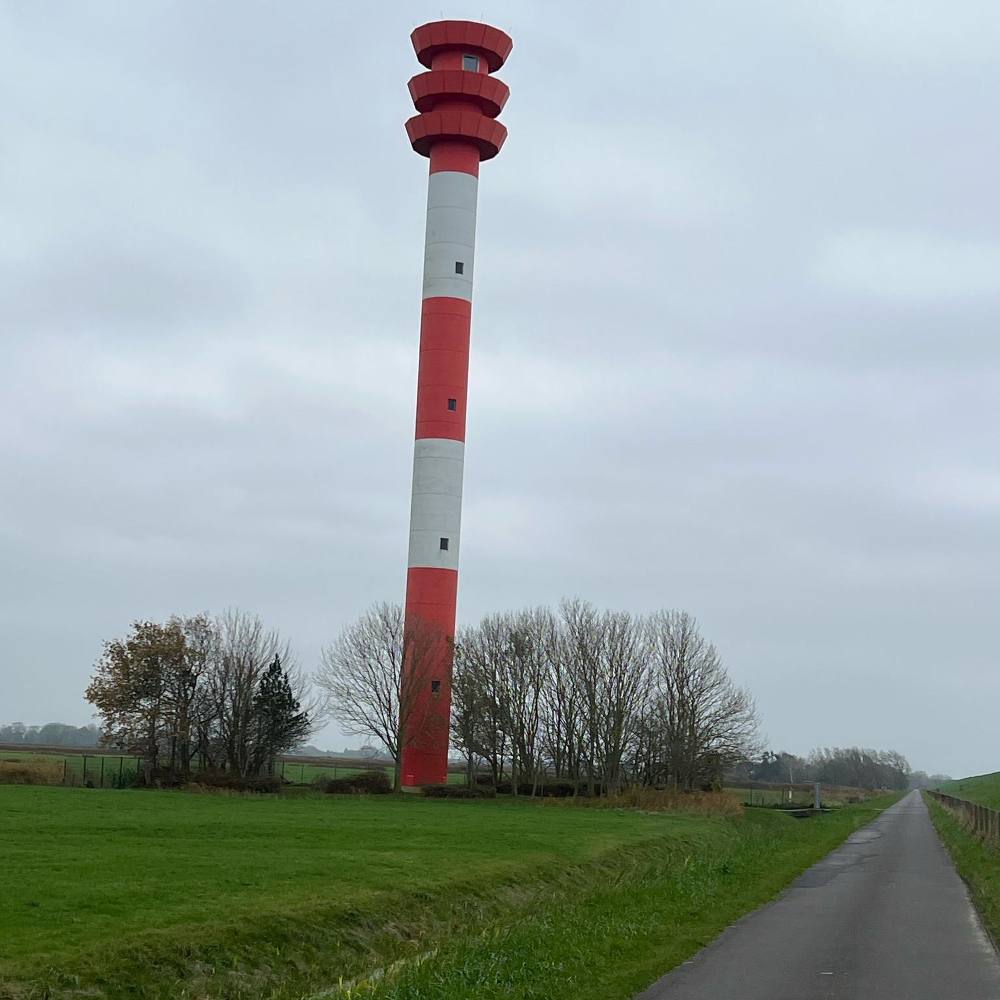
Beautiful panoramic view in the tidy corridor. To the south and east, the Bergtheimer Mulde, to the west the Gramschatzer Forest with radio tower.
0
0

Schindersbrünnle spring and shelter (Rieden)
1
0
Beautiful wayside shrine at Schindersbrünnle
1
0

Very beautiful wayside shrine
0
0

The following test (excerpt) is on the plaque at the shelter: Rieden was of considerable importance for the surrounding villages in the Middle Ages and the early modern period, as it was the seat of the Eichelberg Centenary Court until its dissolution in the early 18th century. Rieden was thus the place of jurisdiction for the villages surrounding the Eichelsberg (a hill between Fährbrück and Rieden). Civil disputes were heard under the chairmanship of the Centenary Count in the historic town hall in Rieden. Criminal cases, however, were judged in the open air on the Eichelberg. A special feature of the Eichelberg Centenary Court is said to have been a kind of ordeal. In the fields, there were supposedly so-called "Niemasa-Plätzli," small squares of a few square meters, located at several locations. If a criminal was sentenced to death, he was released again. After reciting three "Our Fathers," a rider was sent after the condemned man. If the condemned man reached one of the "Niemasa-Plätzli" (Niemasa-Plätzli) before the rider caught up with him, the death penalty was pardoned. According to tradition, the name "Schindersbrünnle" for the source of the Seebach stream refers to the fact that the executioner is said to have washed here after his work.
1
0


Arnstein lies on the Wern River, which bisects the Main Triangle, approximately 20 kilometers from Schweinfurt and 25 kilometers from Würzburg. The southern parts of the municipality lie within the Gramschatz Forest. Arnstein enjoys a very central geographical location. The town is 9 kilometers west of the Schweinfurt/Werneck motorway junction (via the B 26a). According to the Bavarian Surveying Authority, the geographical center of Lower Franconia lies in the Arnstein district of Büchold. (See also: Intersection Monument) https://www.komoot.com/de-de/highlight/7483087
3
0
Frequently Asked Questions
How many no traffic touring cycling routes are available in Gramschatzer Wald?
Gramschatzer Wald offers a wide selection of touring cycling routes, with over 600 available. Many of these are designed to be traffic-free or low-traffic, providing a peaceful cycling experience through the forest and surrounding landscapes.
What is the best time of year to go touring cycling in Gramschatzer Wald?
The Gramschatzer Wald is beautiful year-round, but spring and autumn are particularly recommended for touring cycling. In spring, the deciduous forests burst with fresh green, while autumn offers stunning foliage. Summer is also pleasant, especially on shaded forest paths. Always check local weather conditions before you go.
Are there easy routes suitable for beginners or families?
Yes, Gramschatzer Wald has numerous easy touring cycling routes perfect for beginners and families. These routes often feature gentle gradients and well-maintained surfaces. For example, the View of Hausen – View of Hausen loop from Erbshausen-Sulzwiesen is an easy option, covering about 16 km with minimal elevation gain.
What interesting sights or landmarks can I see along the no traffic touring cycling routes?
Along the routes, you can discover various natural and historical attractions. Highlights include the Kaltenbrunn Spring and its Historic Spring Chamber, the ecologically significant Brandwiese Protected Landscape Area, and the historic Hohenroth Forest Chapel. The Ochsengrund Cycle Path is a prominent feature, offering scenic views through forests and meadows.
Are there places to eat or rest along the routes?
Yes, you'll find options for refreshments. The Waldhaus Einsiedel Beer Garden & Playground is a popular spot near the Forest Experience Center, offering Bavarian specialties. There are also designated barbecue areas in Ochsengrund where you can take a break.
Is public transport available to reach the starting points of these routes?
While Gramschatzer Wald is primarily accessed by car, some villages surrounding the forest, which serve as starting points for routes, may have limited bus connections. It's advisable to check local public transport schedules for specific routes and times if you plan to arrive without a car.
Where can I park my car when visiting Gramschatzer Wald for cycling?
There are several designated parking areas around Gramschatzer Wald, especially near popular trailheads and attractions like the Walderlebniszentrum (Forest Experience Center) and the Waldhaus Einsiedel. These spots provide convenient access to the cycling network.
Are the routes suitable for dogs?
Many of the touring cycling routes in Gramschatzer Wald are suitable for cycling with dogs, provided they are well-behaved and kept on a leash, especially in areas with wildlife or other visitors. Always ensure your dog has access to water, particularly on longer rides.
What kind of terrain can I expect on these no traffic routes?
The no traffic touring cycling routes in Gramschatzer Wald feature a mix of terrain. You'll primarily encounter well-maintained, paved cycle paths, especially on routes like the Ochsengrund Cycle Path. There are also gravel paths through the forest. The elevation changes are generally moderate, making most routes accessible for touring cyclists.
What do other touring cyclists enjoy most about the no traffic routes in Gramschatzer Wald?
The Gramschatzer Wald is highly rated by the komoot community, with an average score of 4.48 stars. Reviewers often praise the tranquility of the extensive deciduous forests, the well-maintained paths, and the opportunity to cycle away from motor traffic. The diverse natural features and historical sites also contribute to a rewarding experience.
Are there any circular touring cycling routes in Gramschatzer Wald?
Yes, many of the touring cycling routes in Gramschatzer Wald are designed as circular loops, allowing you to start and end at the same point. An example is the Chain Fountain loop from Güntersleben, which offers a moderate 23.6 km ride.
What is the typical duration and distance of these no traffic routes?
The routes vary in length and duration to suit different preferences. You can find shorter, easy loops like the View of Hausen loop at about 16 km (around 1 hour), or longer, moderate rides such as the Old Town of Veitshöchheim – Main Meadows, Würzburg loop, which is nearly 30 km and takes over 2 hours.
Most popular routes around Gramschatzer Wald
Most popular attractions around Gramschatzer Wald

Get inspired with the komoot mobile app


Explore more
Browse the best Cycling routes in other regions.
