The best MTB trails around Machern
4.6
(299)
1,059
riders
240
rides
Mountain biking around Machern offers diverse natural landscapes, characterized by an abundance of forests, parks, and bodies of water. The region features varied terrain, from paved paths to unpaved segments through woodlands and along lakesides, including the Mulde River floodplain. This blend provides a scenic backdrop for exploring charming villages and natural features. The area's gentle elevation changes make it suitable for a range of cycling experiences.
Best mountain bike trails around Machern
- The most popular mountain bike trail is…
Last updated: August 6, 2026
4.8
(9)
42
riders
Moderate mountain bike ride. Good fitness required. Advanced riding skills necessary.
4.2
(6)
33
riders
Moderate mountain bike ride. Good fitness required. Suitable for all skill levels.

Sign up for free
5.0
(1)
24
riders
Moderate mountain bike ride. Good fitness required. Advanced riding skills necessary.
5.0
(3)
26
riders
52.9km
02:57
190m
190m
Moderate mountain bike ride. Good fitness required. Advanced riding skills necessary.
4.0
(1)
8
riders
17.1km
01:19
150m
150m
Hard mountain bike ride. Great for any fitness level. Advanced riding skills necessary. Some portions of the route may require you to push your bike.
Get access to more routes and recommendations from other explorers.
Sign up for free
Already have an account?
Our route recommendations are based on thousands of hikes, rides, and runs completed by other people on komoot.
Start today with a free account
Your next adventure awaits.
Login or Signup

Other adventures around Machern

Tips from the Community

The places along the Mulde are particularly threatened by floods. During the August 2002 flood, Grimma was one of the most severely affected municipalities in Saxony, with damage totaling 250 million euros. The June 2013 flood also left behind millions in damages. In 2002, the first plans for flood protection, such as those that occur statistically every 100 years, began in Grimma. In total, the Free State of Saxony and the European Union are investing around 60 million euros in flood protection. The new flood protection facility for Grimma is technically and aesthetically very demanding. The goal was to skillfully combine flood protection, monument protection, and urban development. To find a suitable construction variant, the city was rebuilt on a 1:50 scale, and the model was flooded to simulate water currents. An underground sealing wall, reaching twelve meters deep, influences the natural groundwater flow. Eight wells control groundwater communication.
0
0

The coat of arms stone on the Pöppelmann Bridge is one of the most striking decorative elements of the baroque stone bridge over the Mulde in Grimma. It shows the royal Polish and electoral Saxon coat of arms of Augustus the Strong, who commissioned the construction of the bridge. The richly decorated coat of arms stone with a crown and baroque decor underscores the importance of the bridge as a representative structure and a vital traffic link between Dresden and Leipzig. The coat of arms stone was placed on its pedestal on the bridge on August 5, 1724. A Dresden sculptor had already been working on it since 1718; in 1725 the coat of arms was finally polished and gilded. This essentially completed the construction of the Pöppelmann Bridge. The coat of arms stone visible on the bridge today is a faithful replica. The historical original was moved to the Grimma town hall to protect it from weathering and flood damage. The coat of arms stone is now a popular photo motif and a reminder of the baroque architecture of the master builder Matthäus Daniel Pöppelmann, the architect of the Dresden Zwinger, who also designed the Grimma Mulde Bridge.
3
0
The view of the suspension bridge in Grimma is one of the city's most famous photo motifs. The suspension bridge, built in 1924, spans the Mulde river for a length of 80 meters and connects the old town with the city forest. From the bridge, you can enjoy a wide view of the Mulde, the historic city silhouette, and the Gattersburg located above. Schloss Püchau, on the other hand, is located about 10 kilometers northwest of Grimma in the village of Püchau, directly on the Mulde river. The historic castle with its park is situated in a quiet river landscape and also offers beautiful views of the Mulde valley. However, it is not visible from the Grimma suspension bridge, as the two locations are several kilometers apart.
3
0

More information is available here: https://www.grimma.de/info/poi/steinerne-muldenbruecke-poeppelmannbruecke-grimma-900010794-27290.html
1
0

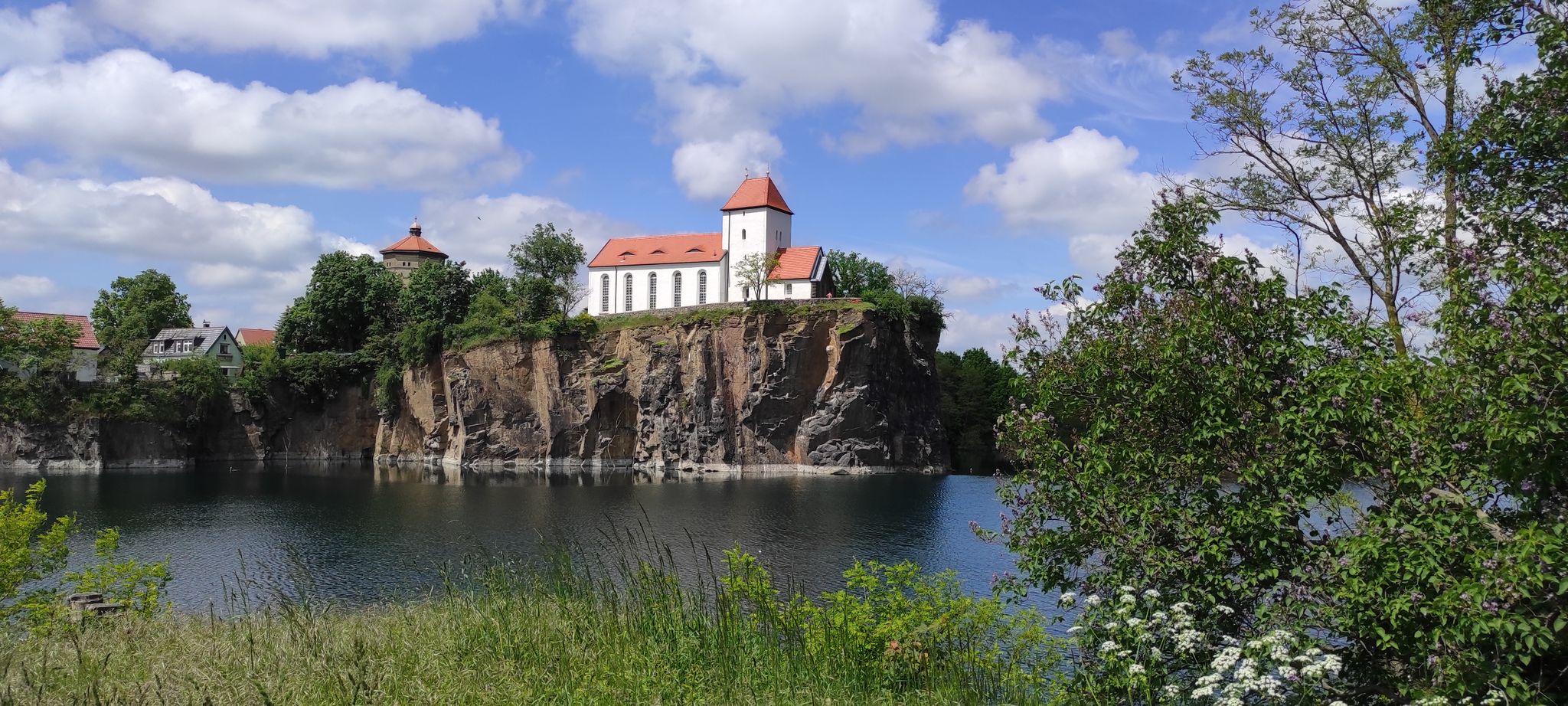
Very nice view of the mountain church.
0
0

A beautifully situated forest swimming pool for relaxation!
0
0

Unfortunately, the observation tower on the Wimberg was closed during my hike, so you couldn't see the surrounding landscape from above.
1
0

Frequently Asked Questions
How many mountain bike trails are available in Machern?
Machern offers a wide selection of mountain bike trails, with over 240 routes available on komoot. This diverse network caters to various skill levels, from easy rides to more challenging routes.
What kind of terrain can I expect on mountain bike trails around Machern?
The terrain around Machern is quite varied, characterized by an abundance of forests, parks, and bodies of water. You'll find a mix of paved paths and unpaved segments through woodlands and along lakesides, including the picturesque Mulde River floodplain. The area generally features gentle elevation changes, making it accessible for different cycling experiences.
Are there mountain bike trails suitable for beginners or families in Machern?
Yes, Machern offers trails suitable for various skill levels, including easier options. For instance, the route Wetland in Planitzwald – Trebsen Castle loop from Altenbach is rated as easy, covering 28.1 km with moderate elevation, making it a good choice for those looking for a less strenuous ride.
What natural features or landmarks can I see along the mountain bike trails?
Many routes in Machern pass by significant natural features and historical landmarks. You can explore areas like the Planitzwald and Westbruch quarries, as seen on the View of the Planitzwald Quarry – Westbruch Quarry Brandis loop from Borsdorf (Sachsen). The region is also rich in forests, lakes, and the Mulde River floodplain. Additionally, you might encounter historical sites such as Machern Castle and its extensive English-style garden.
Are there any loop trails for mountain biking in Machern?
Yes, many mountain bike routes in Machern are designed as loops, allowing you to start and end at the same point. An example is the Observation tower in Taucha city park – End Moraines Near Taucha loop from Borsdorf (Sachsen), which takes you through Taucha city park and features end moraines.
What do other mountain bikers enjoy most about the trails in Machern?
The mountain bike trails in Machern are highly rated by the komoot community, with an average score of 4.6 stars from over 260 reviews. Reviewers often praise the diverse natural landscapes, the blend of forests and lakes, and the variety of routes that cater to different ability levels.
When is the best time of year to go mountain biking in Machern?
Machern's diverse landscape, with its forests and lakes, makes it enjoyable for mountain biking across multiple seasons. Spring and autumn offer pleasant temperatures and vibrant scenery, while summer provides longer daylight hours. Even in winter, some trails may be accessible, though conditions can vary.
Are there any specific attractions or points of interest near the mountain bike routes?
Beyond the trails, Machern offers cultural and historical attractions. You can visit Machern Castle with its baroque garden, or explore other nearby castles like Püchau Castle. The region's proximity to Leipzig also means easy access to attractions like the Belantis amusement park.
Can I bring my dog on the mountain bike trails in Machern?
While many natural areas in Machern are dog-friendly, it's always advisable to check local regulations for specific trails or protected areas. Generally, dogs are welcome on trails if kept on a leash, especially in forested areas or near wildlife. Please ensure you clean up after your pet.
Are there places to eat or stay near the mountain bike trails in Machern?
Machern and its surrounding villages offer various options for refreshments and accommodation. You'll find local cafes, pubs, and guesthouses that cater to visitors. For example, the route View of Wurzen – Mulde riverbank in Grimma loop from Beucha passes through areas where you can find amenities.
What is the typical length and duration of mountain bike trails in Machern?
The trails in Machern vary significantly in length and duration. You can find shorter rides, but many popular routes range from 20 km to over 60 km. For instance, the View of the Westbruch Quarry – Ammelshain Quarry Lake loop from Borsdorf (Sachsen) is 66.6 km long and typically takes around 4 hours 23 minutes to complete.
Most popular attractions around Machern

Get inspired with the komoot mobile app


Explore more
Browse the best MTB trails in other regions.
