The best hikes from bus stations around Calau
4.5
(5113)
20,809
hikers
54
hikes
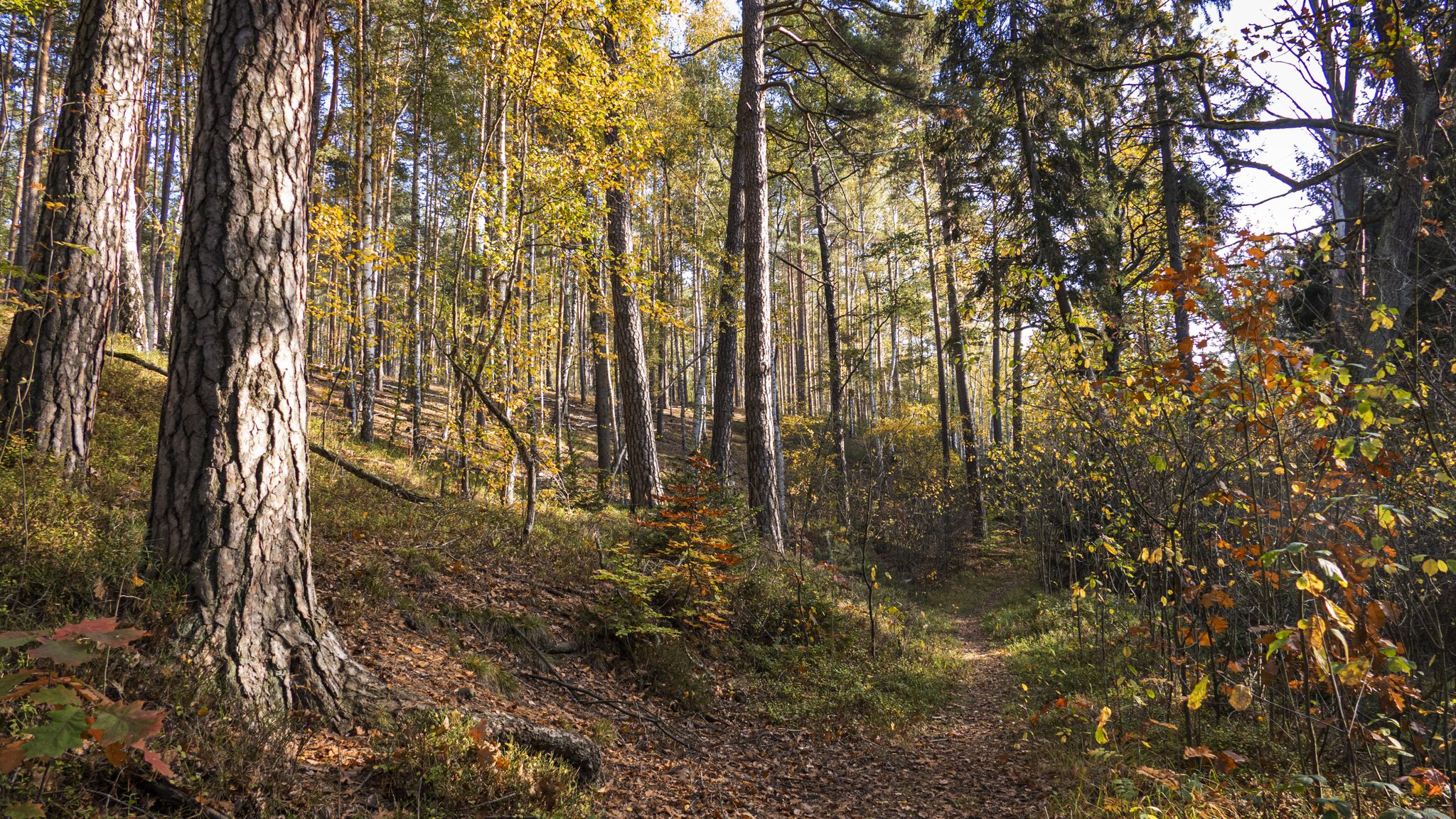
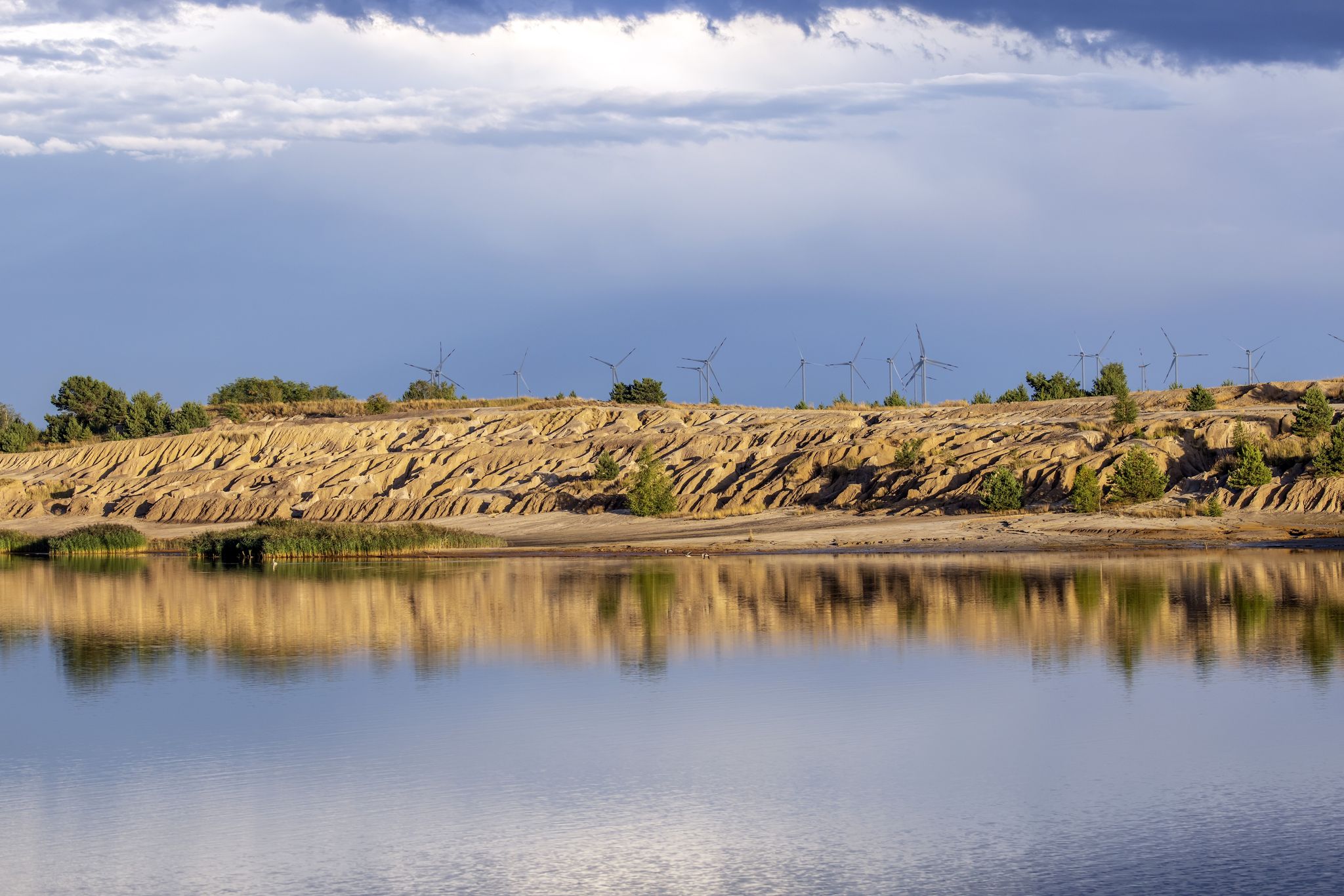
Bus station hiking trails around Calau offer access to a diverse landscape, characterized by the unique Spreewald Biosphere Reserve with its network of waterways and old deciduous forests. The region also features the undulating terrain of "Calauer Schweiz," providing a contrast to the flatter Spreewald. Hikers can explore a mix of pine forests, pond landscapes, and gentle hills, with elevations generally remaining below 200 meters.
Best bus station hiking trails around Calau
- The most popular bus station hiking route is…
Last updated: June 27, 2026
4.8
(90)
270
hikers
10.7km
03:24
110m
110m
Moderate hike. Good fitness required. Mostly accessible paths. Sure-footedness required.
4.8
(9)
18
hikers
Moderate hike. Good fitness required. Easily-accessible paths. Suitable for all skill levels.

Sign up for free
4.7
(15)
56
hikers
Moderate hike. Good fitness required. Easily-accessible paths. Suitable for all skill levels.
15
hikers
Easy hike. Great for any fitness level. Easily-accessible paths. Suitable for all skill levels.
4.0
(3)
5
hikers
Easy hike. Great for any fitness level. Easily-accessible paths. Suitable for all skill levels.
Get access to more routes and recommendations from other explorers.
Sign up for free
Already have an account?
Our route recommendations are based on thousands of hikes, rides, and runs completed by other people on komoot.
Start today with a free account
Your next adventure awaits.
Login or Signup

Tips from the Community


There is also an information board here.
0
0

Beautiful view 🔭 the climb is worth it 💯🔝👍🏻😉
1
0

The view from the tower is worth it! The picnic area is great, as the tables and benches are made of bricks, it is a good idea to bring some seating mats.
0
0
The path to the lookout point is particularly beautiful. The view is limited by the tall trees, but in the open area it extends to the Calauer church tower and further. A very nice, quiet place to linger.
0
0

The train station in Calau is a practical starting point for hikes in the surrounding area. From here, paths lead in various directions, whether to Calauer Schweiz with its rolling hills or along the historic Heedekornwege. The location makes it easy to discover the region's diverse landscape, be it on small paths through dense forests or along wide fields. The train station itself is in a quiet location, which allows for a relaxed start to the day before heading out into nature. A good place to start the hike and explore the area.
0
0
The V-shaped valley “Hölle” is a remarkable, natural valley on the northern edge of the Calauer Schweiz, which creates an almost mystical atmosphere with its narrow, overgrown shape and dark spruce trees. The path down into the “Hölle” is narrow and deeply cut, and this is precisely what makes hiking through it particularly attractive. Water and precipitation once collected here, which led to the formation of a moor. Today, the traces of this past are still visible, and nature conservation measures have contributed to the valley being part of the European NATURA 2000 protected area network. Anyone who dares to descend will be rewarded with a unique, unspoilt landscape that feels cool and damp - perfect for a short, adventurous hike. At the lower exit there is an information board that reveals more about the ecological importance and the renaturation projects of the area. The descent is particularly worthwhile from the Kuhringsberg, where there is direct access to the valley.
0
0
On the northern edge of the Calauer Switzerland, near Werchow, lies the "Hölle", an impressive V-shaped valley that catches the eye with its depth and steep slopes. This is where the Höllbach spring rises, supplying the valley with fresh spring water. The water once fed a swampy moor, the remains of which can still be seen today. The Niederlausitz lowland spruce, which is native to this region and gives the landscape a special character, grows on the edges of the valley. The place, with its peace and seclusion, invites you to take in the nature and offers a pleasant resting place after a hike through the Calauer Mountains.
0
0
Frequently Asked Questions
How many bus station hiking trails are available around Calau?
There are over 50 hiking routes around Calau that are easily accessible from bus stations. These trails cater to various preferences, with a good mix of easy and moderate options.
Are there easy hiking trails accessible from bus stations in Calau?
Yes, many of the trails accessible from bus stations in Calau are considered easy, perfect for a relaxed outing. For example, the Calau Water Tower – Calau (Lower Lusatia) Station loop is an easy route, as is the Electoral Saxon milestone – Riesno Pond loop, both offering gentle paths and minimal elevation gain.
Can I find circular hiking routes starting directly from bus stops in Calau?
Absolutely. Many of the bus-accessible routes around Calau are circular, allowing you to start and end your hike at the same bus stop. Examples include the Kuhringsberg Viewpoint – Hölle Ravine loop and the Calau Water Tower – Calau (Lower Lusatia) Station loop, both designed for convenient round trips.
What kind of landscapes can I expect on bus-accessible hikes near Calau?
Hiking near Calau offers a diverse range of landscapes. You'll find trails through the unique wetland scenery of the nearby Spreewald Biosphere Reserve, characterized by waterways and forests. Additionally, routes in "Calauer Schweiz" provide a more undulating, varied topography, contrasting with the flatter Spreewald. Expect a mix of tranquil nature, dense pine forests, and picturesque village surroundings.
Are there any family-friendly bus station hikes in the Calau area?
Yes, the Calau region is well-suited for family hikes, especially the flatter trails within the Spreewald. Many easy routes, such as the Electoral Saxon milestone – Riesno Pond loop, are short and have minimal elevation, making them ideal for families with children. The region's commitment to nature conservation also means well-maintained paths.
Are dogs allowed on the hiking trails accessible from Calau's bus stations?
Generally, dogs are welcome on most hiking trails in the Calau region, especially when kept on a leash. The diverse landscapes, from open meadows to forest paths, offer plenty of opportunities for you and your canine companion to explore. Always check local signage for any specific restrictions, particularly within nature reserves.
What interesting sights or landmarks can I see along these bus station trails?
The trails around Calau offer a variety of interesting sights. You might encounter natural monuments like the Stradower Teiche Path or the Leiper Weggraben. Historic landmarks such as the Electoral Saxon milestone are also along some routes. The region's rich history and natural beauty provide plenty to discover.
Are there places to eat or rest near the bus station hiking trails?
Yes, you'll find options for refreshments and rest. The region has several inns and shelters, such as the Dubkow Mill Inn or the Wotschofska Inn, which are popular with hikers. These spots offer a chance to refuel and relax during or after your hike.
What is the best time of year to hike these bus-accessible trails in Calau?
The Calau region is beautiful year-round, but spring and autumn are particularly recommended. In spring, the Spreewald comes alive with lush greenery and blooming flora. Autumn offers stunning foliage colors, especially in the deciduous forests. Summer is also pleasant, though some trails might be busier. Winter hiking is possible, especially on the flatter routes, offering a serene, quiet experience.
What makes hiking around Calau unique compared to other regions?
Calau's uniqueness stems from its proximity to the UNESCO Spreewald Biosphere Reserve, offering rare wetland landscapes often called the "Amazon of the East." This contrasts with the more varied topography of "Calauer Schweiz." The blend of accessible, well-maintained trails, rich biodiversity, and cultural insights into the Spreewald's legends makes it a distinctive hiking destination.
Are there any longer, more challenging routes accessible by bus for experienced hikers?
While many routes are easy to moderate, experienced hikers can find longer, more demanding options. The From Goldborn to Ziegelturm – Hiking in Calauer Switzerland route, at over 10 km, offers a moderate challenge with some elevation. The Luckaitztal Brick Tower – Kuhringsberg Viewpoint loop is another moderate option, extending to nearly 14.5 km, providing a good workout while still being accessible by public transport.
Can I combine hiking with other activities in the Calau region?
Absolutely! The Calau region, especially the Spreewald, is perfect for combining hiking with other outdoor activities. You can rent a canoe or punt to explore the intricate network of waterways, offering a unique perspective of the landscape. Cycling is also popular, and many trails are suitable for both hiking and biking, allowing for a varied outdoor experience.
What do other hikers say about the bus station trails in Calau?
The bus station trails in Calau are highly rated by the komoot community, with an average score of 4.5 stars from over 4,000 ratings. Reviewers often praise the tranquility of the routes, the beautiful and diverse natural scenery, and the convenience of accessing trails directly from public transport stops.
Most popular routes around Calau
Most popular attractions around Calau

Get inspired with the komoot mobile app


Explore more
Browse the best Hikes in other regions.
