The best hikes from bus stations around Weißenberg
4.6
(6564)
21,219
hikers
54
hikes
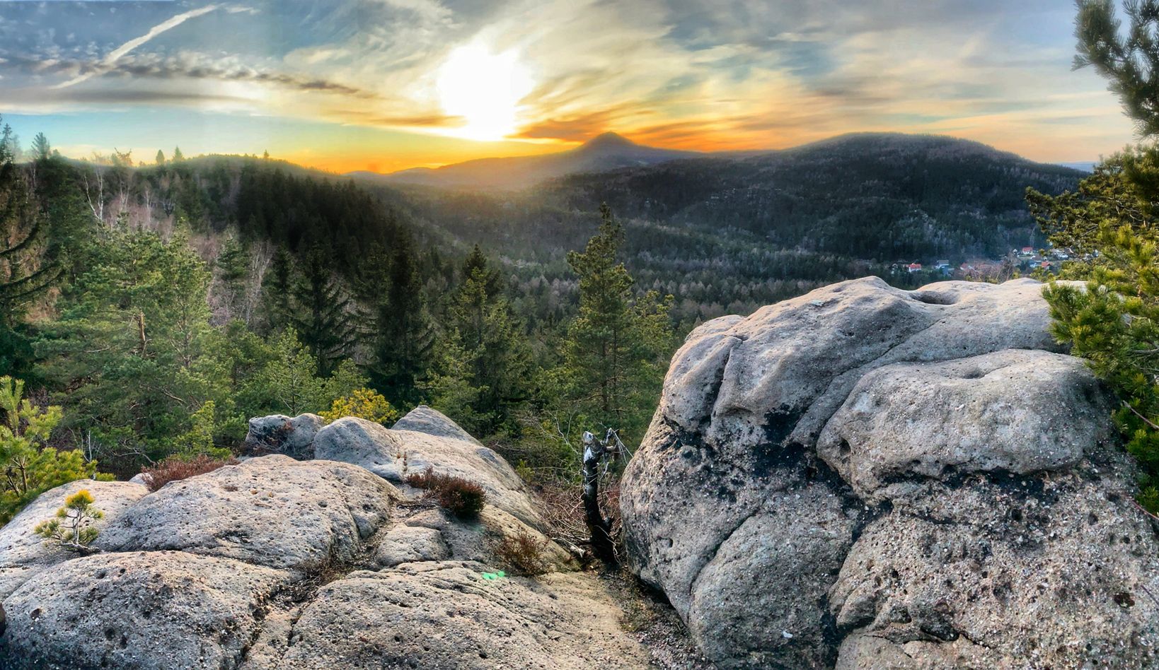
Hiking around Weißenberg (Oberlausitz) offers varied terrain, characterized by river valleys, gentle hills, and historical sites. The region features the Löbauer Wasser river, with many trails running alongside it, and includes smaller rivers and streams. Elevations are generally moderate, with some routes providing views from local hills.
Best bus station hiking trails around Weißenberg
- The most popular bus station hiking route is Gröditz Castle loop from Gröditzer Skala - Hrodźišćanska skala, a 4.1 miles (6.6 km) easy trail that…
Last updated: October 14, 2026
4.8
(301)
798
hikers
6.68km
01:48
80m
80m
Easy hike. Great for any fitness level. Easily-accessible paths. Suitable for all skill levels.
4.8
(6)
26
hikers
Moderate hike. Good fitness required. Easily-accessible paths. Suitable for all skill levels.

4.8
(23)
50
hikers
2.80km
00:44
30m
30m
Easy hike. Great for any fitness level. Easily-accessible paths. Suitable for all skill levels.
4.6
(7)
30
hikers
Easy hike. Great for any fitness level. Easily-accessible paths. Suitable for all skill levels.
4.8
(14)
23
hikers
Moderate hike. Good fitness required. Easily-accessible paths. Suitable for all skill levels.
Get access to more routes and recommendations from other explorers.
Already have an account?
Our route recommendations are based on thousands of hikes, rides, and runs completed by other people on komoot.
Other adventures around Weißenberg

Tips from the Community

Rest area with a view of Horschau. A small bench invites you to linger.
0
0

Well-preserved castle surrounded by nature and a great starting point for a short hike through the forest.
2
0

Drehsa Castle, park, and manor house, with a plaque at the entrance gate providing information about the Way of St. James (Camino de Santiago). Information: First mentioned in 1627 as a fief. The castle, park, and manor house are not open to the public. The observation tower is a former water tower of the manor and was used as a lookout from 1994 to 2007. It has 115 steps, was built in 1889, and supplied water to the castle until 1967.
2
0

Unfortunately, there's a construction fence around the ruins, making it officially impossible to visit. The fence has probably been up for a few years. Unfortunately, it doesn't look like anything will change in the foreseeable future.
0
0
Ideal for resting right by the water.
0
0
Beautiful rest area at the bridge over Löbauer Wasser with a view of the viaduct of the former railway line.
0
0

The dragon slayer Siegfried is apparently still sitting on the tail of the slain dragon. However, the hero himself is no longer complete, although it remains unclear whether the weather conditions have simply had an effect or whether destruction is the cause. The absence of the right arm suggests the latter.
1
0
A mini-Switzerland with slopes and rocks, a stream (Steindörfler Wasser). Very beautiful scenery.
1
0
Frequently Asked Questions
How many bus-accessible hiking trails are available around Weißenberg?
There are over 50 hiking trails around Weißenberg that are easily accessible from bus stations. These routes offer a variety of experiences, from gentle strolls along rivers to more challenging ascents with scenic views.
Are there easy hiking options for beginners or families starting from bus stations?
Yes, Weißenberg offers plenty of easy hiking options perfect for beginners or families. Nearly 30 routes are classified as easy. For instance, the Gröditz Castle loop from Gröditzer Skala - Hrodźišćanska skala is an easy 6.6 km route that takes you through picturesque landscapes. Another great choice is the Schanz Pond – Bressler Family Cemetery loop from Lausker Skala, a shorter 2.7 km path ideal for a relaxed outing.
What kind of landscapes can I expect on these bus-accessible trails?
The bus-accessible trails around Weißenberg in Saxony offer a diverse mix of landscapes. You'll encounter charming river valleys, particularly along the Löbauer Wasser, and areas like the Gröditzer Skala with its unique flora and fauna. Some routes also feature small mountains, such as the Czorneboh, providing varied terrain and scenic views.
Are there any circular routes that start and end at a bus station?
Many of the trails around Weißenberg are circular routes, making them convenient for bus travelers as you can start and end at the same point. The Gröditz Castle loop from Gröditzer Skala - Hrodźišćanska skala is an excellent example, offering a 6.6 km loop. For a longer option, consider the Weißenberg Baroque Town Hall – View of the Löbauer Wasser loop from Nechern - Njechorń, which is a moderate 18.3 km circular hike.
What are some interesting sights or landmarks I can see along the trails?
The trails around Weißenberg are rich with interesting sights. You can explore natural features like the Devil's Stone, Hohe Dubrau, or enjoy panoramic views from the Hochstein Observation Tower. The region also features historical elements, such as the romantic Gothic-style ruin at Lauske Schanze. Don't miss the Czorneboh Mountain Inn and Lookout Tower for both views and a potential stop.
Are the hiking trails around Weißenberg suitable for dogs?
Yes, many of the hiking trails around Weißenberg are suitable for dogs. The natural landscapes, including river paths and forest trails, provide a great environment for your canine companions. Always remember to keep your dog on a leash where required and clean up after them to ensure a pleasant experience for everyone.
What is the best time of year to hike around Weißenberg?
Weißenberg offers enjoyable hiking experiences throughout much of the year. Spring and summer are ideal for vibrant flora and lush greenery, especially along the river valleys. Autumn brings beautiful fall colors to the forests. While some trails are suitable for winter, always check local conditions for ice or snow, particularly on higher elevations like the Czorneboh.
Are there any moderate difficulty trails for more experienced hikers?
Absolutely. For those seeking a bit more challenge, there are 24 moderate trails accessible by bus. The Weißenberg Baroque Town Hall – View of the Löbauer Wasser loop from Nechern - Njechorń is a moderate 18.3 km route that offers a good workout with varied terrain. Another moderate option is the Drehsaer Bathhouse Pavilion – Drehsaer Switzerland loop from Wurschen - Worcyn, covering 7.7 km.
Can I find places to eat or drink near the bus-accessible trails?
While specific cafes and pubs directly at every bus stop might vary, the region does offer options for refreshments. The Czorneboh Mountain Inn and Lookout Tower is a notable spot where you can enjoy a meal or drink with a view. Many villages along the routes may also have local eateries or inns. It's always a good idea to check opening times in advance.
What do other hikers enjoy most about the trails around Weißenberg?
The area is highly rated by the komoot community, with an average score of 4.6 stars. Reviewers often praise the diverse natural beauty, the well-maintained paths, and the accessibility of trails from public transport. Many highlight the peaceful atmosphere and the charming river landscapes, making it a favorite for those seeking a tranquil outdoor experience.
Are there any trails that offer unique historical or cultural insights?
Yes, the region is rich in history and culture. The "Prinzenpfad Lauske - princowska šćežka" is a highly recommended easy route that combines history, idyllic scenery, and local legends around Lauske. While not directly listed in the provided routes, it's an example of the cultural depth you can find. Keep an eye out for historical markers and traditional architecture in the villages you pass through.
Most popular routes around Weißenberg
Most popular attractions around Weißenberg

Get inspired with the komoot mobile app


Explore more
Browse the best Hikes in other regions.
