The best traffic-free bike rides around Zschepplin
4.5
(175)
1,794
riders
65
rides
No traffic road cycling routes around Zschepplin are primarily characterized by the expansive Mulde floodplain, offering largely flat terrain ideal for relaxed cycling. The region is situated within the broader Leipzig area, known for its well-marked cycling trails through diverse natural settings. Cyclists can explore the edges of the Dübener Heide Nature Park, which features mixed forests and river landscapes, alongside the artificial Lober-Leine Canal.
Best no traffic road cycling routes around Zschepplin
- The most popular no traffic road cycling…
Last updated: July 11, 2026
20
riders
21.6km
00:53
30m
30m
Easy road ride. Great for any fitness level. Mostly well-paved surfaces and easy to ride.
4.5
(2)
8
riders
36.1km
01:34
80m
80m
Easy road ride. Great for any fitness level. Mostly well-paved surfaces and easy to ride.

Sign up for free
3
riders
25.3km
01:13
70m
70m
Moderate road ride. Great for any fitness level. Some segments of this route may be unpaved and difficult to ride.
6
riders
17.5km
00:44
40m
40m
Easy road ride. Great for any fitness level. Mostly well-paved surfaces and easy to ride.
6
riders
45.2km
01:53
120m
120m
Moderate road ride. Great for any fitness level. Some segments of this route may be unpaved and difficult to ride.
Get access to more routes and recommendations from other explorers.
Sign up for free
Already have an account?
Our route recommendations are based on thousands of hikes, rides, and runs completed by other people on komoot.
Start today with a free account
Your next adventure awaits.
Login or Signup
Popular around Zschepplin
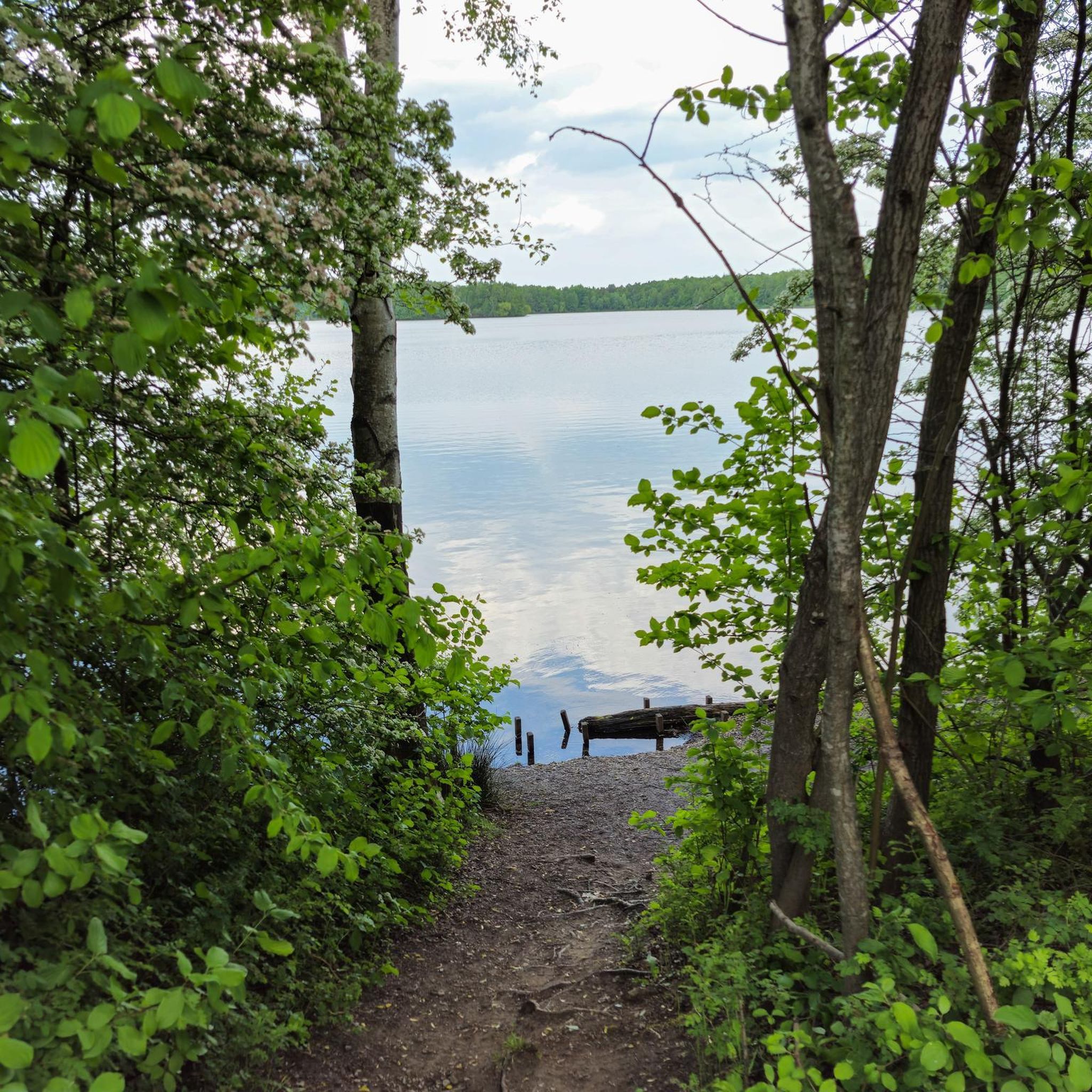

Tips from the Community

The Mulde flows exclusively in the North German Plain, initially through the Saxon Uplands, and passes Grimma, Nerchau, and Trebsen. Approximately near Wurzen, on the western edge of which it flows, the Mulde reaches the Elbe-Mulde Lowland. It then flows through Eilenburg and Bad Düben and shortly thereafter leaves Saxon territory. The remaining course to its mouth is covered by the Mulde in Saxony-Anhalt. Further downstream, until 1975, the Mulde flowed west of the two places Pouch and Friedersdorf in the area of today's Goitzschesee. Since then, it has been dammed up east of the two places in the Muldestausee – a former open-cast mine. Subsequently, the Mulde flows past Muldenstein, Jeßnitz, Raguhn, and Dessau and flows into the Elbe between Dessau and Roßlau after 147 km.[2] The revitalization project "Wilde Mulde" for the lower course in Dessau was recognized in November 2018 as an official project of the UN Decade of Biodiversity.[11][12] Source https://de.wikipedia.org/wiki/Mulde_(Fluss)#Hochwasser
4
0
Although the confluence of the two source rivers takes place at approximately half the total length of the Mulde, the Freiberger Mulde and Zwickauer Mulde already contribute over 80% of the total water volume. This is due to the shape of the catchment area, which is very wide in the Ore Mountains and narrows towards the Elbe, and also to the higher precipitation in the mountains and simultaneously higher proportion of runoff water. The shape of the catchment areas also means that the longer Zwickauer Mulde is the smaller of the two source rivers at the confluence. The hydrologically strongly dominating main branch of the Freiberger Mulde river system is the Zschopau. In its upper catchment area, it is again a named tributary, the Flöha, that contributes the larger water flow and is thus the actual source river of the Mulde. Along this main flow path, the Mulde is approximately 267 kilometers long, and along the longest flow path (Zwickauer Mulde) a good 314 kilometers.[3] The Mulde catchment area shows total drops of 600 to 900 meters for many important flow paths, so that exceptionally high flow velocities prevail here for Northern Germany. The Mulde is sometimes even referred to as the fastest flowing river in Central Europe.[10] Source https://de.wikipedia.org/wiki/Mulde_(Fluss)#Hochwasser
4
0
The Mulde, also known as Vereinte Mulde or Vereinigte Mulde, is a left-hand, non-navigable tributary of the Elbe. It is formed southeast of Leipzig near Sermuth (Saxony) by the confluence of two large headwaters, the longer Zwickauer Mulde and the Freiberger Mulde, which drains a larger catchment area with a greater discharge. The river's catchment area covers large parts of Saxony and, in particular, by far the largest part of the northern slopes of the Ore Mountains. With a water flow of approximately 73 m³/s at its mouth[8], it is the fourth largest tributary of the Elbe. The old name for the Mulde, Milda, is translated by linguists as "the water-rich one".[9] The word component Mel, referring to grinding, is sometimes associated with the name in view of the large number of mills previously operated on the river, which overlooks the fact that river names represent the oldest, often Slavic or Celtic, geographical name layer.
4
0
In 1983, during the tenure of Pastor Krauß and under his energetic guidance, the community undertook the interior renovation of their church. The entire electrical system, including the underfloor heating, urgently needed renewal. The dark painting from 1928 had to give way to a brighter, friendlier one. Only the installation of the electrical system was carried out by a company from Eilenburg; all other renovation work, similar to 1975 and 1980, is the work of so-called after-work brigades and volunteers. In 1993, the community converted the rooms of the former sacristy into a charming community room. The carpentry and drywall work was carried out by the Schneider company. In 1995, with the proceeds from the sold rectory and 40% subsidies, the community finally had funds available to have the church tower re-roofed by the Hoffmann company from Thallwitz. The repair of the mechanical tower clock could be paid for with grants from the monument protection agency and the municipality. Since 1970, three bells have been ringing and reminding again. Source https://www.kirche-am-fluss.de/index.php/kirchen/doberschuetz
1
0
This brings us to the day of horror, November 12, 1925. The old, venerable church was consumed by flames. The cause of the fire remains unknown to this day. It was not until 1928 that the new, present-day church could be consecrated. It is thanks to the then pastor Köppe that it was not built to be oversized. The Doberschütz residents could only enjoy the sound of the three new bells for barely fifteen years, then the two larger ones were confiscated again for war purposes. Hard times began for the church community as early as 1933, and these were hardly to improve after 1945. As early as 1928, the slater had "saved" on the copper nails, so that the first slates fell from the tower after the war. A repair would have been necessary, but there was a lack of money, material and construction capacity. The damage to the roof of the nave was first repaired in 1975 by a new covering. In the same year, the tower and nave also received a new exterior plaster. However, the joy over the new church roof was not to last long. The quality of the roof tiles used was so poor that the roof had to be renewed again in 1980. Source https://www.kirche-am-fluss.de/index.php/kirchen/doberschuetz
1
0
Swabians now settled on the abandoned farms. As early as 1691, the church must have been too small or dilapidated. The nave was built higher, and two galleries now offered enough space. Certainly, money was already scarce at that time, because the construction could not be completed and the tower erected as a roof turret until 1695. Old records mention two bells, the oldest of which is said to have dated from the 15th century. In 1859, the Gutsauszügler Georg Apitz donated a third, larger bell. This and the middle one were sacrificed to the World War in 1917. The smallest one melted in the church fire in 1925. Source https://www.kirche-am-fluss.de/index.php/kirchen/doberschuetz
1
0

The road is really good to drive on.
0
0
Frequently Asked Questions
How many no traffic road cycling routes are available around Zschepplin?
There are over 65 dedicated no traffic road cycling routes around Zschepplin. These routes offer a variety of distances and difficulties, ensuring a suitable option for most cyclists.
What kind of terrain can I expect on no traffic road cycling routes in Zschepplin?
The region around Zschepplin is primarily characterized by the flat, picturesque Mulde floodplain, making for relaxed cycling. You'll also find routes extending into the Dübener Heide Nature Park, which features extensive mixed forests and varied natural settings.
Are there easy no traffic road cycling routes suitable for beginners in Zschepplin?
Yes, Zschepplin offers a good selection of easy no traffic road cycling routes. Approximately 33 routes are rated as easy, perfect for beginners or those looking for a leisurely ride. An example is the Town Sign of Kupsal – Apple Tree Avenue loop from Rödgen, which is relatively short and flat.
What natural features can I discover along the no traffic road cycling routes near Zschepplin?
You can explore the expansive Muldenaue (Mulde Floodplain) with its riverside views. Routes also lead into the Dübener Heide Nature Park, where you might encounter the striking Red Cliff along the Mulde or the serene Gesundbrunnen (Healing Spring) deep within the forest.
Are there any cultural or historical landmarks to see on no traffic road cycling routes in Zschepplin?
Absolutely. Many routes pass by points of interest such as the historic St. Lucia Church and Zschepplin Castle. You could also cycle towards Eilenburg to see the renovated Rathaus or experience a unique crossing at Fähre Gruna. The Wooden Sculpture Meadow Tornau is another interesting stop north of Bad Düben.
Are there circular no traffic road cycling routes around Zschepplin?
Yes, many of the no traffic road cycling routes around Zschepplin are designed as circular tours, allowing you to start and end at the same point. An example is the Wölkau Church – St. Lucia Church (Zschepplin) loop from Wölkau.
Can I find longer, more challenging no traffic road cycling routes in the Zschepplin area?
While Zschepplin's terrain is generally flat, there are moderate routes that offer longer distances and slightly more elevation gain, providing a greater challenge. There are 32 moderate routes available, such as the Mulde River – View of Eilenburg Castle loop from Kämmereiforst, which covers over 44 km.
Is Zschepplin well-suited for family-friendly no traffic road cycling?
Yes, the predominantly flat terrain and numerous easy, traffic-free routes make Zschepplin an excellent choice for family cycling. The Muldenaue offers safe and scenic paths away from busy roads, ideal for all ages.
Where can I park my car when starting a no traffic road cycling tour in Zschepplin?
While specific parking spots for each route are not detailed here, Zschepplin and nearby towns like Eilenburg offer various public parking options. It's advisable to check local parking availability near your chosen starting point.
What do other road cyclists say about the no traffic routes in Zschepplin?
The no traffic road cycling routes around Zschepplin are highly regarded by the komoot community, with an average rating of 4.3 out of 5 stars from 13 reviews. Cyclists often praise the peaceful environment, the scenic river landscapes, and the well-maintained paths that allow for enjoyable rides away from traffic.
What is the best time of year for no traffic road cycling in Zschepplin?
Spring, summer, and early autumn are generally the best seasons for road cycling in Zschepplin. The weather is mild, and the natural landscapes of the Muldenaue and Dübener Heide are at their most vibrant. Always check the local weather forecast before heading out.
Are there places to eat or rest along the no traffic road cycling routes?
Yes, you'll find opportunities for refreshments and rest. The Fähre Gruna, for instance, has a beer garden at the ferry house. Additionally, nearby towns and villages along the routes, such as Eilenburg, offer various cafes and restaurants where you can take a break.
Most popular attractions around Zschepplin

Get inspired with the komoot mobile app


Explore more
Browse the best Road cycling routes in other regions.
