The best traffic-free bike rides around Sülfeld
4.6
(225)
882
riders
43
rides
No traffic touring cycling routes around Sülfeld traverse a landscape characterized by diverse natural areas and agricultural land in Schleswig-Holstein, Germany. The region features significant nature reserves such as Duvenstedter Brook and Nienwohlder Moor, offering varied terrain including heathland, forest, and moorland. Cycling paths often follow well-developed rail trails, like sections of the EBOE Rail Trail, and wind through areas with low elevation and open views of fields. The Norderbeste River also contributes to the area's natural features, providing a…
Last updated: July 11, 2026
4.9
(14)
57
riders
39.3km
02:26
230m
230m
Moderate bike ride. Good fitness required. Mostly paved surfaces. Suitable for all skill levels.
4.6
(33)
141
riders
20.5km
01:17
80m
80m
Easy bike ride. Great for any fitness level. Mostly paved surfaces. Suitable for all skill levels.

Sign up for free
4.3
(7)
60
riders
11.1km
00:41
20m
20m
Easy bike ride. Great for any fitness level. Mostly paved surfaces. Suitable for all skill levels.
4.0
(5)
13
riders
Moderate bike ride. Good fitness required. Mostly paved surfaces. Suitable for all skill levels.
5.0
(2)
24
riders
10.8km
00:42
20m
20m
Easy bike ride. Great for any fitness level. Mostly paved surfaces. Suitable for all skill levels.
Get access to more routes and recommendations from other explorers.
Sign up for free
Already have an account?
Our route recommendations are based on thousands of hikes, rides, and runs completed by other people on komoot.
Start today with a free account
Your next adventure awaits.
Login or Signup
Popular around Sülfeld

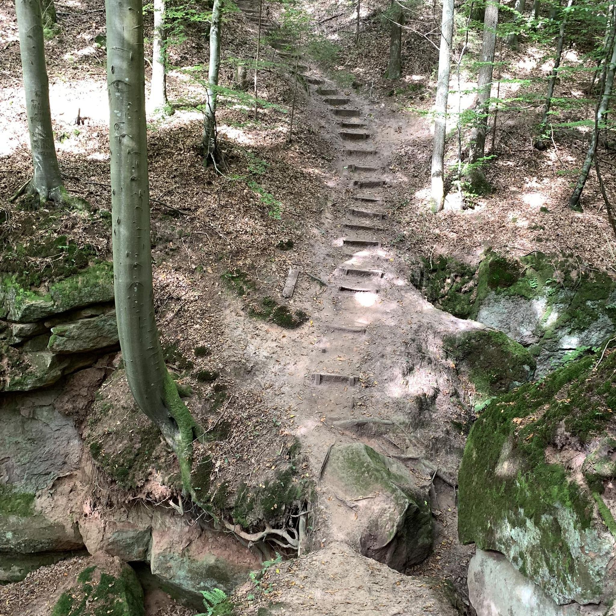
Tips from the Community

Now and then you pass old railway operating buildings and facilities, such as loading and unloading ramps or the old Grabau station.
0
0

A very long wall surrounds the property—for whatever reason. Perhaps it was once a monastery?
0
0

The Nienwohlder Moor lies on the watershed between the North Sea and the Baltic Sea.[2] It drains to the west into the Lankau, to the south into the Alte Alster, and to the north into the Norderbeste. The nature reserve, which is managed by the Schleswig-Holstein State Hunting Association with the exception of the areas owned by the State Forestry Administration[5],[6] can be almost completely circumnavigated on hiking trails, along which information boards are posted at several locations. In the west, a hiking trail runs through the protected area in the area of the Lunden, a towering moraine ridge.
0
0
Today, typical raised moor vegetation can once again be found in the nature reserve, including round-leaved sundew, narrow-leaved cottongrass, bladderwort, white beak sedge, sedge cottongrass, cranberry, as well as cross-leaved heather, rosemary, and common heather. The nature reserve also represents an important habitat for birds. Various wading birds such as the curlew and the common snipe, as well as ducks such as the shoveler, teal, tufted duck, and garganey, as well as meadow pipits, whinchats, and stonechats, are native here. Marsh harriers and short-eared owls can also be found here. The undisturbed moorland is a refuge for cranes, which are now breeding here again. Various woodpecker species, red-backed shrikes, and songbirds are native to the wooded moorland areas. The nature reserve also provides a habitat for various amphibians and reptiles, as well as insects such as dragonflies and butterflies.
0
0
The moor was renaturalized in the 1980s through rewetting measures.[2][3] Today, in the area of former industrial use, it is an open raised bog with numerous water-filled peat pits, surrounded by a bog forest. The farmer's hand-cut peat pits at the edge of the moor are often water-filled. Sphagnum moss quaking grassland grows here, and the peat pits are slowly silting up. Further areas are occupied by grassland and forest. Some of the grassland is extensively grazed by robust cattle.[4] Some areas are still intensively used for agriculture, including one arable area.
0
0
Peat extraction, first documented in 1804, was initially carried out by peat-cutting by peat-farmers, and the peat was used as fuel. During the Napoleonic Wars of 1806–1813, peat was also shipped to Hamburg via the Alster. In the 20th century, peat extraction became an industrial operation. From 1951 to 1976, the white peat was extracted from an area of 84 hectares, initially by hand and later by machine.[2] East of Nahe, there was a peat loading point on the Elmshorn-Barmstedt-Oldesloe railway.
0
0
The nature reserve is located northeast of Hamburg between the towns of Nienwohld, Nahe, Itzstedt, and Sülfeld. It protects a drained and largely peat-extracted raised bog area, which is the largest and best-preserved raised bog remnant in Schleswig-Holstein.[2] To the north, it borders the former Elmshorn-Barmstedt-Oldesloe Railway line.
0
0
The approximately 398-hectare nature reserve is registered under number 100 in the register of nature reserves of the Ministry of Agriculture, Environment and Rural Areas. It was designated in 1982 (date of the regulation: March 25, 1982). The nature reserve replaces the nature reserve of the same name designated in 1980.[1] It is part of the FFH area "Alster system to Itzstedter See and Nienwohlder Moor" and the EU bird sanctuary "Alsterniederung". To the south, it borders the "Nienwohld" landscape protection area. The responsible lower nature conservation authorities are the districts of Stormarn and Segeberg.
0
0
Frequently Asked Questions
How many traffic-free touring cycling routes are available around Sülfeld?
There are over 40 dedicated traffic-free touring cycling routes around Sülfeld, offering a wide range of options for exploring the region. Most of these routes are classified as easy or moderate, making them accessible for various skill levels.
What kind of terrain can I expect on the no-traffic touring cycling routes in Sülfeld?
The no-traffic touring cycling routes in Sülfeld primarily feature a blend of natural areas and cultural heritage sites. You'll find paths through heathland, forests, moorland, and agricultural fields, often with open views. The region is characterized by low elevation, with well-maintained roads and designated bike paths, including sections of former railway lines that have been expanded and improved for cycling.
Are there easy, traffic-free touring cycling routes suitable for beginners or families in Sülfeld?
Yes, Sülfeld offers many easy, traffic-free touring cycling routes perfect for beginners and families. For example, the Old Grabau Station – Abandoned Railway Track loop from Sülfeld is an easy 17 km route with minimal elevation gain, ideal for a relaxed ride. The region's generally low elevation and well-maintained paths make it very family-friendly.
What natural features can I discover along the traffic-free cycling routes?
You can discover diverse natural features, including significant nature reserves. Routes often lead through areas like the Duvenstedter Brook Nature Reserve, known for its heathland, forest, and moorland, or the Hansdorfer Brook Nature Reserve with its repaved forest paths. The Nienwohlder Moor Nature Reserve also offers fascinating moorland landscapes. You might also encounter the Norderbeste River, which is a significant local waterway.
Are there any historical landmarks or points of interest along the no-traffic touring cycling routes?
Yes, Sülfeld offers several historical points of interest. You can find remains of the 16th-century Alster-Beste Canal in the village center. Additionally, routes might pass by Borstel Manor, a beautiful Rococo-style manor house built in 1751. For a unique man-made monument, the Neverstaven Telecommunications Tower on Klingberg offers an opportunity for a slight climb and a view.
Can I find circular touring cycling routes that are traffic-free in Sülfeld?
Absolutely. Many of the no-traffic touring cycling routes around Sülfeld are designed as circular loops, allowing you to start and end at the same point without retracing your steps. An example is the EBOE Trail Gravel Path – Moorwald loop from Sülfeld, which is an easy 11 km circular route.
What is the best time of year to enjoy traffic-free touring cycling in Sülfeld?
The best time of year for traffic-free touring cycling in Sülfeld is generally from spring through early autumn (April to October). During these months, the weather is typically milder and more stable, and the natural landscapes are at their most vibrant. The well-developed paths, especially those repaved in areas like Hansdorfer Brook, ensure good navigability even after rain.
Are there any lakes or water features accessible from the no-traffic cycling routes?
Yes, the Sülfeld area is close to several water features. While not directly on every route, you can find highlights like the Salt Pond in the Bad Oldesloe Spa Park, Krattkoppelsee, and Teufelsteich. The region is also within the Aller river catchment, and the Norderbeste River is a local landmark.
What do other touring cyclists enjoy the most about touring cycling in Sülfeld?
The komoot community rates touring cycling in Sülfeld highly, with an average score of 4.5 stars. Reviewers often praise the region's serene nature reserves, the extensive network of well-maintained, traffic-free paths, and the gentle, varied landscape that makes for pleasant and relaxing rides.
Where can I park my car when accessing traffic-free bike trails in Sülfeld?
While specific parking locations for each trail vary, Sülfeld is a lightly urbanized area with good infrastructure. You can typically find parking options in or near the village center, or at designated trailheads for popular routes. It's advisable to check local signage or use navigation apps for the most convenient parking spots near your chosen starting point.
Are there any longer, moderate traffic-free touring routes for more experienced cyclists?
Yes, for more experienced cyclists looking for a longer, moderate challenge, the Trave Riverside Path – Trave at Kupfermühle loop from Sülfeld offers a 39 km route with over 225 meters of elevation gain. Another moderate option is the EBOE Trail Gravel Path – View of the Duvenstedter Brook loop from Sülfeld, which is 34 km long.
Can I access the traffic-free cycling routes using public transport?
Sülfeld is a municipality in Schleswig-Holstein, Germany, and while it has local public transport connections, direct access to every trailhead via public transport might require some planning. It's recommended to check local bus schedules or regional train connections to nearby towns and then cycle the short distance to your desired route starting point.
Most popular attractions around Sülfeld

Get inspired with the komoot mobile app


Explore more
Browse the best Cycling routes in other regions.
